Europe

A new study from Iceland confirms that a shorter workweek improves productivity.
In some countries, people want more freedom of speech. In others, they feel that there is too much.

The first of many dodecahedrons was unearthed almost three centuries ago, and we still don’t know what they were for.

When the mutual relatives of two royal families died, the countries were likelier to go to war.
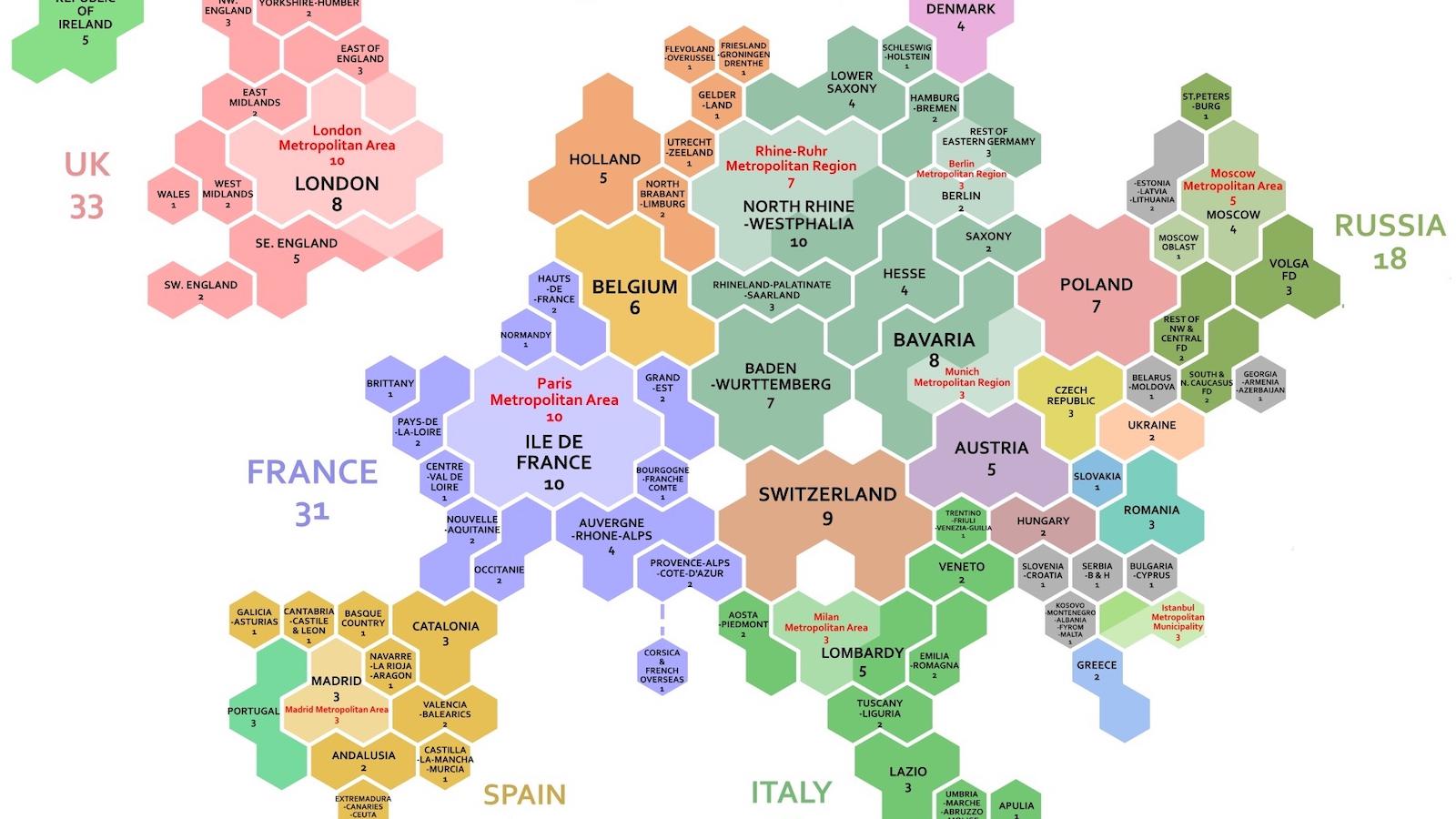
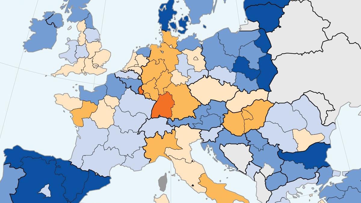
A cartogram makes it easy to compare regional and national GDPs at a glance.

American universities used to be small centers of rote learning, but three big ideas turned them into intellectual powerhouses.
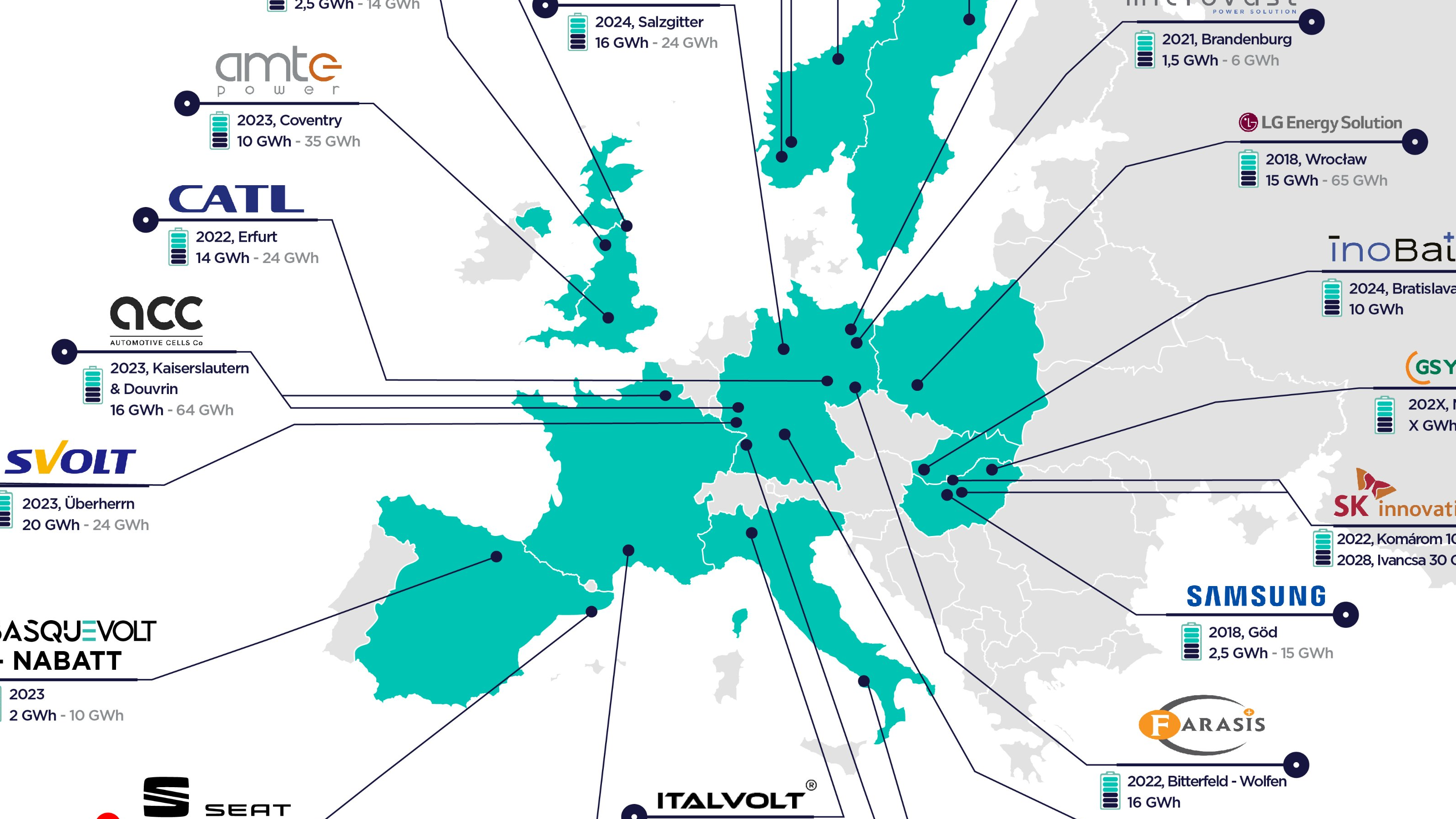
Map shows Europe’s imminent Great Leap Forward in battery cell production

A new study provides a possible scientific explanation for the existence of stories about ancient saints performing miracles with water.
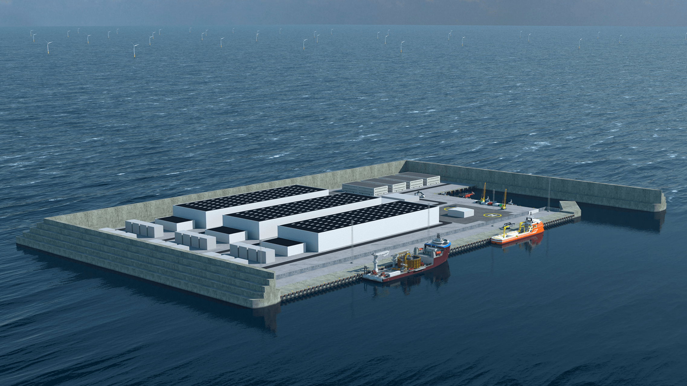
An artificial island in the North Sea is the biggest building project ever in Danish history – and could pave the way for many more.

James Gillray’s ‘plumb-pudding’ caricature is “probably the most famous political cartoon of all time.”
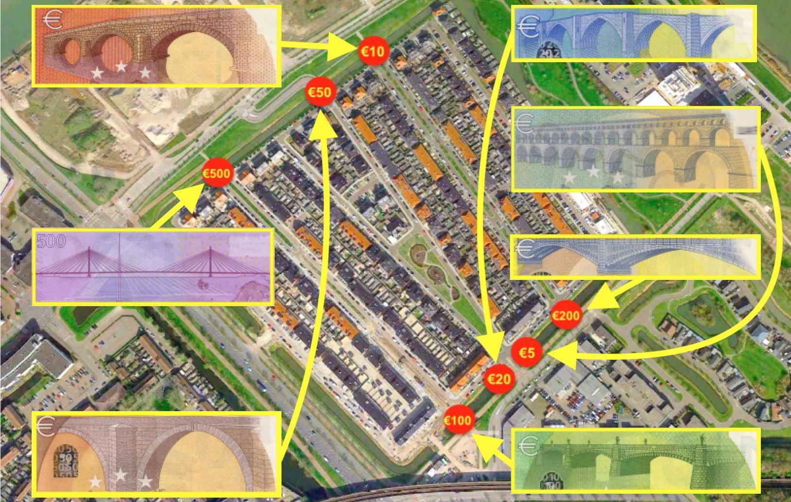
The European currency features buildings that didn’t exist, until Spijkenisse made them in concrete
Topologists can’t tell donuts from coffee mugs, but their maps are revelatory nonetheless.

The chariot survived ancient eruptions and modern-day looters to become a part of the world heritage site.
Despite overall increase over the past 20 years, share of women in science and engineering falls in some European countries

More than a century after the end of hostilities in 1918, some battlefields of WWI are still deadly enough to kill you.
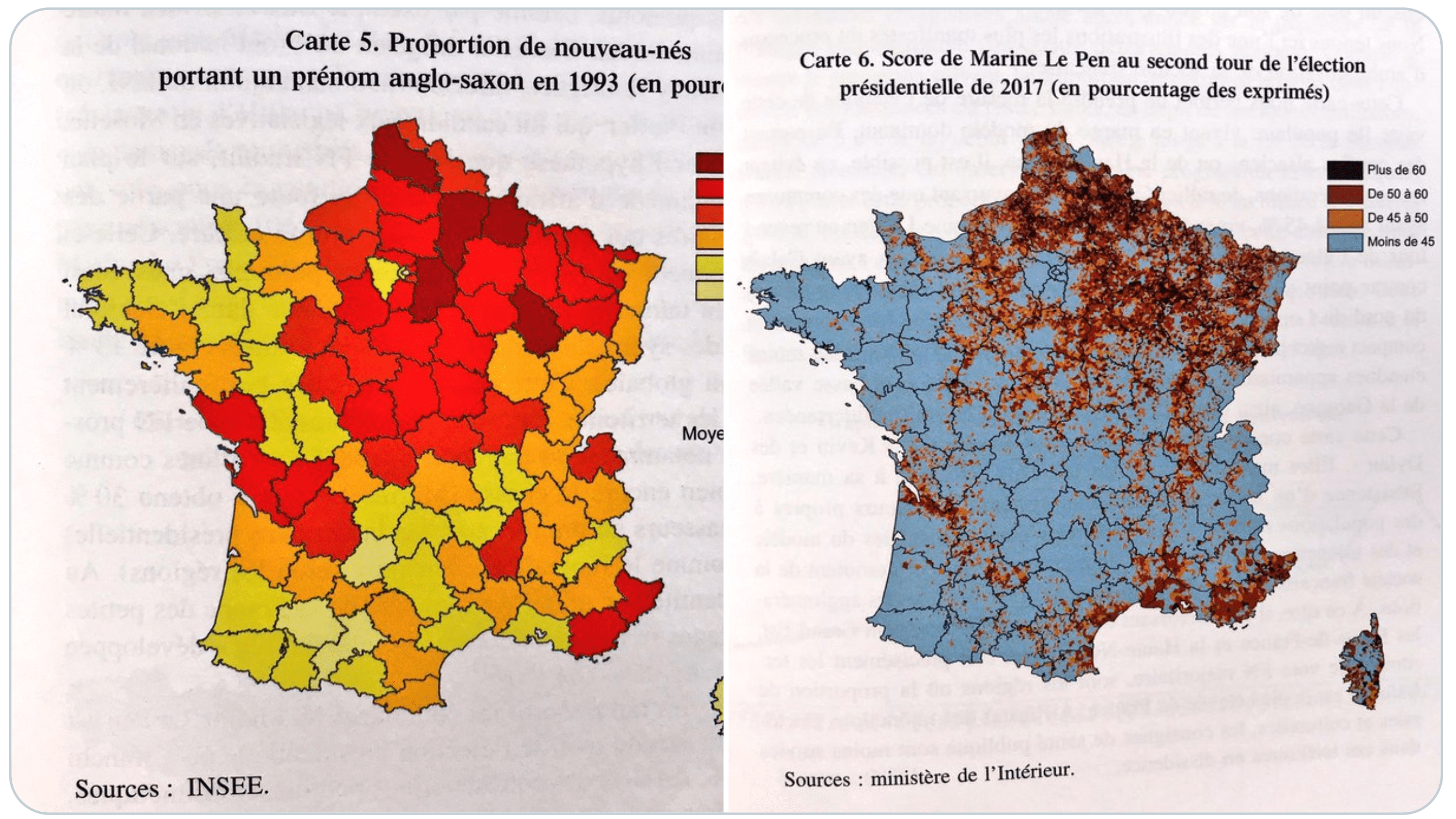
In Germany and France, having an Anglo-Saxon first name is a good predictor of extreme voting behavior.
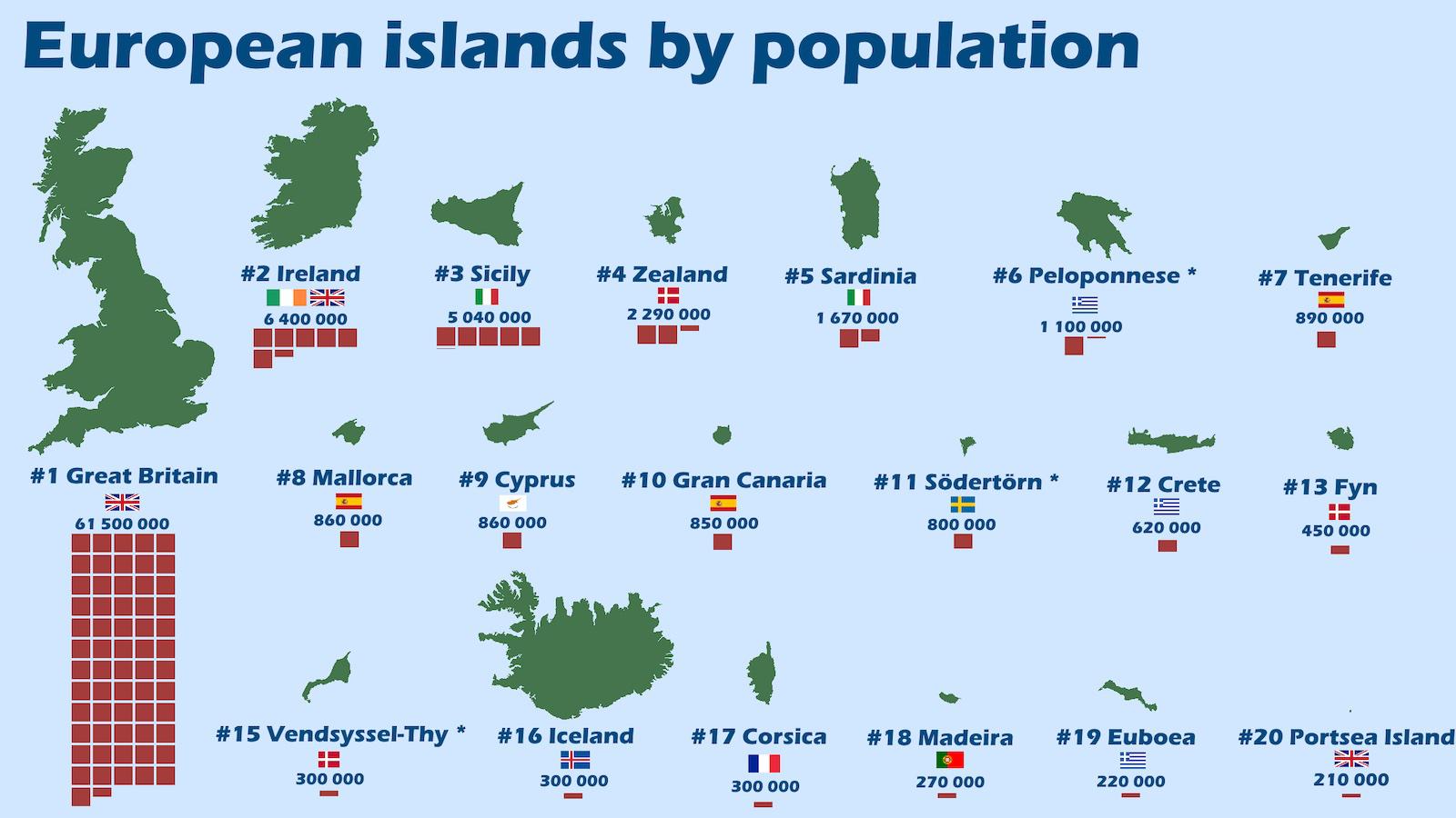
This map of Europe’s 20 most populous islands holds a few surprises and unlocks a truckload of trivia.
Three decades after the demise of the GDR, its familiar contours keep coming back from the dead.
For a purely binary choice, wearing a ring either on the left or right hand can say a lot about the wearer.
Anastasia lives alone in perfect harmony with nature – or so the story goes – and nature serves her devotedly.
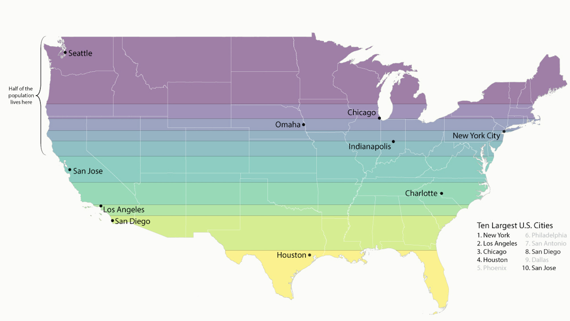
Why not just divide the United States in slices of equal population?
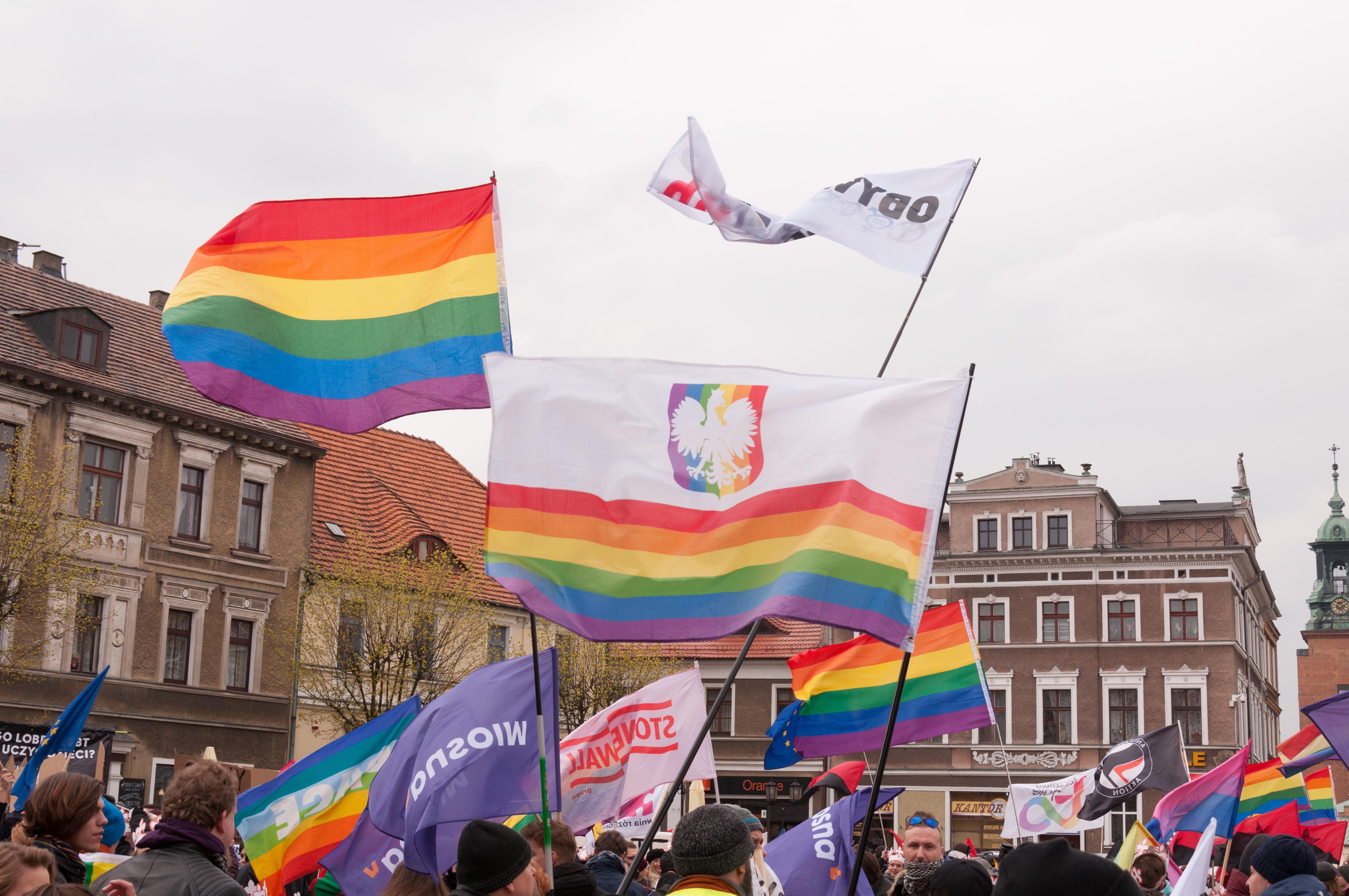
Poland has become an increasingly unwelcoming place for the LGBTQ community. Fifty diplomats hope to change that.

“Nothing but naked people: fat ones, thin ones, old, young…”
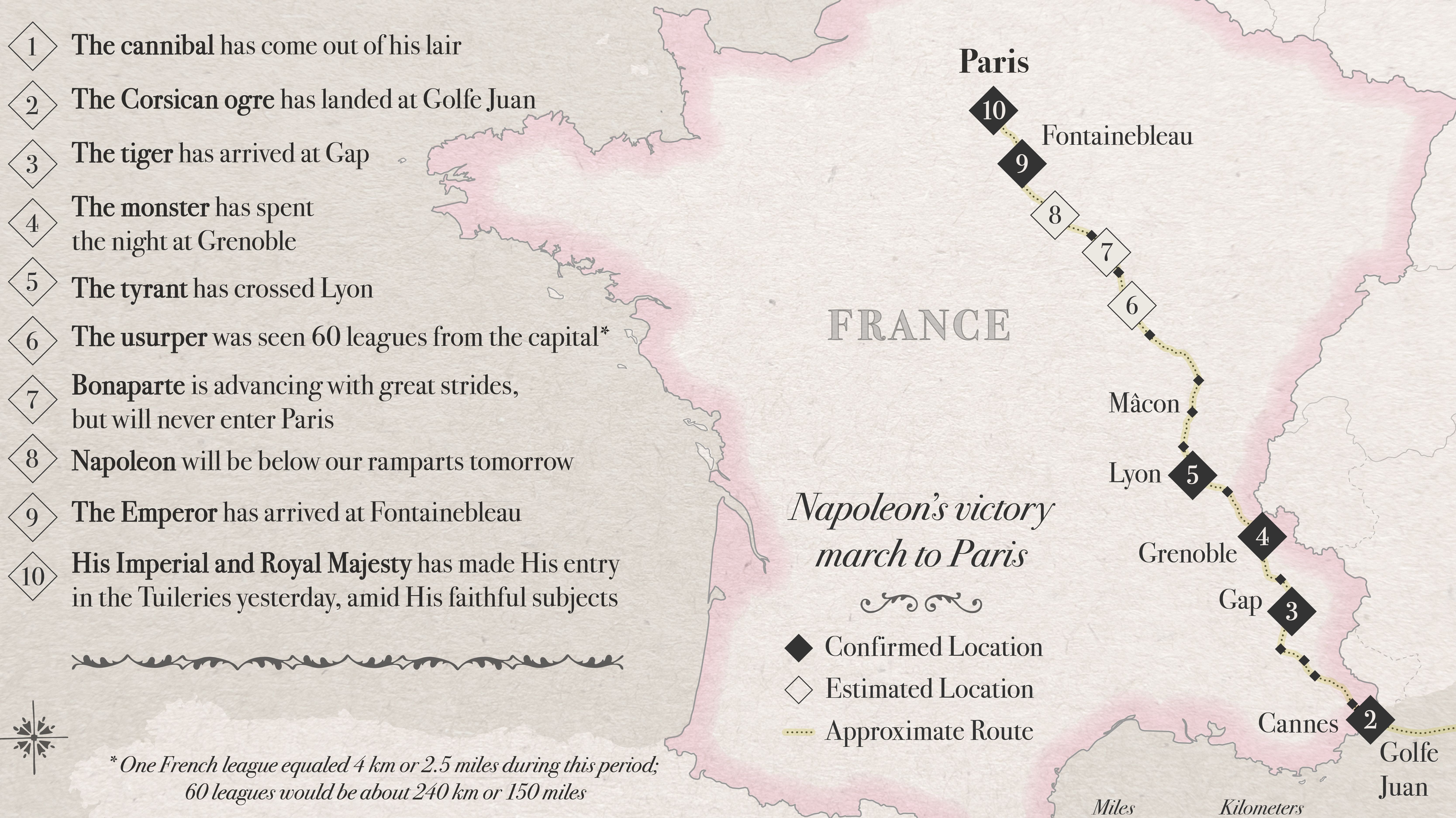
Alexandre Dumas’ famous anecdote about Fake News in the 1800s has a surprising twist.
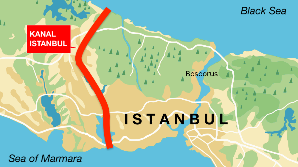
‘Kanal Istanbul’ would create a second Bosporus – and immortalize its creator.

Estonia has combined a belief in learning with equal-access technology to create one of world’s best education systems.
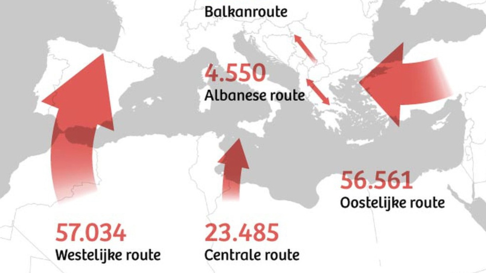
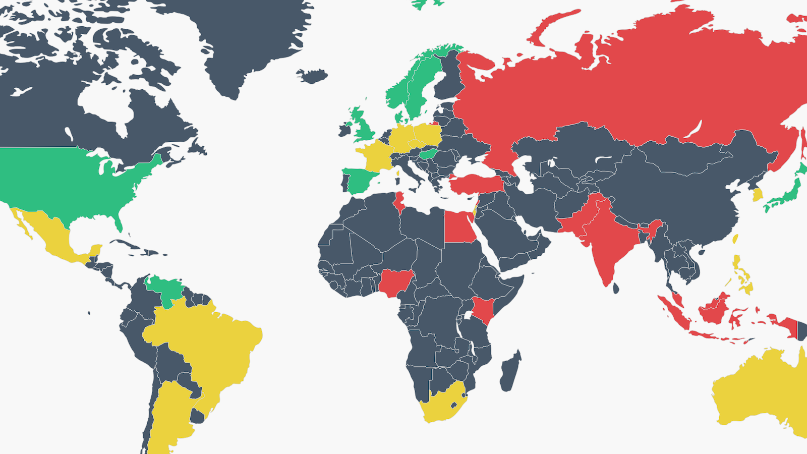
‘Battlefield maps’ show continent under attack from hostile invaders.
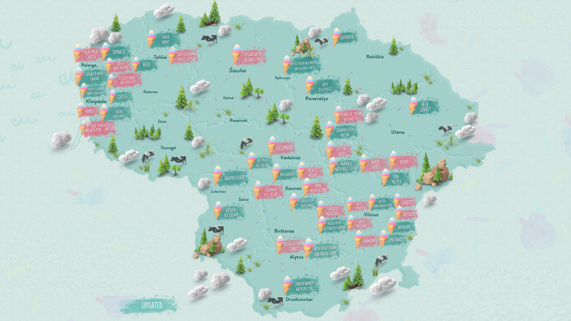
The Baltic nation rolls out an unlikely tourist attraction: 47 weird ice cream flavors.
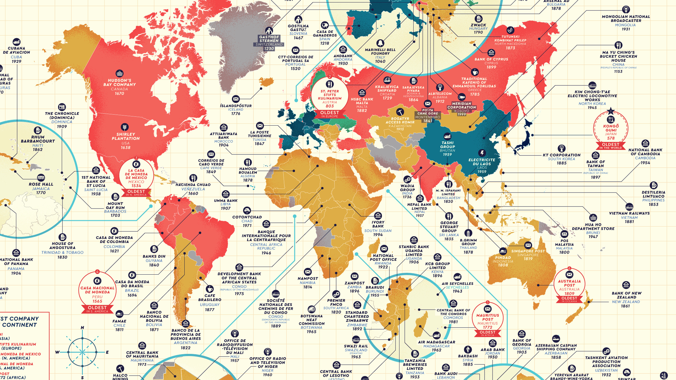
Maps show the oldest company in (nearly) every country – and a few interesting corporate trends.

A man’s skeleton, found facedown with his hands bound, was unearthed near an ancient ceremonial circle during a high speed rail excavation project.