Strange Maps
A special series by Frank Jacobs.
Frank has been writing about strange maps since 2006, published a book on the subject in 2009 and joined Big Think in 2010. Readers send in new material daily, and he keeps bumping in to cartography that is delightfully obscure, amazingly beautiful, shockingly partisan, and more. "Each map tells a story, but the stories told by your standard atlas for school or reference are limited and literal: they show only the most practical side of the world, its geography and its political divisions. Strange Maps aims to collect and comment on maps that do everything but that - maps that show the world from a different angle."
featured


All Stories
President Theodore Roosevelt vetoed the idea.
n Dominique Taléghani is a French scientific journalist by day, a designer of imaginary cartographies by night. On his or her (Dominique is one of those unisex first names) blog, […]
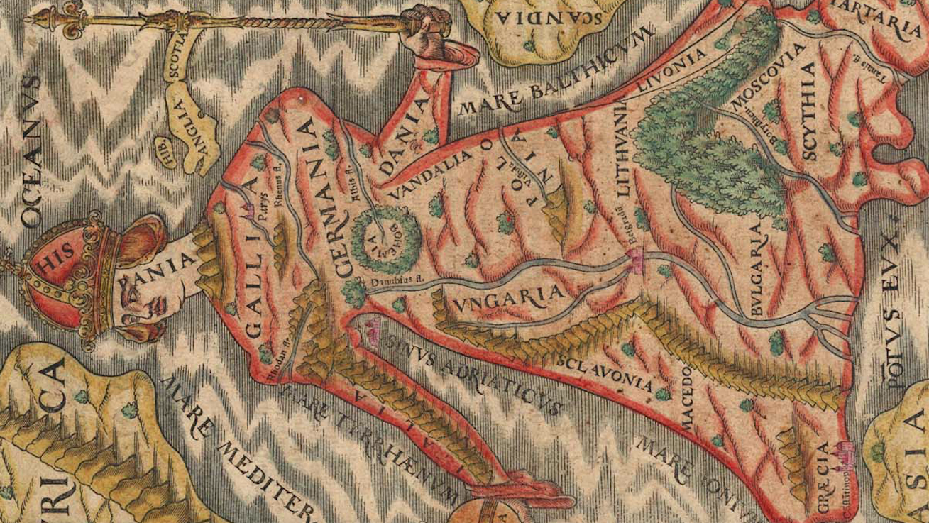
Spain is the head, Lithuania the left knee – you get the idea
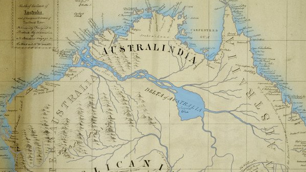
If other continents have large inland river systems, why wouldn’t Australia?
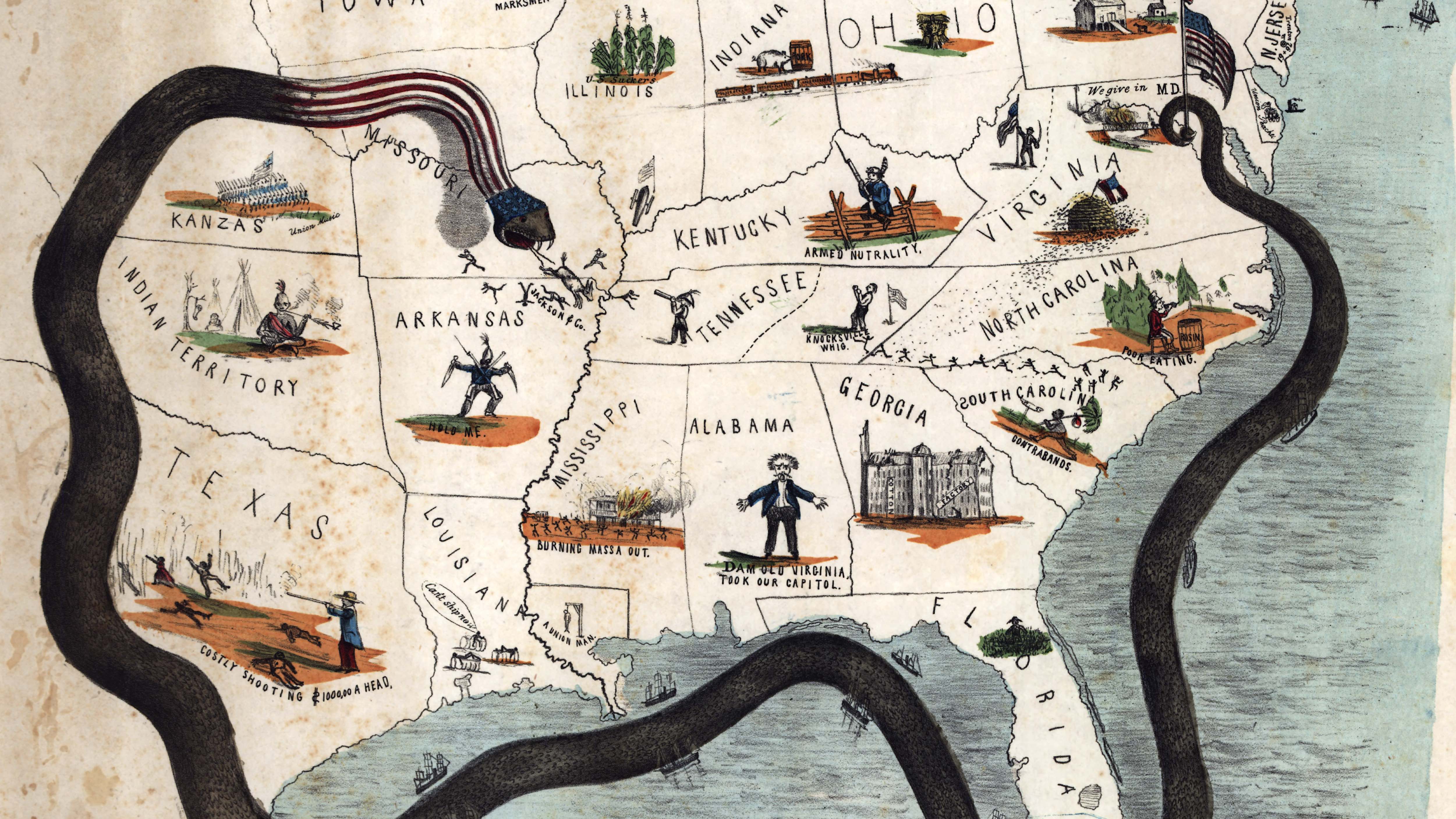
It might have snuffed out Secession with minimal loss of life; but Lincoln chose both the blockade and an invasion
I’m not in the habit of extensively revisiting strange maps already posted here, as there are so many more out there. But the map of the ‘US States Renamed For […]
n When it comes to the discovery and colonization of America, Iceland can claim a longer pedigree than all other European countries. The Icelandic explorer Leif Eriksson (970-1020) was the […]
Is the Boss to Jersey what Joyce was to Dublin?
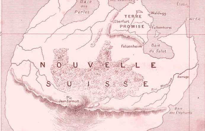
The only way to visit this island is to read the book
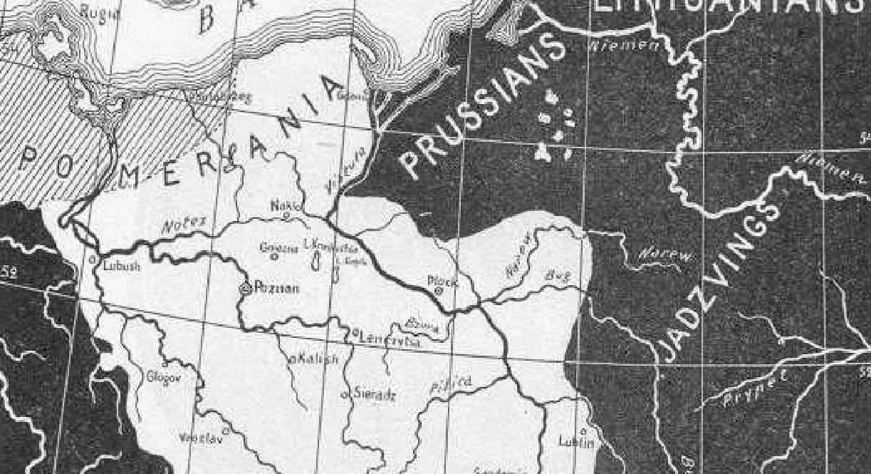
Despite centuries of war and territorial changes, Poland then looks a lot like Poland now.
n This map shows which climate European cities can expect 64 years in the future: n London‘s climate will resemble that of the Portuguese coast;nParis weather will resemble that of […]
n Somewhat in the style of a treasure map, this ‘Map of Online Communities’ shows MySpace, Wikipedia, SecondLife and other user-generated phenomena now populating the internet. n The geography is […]
n The United States expanded westward in ever more rectangular fashion, leading to states out west that are so square, they’re only recognisable in their geographical context. n This map […]
Today the hit counter of this blog went over one million. I’m at a loss for words. Thanks, all of you, for stopping by. I hope you keep enjoying this […]
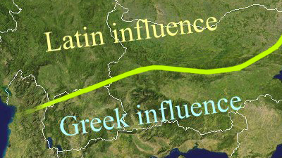
n English is the dominant language in the British Isles, also in their Celtic fringe – Ireland, Scotland, Wales. In Scotland but mainly in Ireland, some territorial measures have been […]
n Some 75 sq. km of the state of Western Australia form Australia’s oldest micronation. The Hutt River Principality has about 20 permanent residents, but thanks to the fascination exerted […]
This is a map of the Stockholm Metro, with the original Swedish names of all the stops translated into English. Literal translations often make for funny reading, and this map […]
n “I wanted something unique, something nobody else had. But every idea I had – it had already been done,” says Britta Oelschlaeger. The 33-year-old photographer, who hails from the […]
n China is flexing its economic muscle nowadays, a process the country itself terms a peaceful rise. One wonders what will happen when China will have ‘risen’: to what degree […]
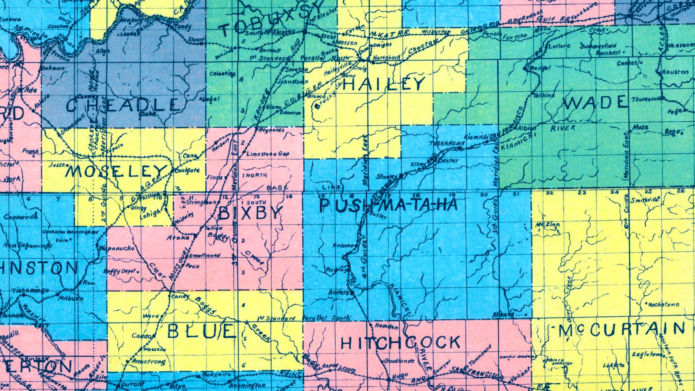
n The Commonwealth of Australia was formed in 1901. Its constitution provides for the creation of new states, also by subdividing extisting ones. Several proposals have been made to alter […]
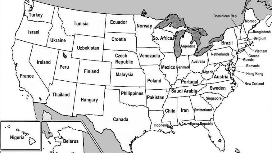
This map renames American states as countries with similar GDPs. It gives you a sense of just how wealthy the United States is.
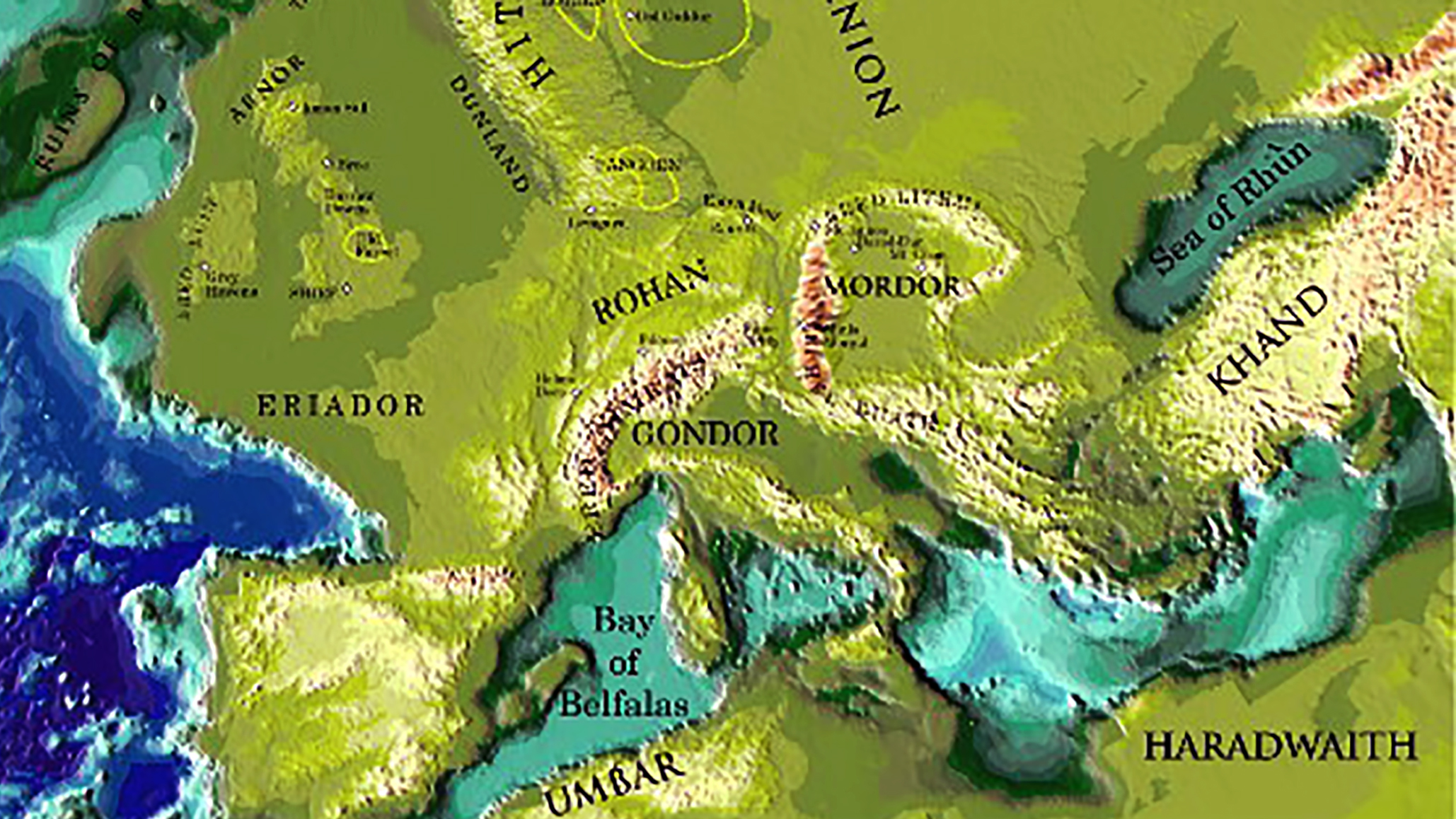
Tolkien himself wrote that “as for the shape of the world of the Third Age, I am afraid that was devised ‘dramatically’, rather than geologically, or paleontologically.”
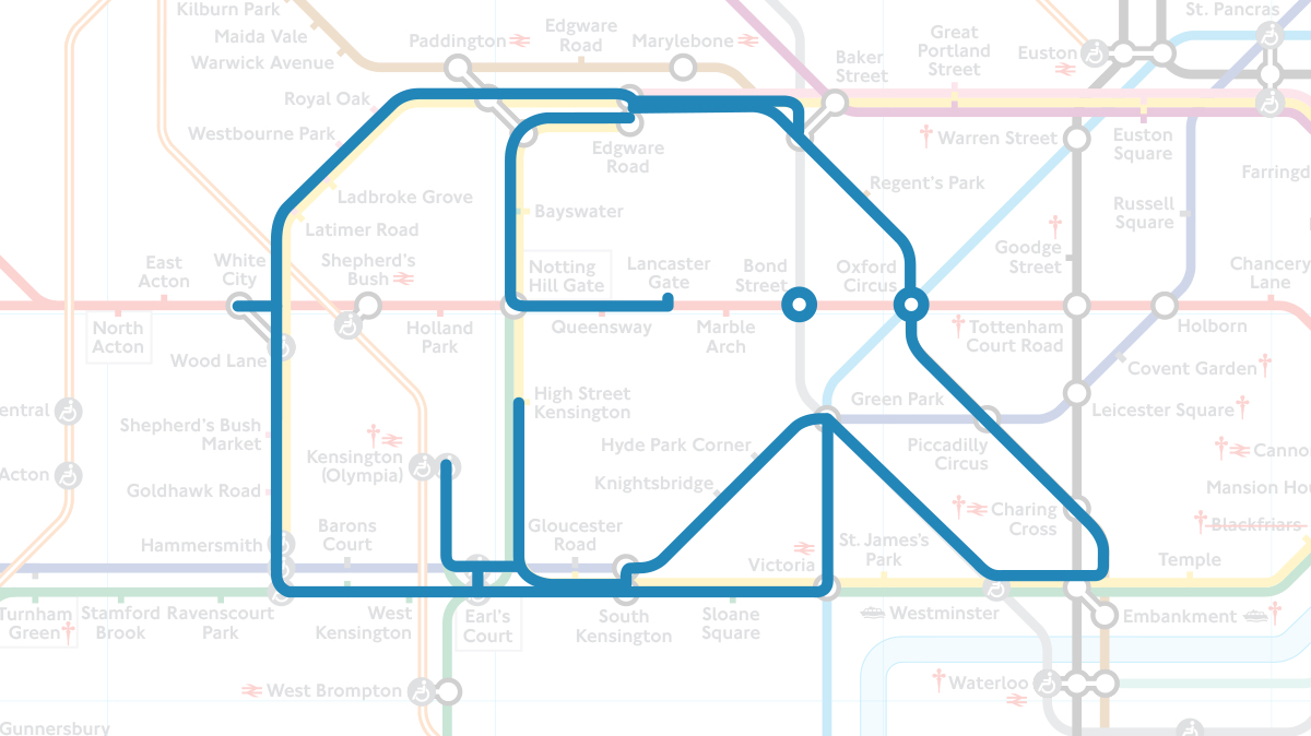
All Elephant and No Castle: a secret bestiary of the London Underground
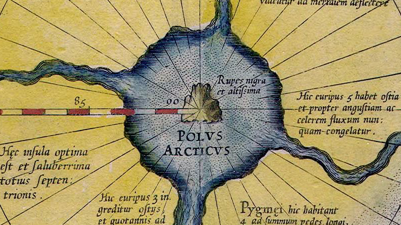
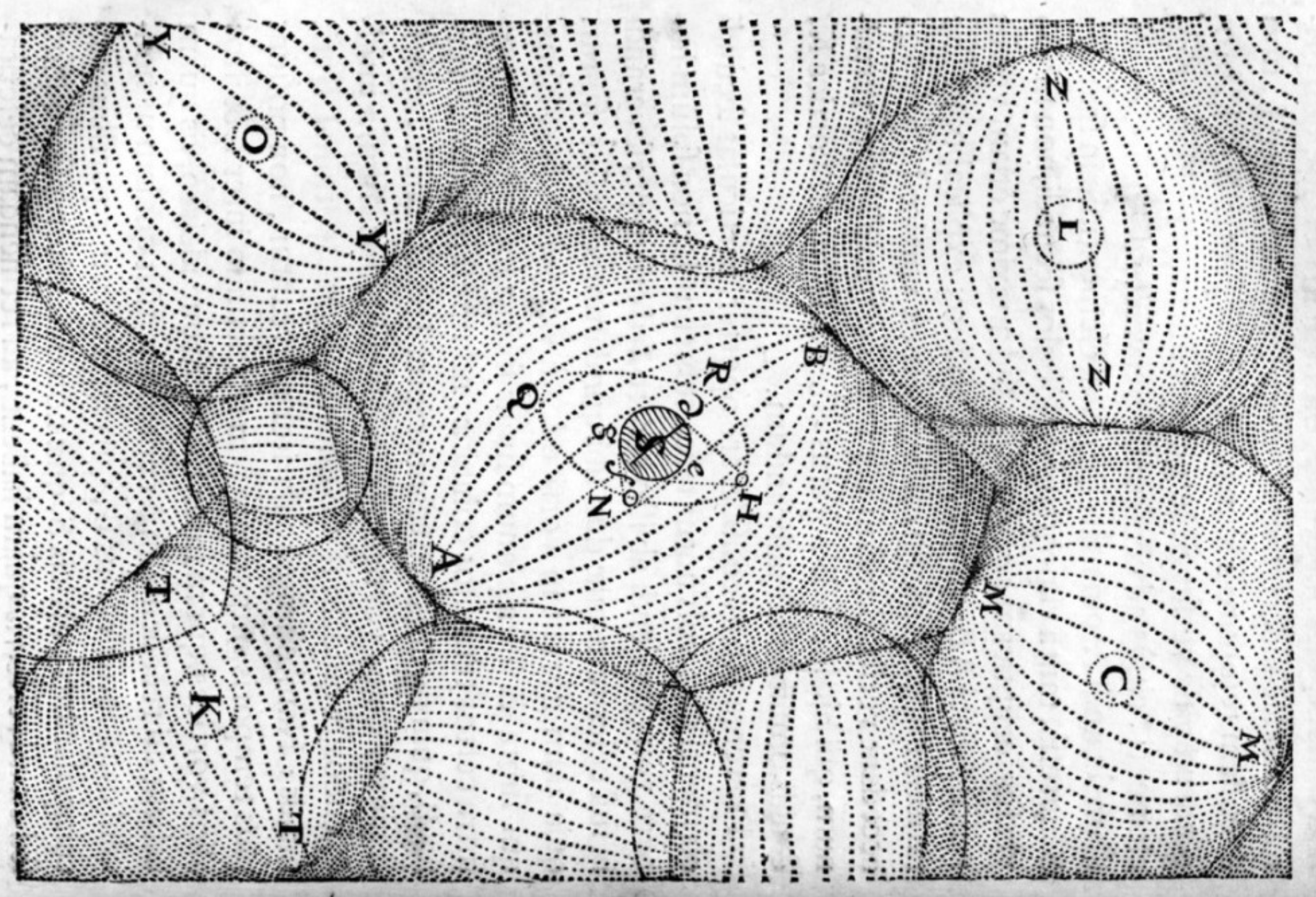
According to Mercator, the North Pole was marked by a giant black magnetic rock
n How delicious is this: obviously a sister-map to the one in posting #103 (‘EuropeFrom Moscow’), but this time applying an unusual perspective to the Cold War situation in Asia in […]
n n The frequently fascinating and highly recommended Catholicgauze (“a blog on geography, geographic thought, and cool geography links”) presents an interesting map showing the results of the first round […]
n A map that does justice to the strangeness of the Cooch Behar enclave complex risks either to be too big to conveniently post here, or too small to show […]
n Under the presidency of Sam Houston (1836-’38, 1841-’44) the then independent Republic of Texas almost came to a peace agreement with the tribal collective known as the Comanche. The […]