Strange Maps
A special series by Frank Jacobs.
Frank has been writing about strange maps since 2006, published a book on the subject in 2009 and joined Big Think in 2010. Readers send in new material daily, and he keeps bumping in to cartography that is delightfully obscure, amazingly beautiful, shockingly partisan, and more. "Each map tells a story, but the stories told by your standard atlas for school or reference are limited and literal: they show only the most practical side of the world, its geography and its political divisions. Strange Maps aims to collect and comment on maps that do everything but that - maps that show the world from a different angle."
featured


All Stories
n A gallant piper, stuggling through the bogs,nHis wind bag broken, wearing his clay clogs;nYet, strong of heart, a fitting emblem makesnFor Scotland – land of heroes and of cakes. […]
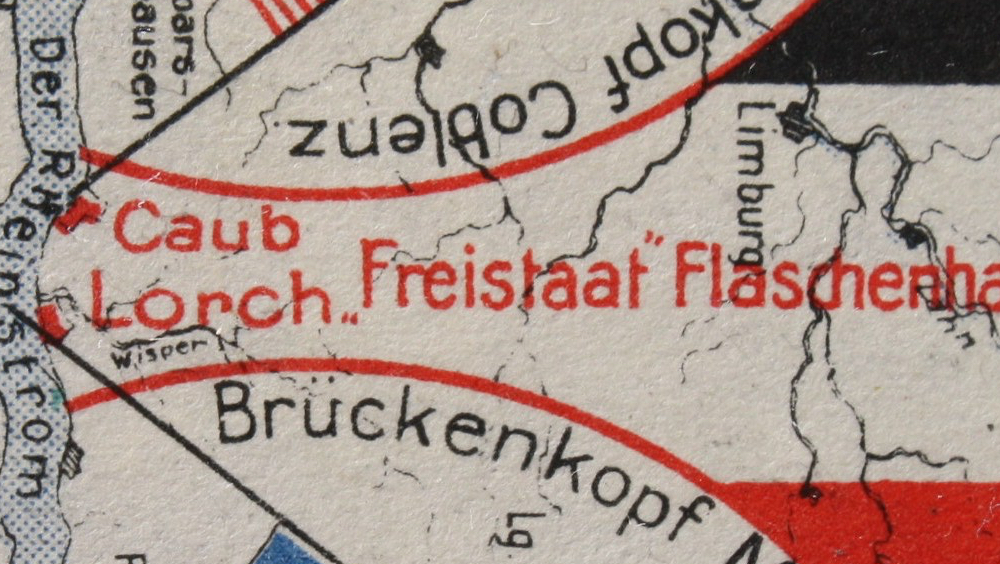
Squeezed in between two occupation zones, the locals opted for independence – and smuggling.
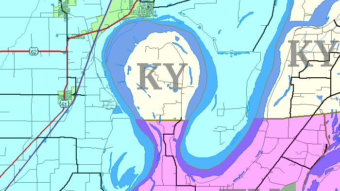
Meet Kentucky’s western exclave, courtesy of the Mississippi
Almost ten years after its first publication, are the predictions in this book any closer to coming true?
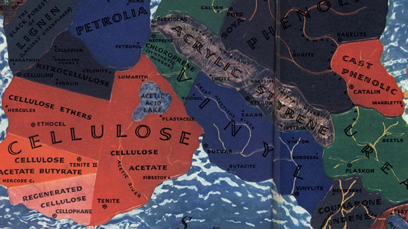
A 1940 map of a fictional continent slightly resembling South America, symbolising different aspects of the new and exciting world of plastics
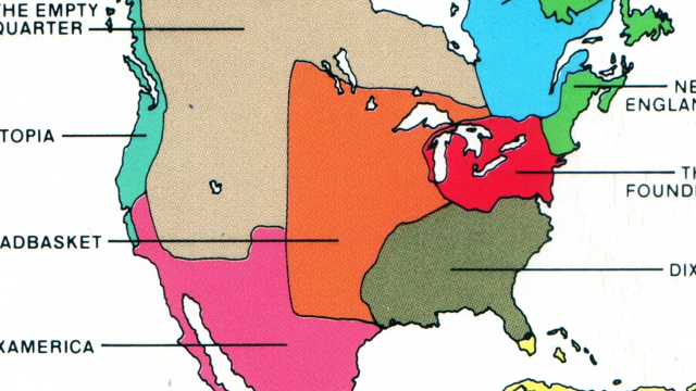
Forget about the United States of America, forget about Canada and about Mexico. North America might be divided into these three states, but the northern half of the American continent […]
The series of tubes famously dubbed the ‘internets’ by president G.W. Bush* constitute a world wide web of interconnectedness. But, as this map demonstrates, there are some black holes in […]
At 678.051 km² (261.797 sq. mi), Texas is the largest of the 48 contiguous states. With a population of over 23 million, it’s also the second most populous, after California. […]
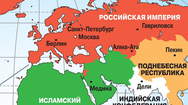
When historians look back on the current conflict in Iraq, they might very well call it the Third Gulf War. The first one would have been the Iran-Iraq War (1980-1988), […]
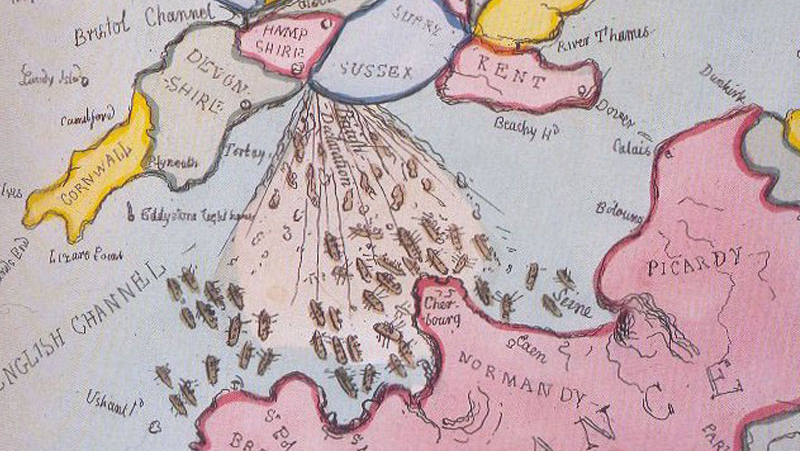
Brexit lends a renewed poignancy to Gillray’s scatological cartoon
n “It takes a big state to absorb the entire North every winter,” the New York Times wrote on February 2 of this year. “Florida is pulling it off.” n […]
n The Daily Mail is one of the UK’s more euroskeptic newspapers, so it must have been with much delight that they were able to present this map to their […]
Heinrich Bunting‘s Itinerarium Sacra Scripturae (‘Travels According to the Scriptures’), first published in 1581, contained accurate maps of the Holy Land, but also three maps of pure fantasy. Two of […]
After 1945, Germany lost about a quarter of its pre-1933 territory to Poland and the Soviet Union. The German-Polish border was established at the so-called Oder-Neisse Line, after the two […]
On 23 July 1977, this map appeared in Krazy Comic, a short-lived (Oct ’76 – Apr ’78) British comic magazine. Judging by the colours alone, this is pretty much your […]
n n This little piece of fashion cartography was made by Dutch artist Coriette Schoenaerts, based in Amsterdam and London. On her website, she explains why she went to the […]
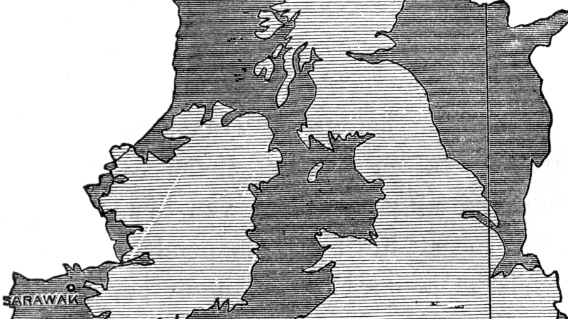
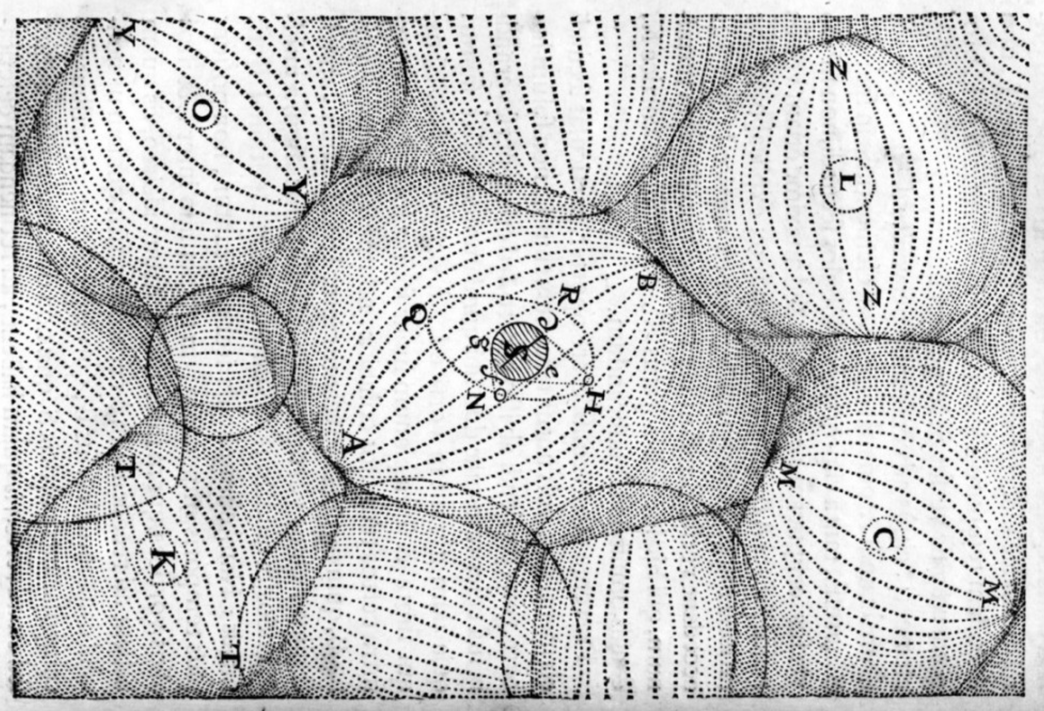
A curious map from Alfred Russel Wallace, the father of biogeography

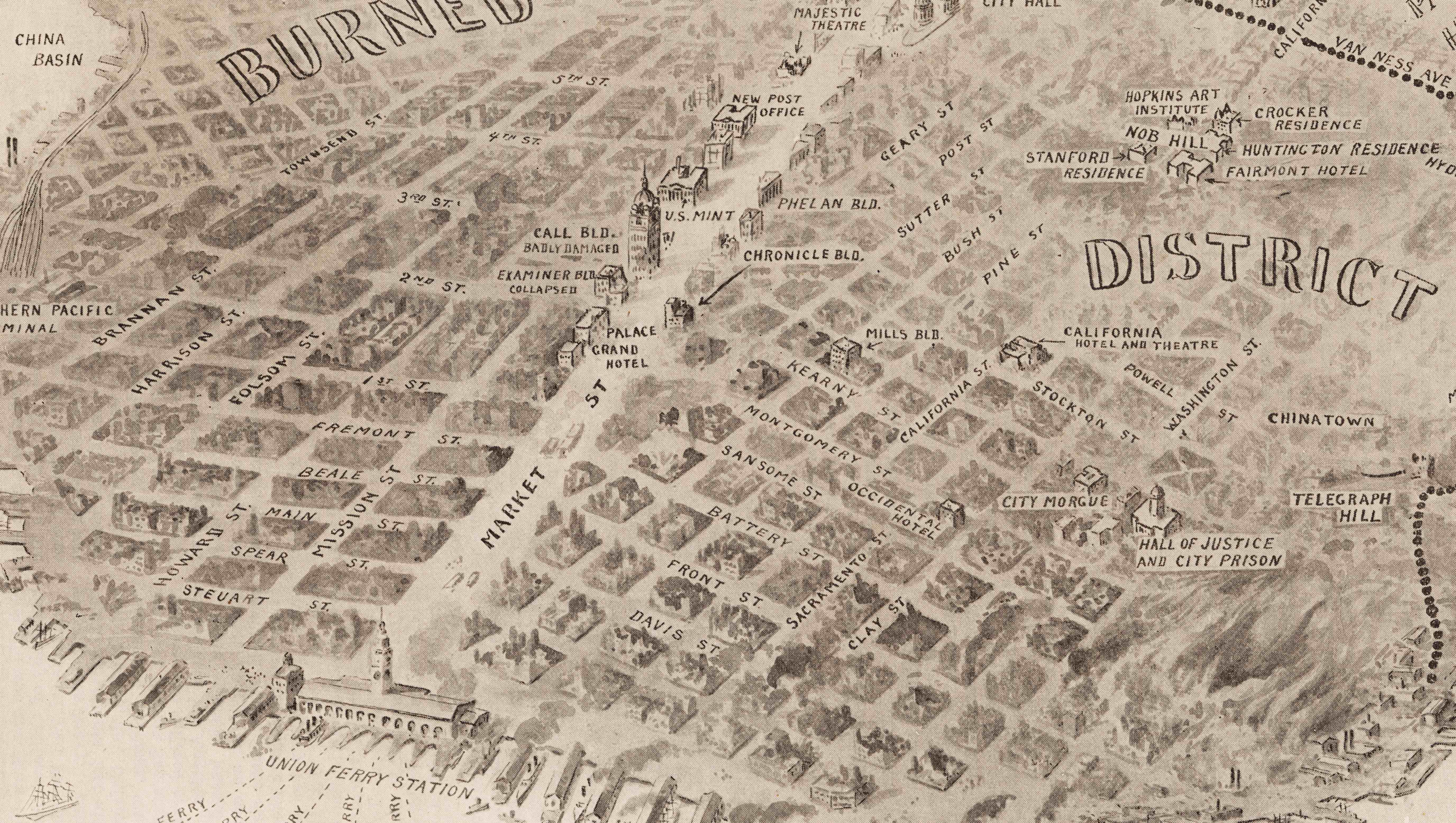
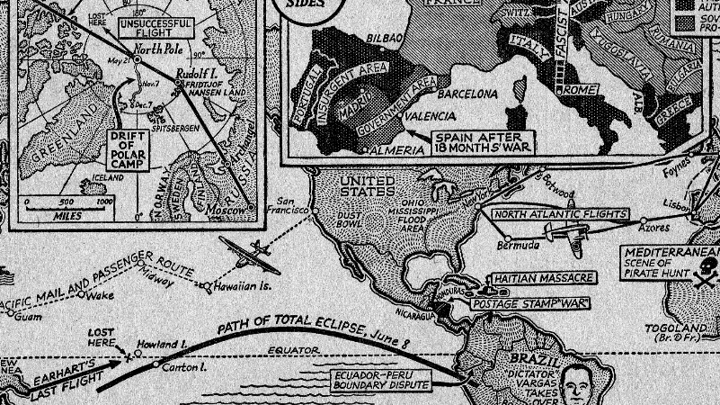
111 years ago, San Francisco was almost wiped off the map
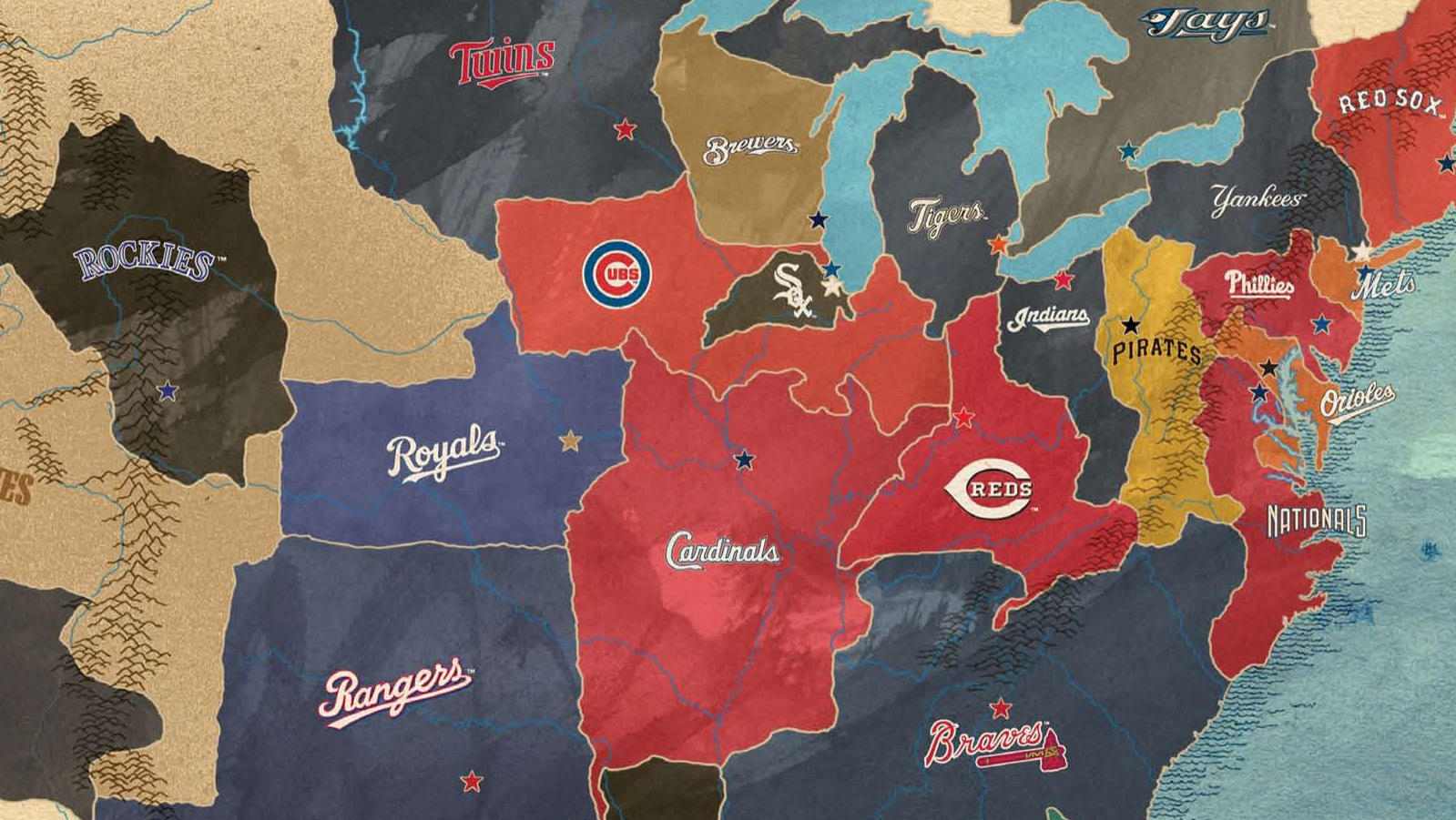
Baseball is the quintessential North American sport, as demonstrated by this map
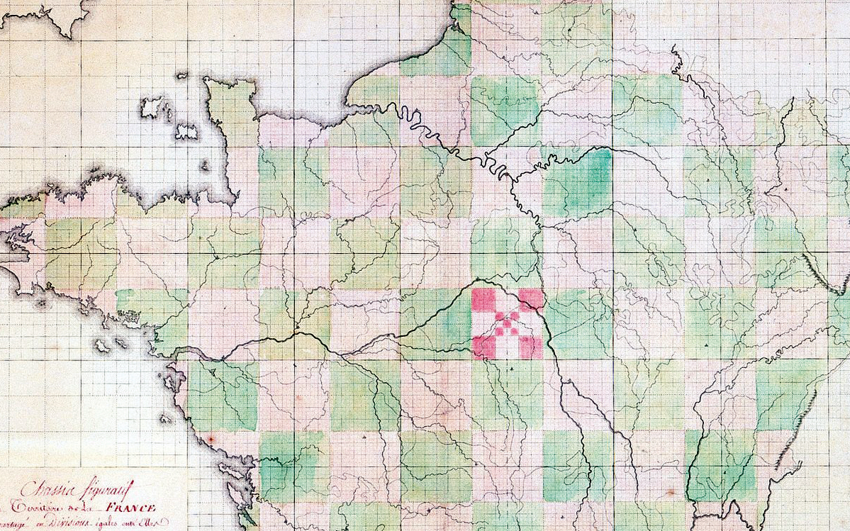
What could be more rational – or more revolutionary – than to impose a rectangular grid on France’s age-old divisions?
Intangible and invisible, but omnipresent: that combination of qualities used to describe only God (or the sense of dread left by His absence). Now it also applies to cyberspace. Any […]
n This is to my knowledge the only indisputable evidence of a nimbo-cartographic simulacrum, ever! You’ll find it on the website of the Fortean Times, a monthly magazine dedicated to […]
n This remarkable painting was made by the Norwegian artist Rolf Groven as a poster proposal for Norway’s pavilion at the World Exhibition in Seville (Spain) in 1992. The title […]
n The Turks have Piri Reis, whose 1513 map shows parts of America and Antarctica with astonishing and, in the case of Antarctica, frankly inexplicable accuracy. The Chinese have this […]
There´s a certain type of children´s literature that just positively requires a map at the end paper of the book. The map is there either to show an itinerary that […]
If you want to witness a total solar eclipse and you live in Europe, you’re out of luck until at least 2026. Unless you live in one of a few […]
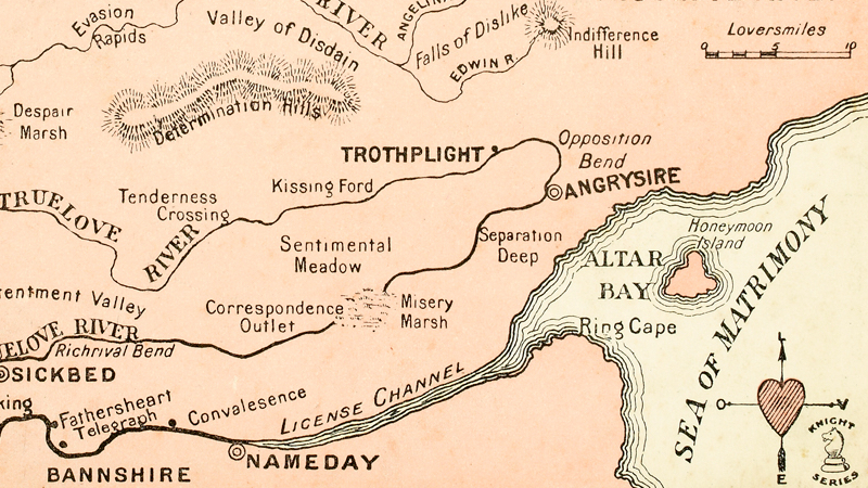
Stuck in Despair Marsh, or marching up the Determination Hills?
As we’ve all learned in school, 70% of the Earth’s surface is covered by water, only 30% is solid ground. What if everything was reversed? What if every land mass […]