Strange Maps
A special series by Frank Jacobs.
Frank has been writing about strange maps since 2006, published a book on the subject in 2009 and joined Big Think in 2010. Readers send in new material daily, and he keeps bumping in to cartography that is delightfully obscure, amazingly beautiful, shockingly partisan, and more. "Each map tells a story, but the stories told by your standard atlas for school or reference are limited and literal: they show only the most practical side of the world, its geography and its political divisions. Strange Maps aims to collect and comment on maps that do everything but that - maps that show the world from a different angle."
featured


All Stories
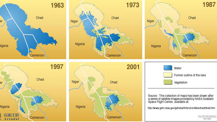
A series of maps detail the rapid disappearance of Lake Chad in Africa.
The Treaty of London gave the eastern half to the Netherlands, creating its curious southern panhandle
Ever since it achieved unification in 1871, Germany craved colonies as a matter of national pride. But by the late nineteenth century, most of the ‘uncivilised world’ was already carved […]
n n This map, made by Mahmud Kashgari bin Husayn bin Muhammad, was included in his Divanu Lügat-it-Türk, a scientific work he published in 1072 (AD) for the benefit of […]
n Gulliver’s Travels (1726) is a satire of contemporary England dressed up as a faux traveller’s tale by Jonathan Swift, narrating in the first person the voyages of one Lemuel […]
nn n It seems impossible to find an online map showing all of the European Union’s so-called Euroregions. Why doesn’t the EU showcase these transnational regions, conceived to promote economic […]
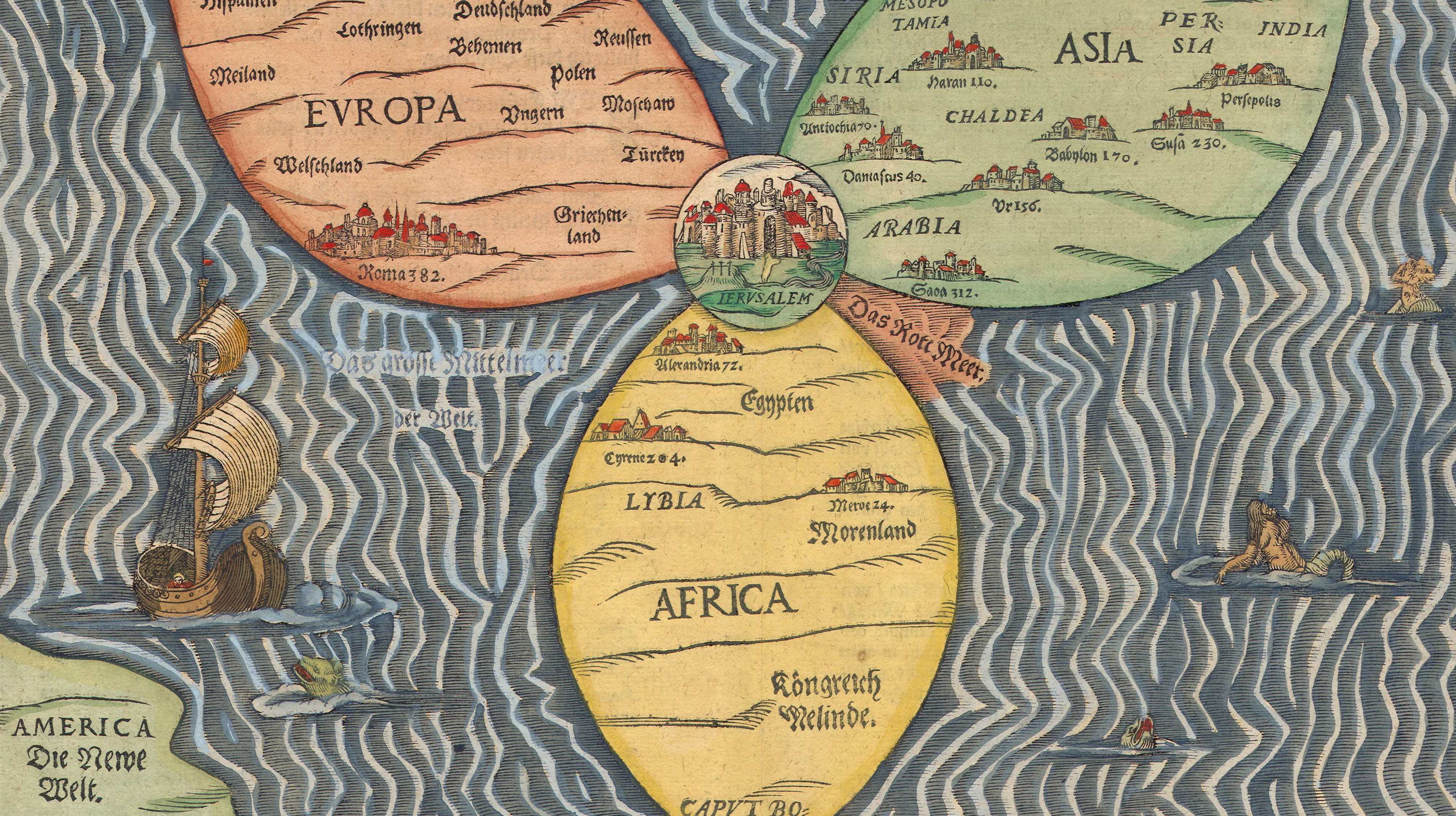
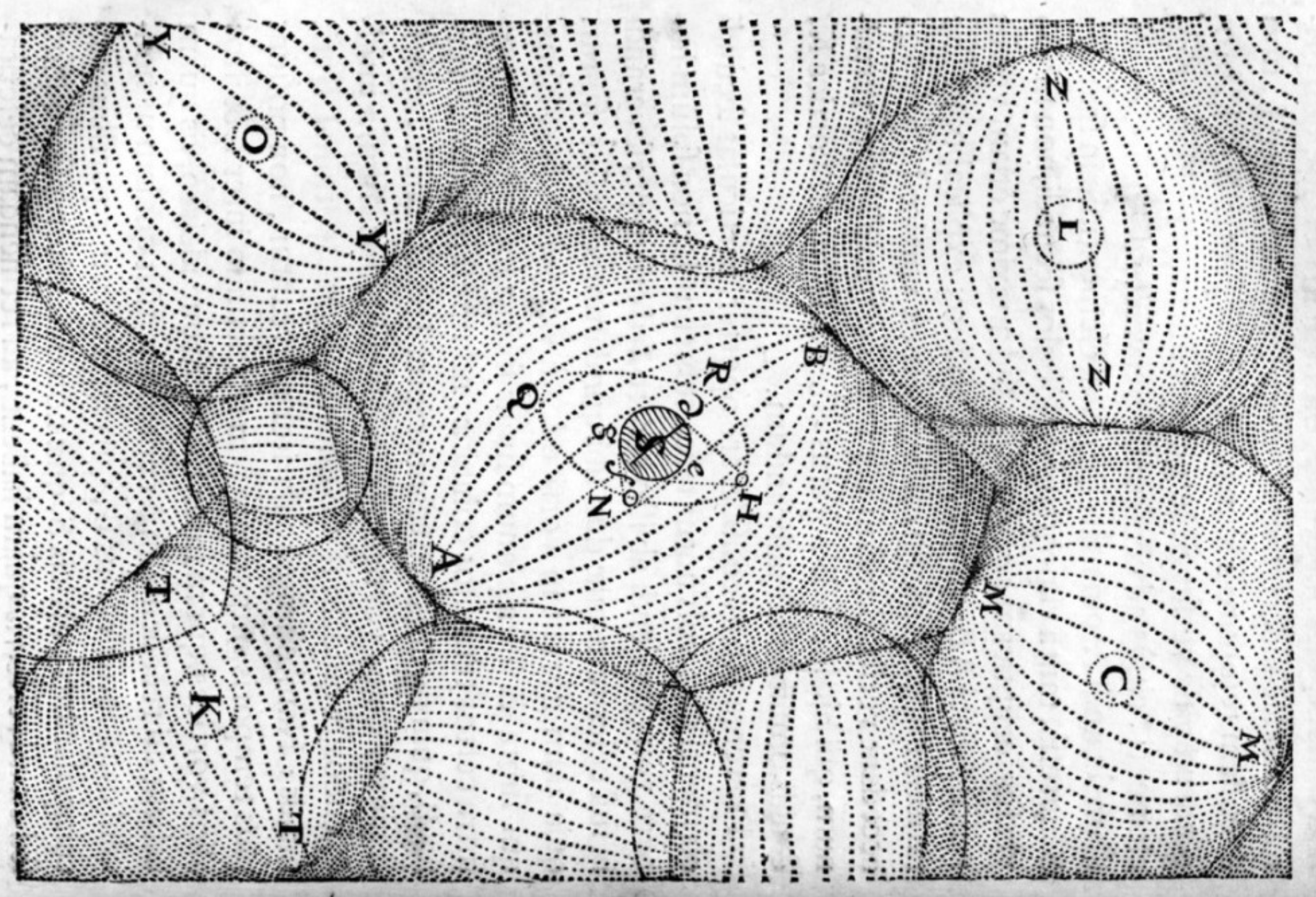
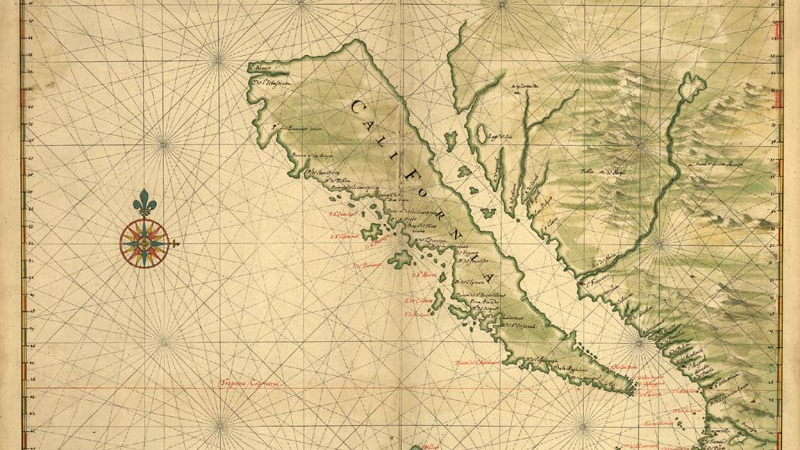
A beautiful map from the time when symbolic cartography was giving way to the Age of Discovery
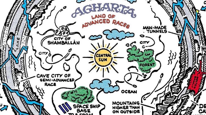
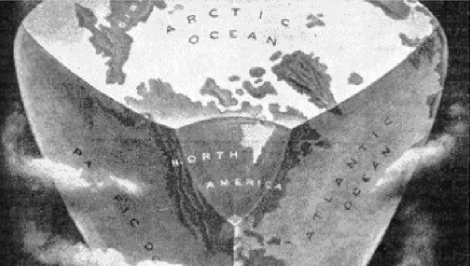
If the Earth is hollow, where does all that magma spewing out of all those volcanoes come from? Somebody must have a half-convincing answer to that question, presumably that handful […]
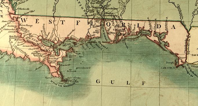
“West Floriday, that lovely nation, Free from king and tyranny, Thru’ the world shall be respected, For her true love of Liberty!” So goes a marching song that never got […]
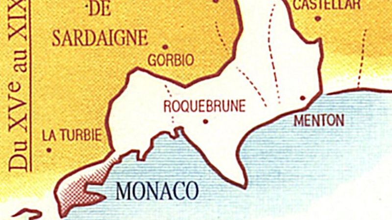
Even one of the world’s most comically small countries can look back on centuries of territorial bigness.
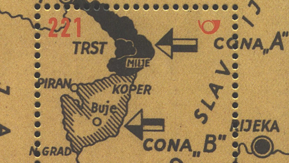
The southern terminus of the Iron Curtain could have been the starting point of World War III
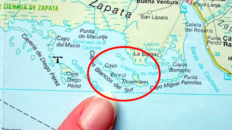
Castro gifted the island to East Germany. They never gave it back. So whose is it now?
n Another traffic map of sorts. If this world map vaguely looks like it’s highlighting a remnant of the British Empire, that’s no coincidence. This map shows which side of […]
n No cloud without a silver lining: the extensive bombing damage to London during the Second World War provided an opportunity to develop a drastic plan for a green, open-spaced […]
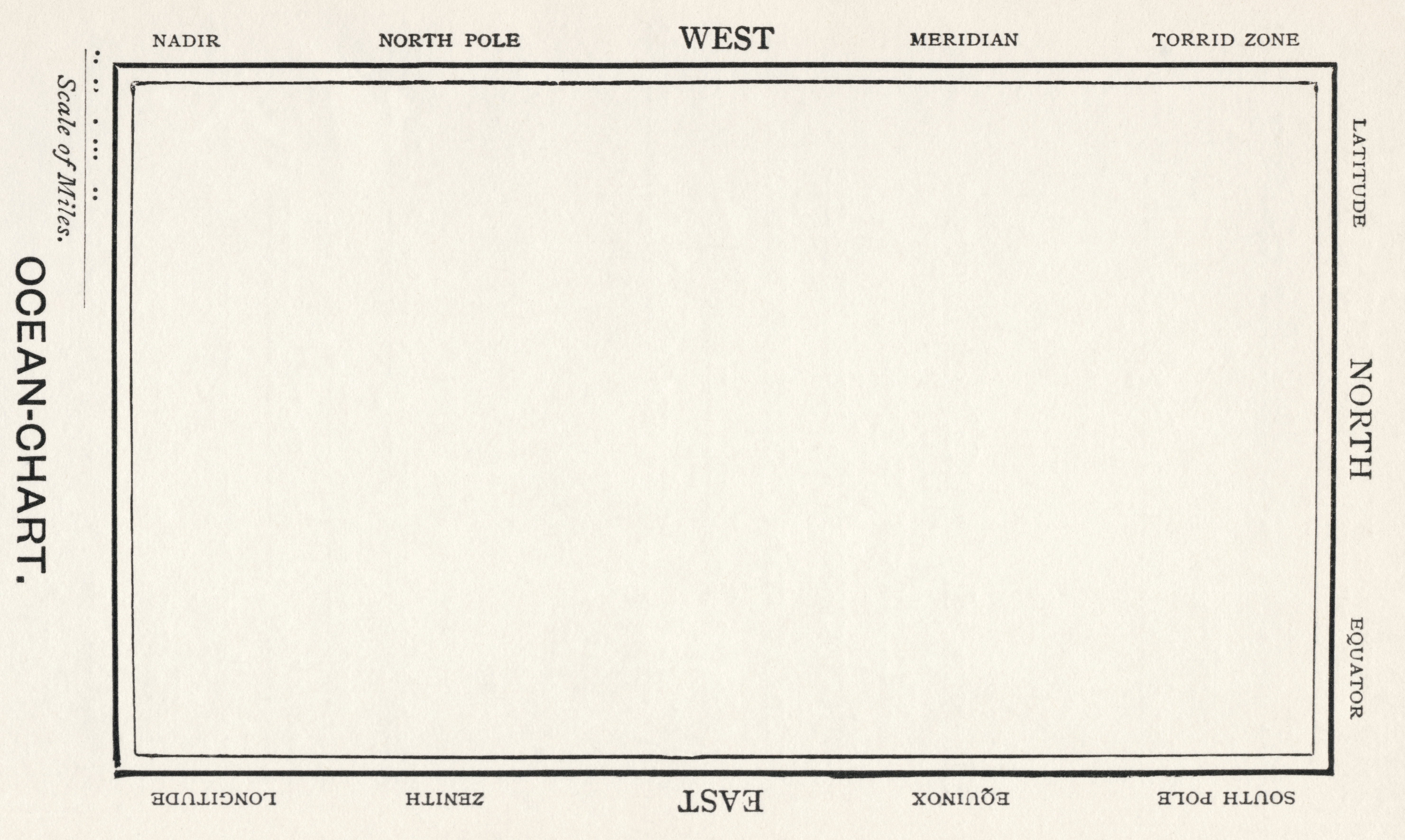
This map is from the Agile Rabbit Book of Historical and Curious Maps (Pepin Press, 2005). It’s a British map dating from 1897, explaining geographical terms by showing them in […]
Many New Yorkers feel their city is more than just the (self-proclaimed) capital of the world. They think it actually is most of the world, the rest of the planet […]
n Nowadays, the southern tip of Africa is dominated by a single state, the Republic of South Africa (punctuated by Lesotho, one of the world’s few enclave-states). But starting about […]
n The Dwight D. Eisenhower National System of Interstate and Defense Highways (Eisenhower Interstate System for short) spans the entire USA, including Alaska and Hawaii. The EIS serves all major American cities and […]
“Who would not pity the poet who has to write and make his rhymes about some bold Sir Francis Drake’s brave journey round the tetrahedron?”
n Your typical American border is the straight line, as demonstrated by the US-Canadian border that follows the 49th parallel for approximately 1.245 miles (2.000 km), longer than any other […]
n The Pennsylvania-Delaware border is characterised by not one, but two cartographic anomalies. One is the Twelve Mile Circle (see previous post), the other one is the Delaware Wedge, an […]
n In November 1915, diplomats François Georges-Picot (for France) and Mark Sykes (for Britain) negotiated an ‘understanding’ about how to divide the Middle East into spheres of influence for their […]
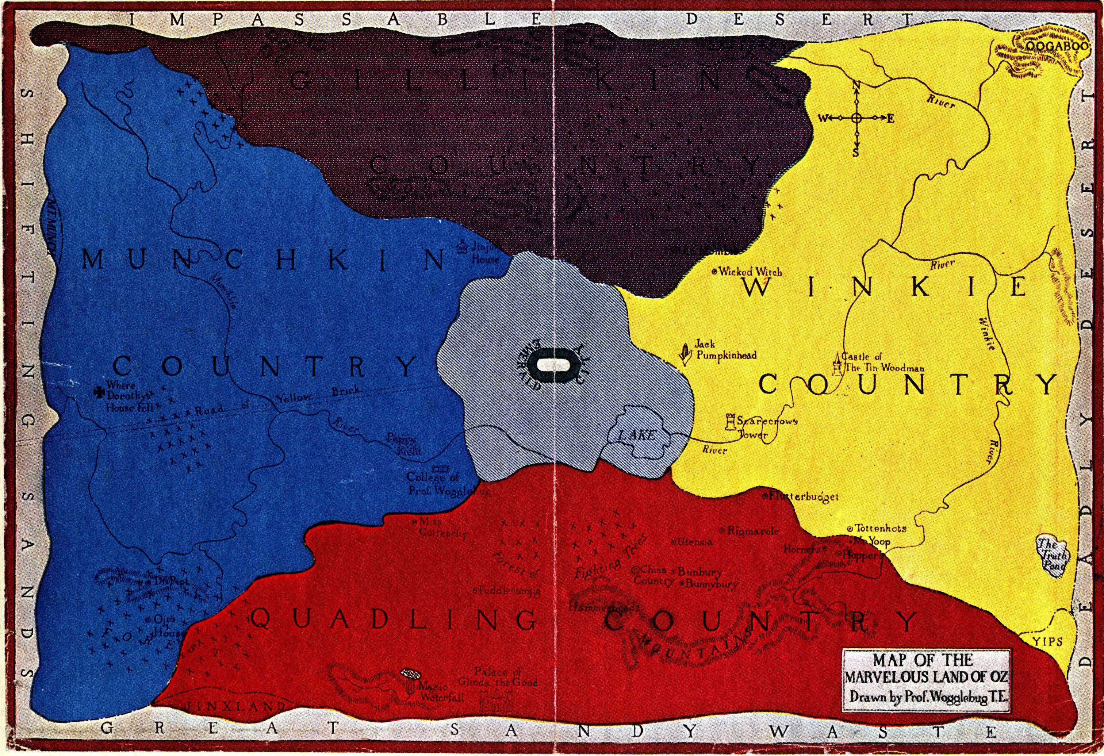
Is the Land of Oz located on a retrograde planet?
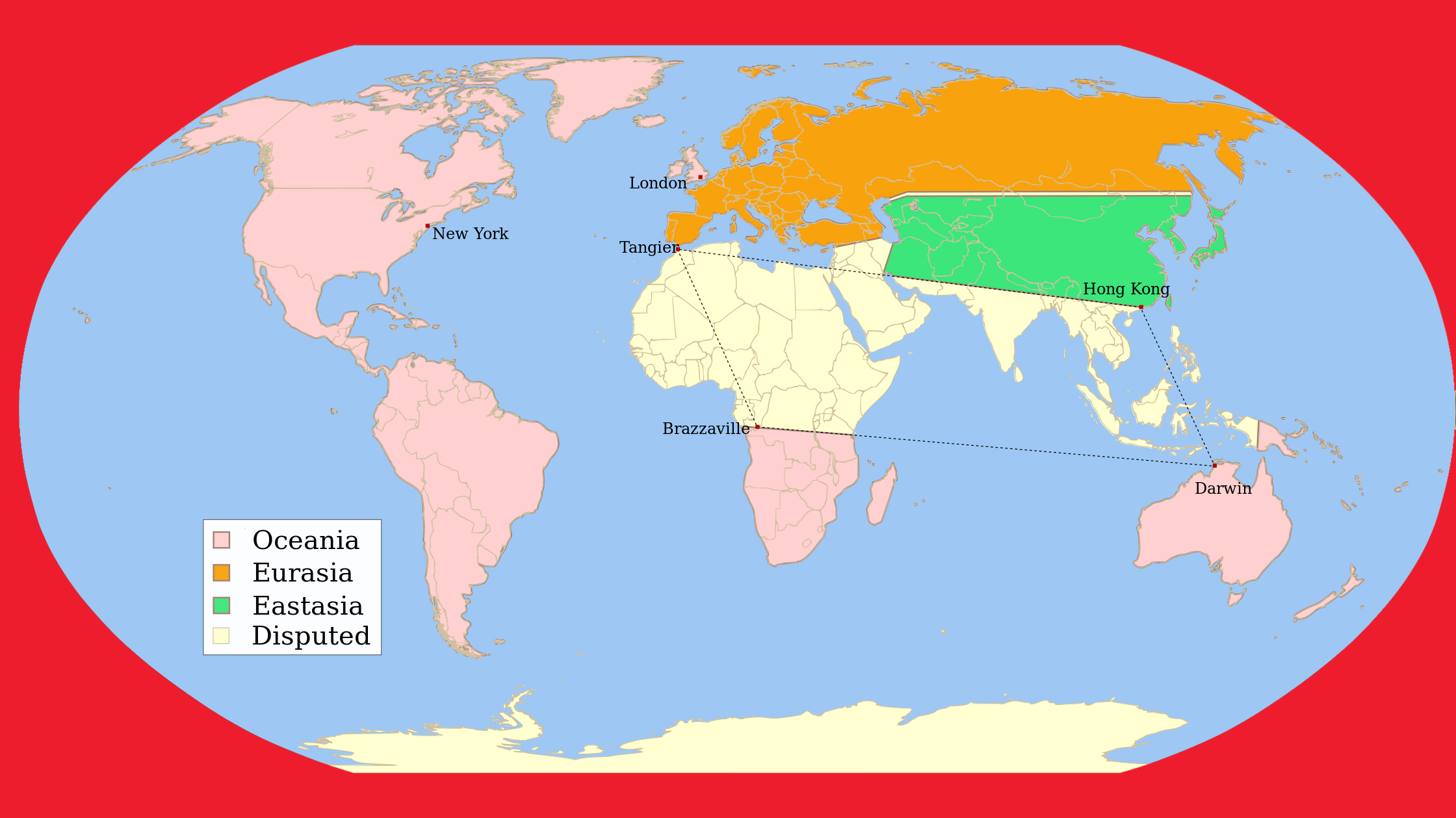
In George Orwell’s dystopian novel ‘1984’, the world is ruled by three superstates. Unfortunately, there’s not much ‘super’ to these states except their size.
In the Netherlands straight after World War II, there existed plans both official and unofficial to annex a large area of Germany as a way of obtaining war reparations (plans […]
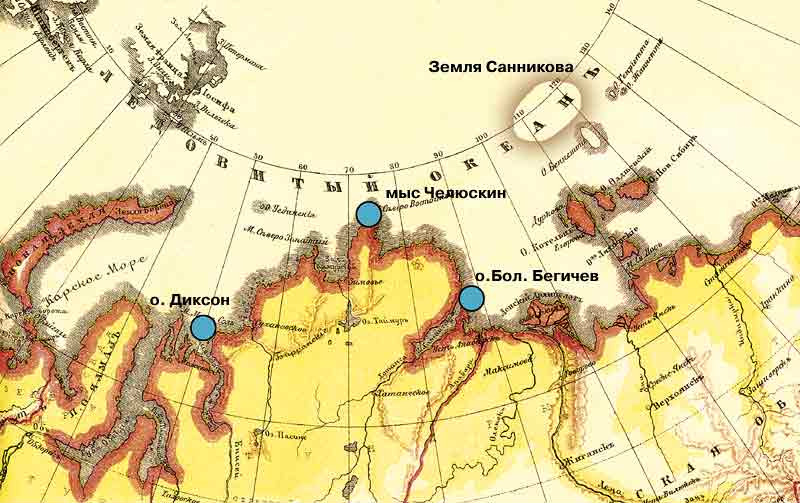
The island inspired a Soviet SF novel and movie
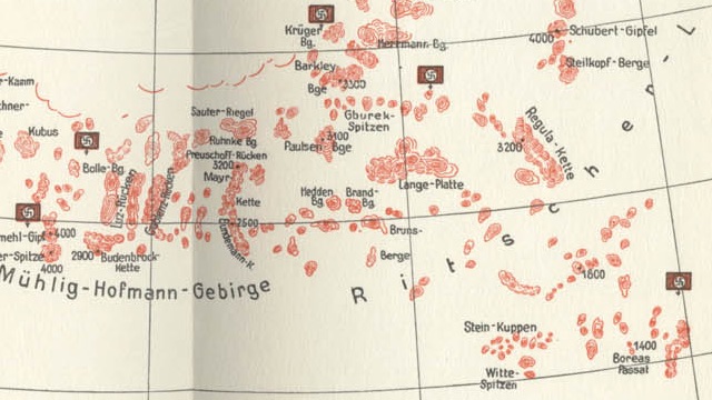
Up to 8,000 people each year go hunting for a legendary gold mine, guided by cryptic maps like these.
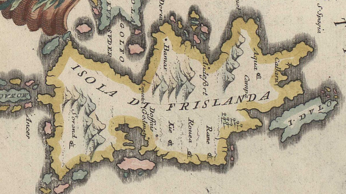
The Zeno Brothers invented a bunch of islands north of Scotland that turned out to have remarkable staying power on maps