Strange Maps
A special series by Frank Jacobs.
Frank has been writing about strange maps since 2006, published a book on the subject in 2009 and joined Big Think in 2010. Readers send in new material daily, and he keeps bumping in to cartography that is delightfully obscure, amazingly beautiful, shockingly partisan, and more. "Each map tells a story, but the stories told by your standard atlas for school or reference are limited and literal: they show only the most practical side of the world, its geography and its political divisions. Strange Maps aims to collect and comment on maps that do everything but that - maps that show the world from a different angle."
featured


All Stories
n Your typical American border is the straight line, as demonstrated by the US-Canadian border that follows the 49th parallel for approximately 1.245 miles (2.000 km), longer than any other […]
n The Pennsylvania-Delaware border is characterised by not one, but two cartographic anomalies. One is the Twelve Mile Circle (see previous post), the other one is the Delaware Wedge, an […]
n In November 1915, diplomats François Georges-Picot (for France) and Mark Sykes (for Britain) negotiated an ‘understanding’ about how to divide the Middle East into spheres of influence for their […]
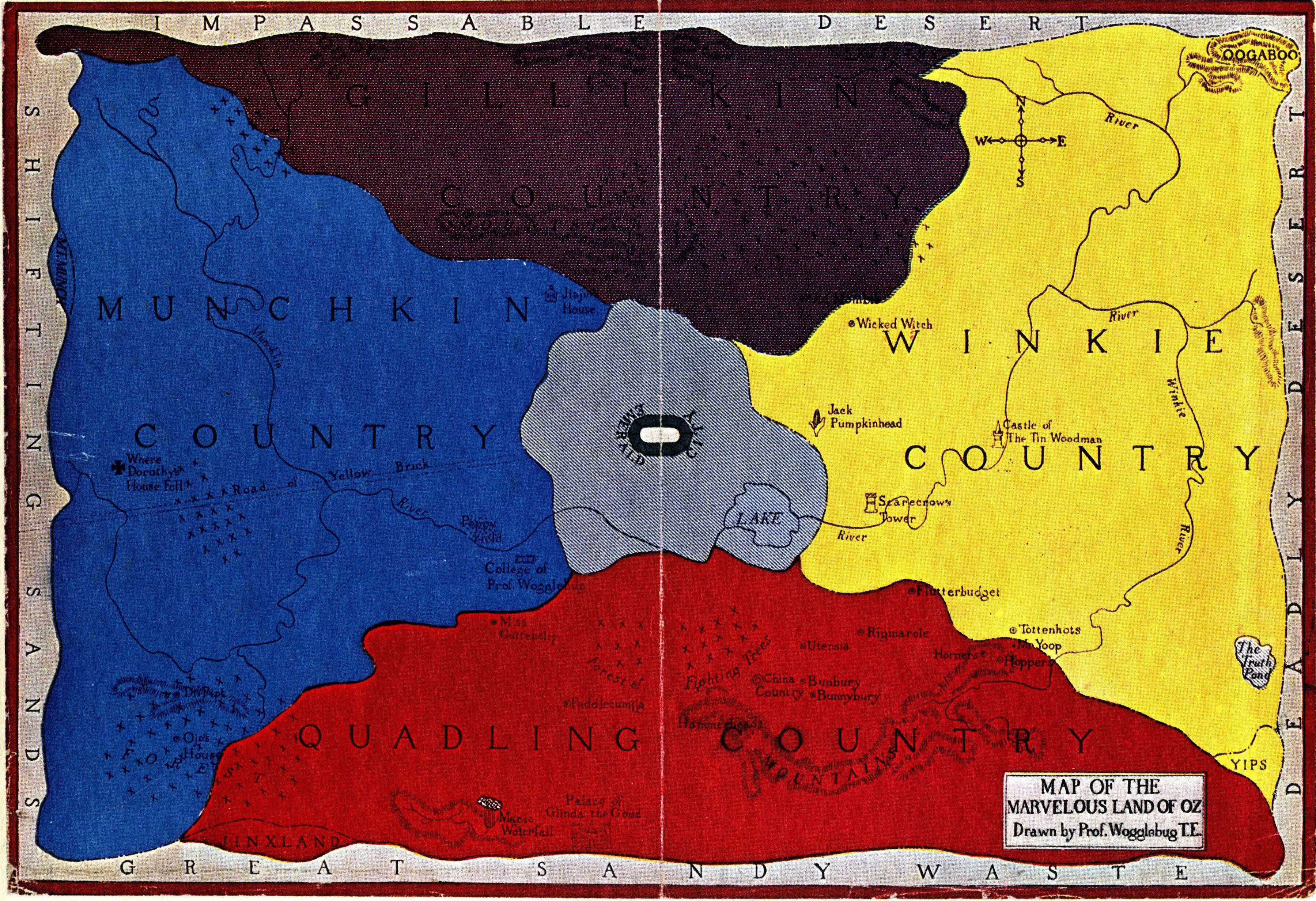
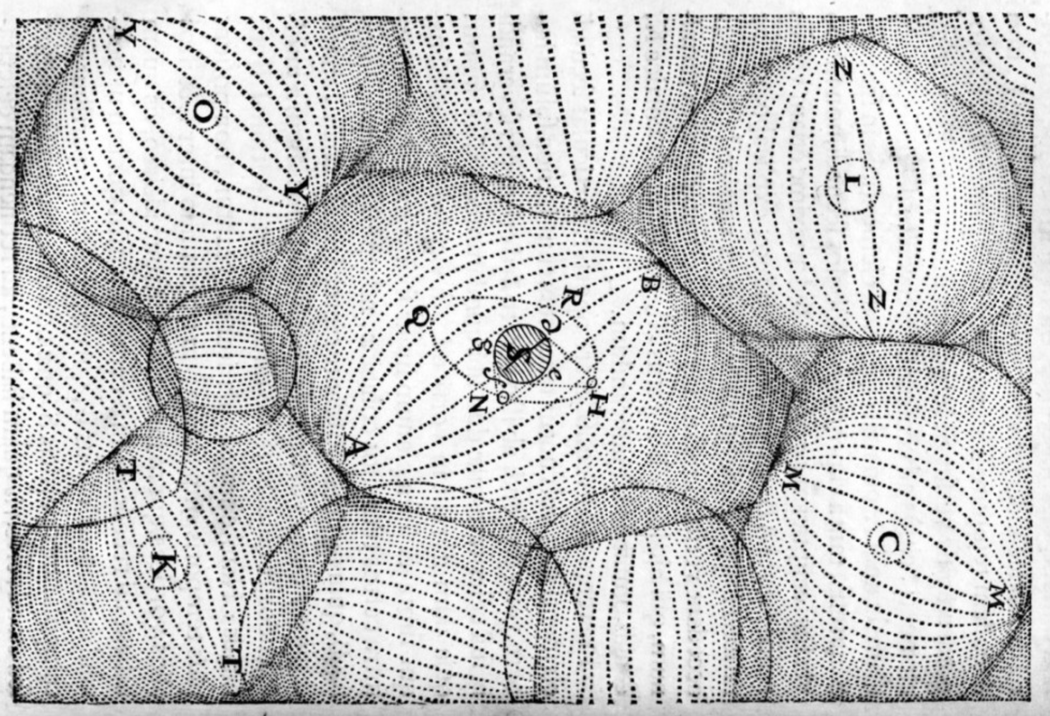
Is the Land of Oz located on a retrograde planet?
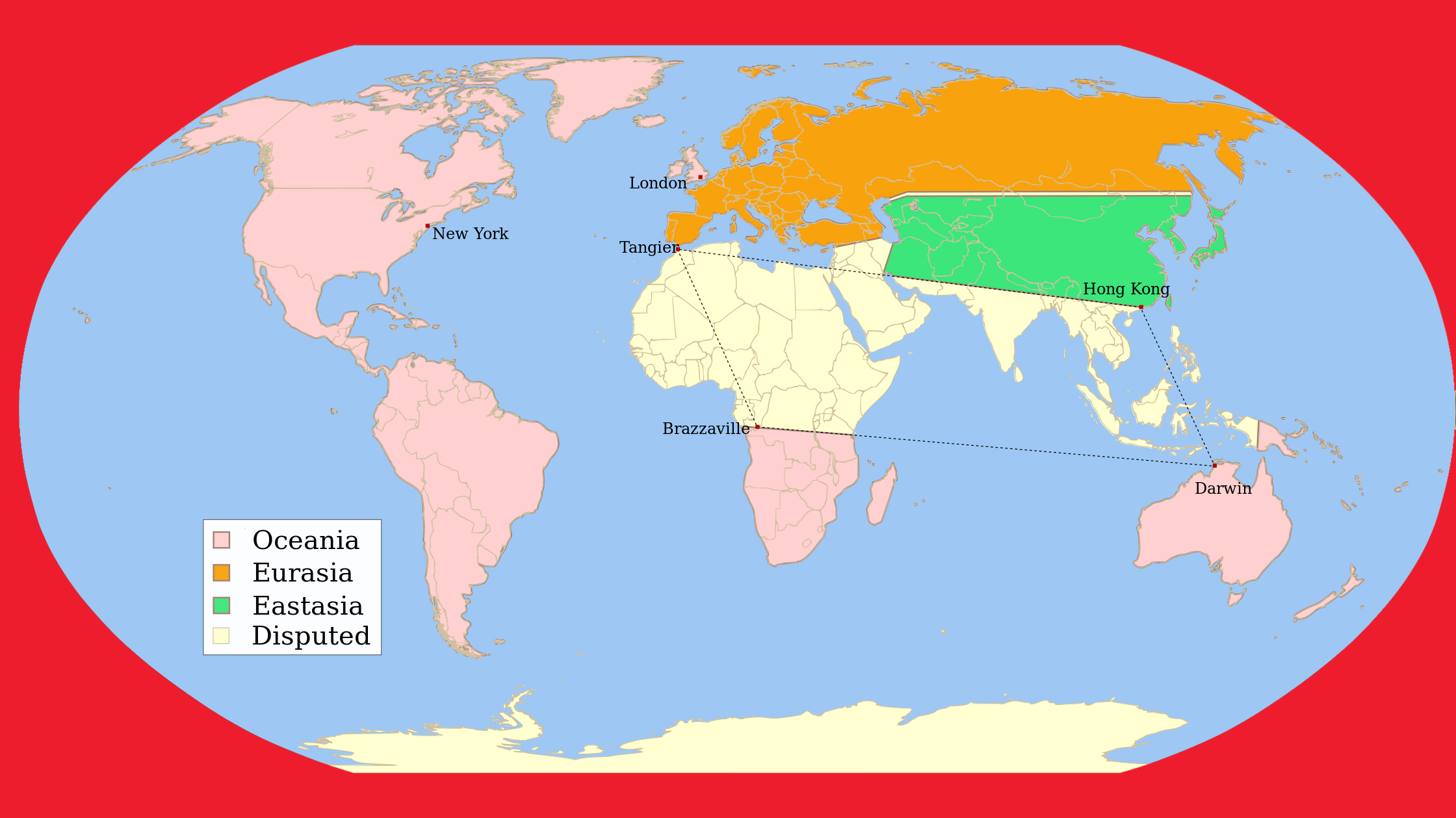
In George Orwell’s dystopian novel ‘1984’, the world is ruled by three superstates. Unfortunately, there’s not much ‘super’ to these states except their size.
In the Netherlands straight after World War II, there existed plans both official and unofficial to annex a large area of Germany as a way of obtaining war reparations (plans […]
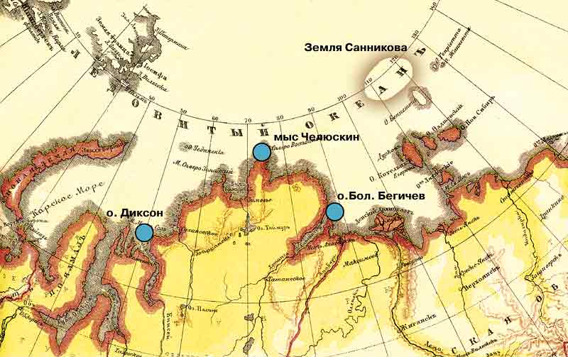
The island inspired a Soviet SF novel and movie
Up to 8,000 people each year go hunting for a legendary gold mine, guided by cryptic maps like these.
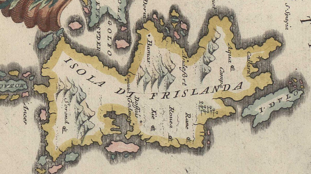
The Zeno Brothers invented a bunch of islands north of Scotland that turned out to have remarkable staying power on maps
Most people know that Batman lives in Gotham City, and that this fictional place is a barely disguised version of New York City – so much so that in real […]
The Vinland Map was discovered in 1957, bound up with a manuscript of undisputed antiquity, the Historia Tartorum. The map supposedly is a 15th century copy of a 13th century […]
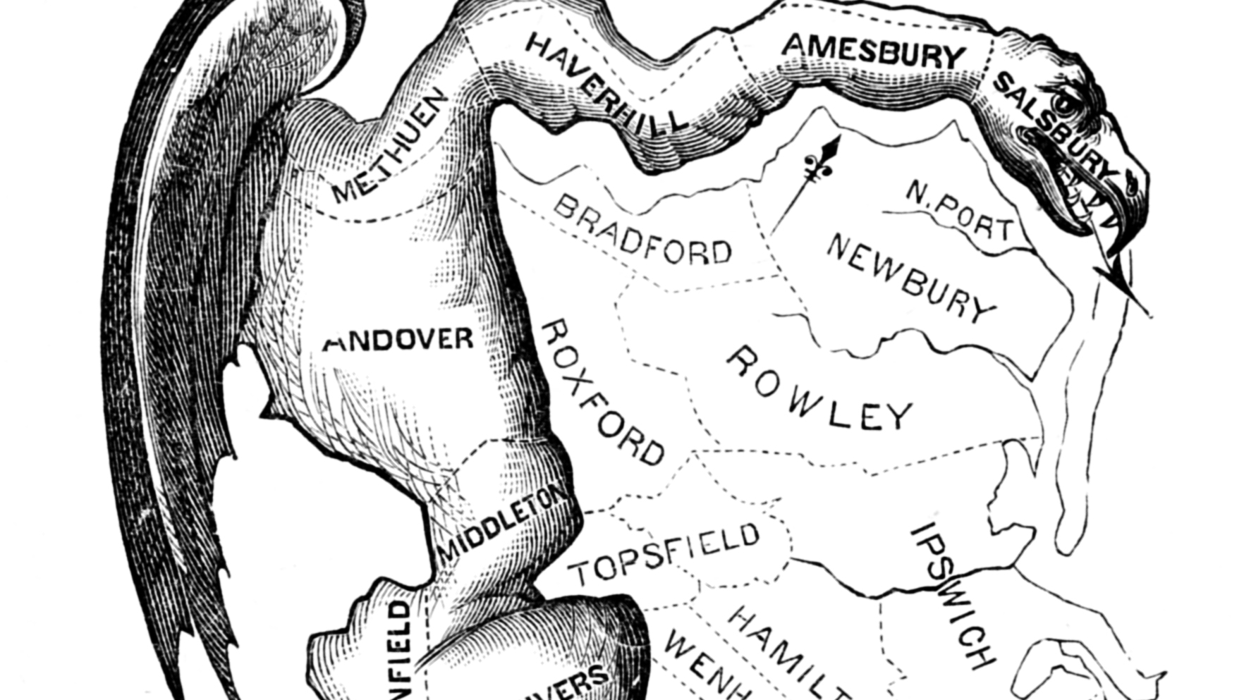
Pigs (or hogs, or swine, or Sus – the Latin name for the species) are omnivorous mammals of Eurasian origin, closely related to hippopotami and generally more known for being tasty than clever […]
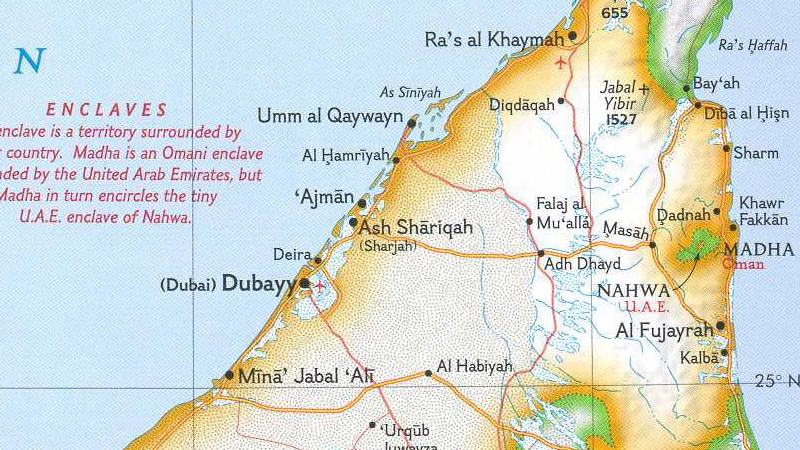
Border weirdness on the Arabian peninsula
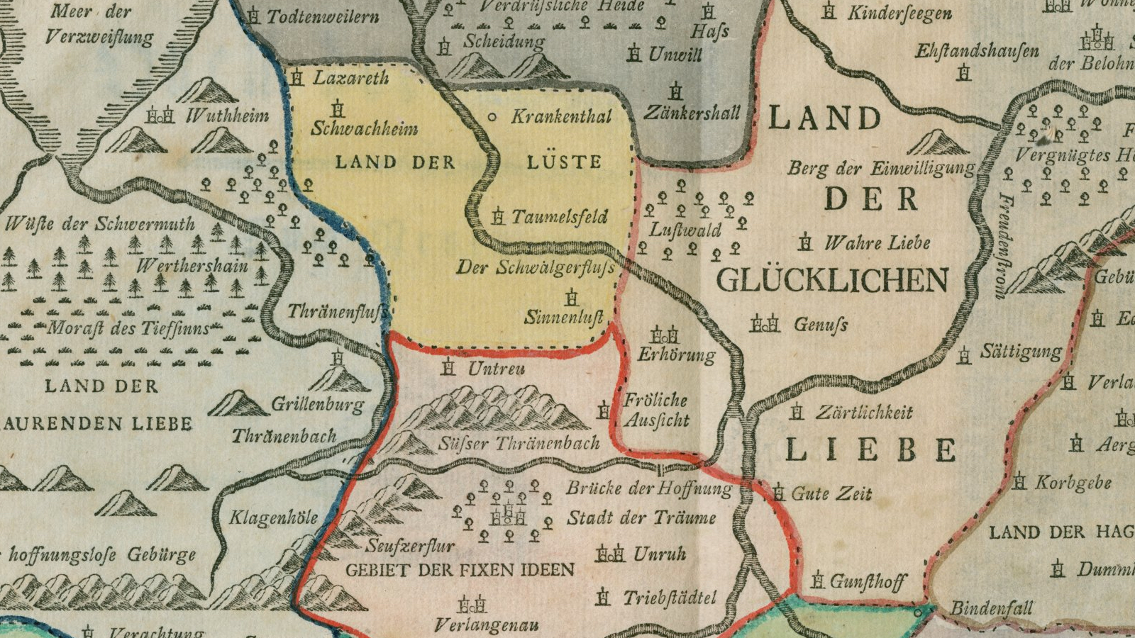
Past Affection Farm, take a left at the River of Tears
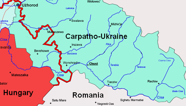
Is there a link between Andy Warhol’s fifteen minutes of fame and the tragicomic history of Carpatho-Ukraine?
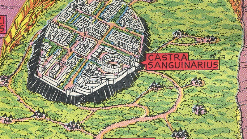
That time the ape-man found an entire Roman province in a hidden valley
Our familiarity with “gerrymandering” comes from the United States revising the boundaries of electoral districts every 10 years, in order to keep up with demographic change.
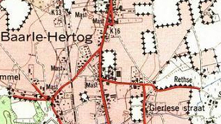
One of the unlikeliest complexes of enclaves and exclaves in the world is to be found on the Belgian-Dutch border, and is centred on Baarle. This town, while surrounded entirely […]
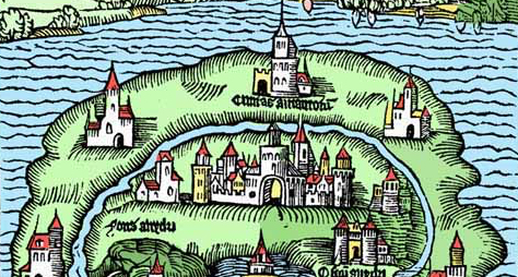
“A map of the world that does not include Utopia is not worth even glancing at”

I’m on a bit of a roll here, as far as strange World War II maps are concerned. Here’s another one, again from the German side, found at this page […]
A Pacific counterpart to Atlantis, Mu is supposed to have been a large continent in the middle of the ocean and the home of an advanced civilisation, having sunk beneath the […]
A British map, I presume, made between 1937 and 1940, showing the German plans for the conquest of Europe “revealed by Secret Nazi Map” – I don’t know if that […]
Another propaganda map dating from just before World War II, but this time from the Nazi-German side. One of the first victims of fascist agression was Czechoslovakia, dismembered at the […]
Although you probably instantly recognise its shape on a map, you may be forgiven for never having heard of Jutland. This northern European peninsula is not an independent entitiy: it’s […]
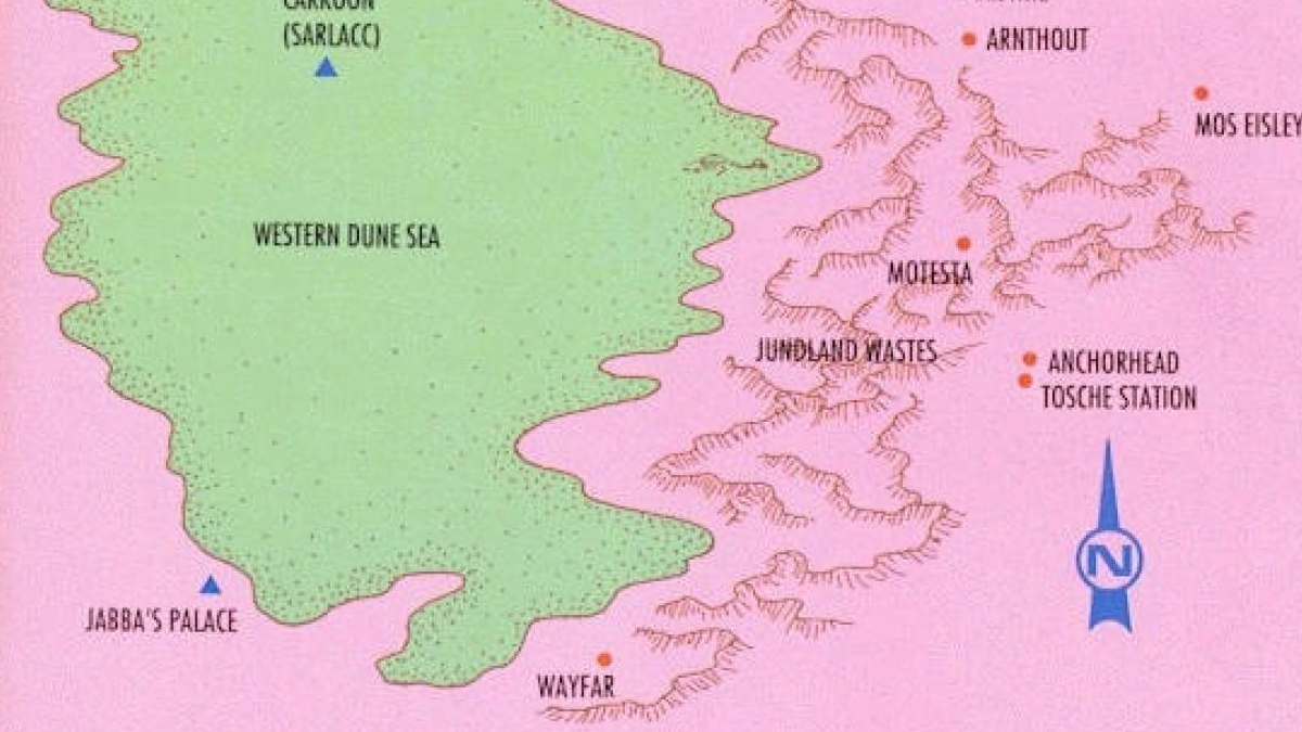
Ironically, the original name for the desert planet is Berber for ‘water springs’
Post #38 of this blog showed a spoof map of the world, supposedly according to Ronald Reagan – the avuncular 40th President of the US, an icon of conservatism to some, […]
Maps on old postcards look really cool, I think (see previous post). So I looked for another one, and found this postcard, dating from 1929. Coincidentally, it illustrates another area […]
In 1849, the Mormons who had recently settled the Wild West near the Great Salt Lake, ‘proposed’ the state of Deseret. It’s not clear to me whether this ‘proposal’ equalled […]
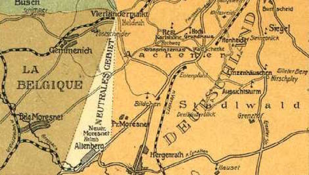
Amikejo was located in Neutral Moresnet, a geopolitical anomaly that managed to survive for a whole century after the Congress of Vienna.