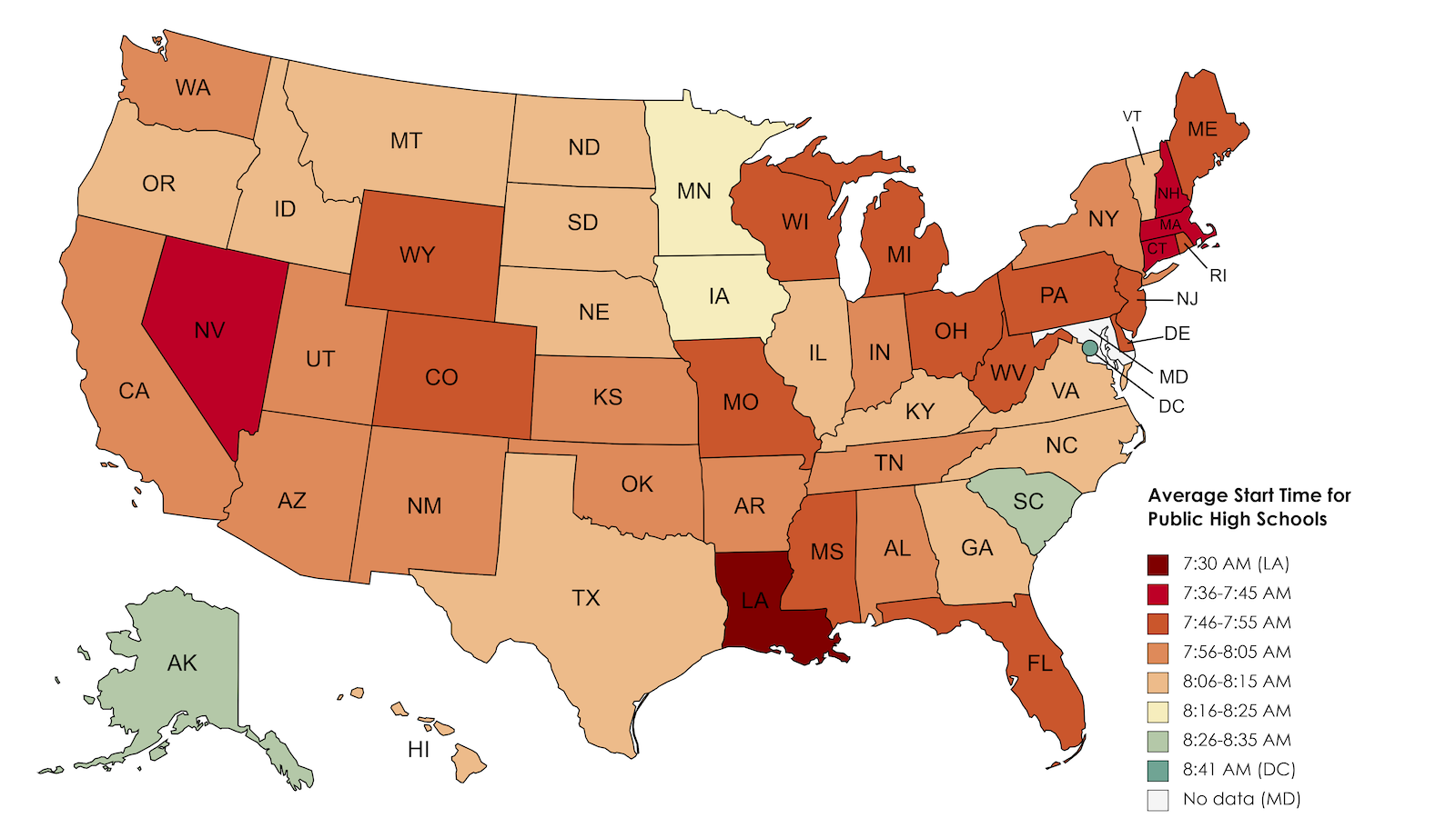
Strange Maps Here’s how early school begins – and why it is bad for students In Louisiana, high school starts at 7:30 am. Research shows that is at least an hour too early.
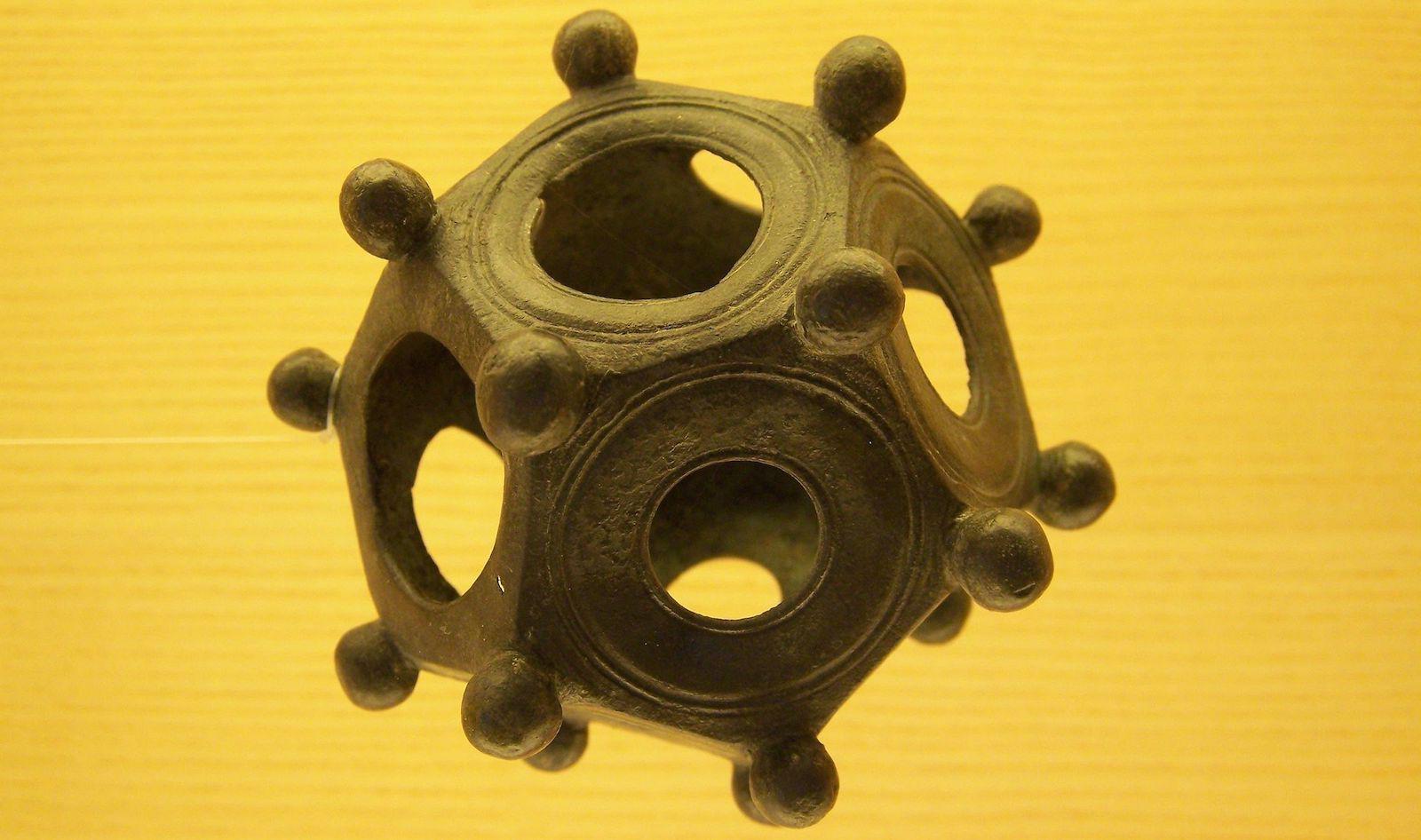
Strange Maps Mysterious dodecahedrons of the Roman Empire The first of many dodecahedrons was unearthed almost three centuries ago, and we still don’t know what they were for.
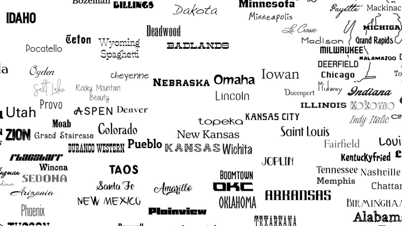
Strange Maps Welcome to the United Fonts of America At least 222 typefaces are named after places in the U.S. — and there’s still room for more.
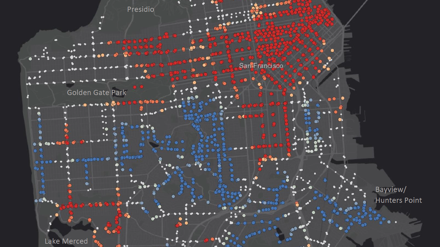
Strange Maps One man visited all 2964 bus stops in San Francisco — for science Americans don’t like to ride the bus. There are ways to fix that.
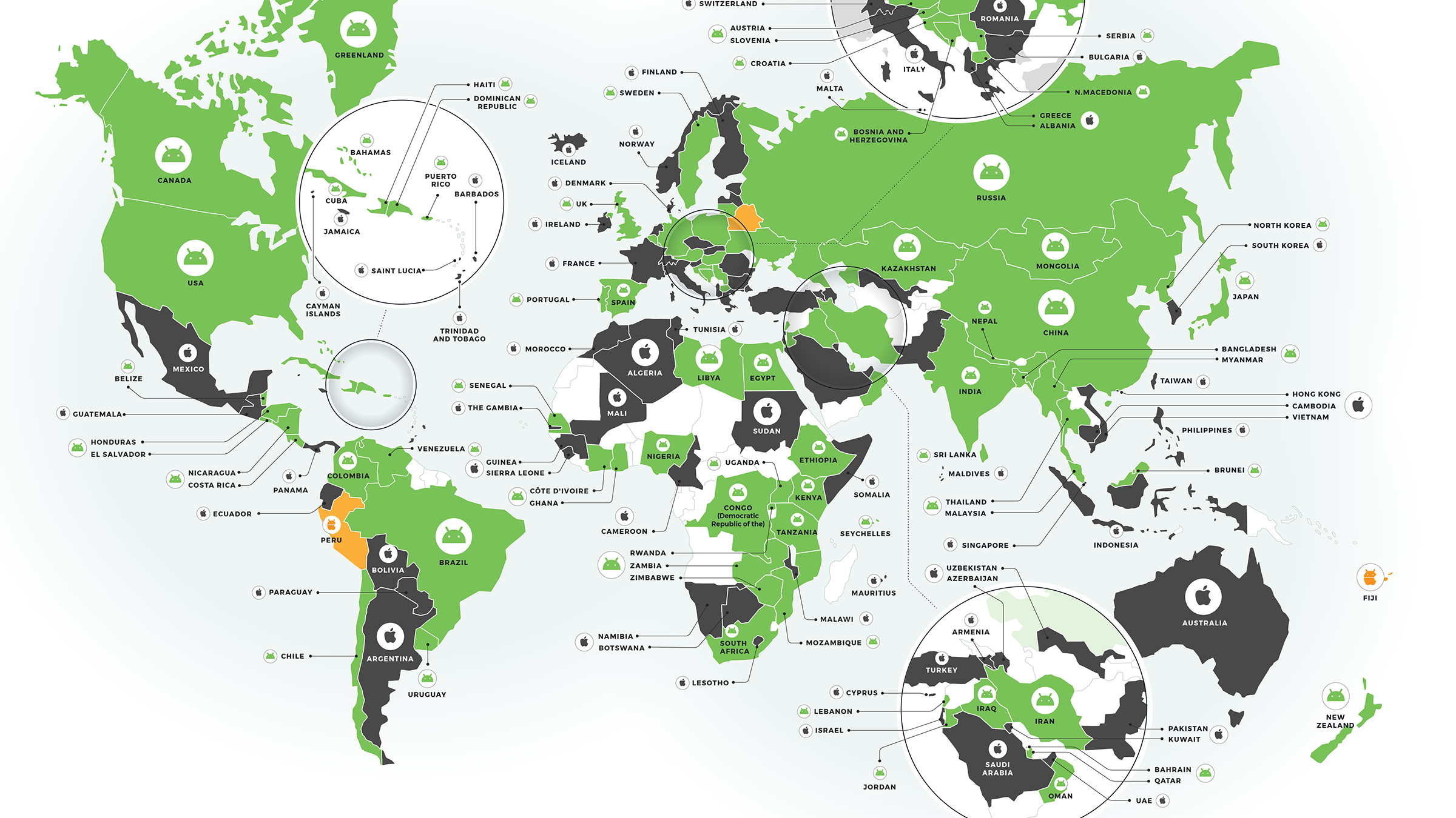
Strange Maps Android has won the phone world war A global survey shows the majority of countries favor Android over iPhone.
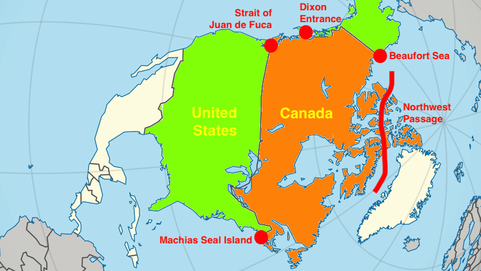
Strange Maps U.S. vs. Canada: five modern-day territorial disputes All of these conflicts have a long history. They may also have a long future.
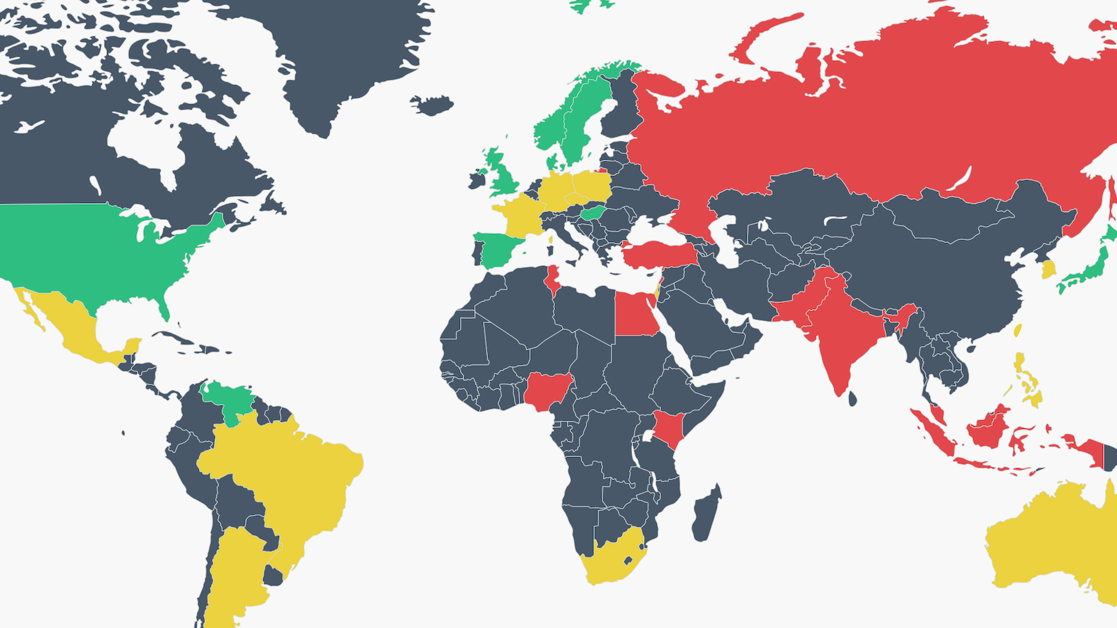
Strange Maps Free speech? Not everybody loves it, this map shows In some countries, people want more freedom of speech. In others, they feel that there is too much.
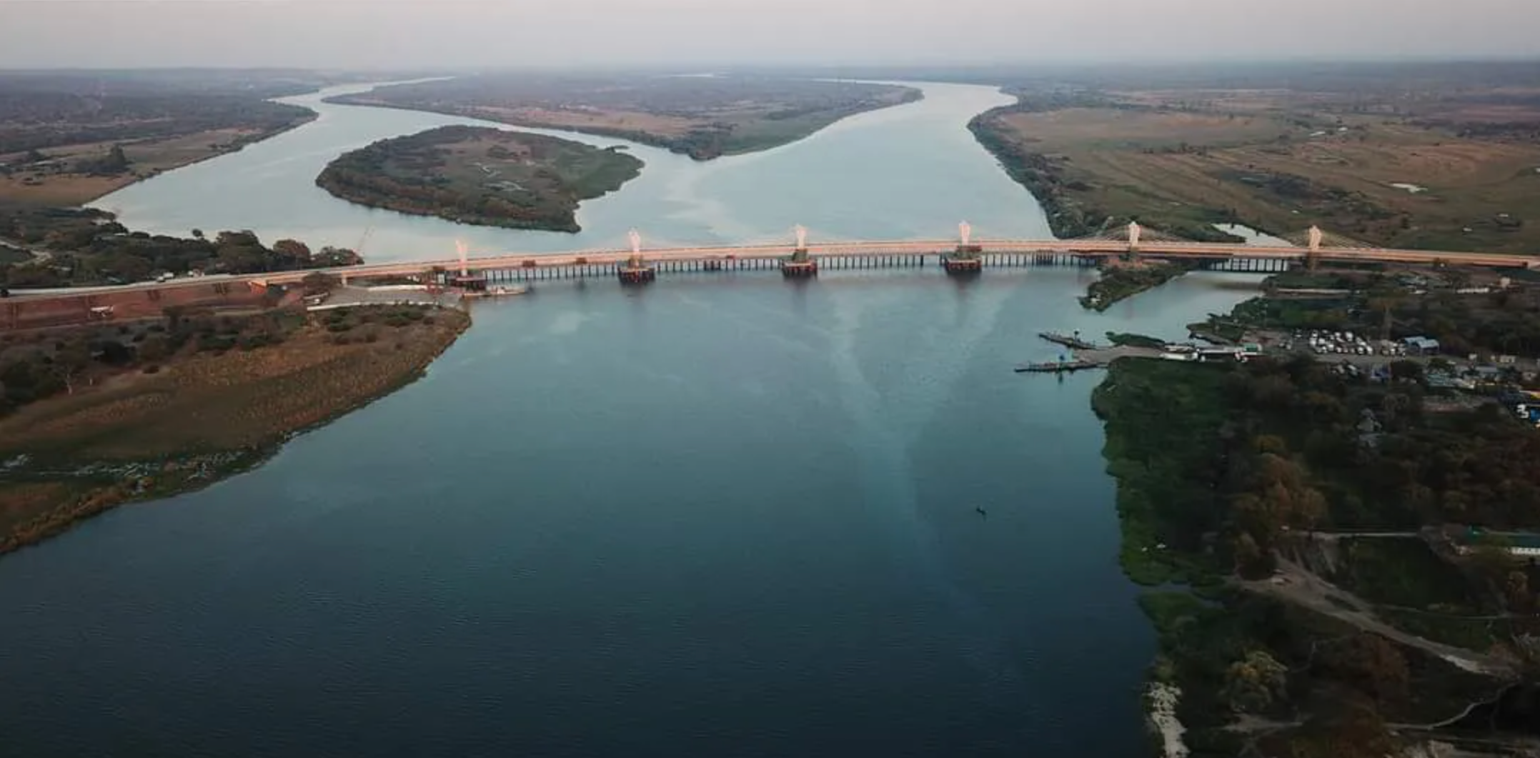
Strange Maps Why Africa’s newest super-bridge is in the continent’s weirdest border zone The Kazungula Bridge connects Zambia and Botswana, barely missing Namibia and Zimbabwe.
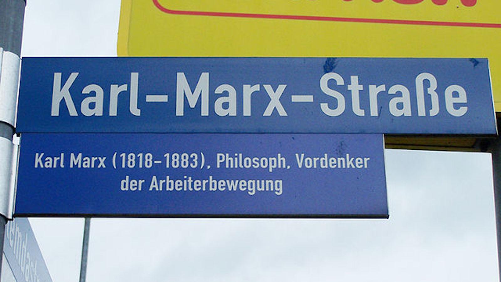
Strange Maps German street names still echo Nazi, Communist, and even Roman past Even 1500 years after the fall of Rome, its western border can still be seen on German street maps.
Strange Maps This map is alive with the beauty of lighthouse signals The unique light signatures of nautical beacons translate into hypnotic cartography.
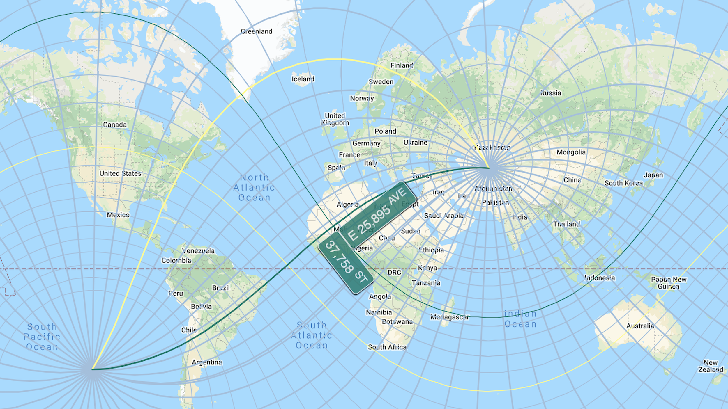
Strange Maps Turn any place on earth into a New York street corner ExtendNY stretches the Big Apple’s gridiron all across the globe – with some bizarre effects
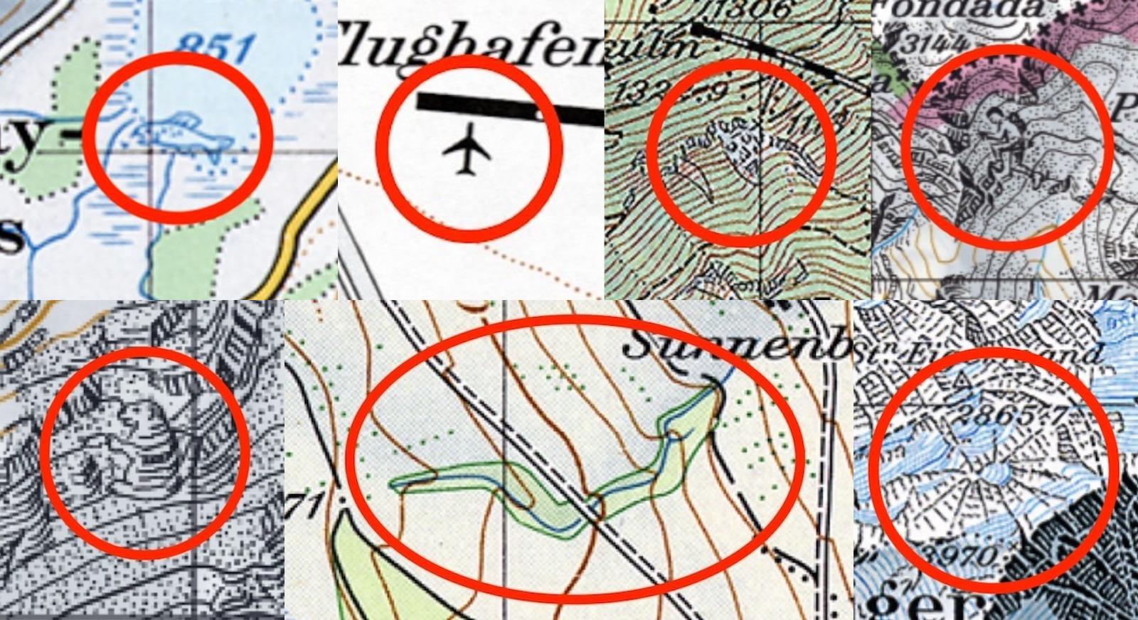
Strange Maps Why Swiss maps are full of hidden secrets Cartography is serious business in Switzerland — but once in a while, the occasional map gag slips through.
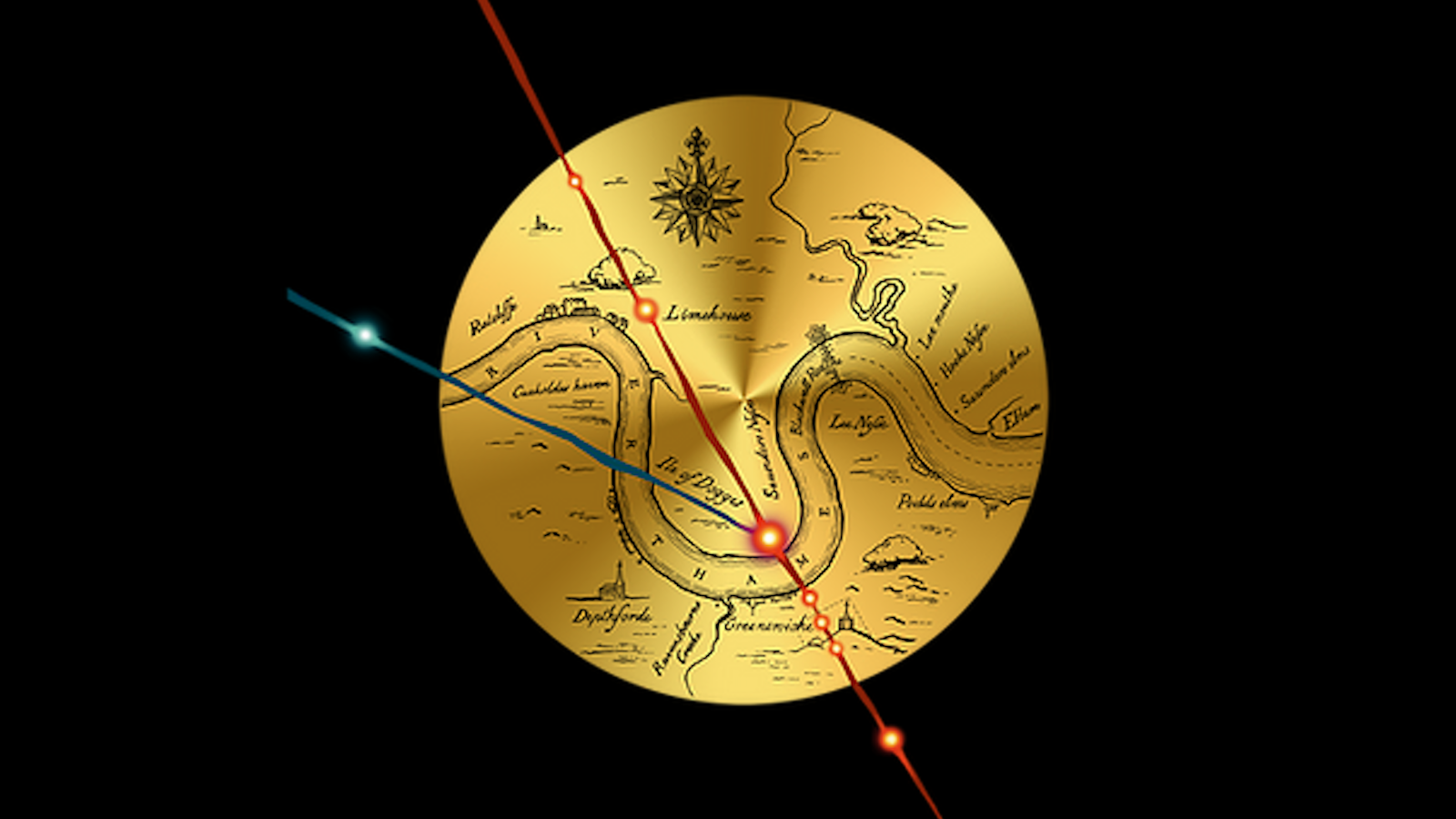
Strange Maps Did dark magic conjure up the British Empire? Esoteric evidence points to a ritual performed by Queen Elizabeth’s court magician John Dee.
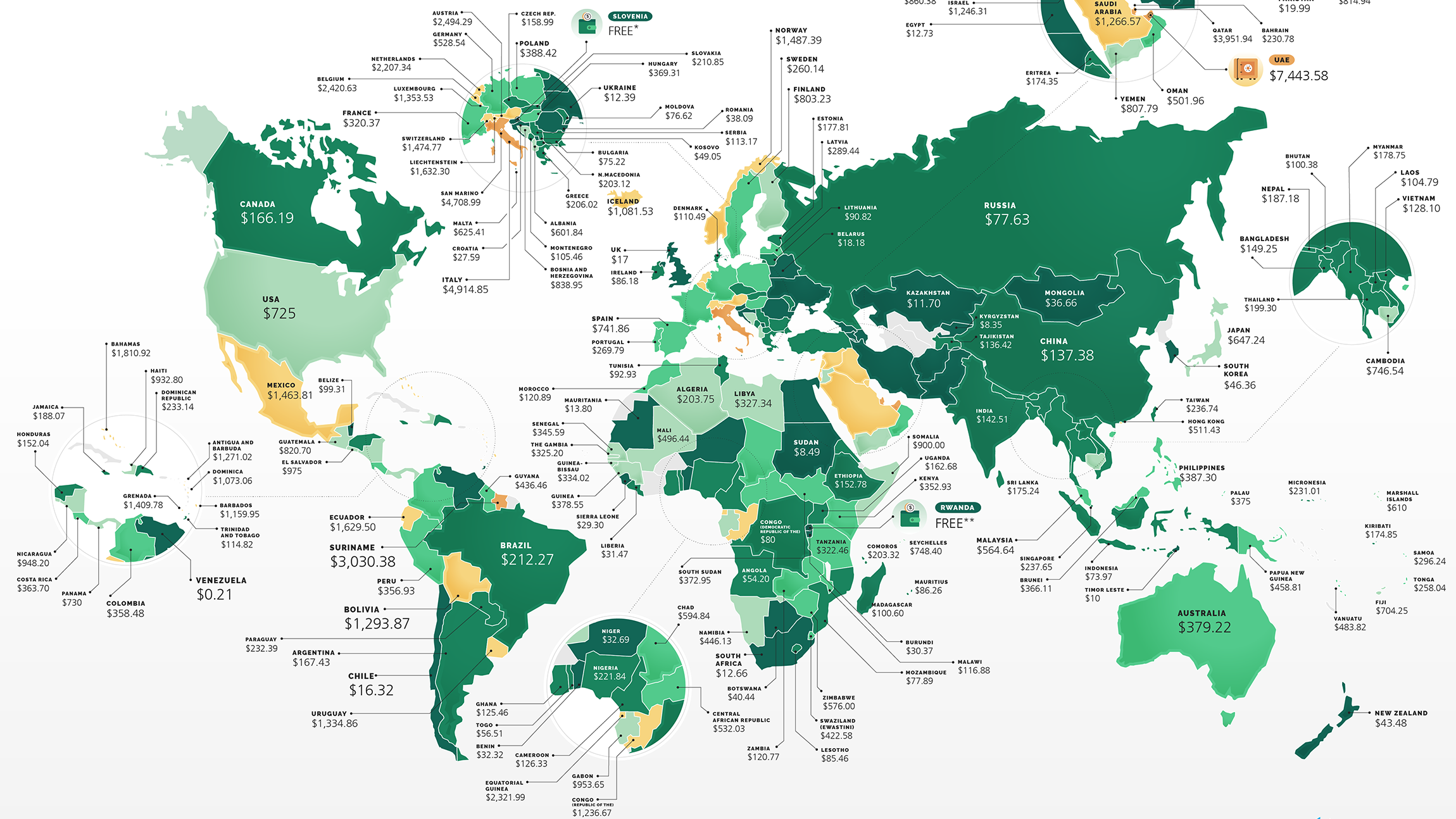
Strange Maps How much does it cost to start a business? There’s a world map for that UAE is the world’s most expensive country to start a business, but it’s free in Rwanda.
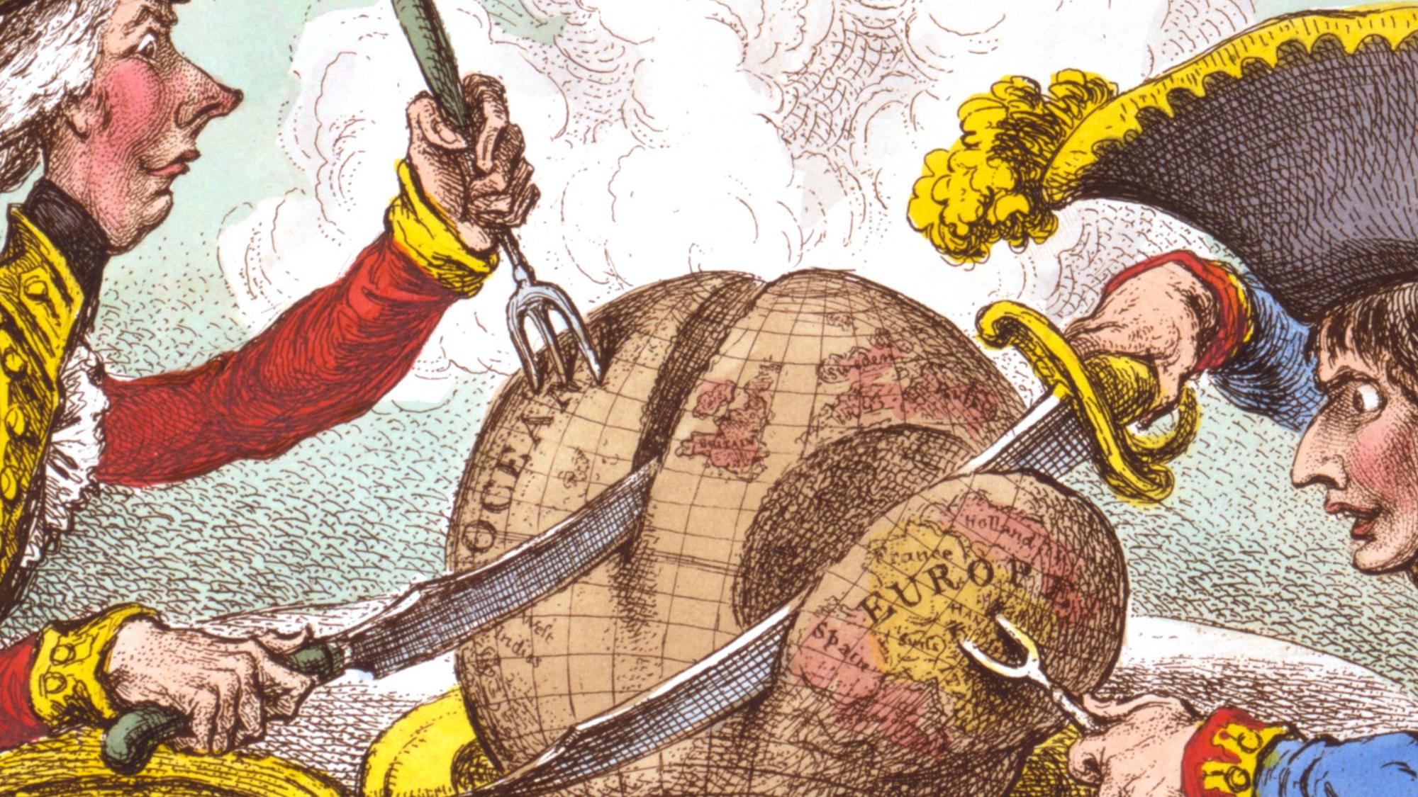
Strange Maps What a carve-up: when French and British ruled the world James Gillray’s ‘plumb-pudding’ caricature is “probably the most famous political cartoon of all time.”
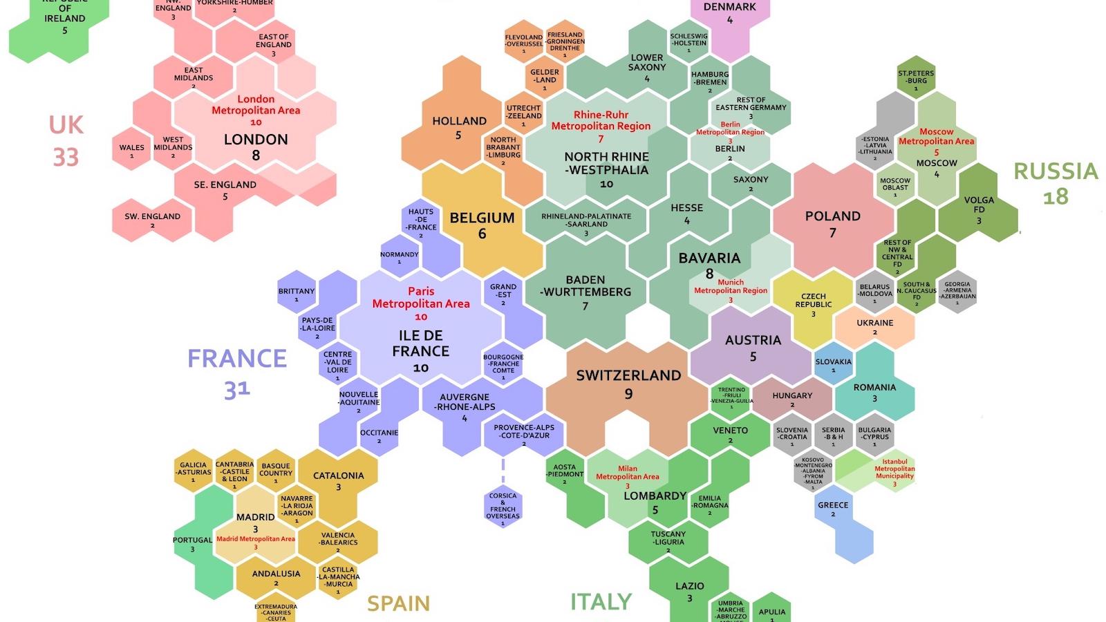
Strange Maps These 1,000 hexagons show how global wealth is distributed A cartogram makes it easy to compare regional and national GDPs at a glance.
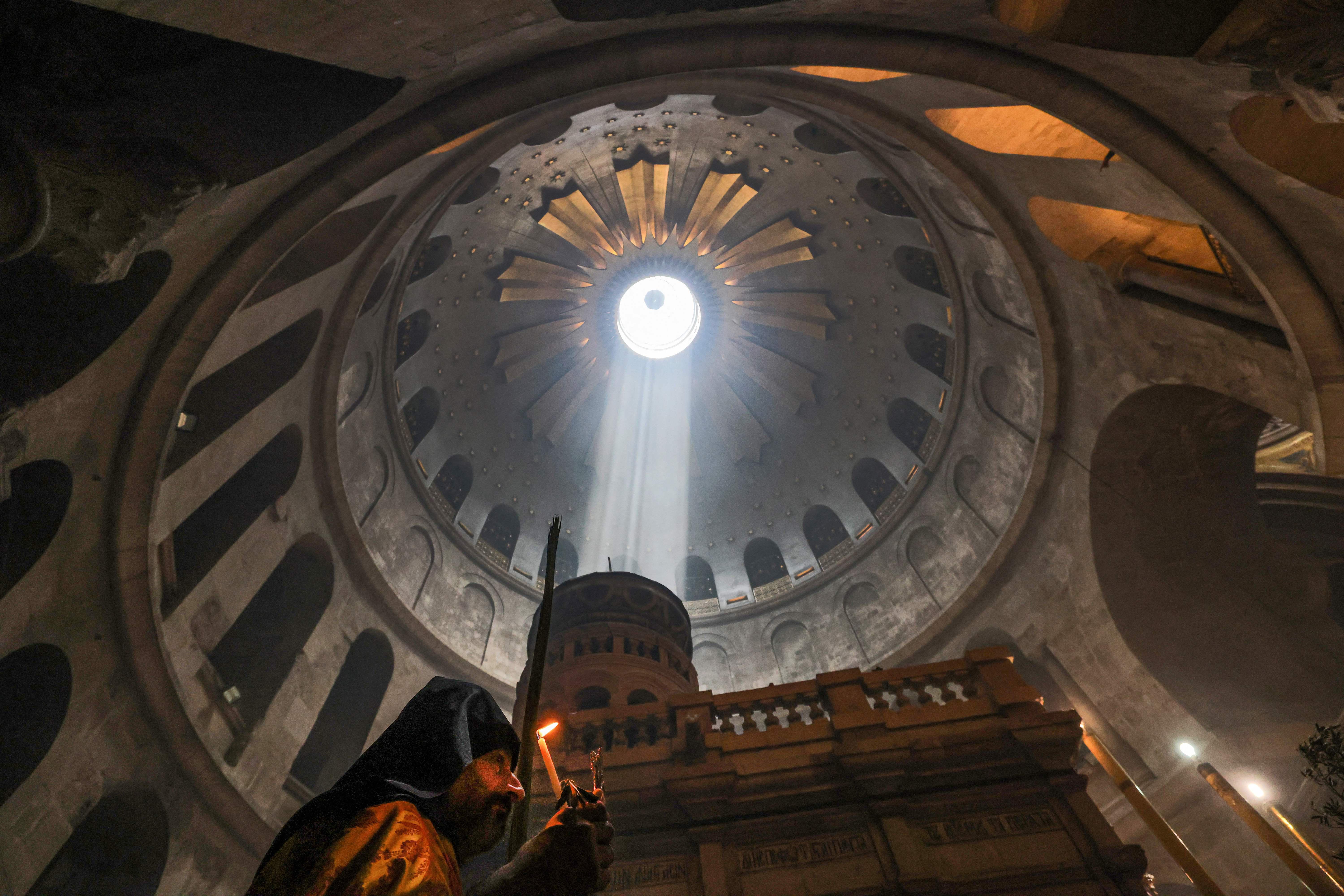
Strange Maps The Christian church so holy that Muslims hold its keys Six denominations share the Holy Sepulcher, but not all between them is peace and love.
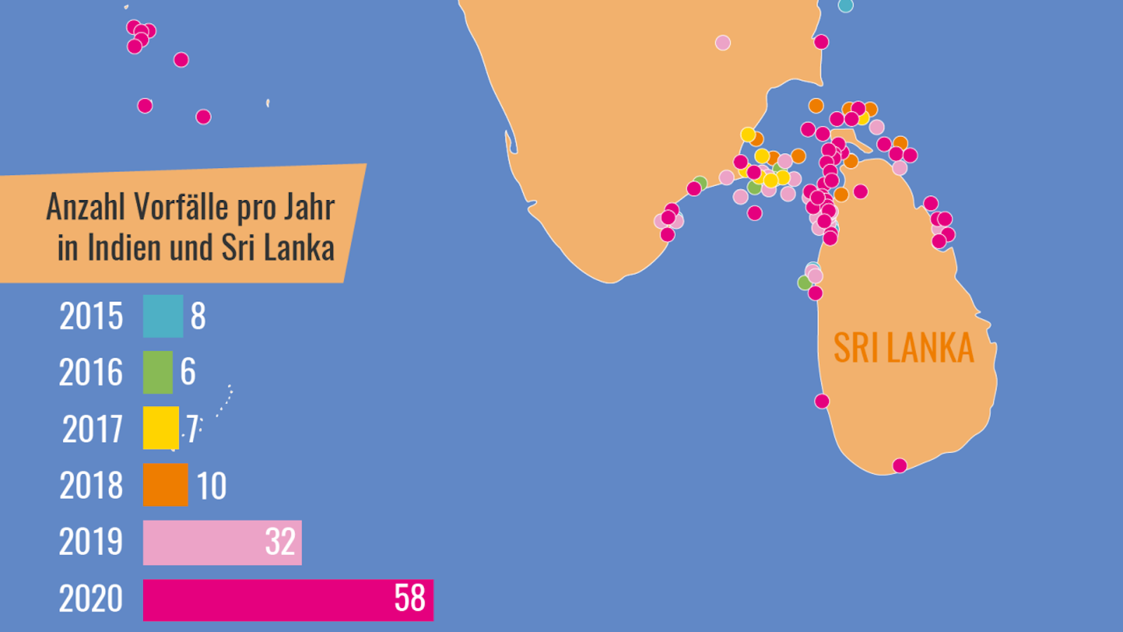
Strange Maps Sea cucumber crime is a thing, and this is where it’s happening A “seafood mafia” is plying the waters between India and Sri Lanka to satisfy China’s appetite for an increasingly rare delicacy.
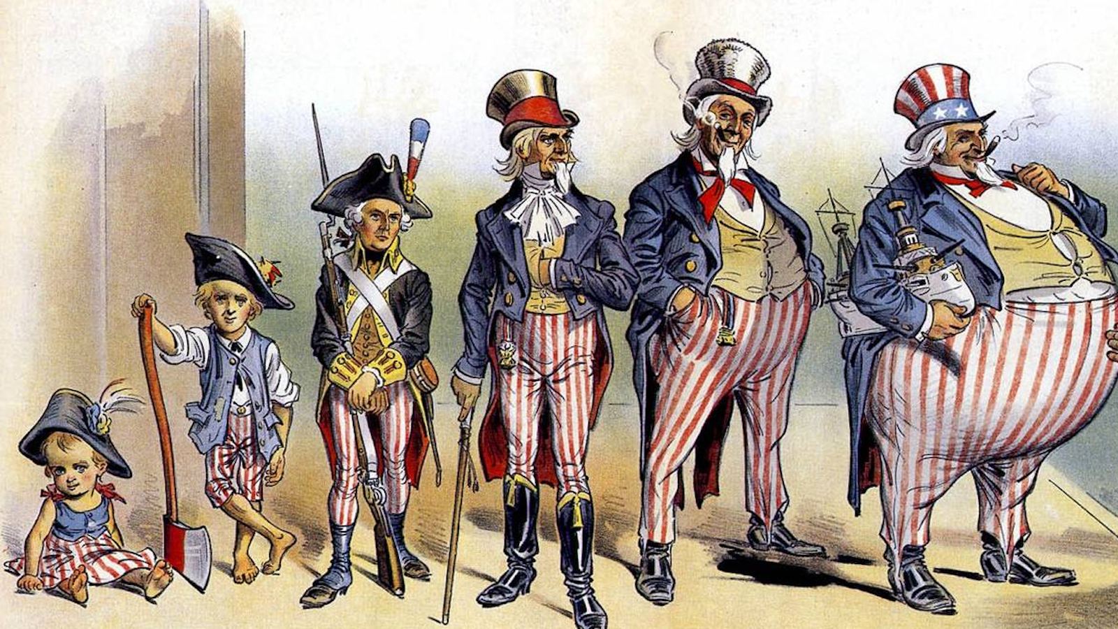
Strange Maps American imperialism: fat-shaming Uncle Sam Opponents of 19th-century American imperialism were not above body-shaming the personification of the U.S. government.
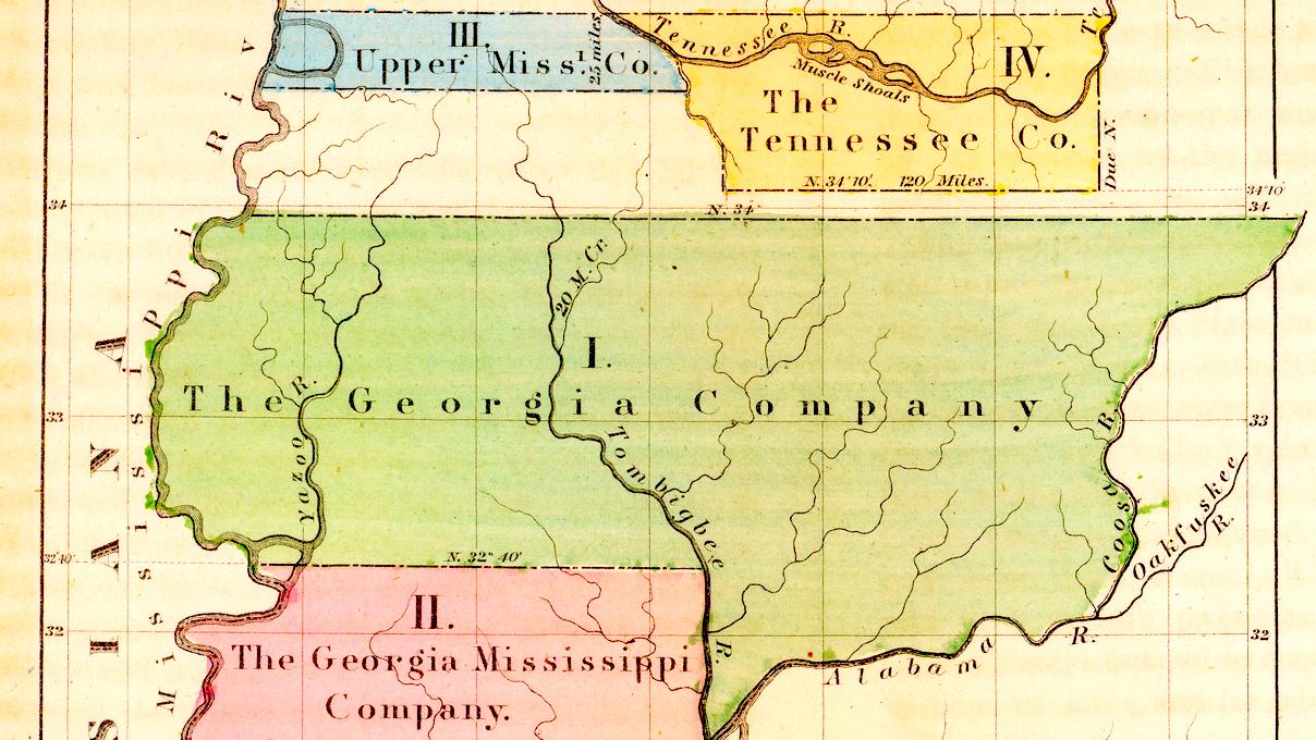
Strange Maps How the Yazoo Land Scandal changed American history Without the now-obscure land investment affair, Georgia might have been a “super state.”
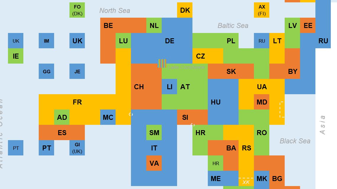
Strange Maps This map of Europe is good for only one thing Topologists can’t tell donuts from coffee mugs, but their maps are revelatory nonetheless.
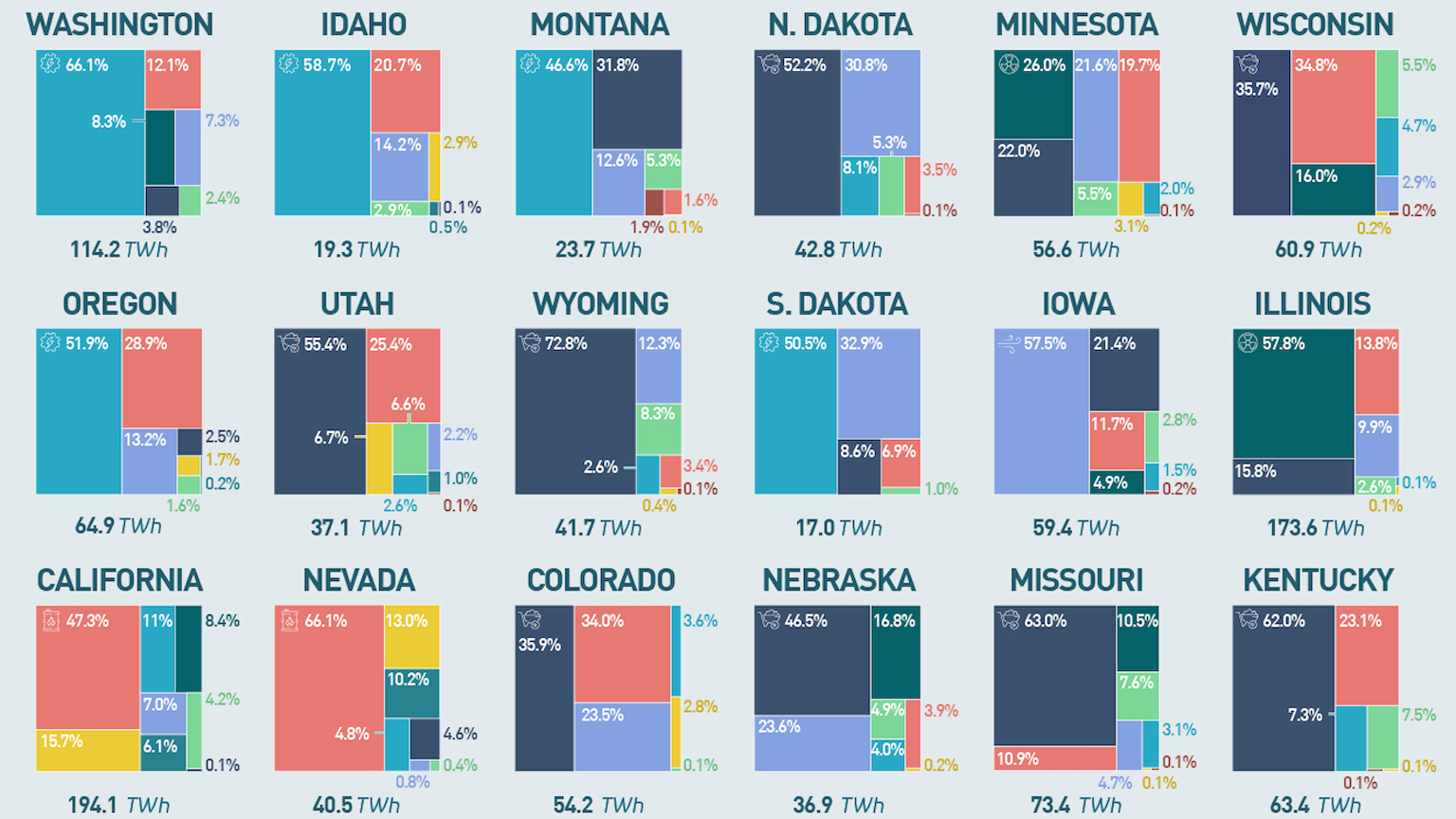
Strange Maps Electricity generation by U.S. state U.S. states vary radically in terms of electricity generation. Vermont is the cleanest, while Delaware is the dirtiest.
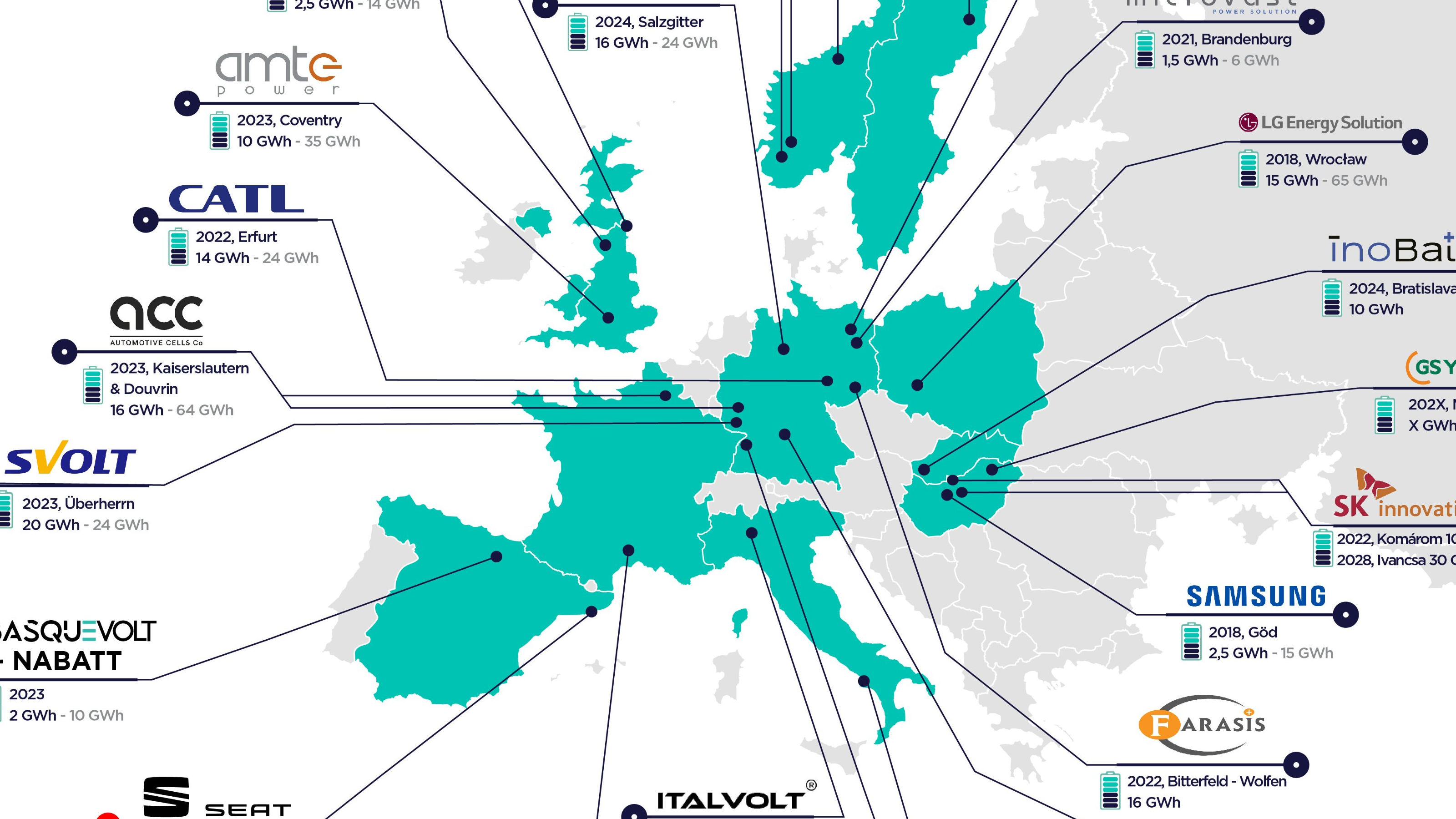
Strange Maps How Europe will beat China on batteries Map shows Europe’s imminent Great Leap Forward in battery cell production
Strange Maps How a “flying circus” gave us the first aerial maps of Earth Thomas Baldwin’s Airopaidia (1786) includes the earliest sketches of the earth from a balloon.
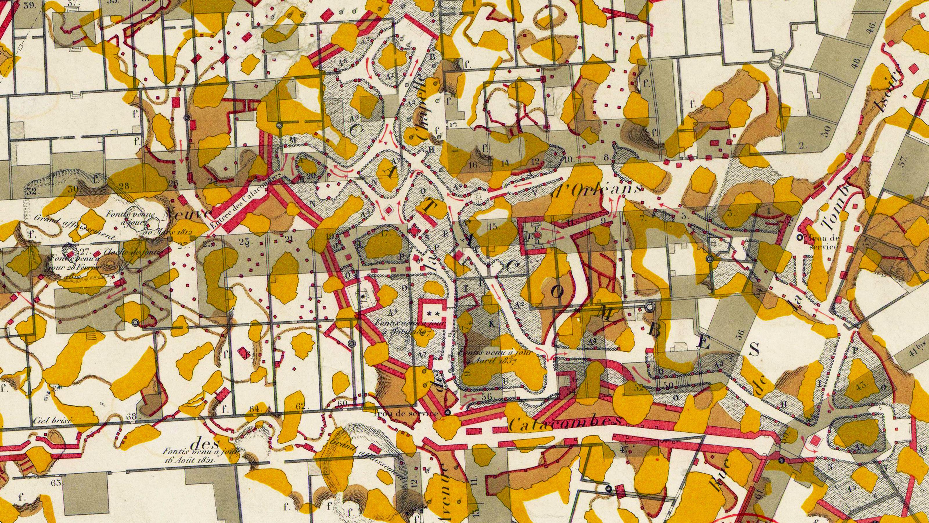
Strange Maps Catacombs of Paris: The city of darkness finds its new raison d’être Ancient corridors below the French capital have served as its ossuary, playground, brewery, and perhaps soon, air conditioning.
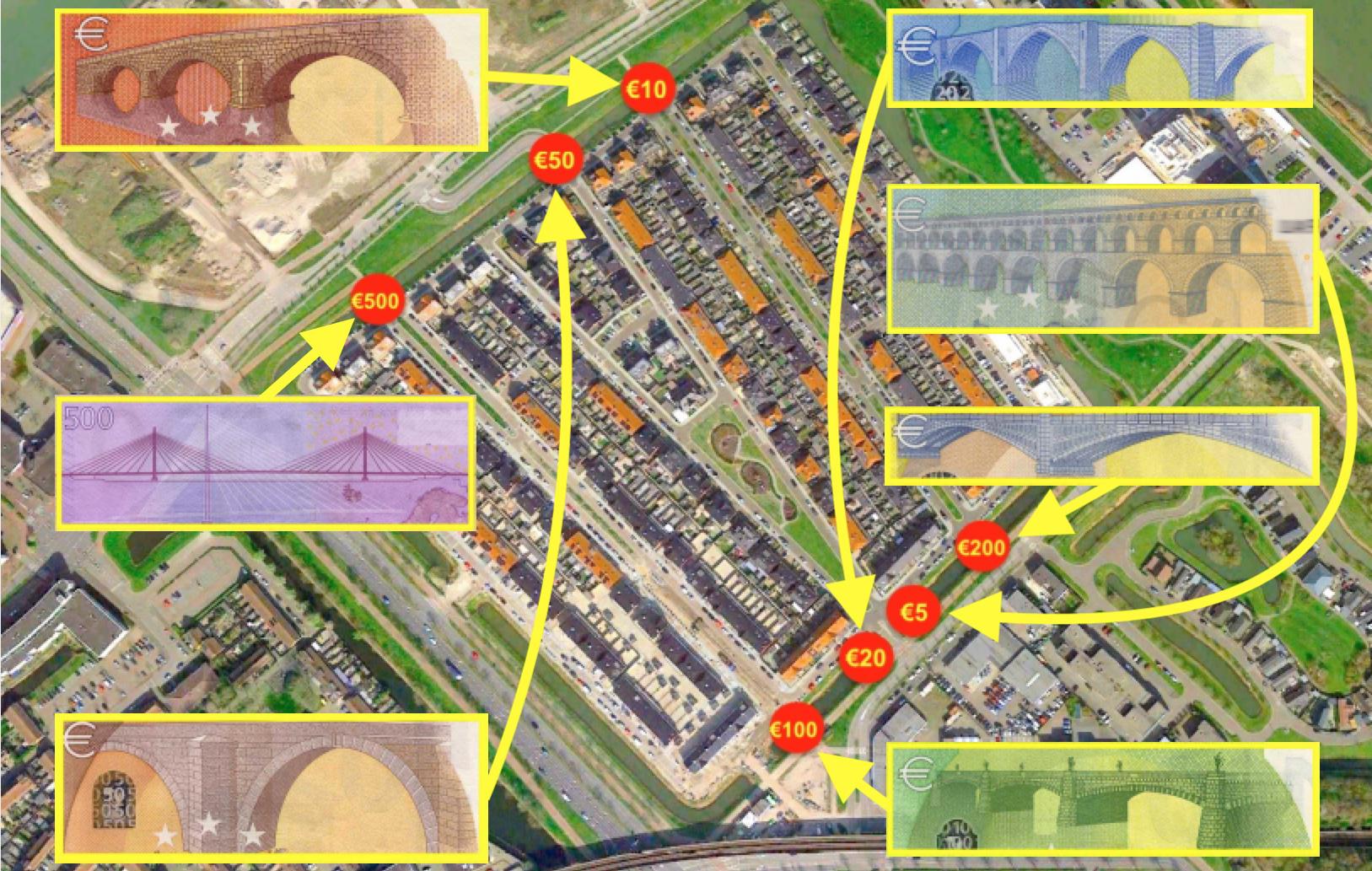
Strange Maps In this Dutch town, the euro’s fictional bridges are now real The European currency features buildings that didn’t exist, until Spijkenisse made them in concrete
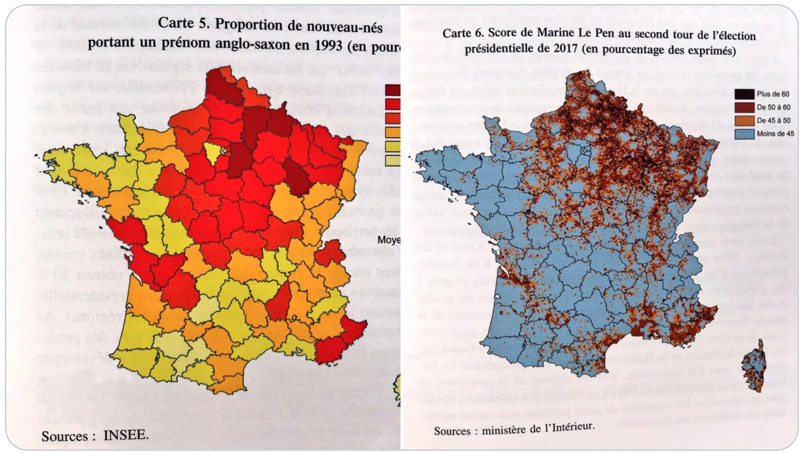
Strange Maps Why do ‘Kevins’ vote for far-right parties? In Germany and France, having an Anglo-Saxon first name is a good predictor of extreme voting behavior.
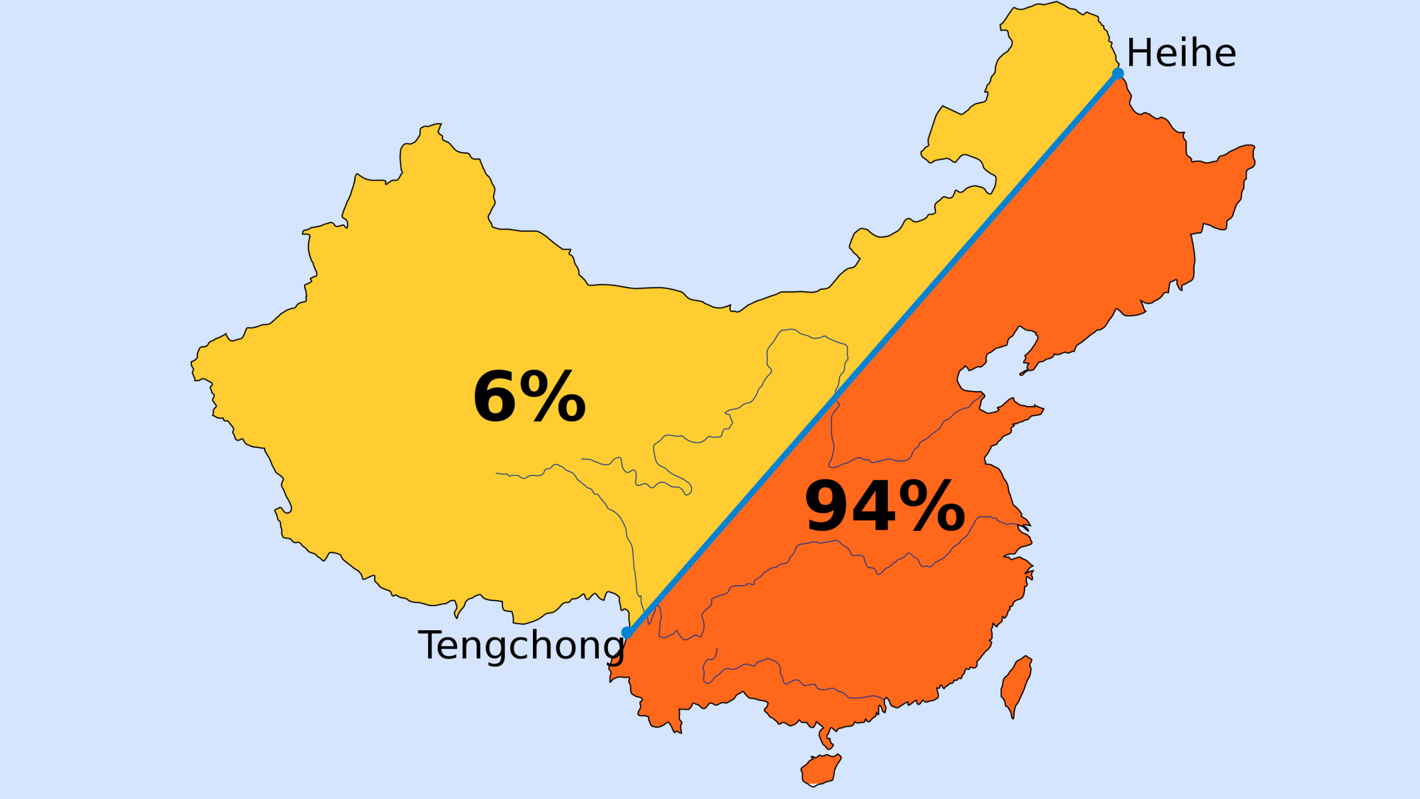
Strange Maps China’s most important border is imaginary: the Hu Line First drawn in 1935, Hu Line illustrates persistent demographic split – how Beijing deals with it will determine the country’s future.
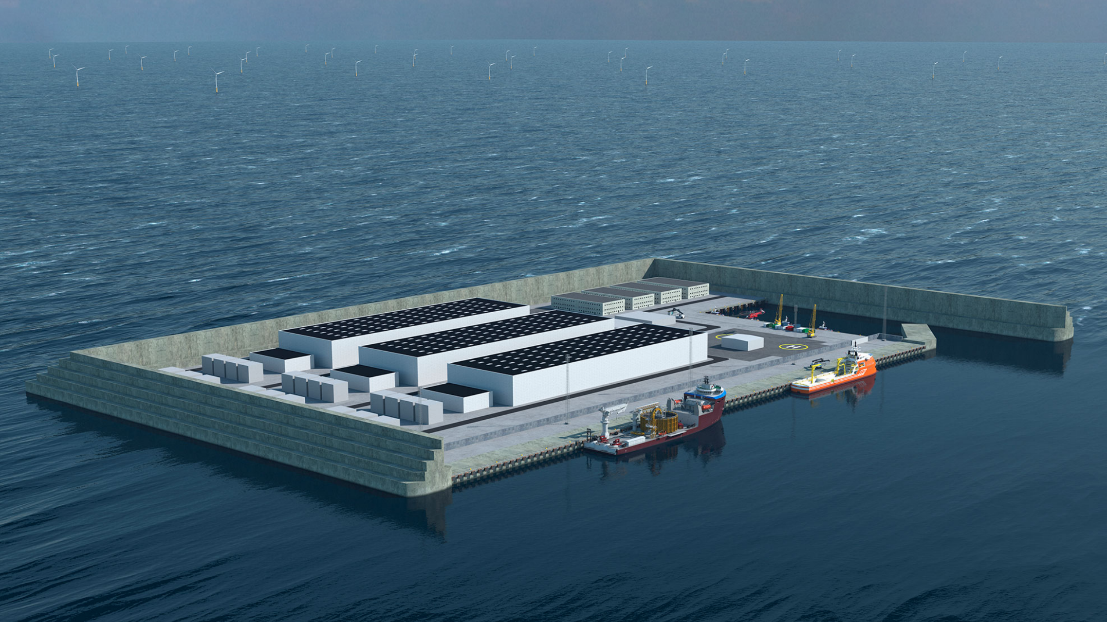
Strange Maps Is this Danish island soon coming to a coast near you? An artificial island in the North Sea is the biggest building project ever in Danish history – and could pave the way for many more.
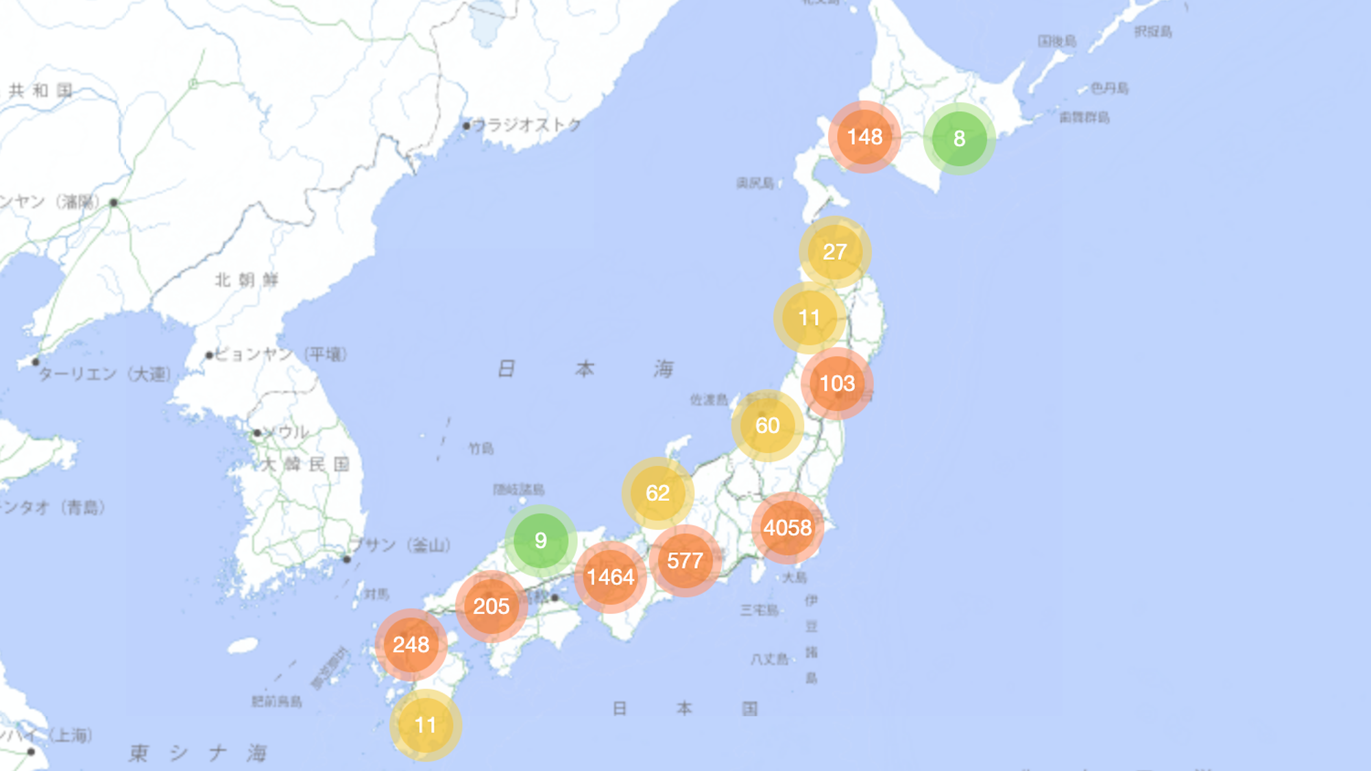
Strange Maps Too loud? In Japan, they’ll map-shame you ‘Dorozoku’ map crowd-sources the whereabouts of noisy kids in Japan – but who’s being anti-social here, exactly?