Strange Maps Just four colors are enough for any map. Why? The four-color theorem was one of the past century’s most popular and enduring mathematical mysteries.
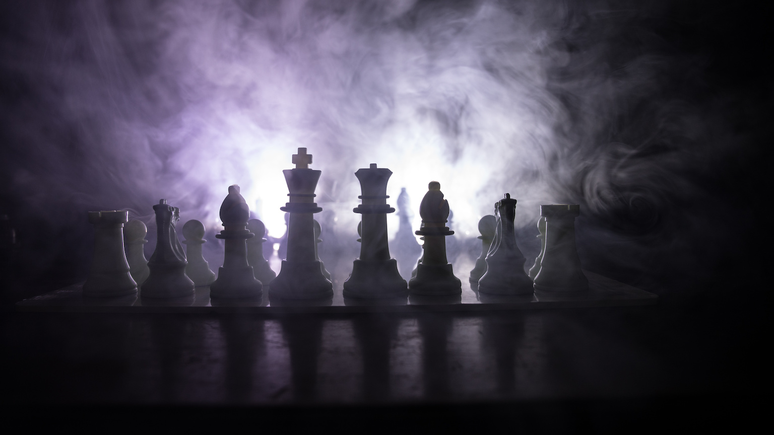
Strange Maps How did chess pieces get their names? One player’s pawn is another’s farmer. And at one time, the queen was a rather powerless virgin.
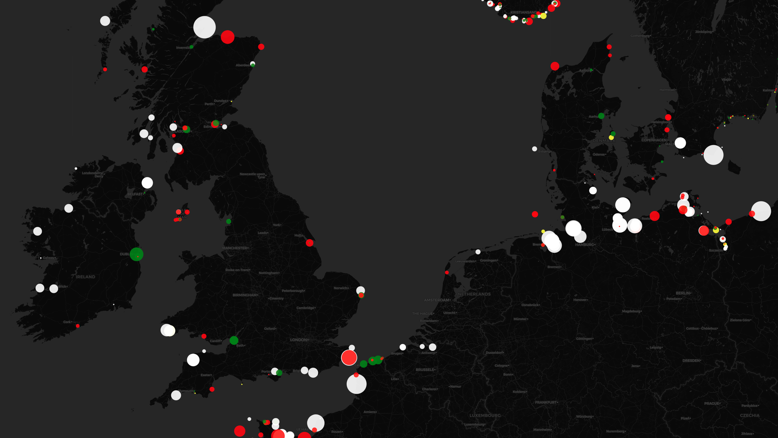
Strange Maps This map is alive with the beauty of lighthouse signals The unique light signatures of nautical beacons translate into hypnotic cartography.
Strange Maps What did Europeans actually discover? Not all that much This map shows that the territories discovered by Europeans add up to an area no bigger than Utah.
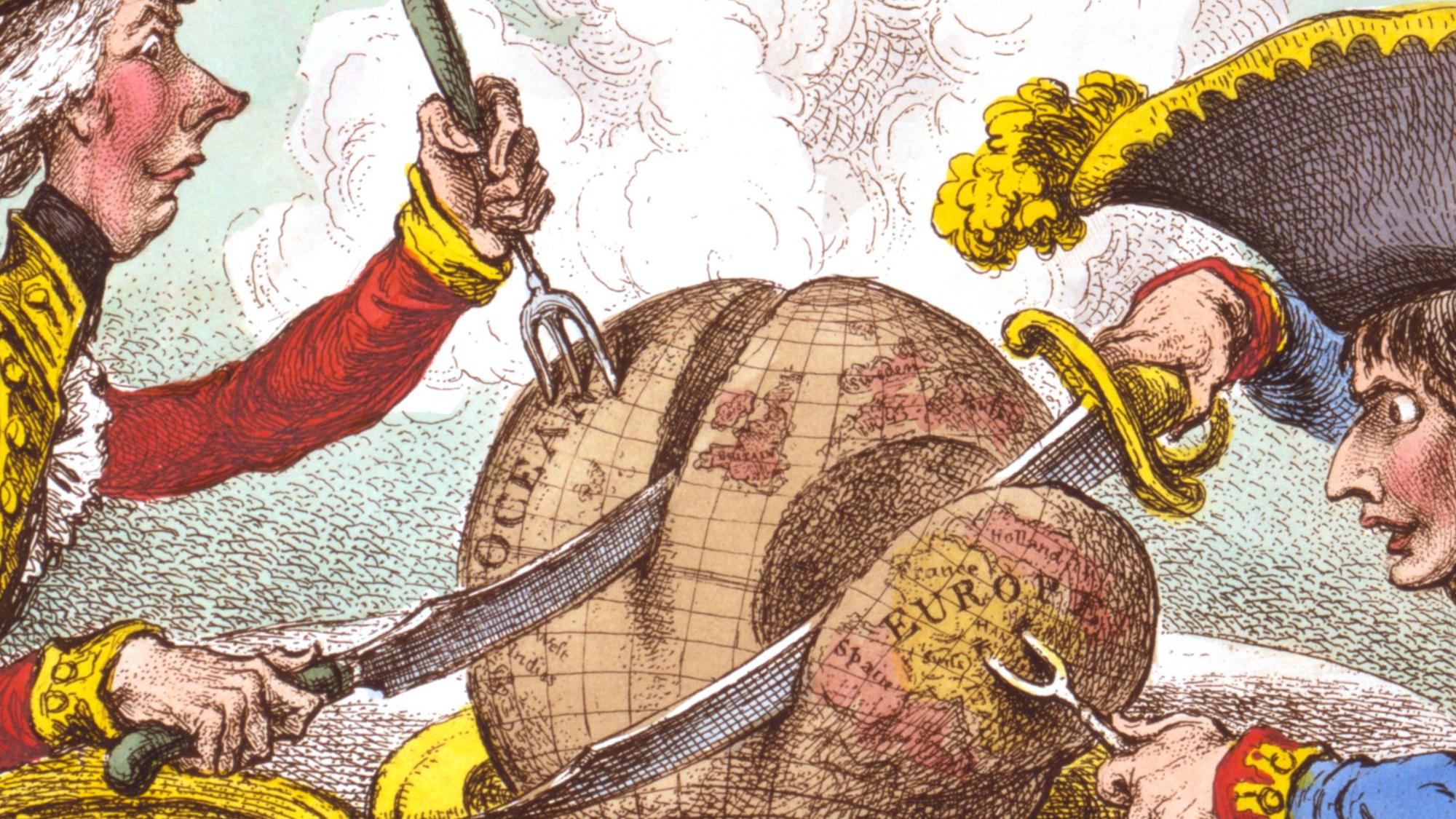
Strange Maps What a carve-up: when French and British ruled the world James Gillray’s ‘plumb-pudding’ caricature is “probably the most famous political cartoon of all time.”
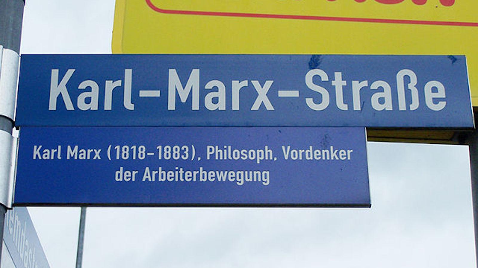
Strange Maps German street names still echo Nazi, Communist, and even Roman past Even 1500 years after the fall of Rome, its western border can still be seen on German street maps.
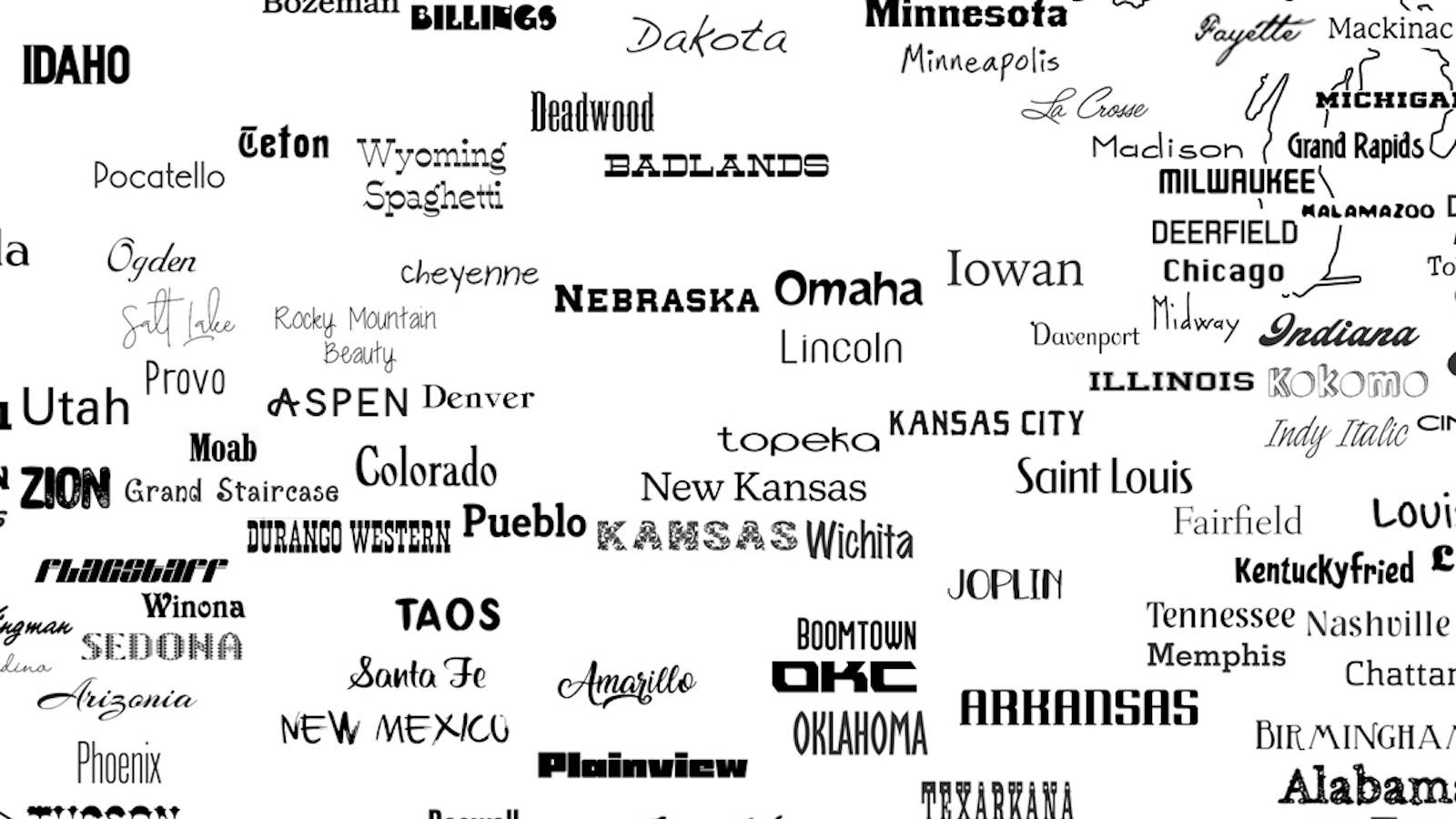
Strange Maps Welcome to the United Fonts of America At least 222 typefaces are named after places in the U.S. — and there’s still room for more.
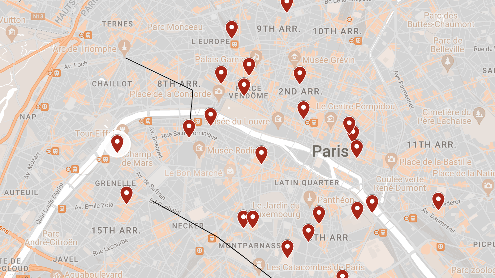
Strange Maps Let George Orwell guide you through 1920s Paris Famished, not famous: retrace Orwell’s hunger days, when he was one of the city’s legion of poor foreigners.
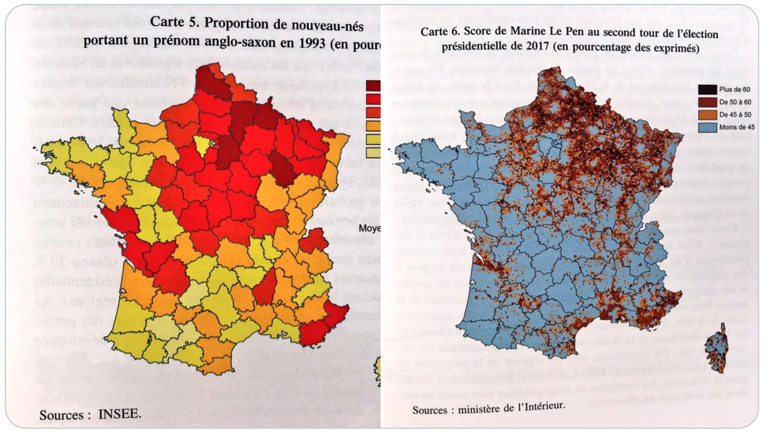
Strange Maps Why do ‘Kevins’ vote for far-right parties? In Germany and France, having an Anglo-Saxon first name is a good predictor of extreme voting behavior.
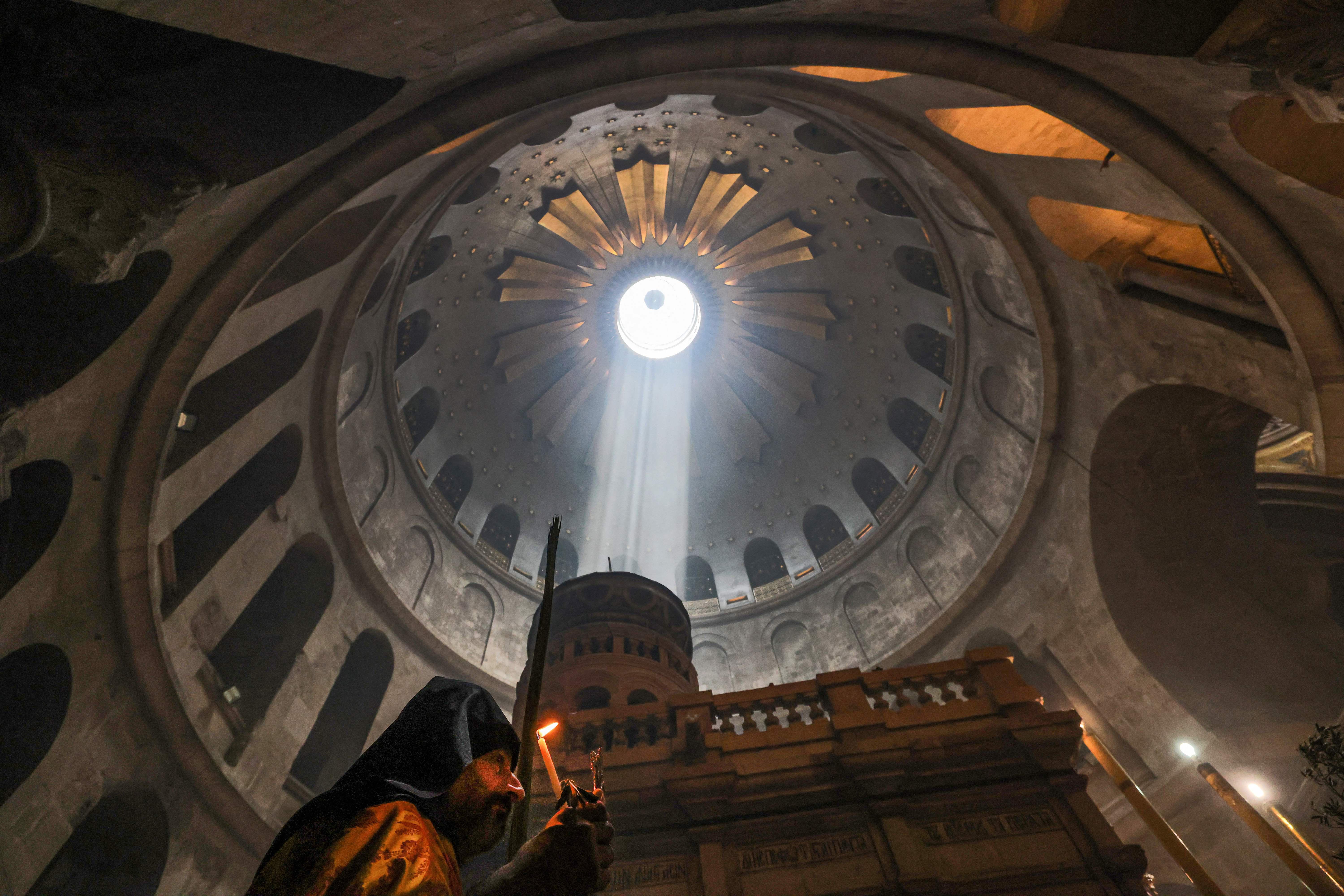
Strange Maps The Christian church so holy that Muslims hold its keys Six denominations share the Holy Sepulcher, but not all between them is peace and love.
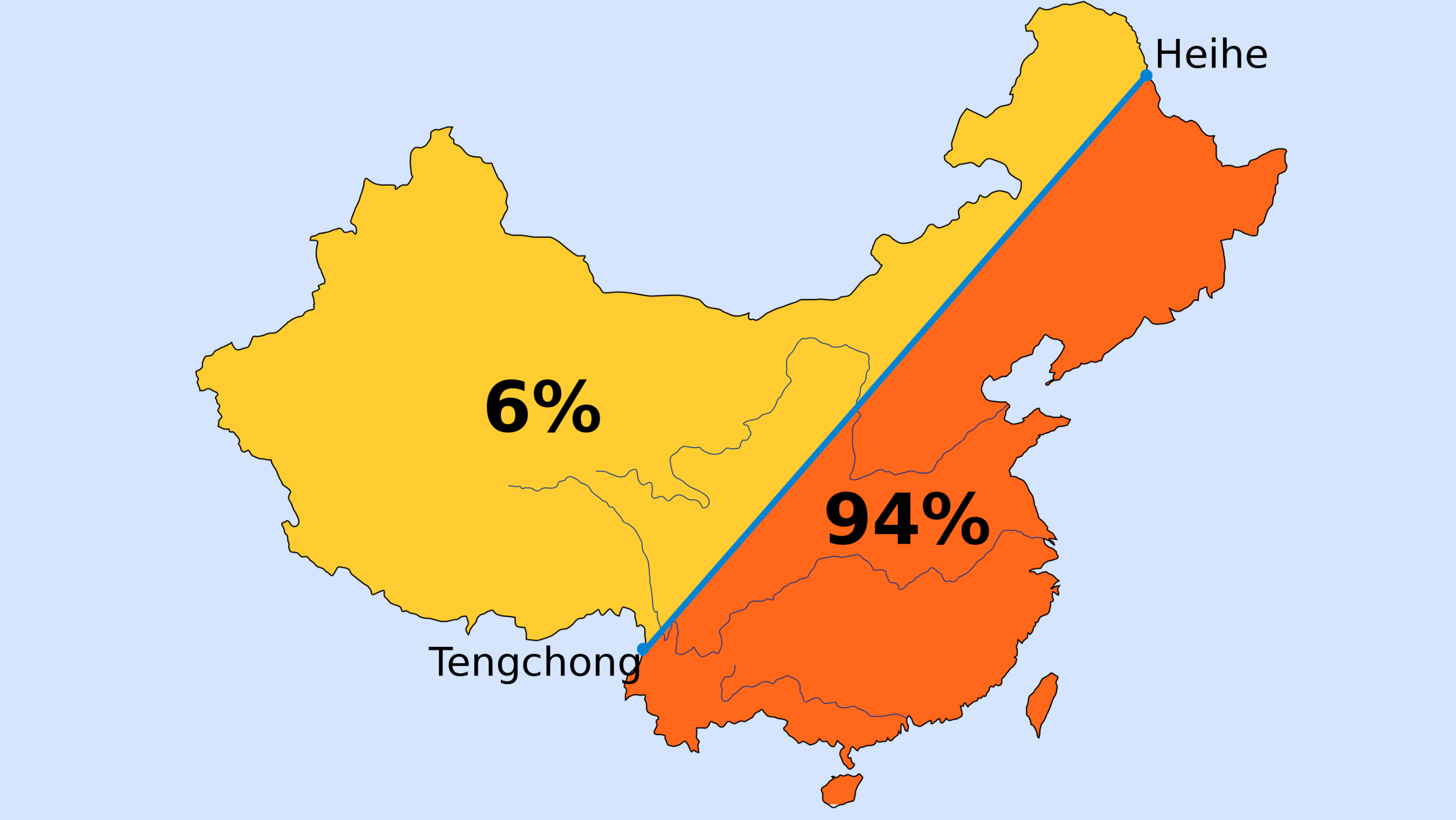
Strange Maps China’s most important border is imaginary: the Hu Line First drawn in 1935, Hu Line illustrates persistent demographic split – how Beijing deals with it will determine the country’s future.
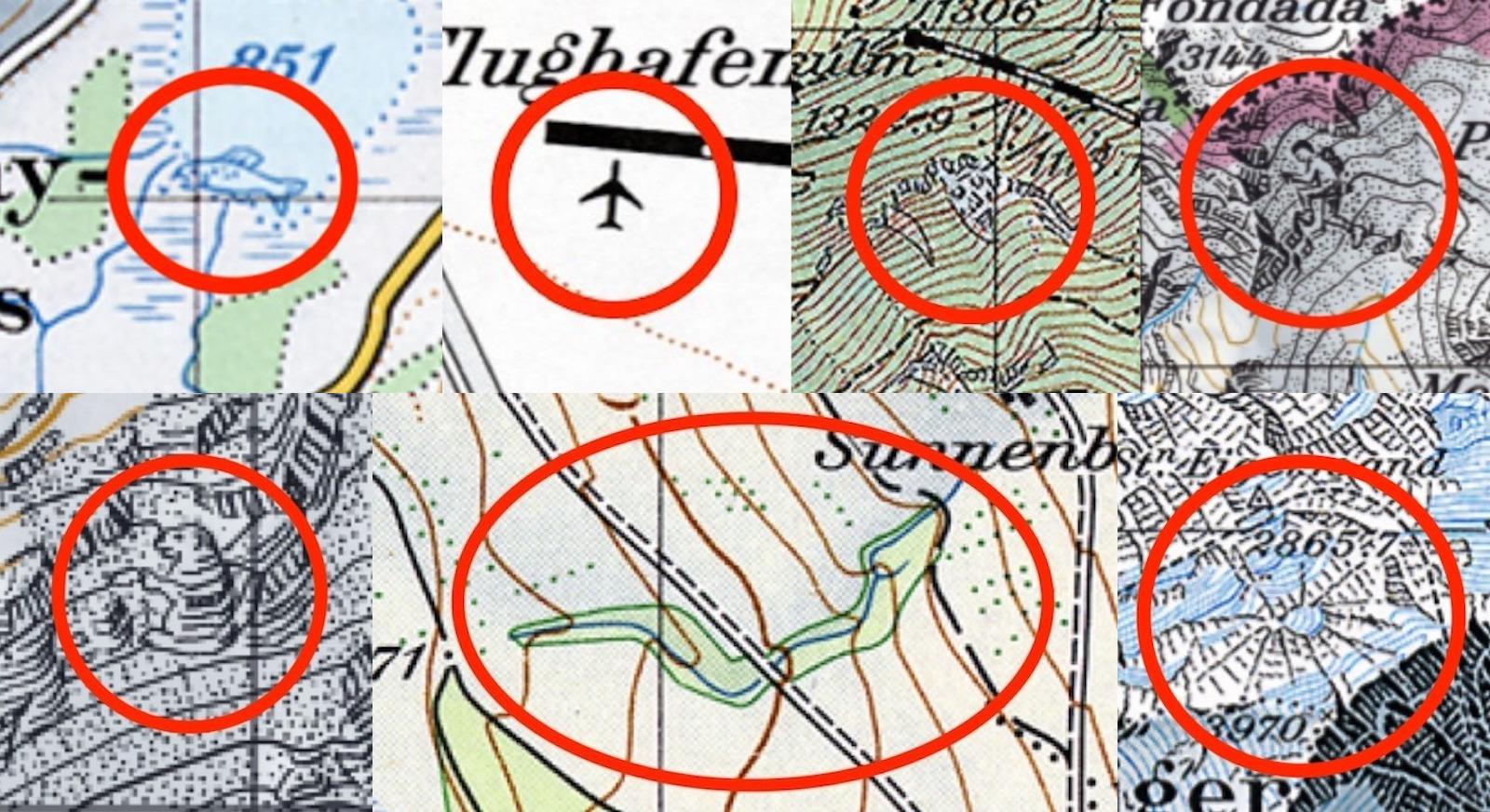
Strange Maps Why Swiss maps are full of hidden secrets Cartography is serious business in Switzerland — but once in a while, the occasional map gag slips through.
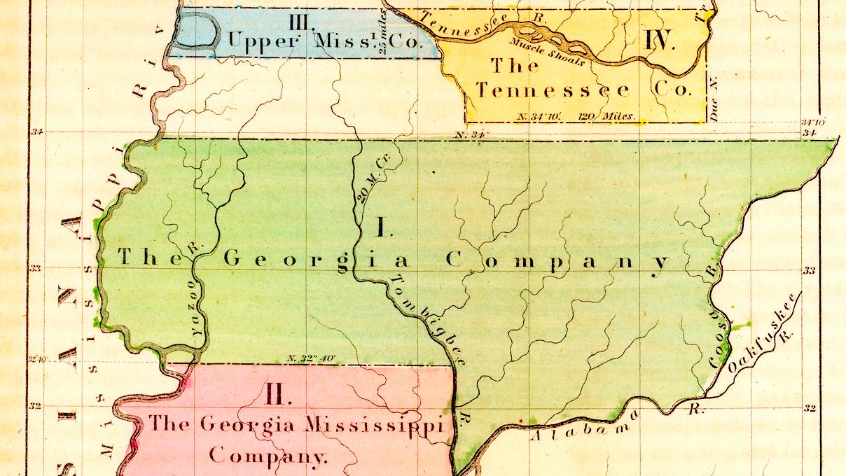
Strange Maps How the Yazoo Land Scandal changed American history Without the now-obscure land investment affair, Georgia might have been a “super state.”
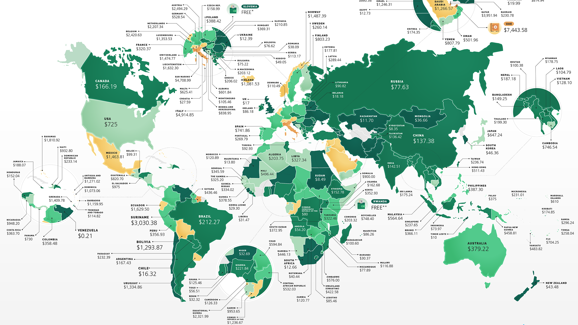
Strange Maps How much does it cost to start a business? There’s a world map for that UAE is the world’s most expensive country to start a business, but it’s free in Rwanda.
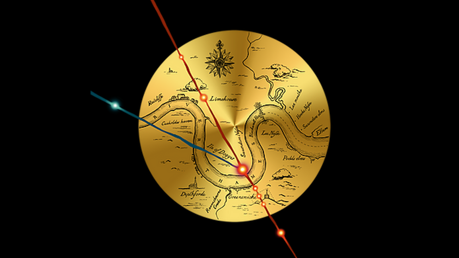
Strange Maps Did dark magic conjure up the British Empire? Esoteric evidence points to a ritual performed by Queen Elizabeth’s court magician John Dee.
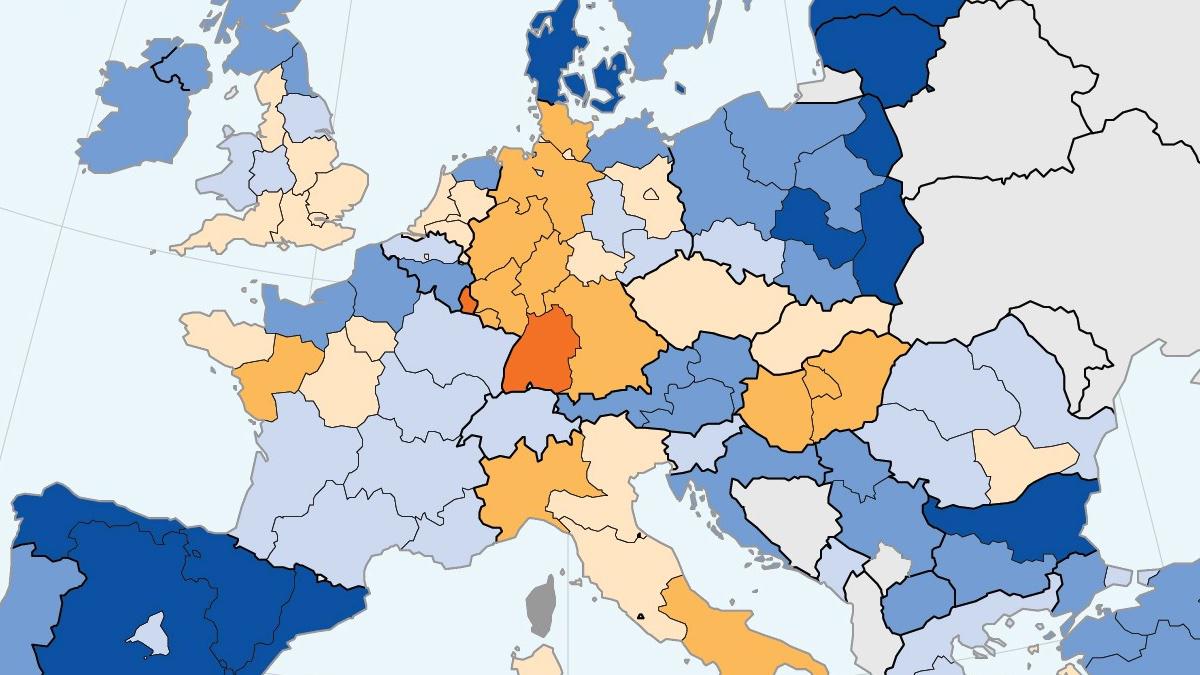
Strange Maps Norway has highest share of women scientists and engineers in Europe Despite overall increase over the past 20 years, share of women in science and engineering falls in some European countries
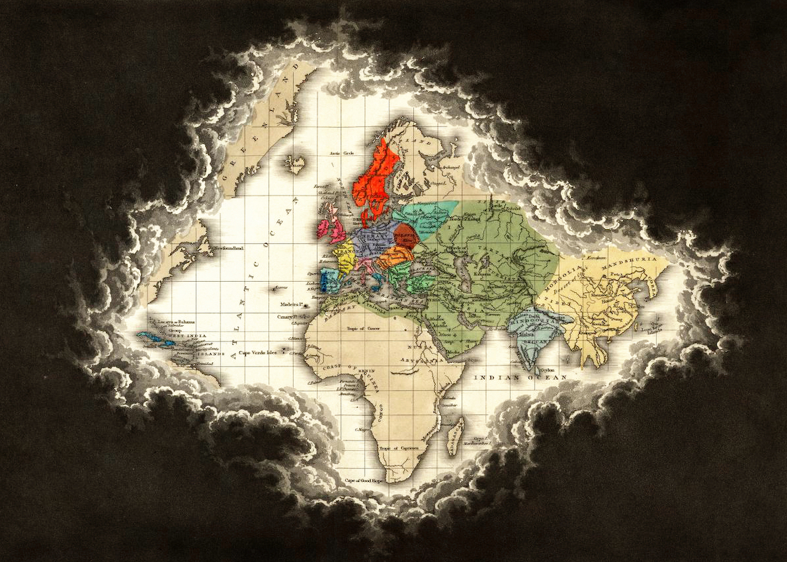
Strange Maps This map of Europe is good for only one thing Topologists can’t tell donuts from coffee mugs, but their maps are revelatory nonetheless.
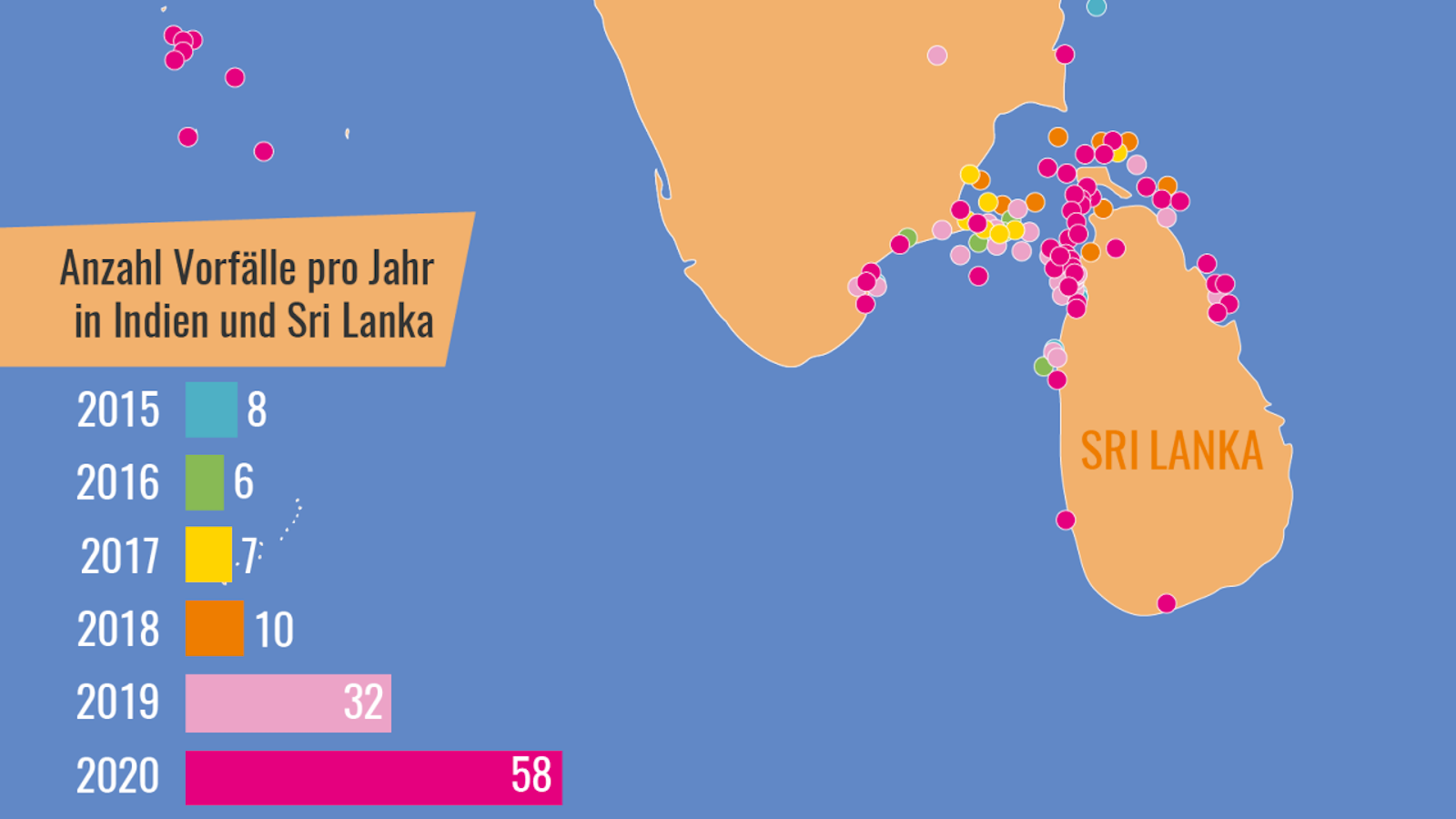
Strange Maps Sea cucumber crime is a thing, and this is where it’s happening A “seafood mafia” is plying the waters between India and Sri Lanka to satisfy China’s appetite for an increasingly rare delicacy.
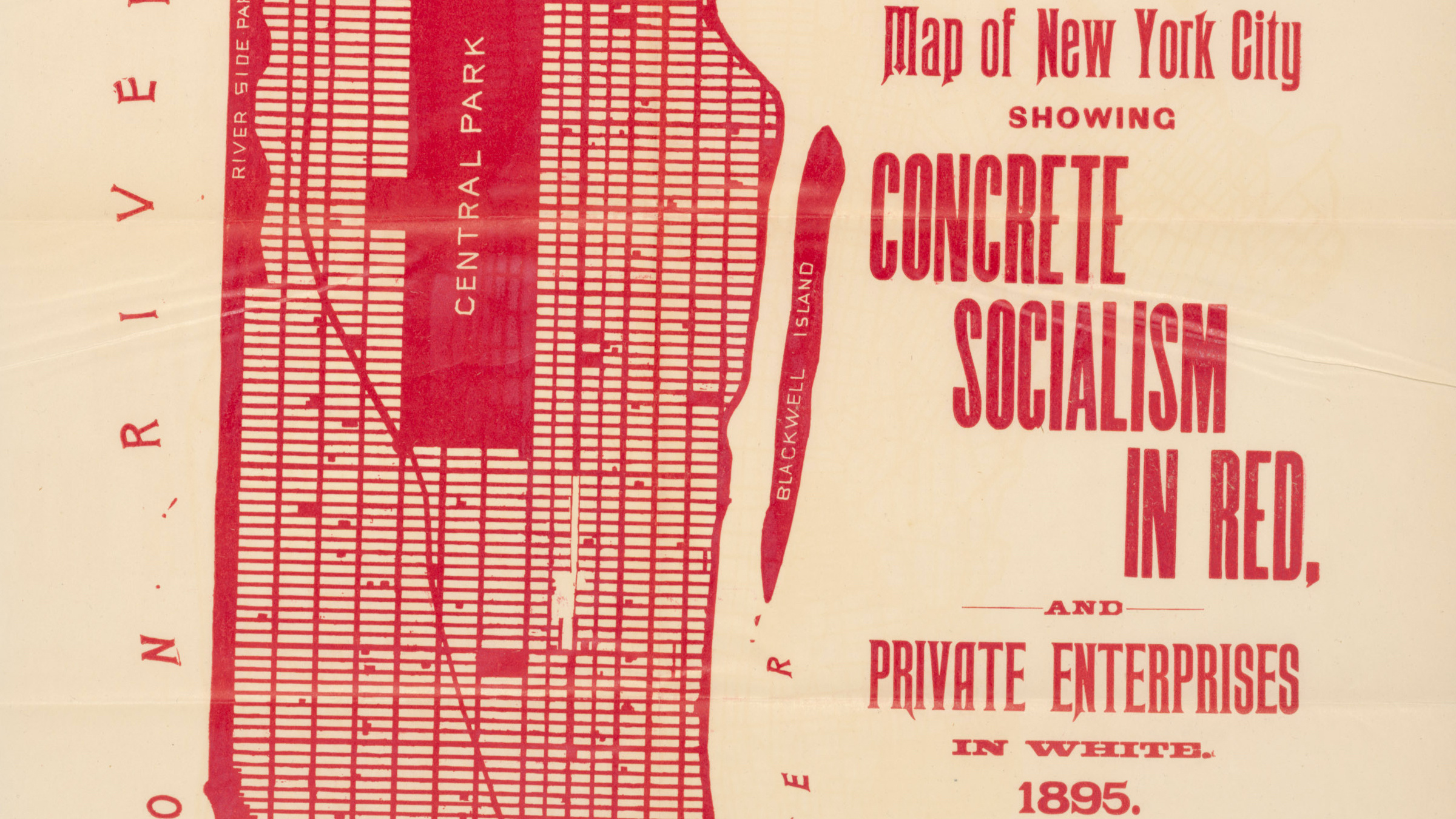
Strange Maps Actually, New York is half socialist already 1895 map of New York City shows ‘concrete socialism’ in red, ‘private enterprises’ in white.
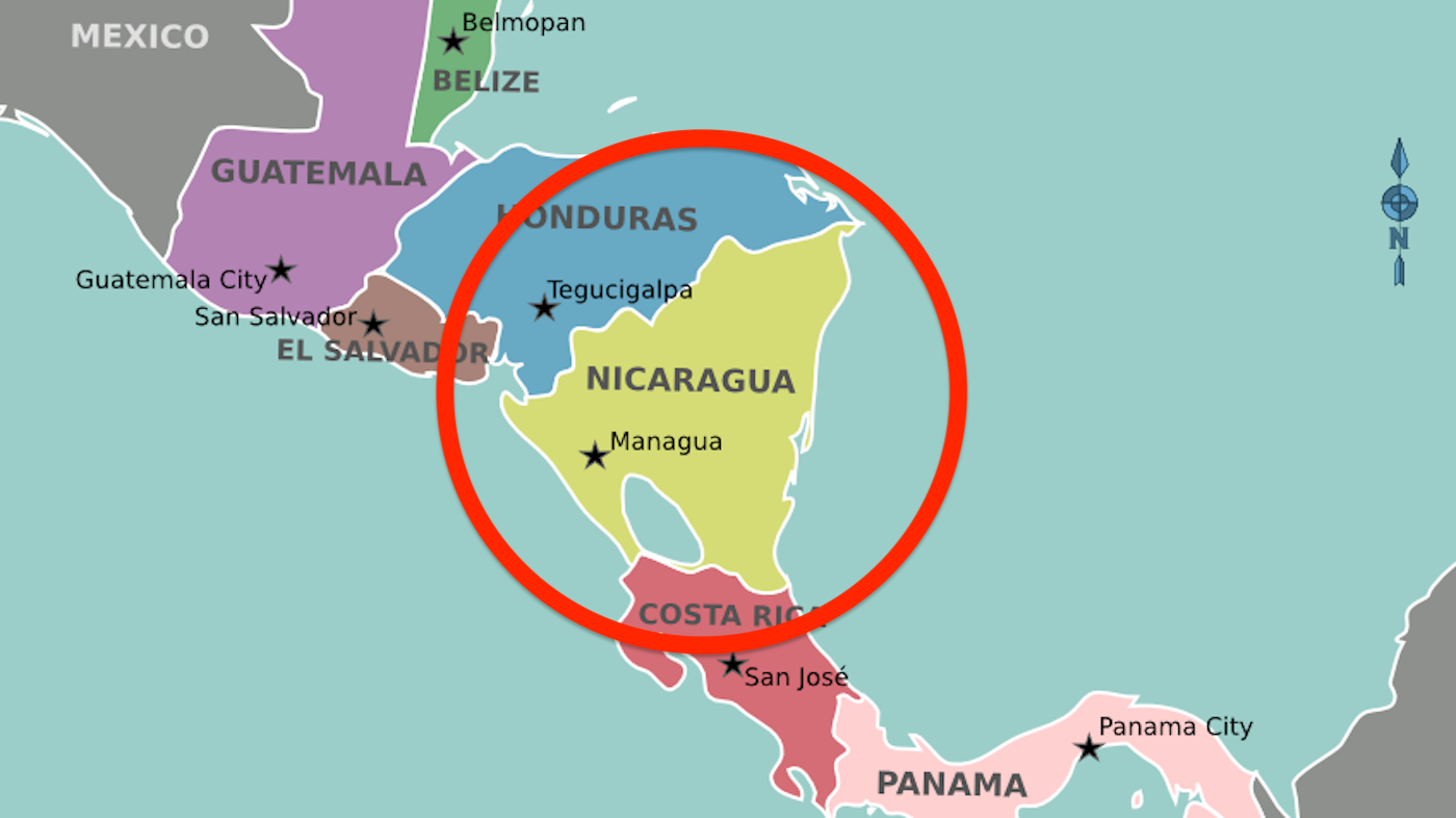
Strange Maps Nicaragua is the most triangular country in the world Underperforming, the U.S. comes in only 157th out of 196 in global triangularity ranking.
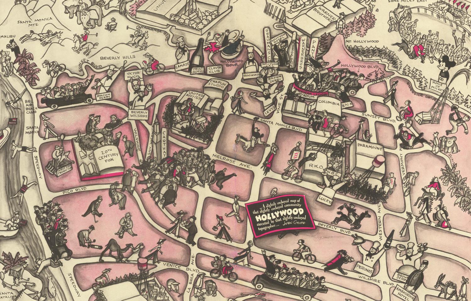
Strange Maps ‘Cockeyed’ map shows both glamour and margins of 1930s Hollywood Legendary cartoonist John Groth’s pictorial map captures LA’s film factories in their Golden Age.
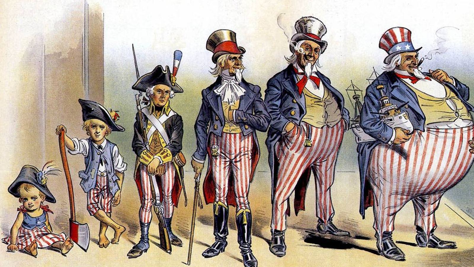
Strange Maps American imperialism: fat-shaming Uncle Sam Opponents of 19th-century American imperialism were not above body-shaming the personification of the U.S. government.
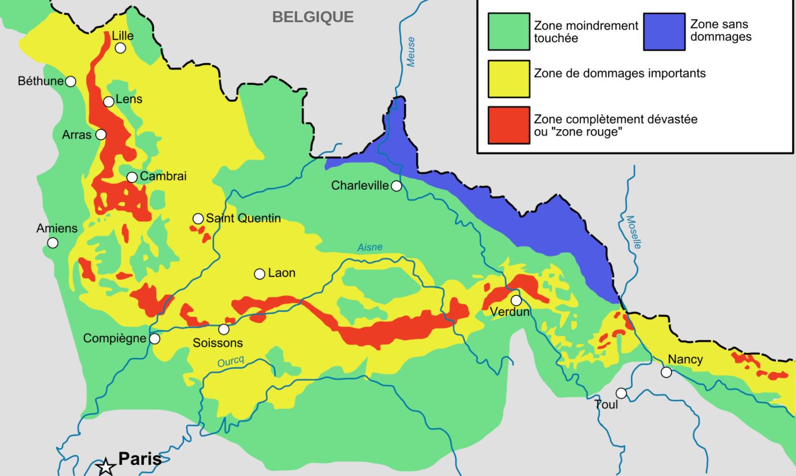
Strange Maps In France’s Red Zones, World War I never ended More than a century after the end of hostilities in 1918, some battlefields of WWI are still deadly enough to kill you.
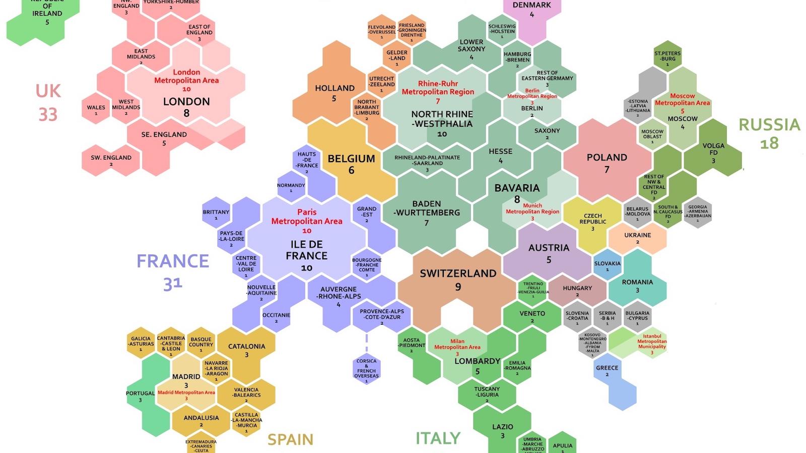
Strange Maps These 1,000 hexagons show how global wealth is distributed A cartogram makes it easy to compare regional and national GDPs at a glance.
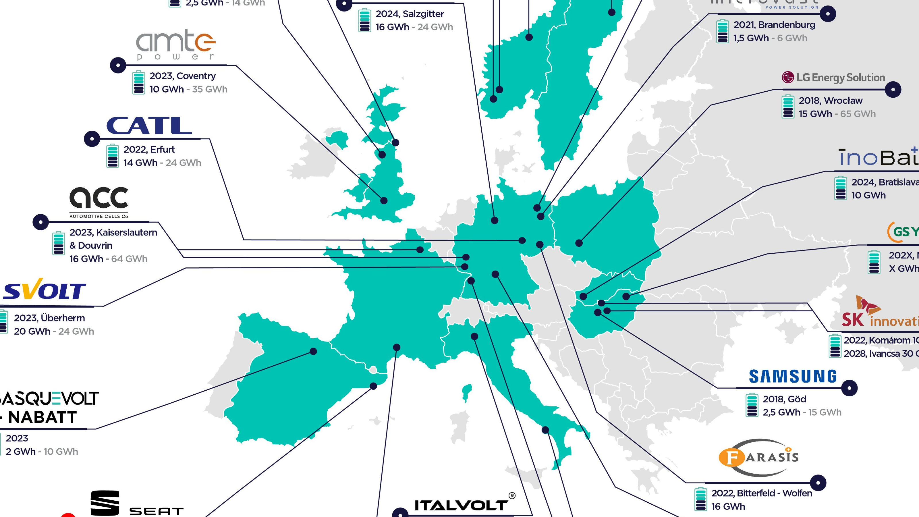
Strange Maps How Europe will beat China on batteries Map shows Europe’s imminent Great Leap Forward in battery cell production
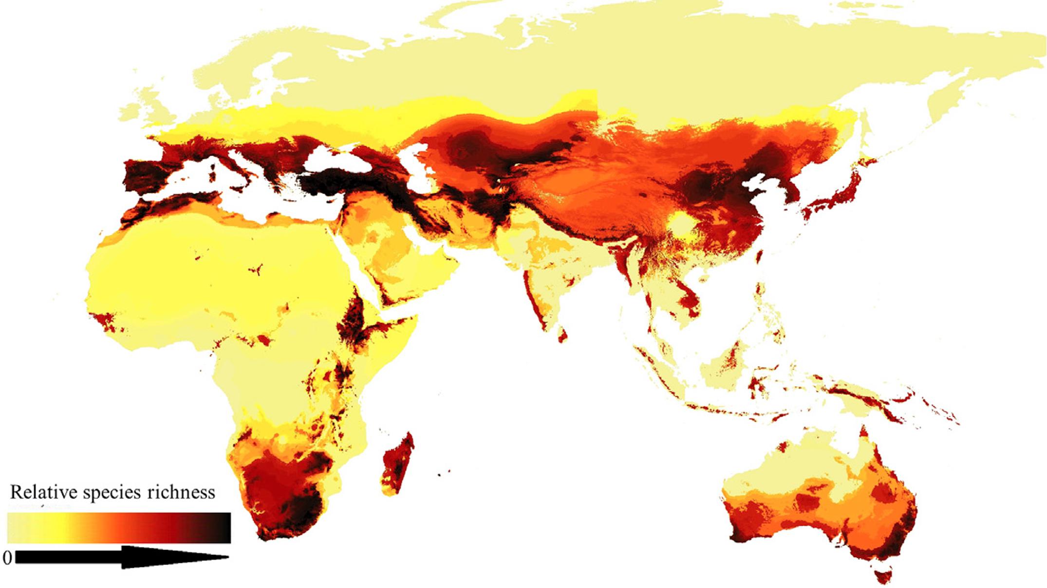
Strange Maps Finally, a world map for bees First picture of worldwide bee distribution fills knowledge gaps and may help protect species.
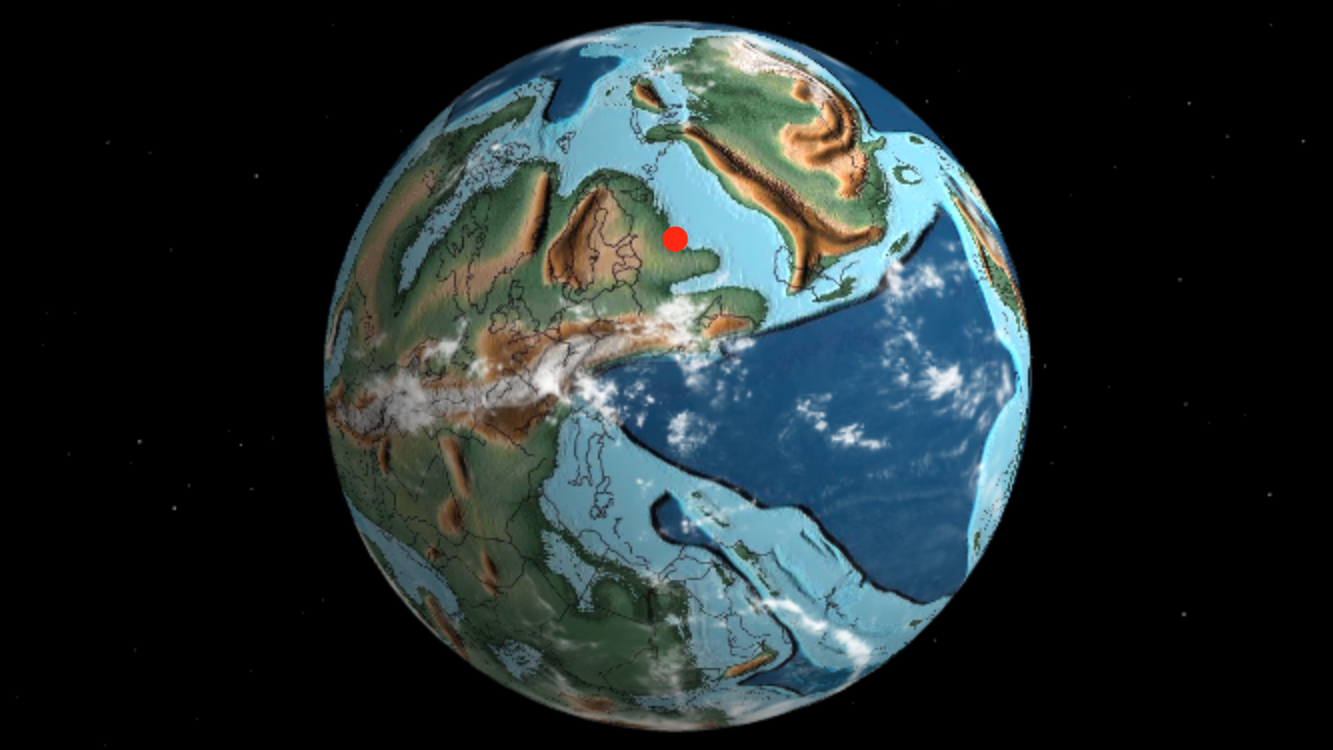
Strange Maps Housebound? This map lets you travel through time Interactive globe shows where your hometown was at various stages of Earth’s deep geological past.
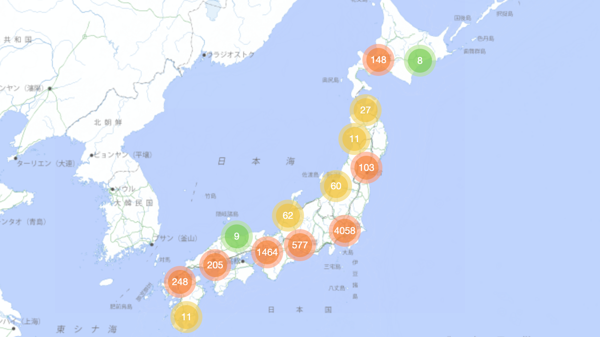
Strange Maps Too loud? In Japan, they’ll map-shame you ‘Dorozoku’ map crowd-sources the whereabouts of noisy kids in Japan – but who’s being anti-social here, exactly?
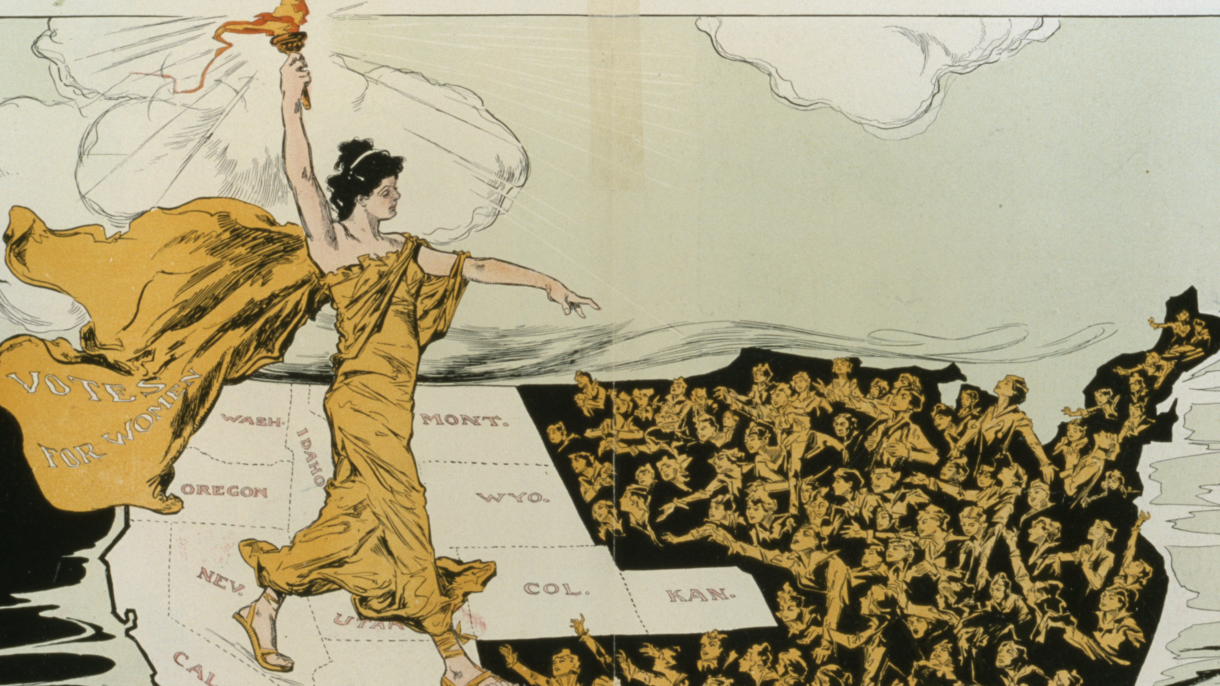
Strange Maps One century ago, women’s suffrage swept America In this 1915 map, Lady Liberty shines her light in the West on women in the East, still in electoral darkness
Strange Maps How a “flying circus” gave us the first aerial maps of Earth Thomas Baldwin’s Airopaidia (1786) includes the earliest sketches of the earth from a balloon.