U.S. Air Force warns UFO enthusiasts against storming Area 51
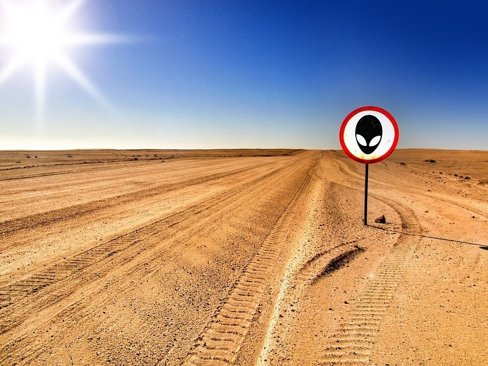
Jokesters and serious Area 51 raiders would be met with military force.
- Facebook joke event to "raid Area 51" has already gained 1,000,000 "going" attendees.
- The U.S. Air Force has issued an official warning to potential "raiders."
- If anyone actually tries to storm an American military base, the use of deadly force is authorized.
Storm Area 51 raid
<p>A majority of news organizations reporting on this situation are taking it with a hefty grain of salt and some light-hearted jokes. No doubt the creators of this event are reveling in the extended coverage, as the "event" isn't meant to go live until September 20th. </p><p>But that hasn't stopped the United States Airforce from issuing a very stern warning. </p><p>In an interview with <a href="https://www.washingtonpost.com/national-security/2019/07/13/half-million-people-signed-up-storm-area-what-happens-if-they-actually-show-up/?utm_term=.e3d6f461c199" target="_blank"><em>The Washington Post</em></a>, Air Force spokeswoman Laura McAndrews informed the news agency that officials knew about the event. Although she didn't give any specifics on what would happen to any would-be trespassers, she stated: </p><p style="margin-left: 20px;">"Area 51 is an open training range for the U.S. Air Force, and we would discourage anyone from trying to come into the area where we train American armed forces. The U.S. Air Force always stands ready to protect America and its assets."</p><p>The facility was officially acknowledged by the U.S. Government in 2013 when the CIA confirmed its existence <a href="https://www.reuters.com/article/us-usa-area51-cia/cia-acknowledges-its-mysterious-area-51-test-site-for-first-time-idUSBRE97G01120130817" target="_blank">through public record.</a> Additionally, other reports have been released about that nature of Area 51 as <a href="https://www.cia.gov/news-information/featured-story-archive/2015-featured-story-archive/area-51-u-2-and-the-accidental-test-flight.html" target="_blank">just an aircraft testing facility</a>. But no amount of publicly-released data will ever quell conspiratorial theorists — or, by extension, good-natured humorists. </p><p>A number of celebrities have RSVP'd to the event or referenced the joke, among them are singer Kevin Jonas, Game of Thrones actor Liam Cunningham, and Jeffree Star. Expect more celebrities and "social media stars," to start cashing in on the memes in the coming months.</p>Alert! Turn back, Area 51 raiders
<p>Toward the end of Jackson Barnes' Facebook post is the message:</p><p>"P.S. Hello U.S. government, this is a joke, and I do not actually intend to go ahead with this plan. I just thought it would be funny and get me some thumbsy uppies on the internet. I'm not responsible if people decide to actually storm area 51."</p><p>Out of the millions who've either signed up or interacted with this internet joke, in some way or another, it's inevitable that some stooges will take this event seriously. </p><p>For instance, a hotel in Rachel, Nevada, called the Little A'Le'Inn, which has glommed onto the Area 51 hype throughout the years has just recently received an unusually high number of reservations for September 20th. </p><p>In a recent interview with the <em><a href="https://www.nytimes.com/2019/07/15/us/area-51-raid.html" target="_blank" rel="noopener noreferrer">New York Times</a></em>, Connie West, a co-owner of the establishment stated that, "My poor bartender today walked past me and said, 'I hate to tell you, but every phone call I've had is about Sept. 20," she then added, "They're pretty serious; they're coming. People are coming."</p><p>Many people that called had mentioned the Facebook post when reserving the rooms. The Facebook post had invited people to Amargosa Valley, which is actually a few hours away from Little A'Le'Inn and further from Area 51 on the opposite side. </p><p>There are multiple signs surrounding the Area 51 perimeter and border which state that not only "photography is prohibited," but the "use of deadly force is authorized." </p><p>But hey, the fool who persists in his folly will become wise. After all, who's to say the Ufologist persisting in his alien search won't find some. Maybe our Naruto running raiders can use this show of force as a bargaining chip with the officials for a tour of the facility. . . if the government officials really have nothing to hide that is.</p>California, an island? Meet cartography's most persistent mistake
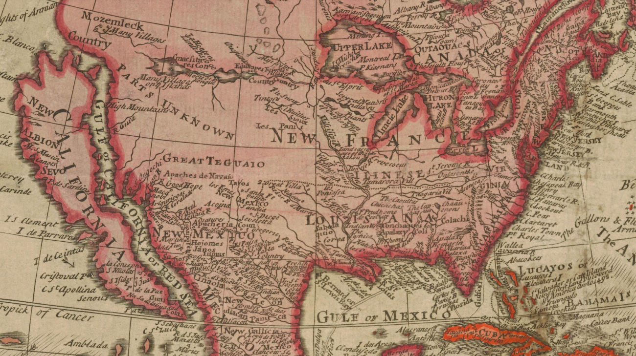
The Glen McLaughlin Collection brings together more than 700 historical examples of 'California as an island'.
- California was born a fiction: named after a made-up island the name of which could be translated as 'caliphate'.
- For centuries, California was a cartographic fiction as well: it was shown as an island until as late as 1865.
- Over 40 years, Glen McLaughlin dug up more than 700 maps of California as an island – the world's biggest collection on cartography's most persistent mistake.
A nameless peninsula
<img type="lazy-image" data-runner-src="https://assets.rebelmouse.io/eyJhbGciOiJIUzI1NiIsInR5cCI6IkpXVCJ9.eyJpbWFnZSI6Imh0dHBzOi8vYXNzZXRzLnJibC5tcy8xOTc1NTk2Ny9vcmlnaW4ucG5nIiwiZXhwaXJlc19hdCI6MTY3MDk1NDA3OH0.LJCEm2zFHnV04I3Z0U-gy2iS7J4ezaCKiGQHyLCVSvw/img.png?width=980" id="4f316" class="rm-shortcode" data-rm-shortcode-id="5f354c1642d89a8355fa5c359356c972" data-rm-shortcode-name="rebelmouse-image" />Detail of an early woodcut world map by Francisco Lopez de Gomara (Zaragoza, 1553). The oldest map in the McLaughlin Collection, it shows California nameless for now, but with its correct, peninsular shape.
<p>In 1971, Glen McLaughlin came across a strange map in a London map shop. Americæ Nova Descriptio, produced by Anne Seile (1) in 1663, showed California as a big, carrot-shaped island, floating off the coast of North America.</p><p>McLaughlin, a venture capitalist in Silicon Valley, bought the map and hung it on a wall at home. It turned into a popular talking point with visitors, and California-as-an-island became McLaughlin's decades-long obsession. <br></p><p>Over the next 40 years, he collected more than 700 maps, charts and other cartographic objects on the topic, building up a visual library of what is one of history's most persistent cartographic fallacies.</p>First mention
<img type="lazy-image" data-runner-src="https://assets.rebelmouse.io/eyJhbGciOiJIUzI1NiIsInR5cCI6IkpXVCJ9.eyJpbWFnZSI6Imh0dHBzOi8vYXNzZXRzLnJibC5tcy8xOTc1NjAyNC9vcmlnaW4ucG5nIiwiZXhwaXJlc19hdCI6MTYxNjc1MTEwNX0.2P0vFyAP5bB2KIU-tAXCqx6vzN5sf8ctybias_WcgqE/img.png?width=980" id="293ee" class="rm-shortcode" data-rm-shortcode-id="a9bbde2c5566abefd8ef50b31c885009" data-rm-shortcode-name="rebelmouse-image" />Detail of 'Granata Nova et California', a map by Corneille Wytfliet, published in Leuven in 1597. It's the oldest map in the collection to label the west coast of North America as 'California'. Again the region is shown, correctly, as a peninsula.
<p>Perhaps that persistence and McLaughlin's obsession spring from the same source. Even though California <em>geographically</em> isn't an island, it does tend to feel like a place separate from the 'mainland'. <br></p><p>Indeed, in more ways than one, California is a one-off. Some metrics are obvious. It's so vast and varied that it could easily be a country on its own, let alone an island. California is the largest state by population (40 million) and GDP ($3 trillion, 15% of the U.S. total). It's home to both the highest and lowest points in the contiguous United States: Mt Whitney (14,505 ft; 4,421 m) and Badwater Basin in Death Valley (-282 ft, -86 m). </p><p>But the Golden State is special in a more intangible way as well. It's where America's westward expansion met its ultimate physical barrier: Manifest Destiny, say hi to Pacific Ocean. Both the 1849 Gold Rush and the birth of Hollywood, half a century later, merely confirmed the image of California in the popular mind as the final destination of the American Dream – there to flourish or wilt.<br></p>Amputation, CA
<img type="lazy-image" data-runner-src="https://assets.rebelmouse.io/eyJhbGciOiJIUzI1NiIsInR5cCI6IkpXVCJ9.eyJpbWFnZSI6Imh0dHBzOi8vYXNzZXRzLnJibC5tcy8xOTc1NjA4Mi9vcmlnaW4ucG5nIiwiZXhwaXJlc19hdCI6MTY2MTQwNzk0M30.vUmtPmEdKQQvhsnsONXMFZyq-ECHs7w6VOLGX9eYUHc/img.png?width=980" id="1c5e0" class="rm-shortcode" data-rm-shortcode-id="8ee1da652e201da9b936ed5d88663baf" data-rm-shortcode-name="rebelmouse-image" />Detail of the second title page of 'Descriptio Indiæ Occidentalis' by Antonio de Herrera y Tordesillas, published in Amsterdam in 1622. This is the earliest map to show California as an island.
<p>It's fitting that a state so synonymous with storytelling should have started out as an invention itself. California is the only state that was named after a fictional place. Bound up with its name was the misconception that California was an island – and so it would remain on many maps, until as late as 1865. </p><p>In 1533, a mutineer from Hernan Cortez' expedition into Mexico landed on a peninsula so elongated that he mistook it for an island. He named it after a fictional island in <em>Las Sergas de Esplandian</em> ('The Deeds of Esplandian'), a romantic novel then popular in Spain. It says that:</p><blockquote><em>"[O]n the right hand of the Indies there is an island called California very close to the side of the Terrestrial Paradise; and it is peopled by black women, without any man among them, for they live in the manner of the Amazons."</em></blockquote><p>The women were gorgeous, brave and strong, and their weapons were all made of gold – the only metal available on the island. <br></p>American caliphate
<img type="lazy-image" data-runner-src="https://assets.rebelmouse.io/eyJhbGciOiJIUzI1NiIsInR5cCI6IkpXVCJ9.eyJpbWFnZSI6Imh0dHBzOi8vYXNzZXRzLnJibC5tcy8xOTc1NjEzNi9vcmlnaW4ucG5nIiwiZXhwaXJlc19hdCI6MTY1NjkwNzg4NX0.c5MT0KZKzu04C-NO6WLH0yj9ZLssqDvalE3j_OJYRm0/img.png?width=980" id="472fd" class="rm-shortcode" data-rm-shortcode-id="56176c6f9bcec5b67f6cb0ea0ab594b9" data-rm-shortcode-name="rebelmouse-image" />Silver coin struck by Laurens van Teylingden to commemorate the capture of the Spanish silver fleet by Dutch admiral Piet Heyn, in 1628 off Matanzas Bay in Cuba. It's the only known representation of California Island on a medal.
<p>Though the name 'California' can be traced to a specific novel, its etymology remains disputed. In the novel, the island is ruled by Queen Calafia. Her job title suggests a derivation from the Arabic 'caliph' ('ruler') – 'California' would thus mean something like 'Caliphate'. </p><p><span></span>Another theory pinpoints the name's origin to 'Califerne', a place mentioned in verse CCIX of the medieval Song of Roland (and also deriving from 'caliph'), while a third one posits a derivation from 'Kar-i-Farn', Persian for 'Mountain of Paradise'. One more: 'calit fornay', Old Spanish meaning 'hot furnace'. </p><p>As early as 1539, an expedition by Francisco de Ulloa demonstrated that the area (near the southern tip of present-day Baja California, Mexico) was a peninsula after all. But fiction proved stronger than fact. Even though the earliest maps do show California attached to the mainland, the name for the place stuck. <br></p>Spanish vs. English
<img type="lazy-image" data-runner-src="https://assets.rebelmouse.io/eyJhbGciOiJIUzI1NiIsInR5cCI6IkpXVCJ9.eyJpbWFnZSI6Imh0dHBzOi8vYXNzZXRzLnJibC5tcy8xOTc1NjIzMC9vcmlnaW4ucG5nIiwiZXhwaXJlc19hdCI6MTY2MTcwMjk5OH0.yNpOhNTjHBOKnEoXzbuizb-p525dcMaPEhyToCBufBA/img.png?width=980" id="ee76e" class="rm-shortcode" data-rm-shortcode-id="c4b49438f097dcc943789ed1ce0021bf" data-rm-shortcode-name="rebelmouse-image" />Detail of 'Americque Septentrionale' by Nicolas Sanson (Utrecht, ca. 1682). Classic representation of California as an island, with some extra fantasy islands added to the narrows separating it from the mainland.
<p>But the idea of the island of California proved pretty tenacious too. After an 80-year period of continental attachment, California started to appear on maps as an island, from 1622 onward and far into the 18th century.</p><p>California's insular revival is generally ascribed to Antonio de la Ascension, a Spanish clergyman who had sailed along North America's West Coast in the early 1600s and yet, contrary to the evidence, claimed California was an island. </p><p>Perhaps this was to invalidate the English claim on the continent. In 1579, Sir Francis Drake had landed at a place he called 'Nova Albion' (today known to be Point Reyes, California), and claimed the region for England. If Drake's landing could be situated on an island, De la Ascension seems to have thought, Spain's claim to the mainland itself would remain undisputed.<br></p>Geography, 'rectified'
<img type="lazy-image" data-runner-src="https://assets.rebelmouse.io/eyJhbGciOiJIUzI1NiIsInR5cCI6IkpXVCJ9.eyJpbWFnZSI6Imh0dHBzOi8vYXNzZXRzLnJibC5tcy8xOTc1NjMxMS9vcmlnaW4ucG5nIiwiZXhwaXJlc19hdCI6MTYzOTU0NzE0MH0.fohBEJ9rRVBPHZYQLbJYipRyO79vjk3LQBDkpnkRehE/img.png?width=980" id="d8e98" class="rm-shortcode" data-rm-shortcode-id="775908fd4431803a273c4e31dce080d2" data-rm-shortcode-name="rebelmouse-image" />Introduction to the chapter on America in Robert Morden's 'Geography Rectified' (London, 1700). Fighting a losing battle on the naming of the New World ("commonly, but improperly, termed America"), but cool with the name California, and with its insularity.
<p>That it would take more than a century to set the record straight again speaks to California's by now semi-legendary status. Other famous cartographic legends on the map of the Americas include Norumbega, El Dorado and <a href="https://www.nationalgeographic.com/archaeology-and-history/archaeology/seven-cities-of-cibola/" target="_blank" rel="noopener noreferrer">Siete Ciudades</a>.</p><p>Father Eusebio Kino's expedition (1698-1701) proved – again – that California was connected to the North American mainland. The title of his report left no doubt: 'A passage by land to California'. Still, not everyone was prepared to give up the ghost of California Island. <br></p><p>However, by 1747, king Ferdinand VI of Spain had had enough. Tiring of the persistent falsehood infesting his maps, he simply decreed that "California is not an island". Only after this was reconfirmed by the expeditions of Juan Bautista de Anza (1774-1776) was the fiction definitively laid to rest.</p>A lunar view
<img type="lazy-image" data-runner-src="https://assets.rebelmouse.io/eyJhbGciOiJIUzI1NiIsInR5cCI6IkpXVCJ9.eyJpbWFnZSI6Imh0dHBzOi8vYXNzZXRzLnJibC5tcy8xOTc1NjM3Mi9vcmlnaW4ucG5nIiwiZXhwaXJlc19hdCI6MTY1NjQzNjI2NX0.fw-0JEKTzQz9I_DounZPCjs2s3w54KnZiyVcBIVcUY0/img.png?width=980" id="7a834" class="rm-shortcode" data-rm-shortcode-id="72280e5197294472ce490ca05aa52021" data-rm-shortcode-name="rebelmouse-image" />'Facies terrae americana in luna conspecta' ('The American face of the Earth, from a lunar perspective'): map by John Seller, part of his 'Atlas Coelestis' (London, ca. 1700). The island of California is the smaller mistake on this map – there's also a giant southern continent almost touching the southern tip of South America.
<p>But it's hard to kill a ghost, and cartographic spectres are particularly persistent. Even as the rest of the world caught up with the facts on the ground, a Japanese map in 1865 showed California – by then thoroughly explored, well described and increasingly populated – as an island nevertheless, the last such occurrence in cartographic history. </p><p>Glen McLaughlin's collection is testament to the mesmerising power of map mistakes, over other cartographers and over collectors like himself. In 2011, and by then in his 80s, he had had enough, though: he parted with his collection, which was acquired in its entirety by Stanford University. It's now online in its entirety, featuring these maps and many others.<br></p>Mapmaking by committee
<img type="lazy-image" data-runner-src="https://assets.rebelmouse.io/eyJhbGciOiJIUzI1NiIsInR5cCI6IkpXVCJ9.eyJpbWFnZSI6Imh0dHBzOi8vYXNzZXRzLnJibC5tcy8xOTc1NjQxOS9vcmlnaW4ucG5nIiwiZXhwaXJlc19hdCI6MTYzODA4NjIwMn0.6zJtAH2NXARxT4-cdxULp3S94MuV9H-G44kFzimiG5Y/img.png?width=980" id="bf464" class="rm-shortcode" data-rm-shortcode-id="d5701fb8bfa334d4346bd5e2fc572a0f" data-rm-shortcode-name="rebelmouse-image" />Title page illustration for Heinrich Scherer's 'Geographia Artificialis' (Munich, 1703), showing six symbolic figures (clockwise from the top: Topography, Astronomy, Mathematics, Drawing, Geometry and History) collaborating to produce a globe – which despite their best efforts shows California as an island.
Noahide California
<img type="lazy-image" data-runner-src="https://assets.rebelmouse.io/eyJhbGciOiJIUzI1NiIsInR5cCI6IkpXVCJ9.eyJpbWFnZSI6Imh0dHBzOi8vYXNzZXRzLnJibC5tcy8xOTc1NjQ1OC9vcmlnaW4ucG5nIiwiZXhwaXJlc19hdCI6MTY3NjEwODczOX0.clSv_MYZnnd-o2w9Tw4RvnpZCtdsIVtGJ5c4gbMFqDg/img.png?width=980" id="b6739" class="rm-shortcode" data-rm-shortcode-id="93e02e610bef0a40f17ef003c8c28344" data-rm-shortcode-name="rebelmouse-image" />'A Map of all the EARTH and how after the Flood it Was Divided among the Sons of Noah'. (Joseph Moxon, London, 1711). California is on the extreme right of the map, almost falling off (a fate that often befalls New Zealand these days). North America is green, and labelled 'Japhet'. California is yellow, but it's unclear whether this indicates it belongs to another son of Noah's (or which one).
A giant carrot
<img type="lazy-image" data-runner-src="https://assets.rebelmouse.io/eyJhbGciOiJIUzI1NiIsInR5cCI6IkpXVCJ9.eyJpbWFnZSI6Imh0dHBzOi8vYXNzZXRzLnJibC5tcy8xOTc1NjQ5OS9vcmlnaW4ucG5nIiwiZXhwaXJlc19hdCI6MTY1NzkyNTk3NX0.Qx1cpEW2GeZA0BKUu5QSFi5-M0jnWDBla8_K_zvRjZs/img.png?width=980" id="7e431" class="rm-shortcode" data-rm-shortcode-id="d1b820d00aa022fc19bcfcc03ab3f695" data-rm-shortcode-name="rebelmouse-image" />'La Californie ou Nouvelle Caroline': map by Nicolas de Fer (Paris, 1720) showing California in the shape and colour of a giant carrot, floating off the coast of North America, and proposing an alternate name for the island: 'New Carolina'. The text relates to the missionary work of the Jesuits in the area.
Catholics and heathens
<img type="lazy-image" data-runner-src="https://assets.rebelmouse.io/eyJhbGciOiJIUzI1NiIsInR5cCI6IkpXVCJ9.eyJpbWFnZSI6Imh0dHBzOi8vYXNzZXRzLnJibC5tcy8xOTc1NjU0My9vcmlnaW4ucG5nIiwiZXhwaXJlc19hdCI6MTY0NDA3MjI1NH0.3HrjuHXajFESyH8_n2rWxx1RY3hGSDaaLCEeQ-JgzcM/img.png?width=980" id="0db9b" class="rm-shortcode" data-rm-shortcode-id="72dd0c43d7756c547c4c25353a463fd9" data-rm-shortcode-name="rebelmouse-image" />Detail of a 1725 map by Christoph Weigel, showing California as a large island, with a sketchy territory to its north, labelled 'Terra Essonis'. Helpful legend in the top left corner: 'Gold Catholisch; Erdfarb Heydnisch' (yellow-coloured countries: catholic; earthen-coloured countries: heathen). California counts as catholic, as does Florida.
A polar perspective
<img type="lazy-image" data-runner-src="https://assets.rebelmouse.io/eyJhbGciOiJIUzI1NiIsInR5cCI6IkpXVCJ9.eyJpbWFnZSI6Imh0dHBzOi8vYXNzZXRzLnJibC5tcy8xOTc1NjU4MS9vcmlnaW4ucG5nIiwiZXhwaXJlc19hdCI6MTYyNjI3ODQ5MH0.tlITZNJn77VGz6ZdPcSIGIk6MKTfg2JflKVDkx-I_ds/img.png?width=980" id="f2da1" class="rm-shortcode" data-rm-shortcode-id="d1e490b2bee40a609b8e2ac912a0214b" data-rm-shortcode-name="rebelmouse-image" />Hemispherical map centred on the North Pole, created by Isaak Tirion in Amsterdam in 1735, showing the northern tip of the island of California (circled).
East is east and west is west
<img type="lazy-image" data-runner-src="https://assets.rebelmouse.io/eyJhbGciOiJIUzI1NiIsInR5cCI6IkpXVCJ9.eyJpbWFnZSI6Imh0dHBzOi8vYXNzZXRzLnJibC5tcy8xOTc1NjYxMC9vcmlnaW4ucG5nIiwiZXhwaXJlc19hdCI6MTY1MTkwMTk1OH0.r-d_a2QNanQReQyw_j3FYjS0uVExSJOw73BMLANWb0k/img.png?width=980" id="4d770" class="rm-shortcode" data-rm-shortcode-id="cf13dc4472e4d403772a0495c3f88b4d" data-rm-shortcode-name="rebelmouse-image" />Detail of a map by Richard William Seale, created in London in 1745. While the East Coast is shaping up with names and borders still recognisable today, the West Coast is still dominated by that huge, floating island – rendered in great detail for added believability.
California as a Pacific island
<img type="lazy-image" data-runner-src="https://assets.rebelmouse.io/eyJhbGciOiJIUzI1NiIsInR5cCI6IkpXVCJ9.eyJpbWFnZSI6Imh0dHBzOi8vYXNzZXRzLnJibC5tcy8xOTc1NjY3NS9vcmlnaW4ucG5nIiwiZXhwaXJlc19hdCI6MTYzMjI5NDg1OX0.yJmzOBA_srjWBz9hWfQpOkC2NIQ_a40yerbCOVnBFls/img.png?width=980" id="2d3b1" class="rm-shortcode" data-rm-shortcode-id="76aa3494d3b4728f828b13dd41bdedaa" data-rm-shortcode-name="rebelmouse-image" />'De Groote Zuyd-Zee en 't Eylandt California', created by R. and J. Ottens and printed in Amsterdam in 1745. The map shows California as a Pacific island, larger than Japan and much more defined than Australia or New Zealand, traced only in partial outlines and labelled Hollandia Nova and Zeelandia Nova.
'François Draco'
<img type="lazy-image" data-runner-src="https://assets.rebelmouse.io/eyJhbGciOiJIUzI1NiIsInR5cCI6IkpXVCJ9.eyJpbWFnZSI6Imh0dHBzOi8vYXNzZXRzLnJibC5tcy8xOTc1NjcxNC9vcmlnaW4ucG5nIiwiZXhwaXJlc19hdCI6MTYyNTkwMTgzOX0.4mA6t1gjcw7utC9dLbrWDlsmPiZDcZqrDXxf8d4nkdk/img.png?width=980" id="f5270" class="rm-shortcode" data-rm-shortcode-id="0d781007ce245fb711816d69ece36518" data-rm-shortcode-name="rebelmouse-image" />Detail of 'L'Amérique Septentrionale', created by Jacques Chiquet in 1721 and published in Amsterdam around 1749. It shows a huge and well-defined island of California, its southern tip touching the Tropic of Cancer, facing New Mexico and New Spain across the narrow Vermillion Sea.
Drawing a blank
<img type="lazy-image" data-runner-src="https://assets.rebelmouse.io/eyJhbGciOiJIUzI1NiIsInR5cCI6IkpXVCJ9.eyJpbWFnZSI6Imh0dHBzOi8vYXNzZXRzLnJibC5tcy8xOTc1Njc2NS9vcmlnaW4ucG5nIiwiZXhwaXJlc19hdCI6MTY0MzcxODk2OH0.8GE7HFzkQVS8dAvnuvAw8Vy8UGVBX7xXSB0dONkFFYY/img.png?width=980" id="f909b" class="rm-shortcode" data-rm-shortcode-id="2775c3fbe313a6feaa25a2986f6a2aeb" data-rm-shortcode-name="rebelmouse-image" />Detail of a map published in 1772 by Augsburg cartographer Tobias Lotter, based on earlier work by Guillaume de l'Isle. Rather than choosing between a peninsular or an insular version California, it hedges its bets by blanking out the northern part of the narrow 'Californian Sea'.
Stretchy island
<img type="lazy-image" data-runner-src="https://assets.rebelmouse.io/eyJhbGciOiJIUzI1NiIsInR5cCI6IkpXVCJ9.eyJpbWFnZSI6Imh0dHBzOi8vYXNzZXRzLnJibC5tcy8xOTc1Njc5OC9vcmlnaW4ucG5nIiwiZXhwaXJlc19hdCI6MTY3MzIxNTIwM30.dl_DwECWwBHSOgnVspOUQbDDfol9TTsqlySAok7EAtQ/img.png?width=980" id="00de1" class="rm-shortcode" data-rm-shortcode-id="f7a9461d3c20517048bb7f203120de0a" data-rm-shortcode-name="rebelmouse-image" />Detail of 'Novae Orbis sive Americe Septentrionalis', a map by Matthaeus Seutter (Augsburg, ca. 1790). It shows a particularly stretchy version of the Californian island, with numerous coastal place names (capes, islands) and both Drake's Nova Albion and San Diego on the island itself.
Unmade in Japan
<img type="lazy-image" data-runner-src="https://assets.rebelmouse.io/eyJhbGciOiJIUzI1NiIsInR5cCI6IkpXVCJ9.eyJpbWFnZSI6Imh0dHBzOi8vYXNzZXRzLnJibC5tcy8xOTc1NjgyNy9vcmlnaW4ucG5nIiwiZXhwaXJlc19hdCI6MTYzMTQwOTYwN30.ypfM2lHvIV4hryNzBdsSCiJoZanI7Ip2CSRq_nccONQ/img.png?width=980" id="b4530" class="rm-shortcode" data-rm-shortcode-id="4f69f7710b361137b82c033922d2c1b9" data-rm-shortcode-name="rebelmouse-image" />The last representation of California as an island (in red): detail of a map published in 1865 by Shuzo Sato in Japan.
Why eating turkey really makes you sleepy
Is everyone's favorite Thanksgiving centerpiece really to blame for the post-dinner doldrums?
- Americans kill around 45 million turkeys every year in preparation for the Thanksgiving meal, only to blame our favorite centerpiece for the following food comas.
- Rumor has it our after-dinner sleepiness results from the tryptophan found in turkey.
- However, it is the meal's overall nutritional imbalance, not just the tryptophan, that make us want to leave the dishes for tomorrow. Or maybe the next day.
Tryptophan-tasitc meal
<img type="lazy-image" data-runner-src="https://assets.rebelmouse.io/eyJhbGciOiJIUzI1NiIsInR5cCI6IkpXVCJ9.eyJpbWFnZSI6Imh0dHBzOi8vYXNzZXRzLnJibC5tcy8xODkxNTM4My9vcmlnaW4ucG5nIiwiZXhwaXJlc19hdCI6MTY0ODc1MTg2Nn0.NyeqnpKc7Nf0Z24-tqCrh9_KC7G1WQchuQkEy4mMWFs/img.png?width=1245&coordinates=0%2C38%2C0%2C88&height=700" id="94564" class="rm-shortcode" data-rm-shortcode-id="edf6e2b46612680734f4079d6eb4c6f5" data-rm-shortcode-name="rebelmouse-image" alt="Jerry and George use a turkey's tryptophan to make Celia fall asleep in the episode "The Merv Griffin Show."" />Jerry and George use a turkey's tryptophan to make Celia fall asleep in the episode "The Merv Griffin Show."
(Photo from NBCUniversal)
<p>As any <em>Seinfeld</em> fan can tell you, <a href="https://www.youtube.com/watch?v=Ck66tO90dp0" target="_blank">that stuff in turkey</a> that makes you sleepy is tryptophan. Specifically, <a href="https://www.sleep.org/articles/what-is-tryptophan/" target="_blank">L-tryptophan</a><strong>, </strong>an essential amino acid that our livers synthesize into niacin. Niacin, in turn, helps create the neurotransmitter serotonin. </p><p>Our brains and bodies use <a href="https://www.medicalnewstoday.com/kc/serotonin-facts-232248" target="_blank">serotonin for many functions</a>. It plays a role in appetite, emotional stability, motor skills, and cognitive processes, but it's most famous for regulating our body's sleep-wake cycles. This common knowledge serves as the basis for the belief that turkey makes you sleepy.</p><p>Thing is, a lot of foods contain tryptophan. Nuts, soy, eggs, milk, salmon, chicken, spinach, yogurt, and chocolate are all dietary sources of tryptophan, with many of them containing more tryptophan than our favorite holiday fowl. </p><p>According to <a href="https://www.myfooddata.com/articles/high-tryptophan-foods.php" target="_blank">My Food Data</a>, turkey has 404 milligrams of tryptophan per 100 gram serving. But in the same serving size, pumpkin and squash seeds have 576 milligrams, soybeans have 575, and reduced fat mozzarella has 571. None of these is associated with drowsiness, and nuts are a go-to for an afternoon pick-me-up snack.</p><p>Either turkey is being unfairly maligned or something else is weighing down our eyelids after a Thanksgiving meal.</p>Caloric cat nap
<p>While <em>Seinfeld</em> may have exaggerated the effects of tryptophan, the show did get one thing right. If you want to put your girlfriend to sleep so you can play with her antique toy collection, a calorie-laden meal of turkey, heavy gravy, and a whole box of red wine will do the trick.</p><p>Americans consume a lot of calories during a Thanksgiving meal. This isn't news but the numbers, once laid bare, can still be guilt-inducing. The <a href="https://caloriecontrol.org/stuff-the-bird-not-yourself-how-to-deal-with-the-3000-calorie-thanksgiving-meal/" target="_blank">Calorie Control Council</a> estimates that the average Thanksgiving meal weighs in at 3,150 calories, but it's worth noting that their estimate uses sweet tea as a beverage benchmark and not beer, wine, or cocktails.</p><p><a href="https://www.foxnews.com/food-drink/how-many-calories-are-in-a-thanksgiving-meal" target="_blank">Dietitian Tanya Zuckerbrot told <em>Fox News</em></a> that a turkey day dinner ranges between 3,000 and 4,500 calories. Like the Calorie Control Council, her estimate does not include alcoholic drinks, but she also skipped on appetizers.</p><p>Obviously, these numbers vary depending on the food available and serving sizes. But any estimate will have one thing in common: a single meal sporting well over the USDA recommended daily caloric intake for all demographics outside of Olympian athletes.</p>Putting the sleep turkey myth to rest
<img type="lazy-image" data-runner-src="https://assets.rebelmouse.io/eyJhbGciOiJIUzI1NiIsInR5cCI6IkpXVCJ9.eyJpbWFnZSI6Imh0dHBzOi8vYXNzZXRzLnJibC5tcy8xODkxNTM3Mi9vcmlnaW4uanBnIiwiZXhwaXJlc19hdCI6MTY1ODQ1Njc5M30.tEGq2uvltGuB3fL5zwpz3Dly9A-7ocy89-4Ci3Uj2VU/img.jpg?width=1245&coordinates=0%2C140%2C0%2C0&height=700" id="12b8f" class="rm-shortcode" data-rm-shortcode-id="396589213ce67d88606648ae5b5be215" data-rm-shortcode-name="rebelmouse-image" />Two male turkeys named Peas and Carrots sent by the National Turkey Federation (NTF) to the White House are seen before the upcoming annual turkey-pardoning ceremony on November 19, 2018 in Washington, DC.
(Photo by Chen Mengtong/China News Service/VCG via Getty Images)
<p>And this is why the term "<a href="https://curiosity.com/topics/food-coma-heres-why-you-get-sleepy-after-you-eat-curiosity/" target="_blank">food coma</a>" is much more apt — or, if you want to get clinical, "postprandial somnolence."</p><blockquote>"We've known for many years that meals with an imbalance of nutrients — that are rich in either fats or carbohydrates — are associated with feeling sleepy," <a href="https://theconversation.com/health-check-food-comas-or-why-eating-sometimes-makes-you-sleepy-44355" target="_blank">writes Angus Steward</a>, senior lecturer of nutrition and dietetics at Edith Cowan University. "But this is not the case when nutrients are balanced or the meal is rich in protein."</blockquote><p>When we start our Thanksgiving meal, our stomachs begin producing a hormone called gastrin. Gastrin kickstarts the digestive process, which reroutes blood to our stomachs to carry away the newly formed nutrients. </p><p>Part of the drowsiness is due to the volume of food you consume. It simply takes longer to digest, requiring your body to take it easy while it diverts blood from other bodily functions. But as Steward explains, it isn't just volume at work here. It's also what we eat.</p><p>Thanksgiving meals are heavy in fats and carbohydrates. Carbs release glucose into the bloodstream quickly, causing a spike in insulin production. Insulin helps the body absorb the glucose, but in doing so, it makes it easier for tryptophan to pass the blood-brain barrier. Once tryptophan is in the brain, it begins conversion to serotonin to tell your body it's time to sleep.</p><p>With your body and mind at rest, your body can get to work absorbing the massive meal.</p><p>That's the bad news if you still have a daunting pile of dishes to clean Thanksgiving evening. The good news, as the <a href="https://www.sleepfoundation.org/sleep-topics/food-and-sleep" target="_blank">National Sleep Foundation points out</a>, is that you can use your newfound understanding as a little bio-hack. Eating small bedtime snack that contains both carbs and tryptophan, such as peanut butter on toast, can help you ease into a restful night's sleep.</p>Ending the blame game
<p>So, the myth is partially right; turkey does have a role to play. It and many other Thanksgiving favorites provide you with ample tryptophan. When combined with an overall high-calorie meal and enough stuffing to carb-load for a marathon, the result is a mid-afternoon snooze.</p><p>But the turkey is hardly the sole cause of anyone's sleepiness. If anything, we only have ourselves to blame and can stop blaming it for those decisions. And even if turkey did make us sleepy, let's face it: it has far more grievances against us than we do against it.</p>How to split the USA into two countries: Red and Blue
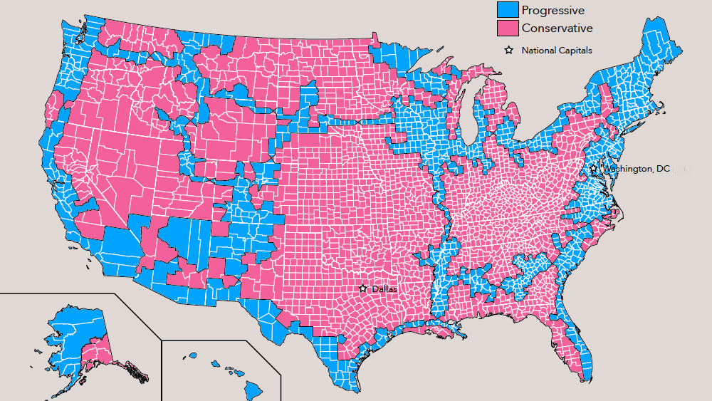
Progressive America would be half as big, but twice as populated as its conservative twin.
- America's two political tribes have consolidated into 'red' and 'blue' nations, with seemingly irreconcilable differences.
- Perhaps the best way to stop the infighting is to go for a divorce and give the two nations a country each
- Based on the UN's partition plan for Israel/Palestine, this proposal provides territorial contiguity and sea access to both 'red' and 'blue' America
Jesusland vs. the U.S. of Canada
<img type="lazy-image" data-runner-src="https://assets.rebelmouse.io/eyJhbGciOiJIUzI1NiIsInR5cCI6IkpXVCJ9.eyJpbWFnZSI6Imh0dHBzOi8vYXNzZXRzLnJibC5tcy8xODgzMjk0MC9vcmlnaW4ucG5nIiwiZXhwaXJlc19hdCI6MTYyMjc1NTQwOH0.ilDDy7043MT1yzEyKmHrXRk8B8LmhWHNa-PCUnXDqyo/img.png?width=980" id="107e2" class="rm-shortcode" data-rm-shortcode-id="54e659f880b5a57ab98b1d6a0122adda" data-rm-shortcode-name="rebelmouse-image" />Canada annexes the entire West Coast and borders Mexico.
Image: Strange Maps
<p>In 2004, this cartoon saw the states that had voted for Democratic presidential candidate John F. Kerry join America's northern neighbor to form the <em>United States of Canada</em>. The states re-electing George W. Bush were dubbed <em>Jesusland</em>. </p>Trumpistan vs. Clintonesia
<img type="lazy-image" data-runner-src="https://assets.rebelmouse.io/eyJhbGciOiJIUzI1NiIsInR5cCI6IkpXVCJ9.eyJpbWFnZSI6Imh0dHBzOi8vYXNzZXRzLnJibC5tcy8xODgzMjk1Ni9vcmlnaW4uanBnIiwiZXhwaXJlc19hdCI6MTY1NTY3MjY1Mn0.7v-FihlBSOW0zmkctN4JPPlVxykP1z11WIAZiNeXcy4/img.jpg?width=980" id="17a85" class="rm-shortcode" data-rm-shortcode-id="bff0308f144f3f4dc3e9b91a592e5738" data-rm-shortcode-name="rebelmouse-image" />Trumpistan is a perforated continent, Clintonesia is a disjointed archipelago.
Image: The New York Times.
<p>In 2016, these two maps disassembled the U.S. into <em>Trumpistan</em>, a vast, largely empty and severely punctuated land mass; and <em>Clintonesia</em>, a much smaller but more densely populated archipelago whose biggest bits of dry land were at the edges, with a huge, empty sea in the middle.</p>Soyland vs. the FSA
<img type="lazy-image" data-runner-src="https://assets.rebelmouse.io/eyJhbGciOiJIUzI1NiIsInR5cCI6IkpXVCJ9.eyJpbWFnZSI6Imh0dHBzOi8vYXNzZXRzLnJibC5tcy8xODgzMjk5MS9vcmlnaW4ucG5nIiwiZXhwaXJlc19hdCI6MTY2NDI1OTkwNX0.RKRjlTgAyEcjxfXR3gNlBuUAwH70DKptyeKPAyFKPt4/img.png?width=980" id="0147a" class="rm-shortcode" data-rm-shortcode-id="9a5700b0ca3c45fcfcf6709a84de6c2b" data-rm-shortcode-name="rebelmouse-image" />Following state borders, a line separates 'red' America (in the south) from the 'blue' half of the country.
Image: Jesse Kelly
<p>Writing in <em>The Federalist</em>, Jesse Kelly in April this year likened America to a couple that can't stop fighting and should get a divorce. Literally. His proposal was to split the country into two new ones: a 'red' state and a 'blue' state.</p><p>On a map accompanying the article, he proposed a division of the U.S. into the <em>People's Republic of Soyland </em>and the <em>Federalist States of America</em> (no prizes for guessing Mr Kelly's politics).</p><p>It's a fairly crude map. For example, it includes Republican-leaning states such as Montana and the Dakotas in the 'blue' state for seemingly no other reason than to provide a corridor between the blue zones in the west and east of the country. <br></p><p>Mr Kelly admitted that his demarcational talents left some room for improvement: "We can and will draw the map and argue over it a million different ways for a million different reasons but draw it we must," he wrote. "I suspect the final draft would look similar (to mine)."</p>Partition, Palestine-style
<img type="lazy-image" data-runner-src="https://assets.rebelmouse.io/eyJhbGciOiJIUzI1NiIsInR5cCI6IkpXVCJ9.eyJpbWFnZSI6Imh0dHBzOi8vYXNzZXRzLnJibC5tcy8xODgzMjk5OS9vcmlnaW4ucG5nIiwiZXhwaXJlc19hdCI6MTYzNzk4NzAwN30.Orca-tr-Xw3KO99jFwmy-EayDAPhKqHMqs4xjckEBCc/img.png?width=980" id="46e2e" class="rm-shortcode" data-rm-shortcode-id="7fab8119a2ae273a9fa292c47e76c89e" data-rm-shortcode-name="rebelmouse-image" />A county-level division between red and blue, with contiguous territories for both.
Image: Dicken Schrader.
<p>"No, this map won't do," comments reader Dicken Schrader. "It's too crude and would leave too many members of the 'blue' tribe in the 'red' nation, and too much 'red' in the 'blue' state." </p><p>Agreeing with the basic premise behind Mr Kelly's map but not with its crude execution, Mr Schrader took it upon himself to propose a better border between red and blue.</p><p>Analyzing election maps from the past 12 years, he devised his own map of America's two nations, "inspired by the original UN partition map for Israel and Palestine from 1947." Some notes on the map:</p><ul><li>To avoid the distortions of <strong>gerrymandering</strong>, it is based on electoral majorities in counties, rather than electoral districts.</li><li>As with the UN partition plan for Israel/Palestine, all territories of both states are <strong>contiguous</strong>. There are no enclaves. Citizens of either state can travel around their nation without having to cross a border.</li><li>The intersections between both nations are placed at actual interstate overpasses, so both states have <strong>frictionless access</strong> to their own territory.</li><li>In order to avoid enclaves, some 'blue' islands had to be <strong>transferred</strong> to 'red', and some 'red' zones were granted to the 'blue' nation. "This exchange is fair to both sides, in terms of area and population".</li><li>Both nations have <strong>access to the East, West and Gulf Coasts</strong>, and each has a portion of Alaska. </li></ul>Red vs. blue
<img type="lazy-image" data-runner-src="https://assets.rebelmouse.io/eyJhbGciOiJIUzI1NiIsInR5cCI6IkpXVCJ9.eyJpbWFnZSI6Imh0dHBzOi8vYXNzZXRzLnJibC5tcy8xODgzMzAwNC9vcmlnaW4uanBnIiwiZXhwaXJlc19hdCI6MTY1MDY0ODkzNn0.Su5f1X7XF4B-MrrizDdVmP2t5IyDN1EziPk1QgPgLBM/img.jpg?width=980" id="1fb98" class="rm-shortcode" data-rm-shortcode-id="7a6a74a5b35ffec813975d42861d68b7" data-rm-shortcode-name="rebelmouse-image" />Washington DC would remain part of 'blue' America, and its capital.
Image: Dicken Schrader
<p>Some interesting stats on these two new nations:</p><p><strong>Progressive America (blue)</strong></p><ul><li><strong>Area: </strong>1.44 million sq. mi (3.74 million km2), 38% of the total U.S.</li><li><strong>Population:</strong> 210 million, 64.5% of the total U.S.</li><li><strong>Pop. Density:</strong> 146 inhabitants/sq mi (56/km2), similar to Mexico</li><li><strong>Capital: </strong>Washington DC</li><li><strong>Ten Largest Cities:</strong> New York, Los Angeles, Chicago, Houston, Phoenix, Philadelphia, San Antonio, San Diego, San Jose, Jacksonville</li></ul><p><strong>Conservative America (red)</strong></p><ul><li><strong>Area: </strong>2.35 million sq. mi (6.08 million km2), 62% of the total</li><li><strong>Population:</strong> 115.4 million, 35.5% of the total</li><li><strong>Pop. Density:</strong> 49 inhabitants/sq mi (19/km2), similar to Sudan</li><li><strong>Capital: </strong>Dallas</li><li><strong>Ten Largest Cities:</strong> Dallas, Austin, Fort Worth, Charlotte, Nashville, Oklahoma City, Louisville, Kansas City, Omaha, Colorado Springs.</li></ul>What about the nukes?
<img type="lazy-image" data-runner-src="https://assets.rebelmouse.io/eyJhbGciOiJIUzI1NiIsInR5cCI6IkpXVCJ9.eyJpbWFnZSI6Imh0dHBzOi8vYXNzZXRzLnJibC5tcy8xODgzMzA0OS9vcmlnaW4ucG5nIiwiZXhwaXJlc19hdCI6MTY2MTA4ODM2MX0.dJM0n0NFEbOPvR4aVhNSvr7o5YGOv5BSqC1EiJZ1xQc/img.png?width=980" id="96746" class="rm-shortcode" data-rm-shortcode-id="58c8111edc6435fb2abf76e91af925c5" data-rm-shortcode-name="rebelmouse-image" />The partition would not create enclaves, but allow citizens of either nation frictionless access to the entire territory of their state.
Image: Dicken Schrader
<p>'Blue' America would be roughly half the size of 'red' America but have almost double the population.</p><p>In terms of area, 'blue' America would be the 13th-largest country in the world, larger than Mexico but smaller than Saudi Arabia. 'Red' America would be the 6th-largest country in the world, larger than India but smaller than Australia. </p><p>In terms of population, 'blue' America would now be the 5th-most populous county in the world, with more population than Brazil but less than Indonesia. 'Red' America would be the 12th, with more population than Ethiopia but less than Japan.<br></p><p>For those who think this divorce would end the argument between both tribes, consider that both countries would still have to live next to each other. And then there's the question of the kids. Or, in Mr Schrader's translation to geopolitics: "Who gets the nukes?"</p><p>--<br></p><p><em>Many thanks to Mr Schrader for sending in this map. </em></p><p><strong>Strange Maps #948</strong></p><p><em>Got a strange map? Let me know at </em><a href="mailto:strangemaps@gmail.com" target="_blank">strangemaps@gmail.com</a>.</p>Reality show idea: Make Flat-Earthers search for the world's edge
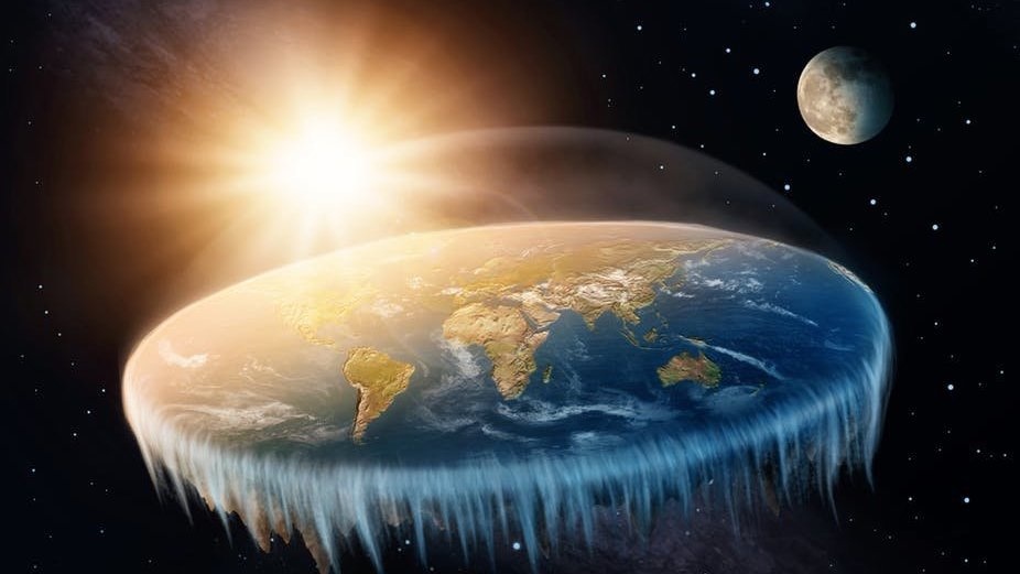
The contestants would try to reach the end of the world, as they understand it.
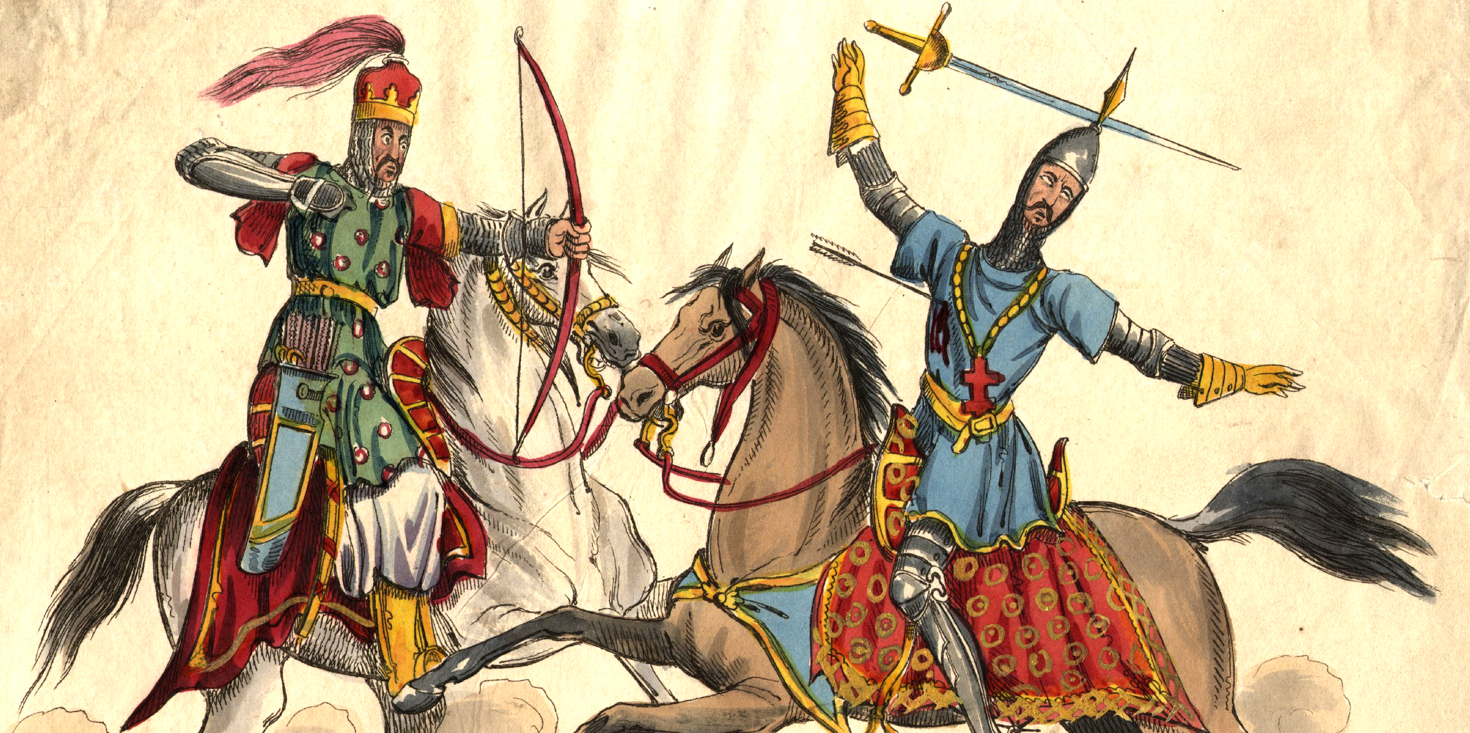
- According to Flat-Earthers, our planet is flat and space travel doesn't happen.
- People are calling for a reality show about Flat-Earthers.
- Flat-Earthers say a 150-foot ice wall surrounds the world.
