Did Google Maps Spark a War?

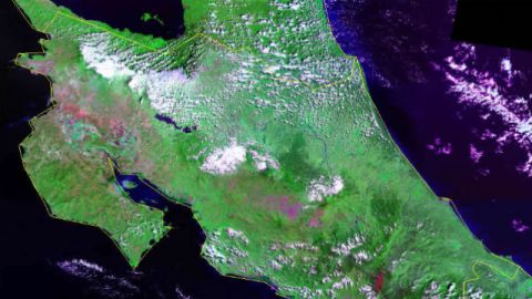
Where once only two rocks marked a sleepy border between Costa Rica and Nicaragua, recent days have witnessed an escalation in tension between the Central American neighbors over the tiny Isla Calero at the mouth of the Rio San Juan, which both nations have claimed since 1850. Nicaragua began to re-dredge the San Juan in October in order to restore its channel route, a move justified by the Google Maps portrayal of the border location, which it turns out was off by about 2.7 kms (1.6 miles).
No, this is not a techno-geopolitical Woody Allen farce, but a reminder that borders are still a strong source of pride, even hostility, well into the 21st century. Since Costa Rica abolished its military in 1948, even an old school Nicaraguan guerilla leader like Eden Pastora was able to lead the incursion, claiming he relied on maps dating to 1858. Ironically then, while the Organization of American States (OAS) sprung into mediation mode, the Nicaraguan foreign ministry was quick to blame the U.S. State Department (the source of the border demarcation used by Google Maps) for attempting undermine the government of Daniel Ortega. Google has apologized and is working to re-issue the map using corrections from the State Department. But Nicaragua has asked Google not to make any such adjustments, evidently stalling while it alters the facts on the ground.
The still unfolding episode falls into a broader pattern of how technology is affecting traditional international relations issues from border disputes to civil wars and revolutions. The role of Twitter in the Iranian election street protests in the summer of 2009 is still hotly contested, for example. Less known is the Malaysia-Indonesia dispute over the Sipadan and Ligatan islands, which in 2005 flared up and caused mass hostilities—in Internet chat rooms, that is, where the war of words was intense and tempers flared.
It’s too early to tell whether the Internet can fully sublimate passions away from the battlefield as football/soccer has done in Europe. Right now, bother are occurring at the same time. Remember that in 2005, Chinese protestors trashed the Japanese embassy in Beijing over the perennial issue of Japanese visitors visiting the Yasakuni war shrine in Tokyo. A more low-key version of this is currently underway in the two nations’ dispute over the capture of Chinese fishing boat near disputed islands in the East China Sea.
The technology-geopolitics nexus will only become more central in 2011 as all nations are required to formally log their exclusive maritime border claims in accordance with the UN Convention on the Law of the Sea (UNCLOS). Look for GPS technologies to be widely deployed as nations seek to make their maps more precise—but potentially challenging even settled and accepted boundaries in the process. Technology map yet lead to a world mapped with precision, but it could unleash more Banana Republic type episodes along the way.
Ayesha and Parag Khanna explore human-technology co-evolution and its implications for society, business and politics at The Hybrid Reality Institute.


