Late historian’s 3D map of Notre Dame can help France restore it to impressive detail

Photo credit: Dan Kitwood / Getty Images
- Notre Dame, France’s famous medieval cathedral, was severely damaged by a fire on Monday.
- Fortunately, at least two recent projects have taken detailed 3D scans of the cathedral, which could help in restoration efforts.
- As laser-scanning and digital imaging technology gets cheaper, some suggest we should digitally record historical sites in the event they get damaged, or worse.
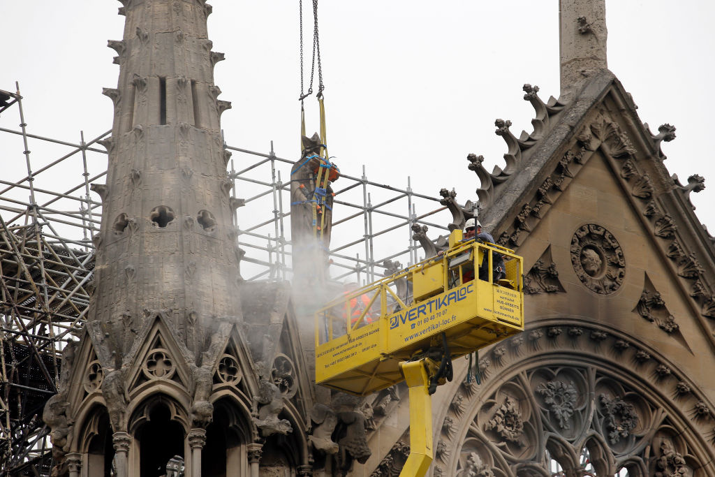
A fire destroyed Notre Dame’s spire and wooden roof on Monday, causing devastating and possibly irreparable damage to the famous 856-year-old cathedral.
“It was one of the oldest — until today — surviving roofs of that kind,” Robert Bork, an architectural historian at the University of Iowa, told Wired. “It’s incomparable.”
But some are hoping that recently compiled digital representations of Notre Dame could help France reconstruct it in the coming years. One such case digitally capturing Notre Dame came from the makers of “Assassin’s Creed Unity,” a video game released in 2014, whose designers took on the lofty challenge of recreating the exterior of the 856-year-old medieval cathedral for the game.
“We were able to find a lot of blueprints showing us exactly how Notre Dame was constructed,” said Caroline Miousse, a senior game artist, in a 2014 blog post from Ubisoft. “But it also really just helped me a lot to talk to people. It’s very difficult to take a big picture of Notre Dame and capture every single detail. You really have to take a bunch of pictures of everything and put them all together like a puzzle.”
However, the most detailed imaging comes from the late art and architectural historian Andrew Tallon, who spent years using laser scanners to capture virtually every detail of the cathedral’s interior and exterior. Laser scanners work by shooting beams and measuring how long it takes for the light pulse to travel from the device, to the object, and back.
Tallon, who passed away on November 16, 2018, had a specific way of compiling this massive amount of data, one that resulted in stunning 3D images.
“Each time he makes a scan, he also takes a spherical panoramic photograph from the same spot that captures the same three-dimensional space,” wrote Rachel Hartigan Shea for National Geographic. “He maps that photograph onto the laser-generated dots of the scan; each dot becomes the color of the pixel in that location in the photograph.”

Image source: Google / CyArk
Conserving world heritage sites with 3D mapping
Thanks to the Tallon’s work, France might be able to reconstruct the spire and roof of Notre Dame in a way that resembles and respects the original design. Other groups have also been busy scanning world heritage sites in an effort to conserve the structures in the event of damage, or total destruction. One such group is CyArk, a conservation nonprofit whose mission is to “digitally record, archive and share the world’s most significant cultural heritage and ensure that these places continue to inspire wonder and curiosity for decades to come.”
In 2018, Google partnered with CyArk on a project that aims to capture digital representations of historical sites, and to eventually make them accessible to the public on the Google Arts & Culture platform.
Chance Coughenour, Program Manager at Google Arts & Culture said “with modern technology, we can capture these monuments in fuller detail than ever before, including the color and texture of surfaces alongside the geometry captured by the laser scanners with millimeter precision in 3D. Detailed scans can also be used to assist restoration efforts.”