The Earth’s A Big Green Marble
What’s the Latest Development?
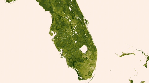
The National Polar-Orbiting Partnership (NPP), a collaboration between NASA and the National Oceanic and Atmospheric Administration (NOAA), has produced a series of high-resolution images that displays the planet’s vegetation in closer detail than ever before. They were created using data from the Visible-Infrared Imager/Radiometer Suite (VIIRS), an instrument on board the Suomi NPP satellite. VIIRS measures both visible and near-infrared light; because leaf cells reflect near-infrared light, the lushness of an area can be determined by how much of that light is “visible” to the instrument.
What’s the Big Idea?
The detailed maps created with VIIRS’ data reveal changes in vegetation over time, which can give scientists a heads-up on drought and wildfires, They can even warn of potential malaria outbreaks, according to the NOAA: “As vegetation grows in sub-Saharan Africa, so does the risk for malaria…Vegetation indexes provide world health organisations the lead time needed to distribute supplies and medicine.” The maps also indicate a global increase in vegetation, with more of it moving north as greenhouse gas emissions encourage photosynthesis.
Photo Credit: NASA/NOAA
