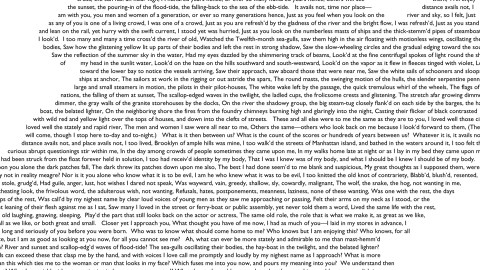
Whitman Poem Transformed into a Map of Brooklyn

“Flood-tide below me! I watch you face to face; Clouds of the west! Sun here half an hour high! I see you also face to face”
So begins Crossing Brooklyn Ferry, a stirring, enumerative ramble of a poem by Walt Whitman, first published in 1856 under the title Sun Down Poem and later included in Leaves of Grass, his constantly-expanding magnum opus.
And so begins this map of Brooklyn, filled out from top to bottom and left to right with the almost 2,000 words that Whitman used to transform a mundane ferry ride from Manhattan to Brooklyn into a paean for New York, a metaphor for a journey of the soul, and a contemplation of his connection to all humanity, present and future.
By its transformation into a map, the poem pays yet another tribute to the city. Isolated and abstracted into a sequence of variegated lines of type, it suddenly becomes apparent that Brooklyn looks like a winged seahorse, about to fly away to the west.
This map version of the Whitman poem was produced by Gretchen Culp, a Brooklynite herself – as well as a cartographer. Map first found here at Geographer at Large; Ms. Culp kindly provided me with a larger, legible version. If you have trouble reading this, enlarge or right-click to download.

Strange Maps #841
Got a strange map? Let me know atstrangemaps@gmail.com.


