611 – Our One-Continent World: Pangea (Political)
There’s much to criticise about this map of Pangea [1], but in spite of the geological anachronisms, it’s hard to tear your eyes away from it. The map shows a world in which the continents have broken loose from their moorings and crashed into each other in a planet-wide collision. These United Nations of Pangea are a cartographic improbability radiating the lurid attraction of a roadside accident. Ah, the blood, the noise, the endless poetry! [2]
Younger readers may be surprised to learn that this Mother of All Pile-Ups is not mere fiction. The map reconstitutes the world’s single supercontinent as it existed between 300 and 200 million years ago [3] – but with one obvious difference: it borrows today’s national borders and transposes them on Pangea, dramatically increasing the visual tension between the world as we know it today, and the world as it once was. The past, in this case, is not just a foreign country, but an alien continent.
The fascinating thing about this map is that incongruity between this world’s familiar nations, and that world’s bizarre supercontinent. The incongruity seems designed with that F. Scott Fitzgerald quote in mind: “The test of a first-rate intelligence is the ability to hold two opposing ideas in mind at the same time and still retain the ability to function.”

It is one thing to see the continents reassembled into a single block – the stuff of any paleogeological map of Pangea – but quite another to see the US state of Florida hemmed in between the Guyanas [4] and the Guineas [5]; to witness Antarctica, Australia and the Indian subcontinent conspirationally huddled together in the world’s most improbable threesome; to see Newfoundland, on Canada’s east coast, function as the wedge that drives Morocco and Spain apart; or to find Iran mercilessly chopped in three, its parts flung far across the Thetys Sea. Surely, a punishment too severe, whatever her sins!
Our world’s borders greatly improve the visual spectacle of this map. But shoehorning today’s countries and continents into the Pangea of eons [6] ago means sacrificing accuracy for recognisability.
For example, even though the Great Lakes and Hudson Bay are firmly anchored to our mental map of North America, and they’re present here as well, these great natural phenomena are only immutable from the puny perspective of our short human lifespans. They were formed no longer ago than 10.000 years, after the most recent northward retreat of the glaciers [7].
Geological anachronisms are much easier to ignore, or rather to remove, if they’re mere islands out of time. Such should have been the fate of Iceland, one of the youngest countries on earth, geologically speaking: it was thrust up out of the waves of the North Atlantic just under 20 million years ago, on a volcanic hot spot along the Mid-Atlantic Ridge. Yet Iceland is also right there on the map, squeezed between the Hebridean coast of Scotland and the fjord-indented shores of Greenland and Norway.
But this map is not meant to be accurate, at least not to that degree. It is a tongue in cheek follow-through of one of the most basic observations one can make while looking at a world map.
It only takes a cursory glance at that map to see that some land masses separated by bodies of water are like linking pieces of a global puzzle. The corresponding coastlines of Madagascar and Mozambique are a suspiciously good fit, as are those of Finland and Sweden. The most obvious example, however, are the Atlantic coasts of South America and Africa.
That most striking of correspondences only became apparent after the discovery of America – and after enough progress in mapmaking to enable a faithful rendering of the respective shorelines. It’s perhaps no surprise then that a cartographer first remarked on the spooning of these continents. In his Thesaurus Geographicus (1596), Abraham Ortelius proposed that the Americas “were torn away from Europe and Africa […] The vestiges of the rupture reveal themselves, if someone brings forward a map of the world and considers carefully the coasts of the three [continents]”.
Ortelius may have been right on the effect, he was less than correct on its causes. He suggested that the distancing of the continents was the result of “earthquakes and floods”. It took a few centuries for science to get this right.
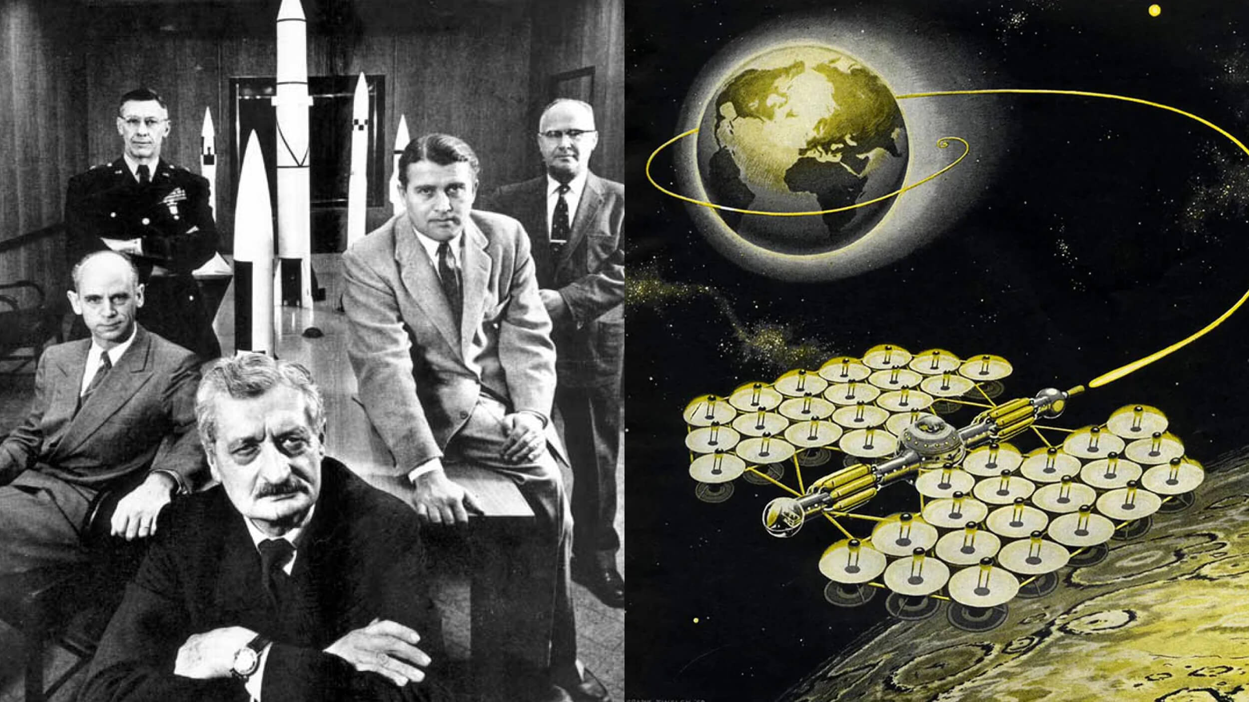
For incredibly, the currently generally accepted theory on continental drift is barely a century old. The German geophysicist and polar explorer Alfred L. Wegener [8] first hypothesised what he called Kontinentalverschiebung in a series of articles in 1912, and later expanded on the theory of continental drift in the book Die Entstehung der Kontinente und Ozeane (1915). He would refine his arguments in thee more editions of the book, the last one published year before his untimely death on a Greenlandic expedition in 1929, but harvest mainly scorn and derision for his efforts.
For a theory that controversial, Wegener’s starting points were surprisingly commonplace. Like Ortelius, Wegener took on board the near-perfect fit of South America with Africa. And like a string of 19th-century scientists, he became aware of the similarities in plant life and fossil finds on either side of the South Atlantic. His innovation was to reject the prevailing theory of a sunken land bridge to explain those similarities, instead pushing the hypothesis that the present, separated continents had formed an Urkontinent before drifting apart.
One of Wegener’s problems was that he never managed to pinpoint a cause for the drifting, although among the ideas he put forward was the notion that oceanic ridges, like the Mid-Atlantic one on which Iceland is perched, pushed continents out from each other [9].
This notion would form the basis of plate tectonics – the now generally accepted theory that describes how the Earth’s lithosphere [10] consists of different plates that slowly collide with, separate from or grind against each other. These activities are responsible for earthquakes, volcanic eruptions and continental drift.
Yet it took decades for this theory to gain a serious following. Opposition to Wegener’s big idea even gave rise to its opposite, so-called ‘permanentism’ [11]. The idea of something as solid and massive as a continent moving around just seemed too improbable. But given enough time, considering the relative plasticity even of rocks under enough pressure, and provided with mounting evidence of tectonic plates carrying the continents, drifting and colliding on earth’s molten mantle.
Only in the late 1950s and early 1960s, when data from the new discipline of paleomagnetism seemed to prove the theory, did continental drift decisively win the argument.
Wegener’s Urkontinent is these days better known as Pangea. It may have looked roughly like the land mass portrayed here. Its exact contours are a matter of speculation, but generally it is thought to have looked like the land mass on this map: Africa locked into North and South America to its west, and attached to an amalgam of Antarctica, Australia and India to its southeast, with the remaining Eurasian land mass then twisted on its head to serve as Pangea’s hat, and Europe a crescent-shaped smear in between. Surrounding the single continent would be the world’s single ocean, Panthalassia.
If all of that sounds like a fantastically alien concept this close to home, you’re in for a treat: for Pangea and Panthalassia were but the latest incarnations of what may well have been a series of supercontinents and superoceans, continuously breaking up and getting back together as if they were geology’s answer to Richard Burton and Elizabeth Taylor. Here are some other supercontinents, each next one older and more hypothetical than the previous one:
- Pannotia, a.k.a. the Vendian supercontinent or Greater Gondwanaland, probably formed around 600 million years ago. Around 540 million years ago, it drifted apart into four separate continents: Laurentia, Baltica, Siberia and Gondwana. These would later recombine to form Pangaea.
- Rodinia [12] may have existed from 1.1 billion to 750 million years ago, or not: another theory/configuration thought to have existed around this time is called Paleo-Pangea (or Proto-Pangea). The super-ocean that surrounded Rodinia (if it existed) is called Mirovia, also a Russian derivation.
- Columbia (a.k.a. Nuna, or Hudsonland), may have existed from 1.8 to 1.5 billion years ago. Evidence of its existence is based upon geological and paleomagnetic data.
- Kenorland, formed about 2.7 billion years ago, broke up about 2.1 billion years ago.
- The most hypothetical supercontinents are Ur, formed about 3 billion years ago, possibly the world’s first continent, if it weren’t for the even more hypothetical Vaalbara, formed about 3.6 billion years ago.
Considering the evidence of the deep past, and the continued tectonic activity moving continents around, it is indeed likely that at some point in the distant future, our separated continents will re-arrange in a single supercontinent. Three proposed supercontinents that could become reality in the future are Amasia (the fusion of America and Asia, over the North Pole, 50 to 200 million years hence), Novopangea (the reconstitution of a single supercontinent by the closing of the Pacific Ocean) and Pangea Proxima (in which Australia and Antarctica merge, but stay separate from all other land, which also merges).

So it is by mere accident of birth that we, the human race, live on a multi-continent Earth instead of on a planet dominated by a supercontinent, surrounded by a single ocean. How different would human history have looked, if we had shared a single continent? Well, for one, something as history-altering as the Discovery of America would have been impossible. No area that large could exist in a vacuum on a single-continent Earth. Would Pangea have been beneficial, enabling more trade and cultural exchanges? Or would it have been the death-knell of humankind itself, allowing war and disease to ravage the entire world in one fell swoop?

How long before this becomes a grassroots movement?
What’s for sure is that its borders would look nothing like these, which result from our multicontinental world. How could non-existing coastlines cause a land border between Mexico and Colombia, for instance? But still, I bet you’re looking to see whether your country is up or down in this brave, new Pangea, and what its new neighbourhood looks like. Good news if you’re Russian: finally, a warm-water port! Or Tibetan: bye bye, China! Bad news if you’re claustrophobic, and Malagasy [13]: you are now surrounded by half a dozen neighbouring countries instead of the ocean. Or if you’re Swiss, and hate water: you’re now in need of a navy [14].
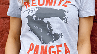
Many thanks to Sam Huddy, Erik Smit and Rikkie Neutelings for sending in this map, found here on Reddit. The map of future supercontinents found here. The Reunite Pangea t-shirt for sale here. This blog is unaffiliated with the commercial or political aims of whoever sells these t-shirts.
_______
[1] From the Greek Παν-γαία, for ‘Whole Earth’. Transliteration from Greek to Latin alphabet varies from the pedantic Pangæa over the stodgy Pangaea, to the now commonly accepted (but for some still hideously syncopated) Pangea. Less frequently used is Pangaia, perhaps to prevent confusion with the Gaia hypothesis.
That concept posits the Earth as a complex biosphere naturally geared towards some kind of life-enabling balance, the self-regulatory systems of which are akin to those of a living organism. Like the other derivations, this term too is borrowed from the original Greek word for Earth.
The prefix pan– is also used in a geopolitical sense, describing the aspiration of certain ethnic, cultural, or religious groups to achieve political union beyond the constrictions of contemporary borders. E.g.: pangermanism, panslavism, panislamism, etc. ↩
[2] Dixit the ultra-chauvinist, one-man insult factory Lord Flasheart, that eerie prefiguration of Nigel Farage, in Blackadder Goes Forth, episode 4. ↩
[3] A.k.a. ‘the time before the internet’. ↩
[4] Guyana, Suriname and French Guiana, the odd ones out in South America. See this piece about the loneliness of the Guyanas. ↩
[5] Guinea is a historical European term for the area in West Africa between the Sahel in the north and the Gulf of Guinea in the south. It may derive from a Berber word for ‘black, burnt’, as a reference to the darker skin colour of the region’s inhabitants (cf. the Arab term as-Sudan, and the Greek Aithiops, both similar references).
European traders and colonists subsequently labelled subregions of historical Guinea for their main exports: the Gold Coast (now Ghana), the Pepper, or Grain Coast (roughly consistent with Liberia and Sierra Leone), the Ivory Coast (now the independent nation of that name, sometimes also referred to by its French name, Côte d’Ivoire), and the Slave Coast (mainly the Nigerian coastal areas).
The name Guinea survives in two independent states: the former French colony of Guinea (Guinée in French) and the former Portuguese colony of Guinea-Bissau (the hyphenated geonym includes the name of the capital, to distinguish it from its neighbour Guinea, see also the Democratic Republic of Congo and the Republic of Congo, sometimes referred to as Congo-Kinshasa and Congo-Brazzaville respectively).
The name Guinea has also been transported to Oceania, where New Guinea (the world’s second-largest island) is now divided in a western, Indonesian half, and an eastern half, which is independent as the name of Papua New Guinea (often abbreviated to PNG). ↩
[6] A Greek term originally understood to mean a lifespan, an eternity, or an ‘age’ (as in a very long, but undefined period). It is used here in the latter context, its most common usage these days. Geochronologically more correct would have been era.
In geochronology, an eon is the largest of the subdivisions of geological time. So far, there have been four Eons (each at least half a billion years), 10 Eras (each several hundred million years), and numerous Periods, Epochs (up to tens of millions of years), Ages (up to millions of years) and Chrons.
In case you’re wondering: we’re currently in the Phanerozoic Eon (which started with the emergence of the first hard-shelled creatures, 542 million years ago), the Cenozoic Era (its beginning marked by the Cretaceous-Tertiary extinction that killed off the dinosaurs 66 million years ago), the Quaternary Period (2.6 million years old, since the start of recent glaciations), and the Holocene Epoch (since the end of the last Ice Age and the start of the so-called Neolithic Revolution, 12.000 years ago). Some have suggested that our current circumstances, in which humans have significantly impacted and altered their environment, should be called the Anthropocene. ↩
[7] One of geology’s key questions: is the current geological epoch interglacial – i.e. an interval between two ice ages, or postglacial – well and truly past the alternating freezing and thawing that marked the Pleistocene? That geological period began about 2.5 million years ago, and either still continues (if the former is true) or ended about 12,000 years ago (in the latter case). ↩
[8] In 1913, Wegener married Else, daughter of Wladimir P. Köppen, who lent his name to the Köppen climate classification system. ↩
[9] The Mid-Atlantic Ridge runs the entire length of the Atlantic Ocean, and extends up to 1.5 miles above the ocean floor. Its crest is marked by a rift, where constant lava eruptions are driving the Eurasian and North American plates further apart, at a rate of up to 5 inches per year (roughly the speed at which your fingernails grow). ↩
[10] The rigid, rocky outer shell of the Earth. It is lower in density than the underlying layer, the asthenosphere. ↩
[11] A theory allowing little or no change in the shape and position of continents and oceans. ↩
[12] From the Russian Родина (‘Rodina’), which means ‘Motherland’. The Russian Motherland is the subject of the world’s largest non-Buddhist free-standing statue, at Volgograd. ↩
[13] The ethnonym for inhabitants of Madagascar. ↩
[14] And not for the first time on this blog. See also #133. ↩


