365 – A Nameless Intra-Irish Pene-Enclave

n
A pene-enclave is almost an enclave in the same way that a peninsula* almost is an island. But only on a strictly lexical level. If we descend from the abstraction of definition to particular examples, things get messy — in an almost clintonesque way: all depends on what your definition of almost is.
n
Most people will instinctively agree on what constitutes a peninsula: a piece of land almost completely surrounded by water, but for a narrow isthmus that connects it to the mainland. No isthmus, no peninsula.
n
You would expect the same of a pene-enclave, minus the water: it should also require a contiguous land corridor to its ‘mainland’. But most lists of pene-enclaves mention places that are reachable from their mainland across bodies of water (e.g. Ceuta and Melilla, the Spanish holdings on Morocco’s North African coast). So: no isthmus, but still a pene-enclave.
n
How so?
n
There is some justification for this different, broader definition. A proper enclave needs to be cut off from its mainland. One could debate whether being accessible only via the sea or across a river counts as being “cut off” or not. If you define that ambiguity as the almost implied in the prefix, then yes, these Isolates-by-the-Sea are pene-enclaves.
n
One reason for embracing this ambiguity might be that requiring a narrow land corridor makes for an exceedingly short list of pene-enclaves. Of one, to be exact. The only international example of a pene-enclave springing to mind is Jungholz, which would be an Austrian enclave inside Germany, were it not connected to the Heimat via a single point — the summit of Mount Sorgschrofen.
n
A single point: that’s the narrowest possible isthmus. But when does an isthmus stop being narrow? When it does, there is no longer an isthmus, and therefore no longer a pene-enclave.
n
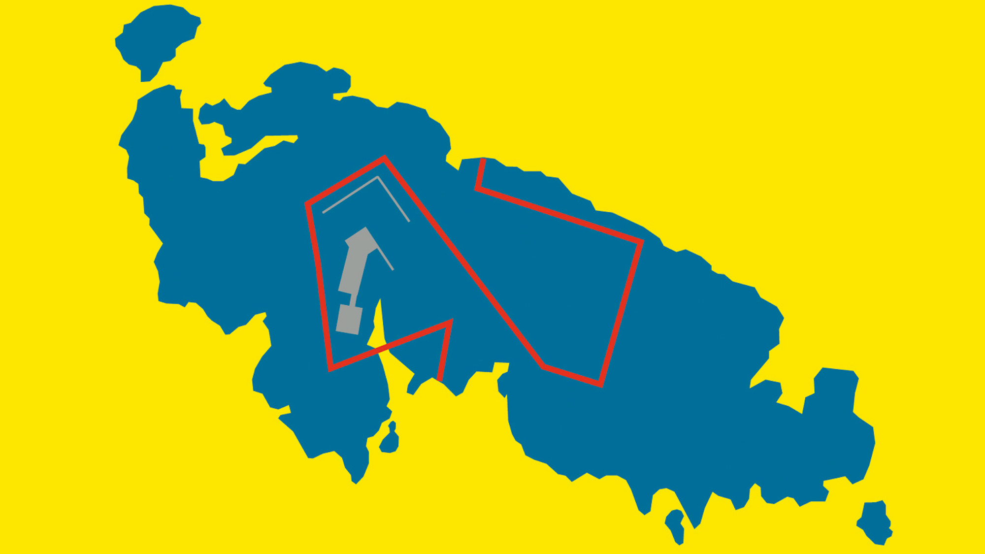
I never thought I would catch a bona fide pene-enclave in the wild, but then I came across this bizarre boundary (while detail-scanning the intra-Irish border on Google Maps, as one does in one’s spare time). I am sure nobody would dispute that this pene-enclave has a properly narrow isthmus. Judging by the map’s scale (in the bottom left corner), it can’t be much wider than 100m (app. 330 ft). The pene-enclave itself continues for several kms (or miles) in both length and breadth.
n
The area looks to be quite rural, and is dotted with typically Irish toponyms and the occasional bucolic English one (“Rabbit Island”). It is dissected by the N3 road from Monaghan to Cavan, both in the Republic of Ireland. The N3 becomes the A54 for the duration of its brief foray into Northern Ireland — actually, its two brief forays, thanks to the pene-enclave.
n
However, extra information-wise, this intra-Irish pene-enclave is frustratingly un-googleable; other than that it is located between County Monaghan (Ireland) and County Fermanagh (UK), there’s not really any information to be found. The aberration remains nameless, its raison d’etre a mystery. Suggestions for a name are welcome, as are clues to its origin.
n
.
n
n
—————
n
Update: Drummully Polyp, or Coleman’s Island
n
Thanks for all your comments to this post. How great it is to be able to post a mysterious map like this one and have the commenters fill in the blanks! For starters, the previously-unnamed entity now has not one, but two names. We know a bit more about the area’s historical circumstances, have an inkling of the local head-count (onehundred-ish, and falling) and someone’s even sent in a picture of the local parish church inside the pene-enclave.
n
“In south Fermanagy, the most obvious anomaly [in the Irish border] was the Drummully polyp, a Monaghan DED [District Electoral Division] ‘practically enclosed’ within the North. North and South interlocked like jigsaw pieces, and the Clones to Cavan railway crossed the Border six times in five miles.”
n
(extract from The Irish Border – History, Politics, Culture by Malcolm Anderson and Eberhard Bort (eds.), Liverpool University Press, 1999)
nn
n
(extract from A Topographical Dictionary of Ireland by Samuel Lewis, 1837)
nMany thanks to mollymooly for digging up these references and data. Drummully is the name of the local parish, that in 1837 had 667 inhabitants. In 2002, the Drummully DED (981 hectares) had 102 inhabitants; in 2006 this had decreased to 92. Gary McMurray (comment #44) posted a link to a picture of the parish church within the pene-enclave. nThe Drummully Polyp came up in a question to the Dail (Irish Parliament ) on 15 May 1980, about whether the helicopters the Irish Army had to use to fly its soldiers in to man checkpoints on a road that had no direct ground vehicle access from the rest of the Republic didn’t bear too much of a resemblance to British Army helicopters (which presumbably might confuse those with intent to attack British – or Irish – helicopters).nAs to why it has the quirky shape it does, Paddy Matthews suggests that “presumably [the Drummully Polyp] would have been a near-enclave held by the McMahons (from whose territory County Monaghan was created) in the territory of the Maguires (which gave rise to County Fermanagh).”n
Max, who has firsthand knowledge of intra-Irish border policing, has a different name for the area: ”
nWhen I had some responsibility for border policy in the 1980s this little bit of land was known by the Irish Army patrols as Coleman’s Island. It was regularly patrolled on foot by the Army because there was no way to access it by road. The border is rife with oddities; at several points it actually runs along the road, so that driving on the Northern side of the road you were in the UK and driving on the other side of the white line you were in Ireland. This wasn’t necessarily a trivial thing in the 1980s, when the British Government had made a lot of people living in Ireland the subject of so-called exclusion orders which meant that they could be arrested and imprisoned just for entering Northern Ireland. A number of people living in border counties had to adopt very circuitous routes to and from their regular destinations as a result.”Many of the commenters offered examples, or even whole lists of other pene-enclaves. Not so rare as I imagined, pene-enclaves are positively abundant if you include the subnational ones. See comments for suggestions. Some of the example mentioned (not necessarily pene-enclaves themselves) were mentioned earlier on this blog:n
n
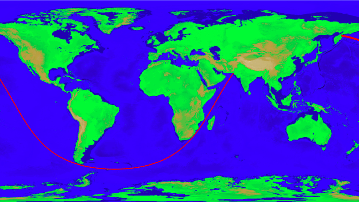
As already mentioned in the post itself, the definition of what is a pene-exclave (and indeed a peninsula) hinges on how you define “almost” (as in, “almost an enclave” or “almost an island”), i.e. on the narrowness of the isthmus. But where, for example, is the isthmus of Florida, Christian quite rightly asks. And yet no one will dispute Florida is a peninsula.
n
The French, as Geiseric remarks, make a useful distinction, between
n
A word on the word “pene-enclave” itself: Greg suggested the prefix should be pronounced pen-nay (but warned against looking up the prefix pene- in Wikipedia, as this redirects to “penis”, picture and all). That link should not be a surprise, Jorge Rosa stated: “Just look at the evidence”, while Geiseric suggested the pronunciation pi-ney (as it derives from paene-), but also contracting the word to ‘penenclave’.
nune péninsule (in general, any piece of land surrounded by water, attached to a larger piece of land, without the attachment needing to be narrow, i.e. la péninsule des Balkans) and une presqu’ile(where the attachment is noticeably to particularly narrow).In conclusion, as questions can be asked about the definition, spelling and pronunciation of the word pene-enclave, Aletheia Kallos (who qualifies the word as “ugly, confusing and unnecessary”) suggests a few alternatives: salient, proruption, panhandle and chersonese. To which might be added: strip – and of course polyp.nnn