Here on Earth, one of the greatest geological wonders of all is the Grand Canyon. Carved by the Colorado River over millions of years, which connected multiple older segments of the canyon together, the full extent of this giant, steep-sided valley is now remarkable and impressive. Spanning 446 kilometers (277 miles) in length, the canyon is up to 29 kilometers (18 miles) wide and up to 1.857 kilometers (1.153 miles) deep. The advance, retreat, and melting of glaciers, combined with the release of enormous amounts of water, have exposed a wide variety of rocks formed throughout Earth’s geological history, including formations as many as 2 billion years old.
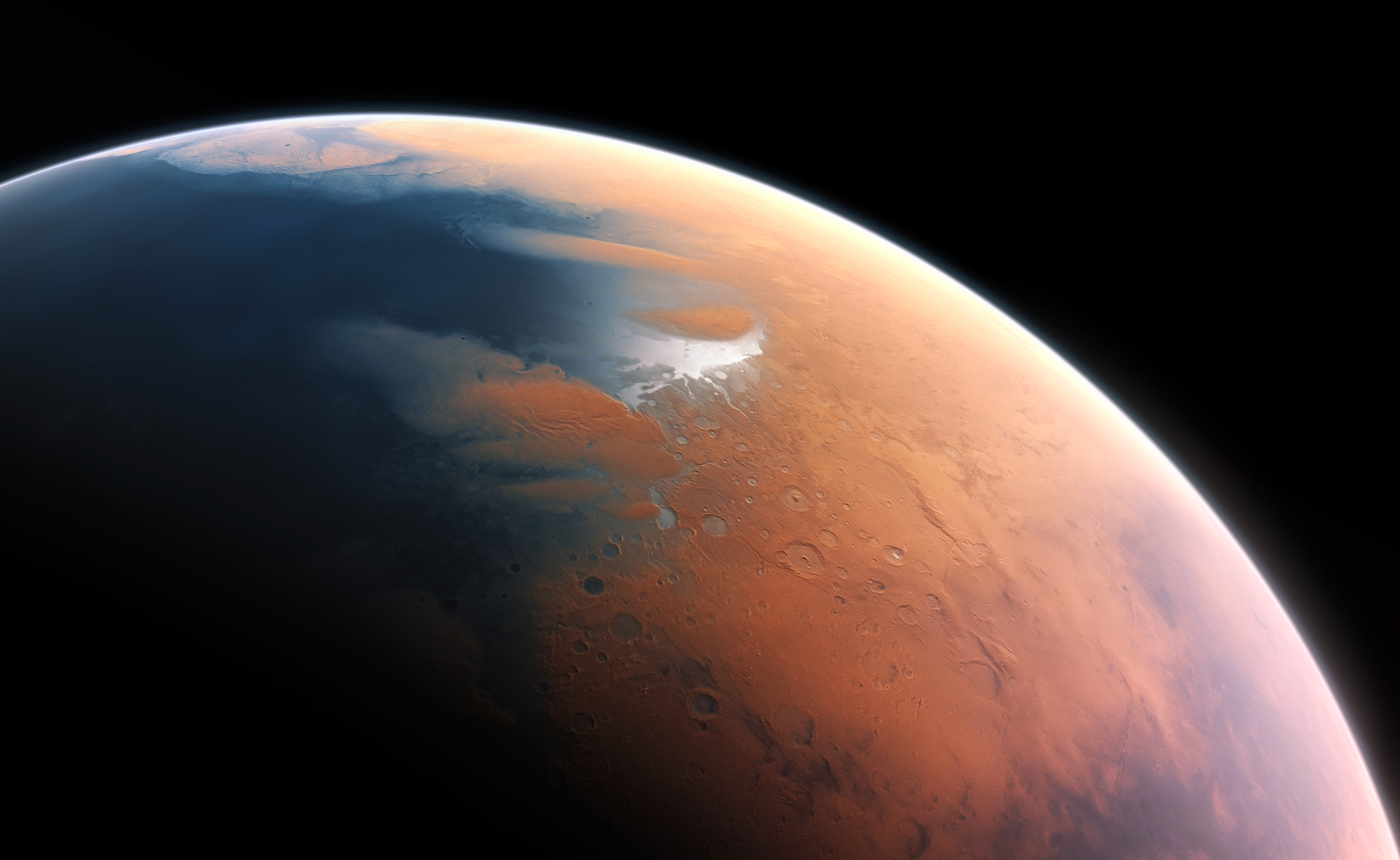
And yet, the full extent of Earth’s Grand Canyon pales in comparison to the grandest canyon in all the Solar System: Valles Marineris on Mars. Mars, a much smaller planet than Earth with a very different geological past, might not seem like the ideal candidate for such a gigantic feature, and yet not only is it present, it was likely created in a very different fashion than the Grand Canyon was on Earth. But how, precisely, did it form? That’s what Rosa Been wants to know, asking:
“You know how Mars has a huge scar in it? Like 6 miles deep. I was curious what caused it. I’ve heard it could be an asteroid or solar flare kinda thing etc.”
It could have been a lot of things, and in reality, it was probably formed by many processes combined. But the greatest lesson of all for its formation may not come from Earth’s Grand Canyon at all, but a very different feature. Here’s the most likely story we’ve been able to piece together.
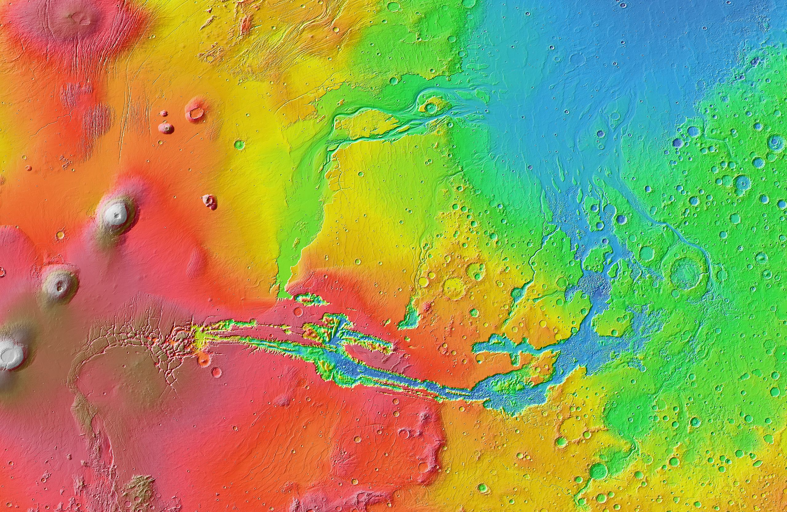
What you see, above, is a topographic map of Mars. Although there are many notable features, there are a few prominent ones that are relevant when it comes to discussing the grandest canyon of them all, Valles Marineris, which appears just south of the Martian equator and just slightly to the east of what’s known as the Tharsis bulge on Mars: the high-elevation region (in red) that’s home to many of the largest volcanic mountains in all the Solar System, including Olympus Mons, which is the lone white-capped mountain at the western edge of the Tharsis bulge. On either side of the Tharsis region are “dark blue” regions, which correspond to low-elevation regions that likely once were home to ancient Martian oceans.
While today, Mars is a cold, dry, desert world, where liquid water cannot persist on its surface due to the overwhelmingly low atmospheric pressure – just 1/140th of Earth’s at the Martian surface – in the past, Mars was very different. Although we still have enormous uncertainty about many aspects of our Solar System’s past, we now know enough to reconstruct a very interesting, detail-rich history of Mars from many lines of evidence. While a lot of what follows is a speculative story, this is presently the best consensus picture of how Mars came to be the way it is today, and in particular, how the “grandest canyon” in all the Solar System came to be on Mars.
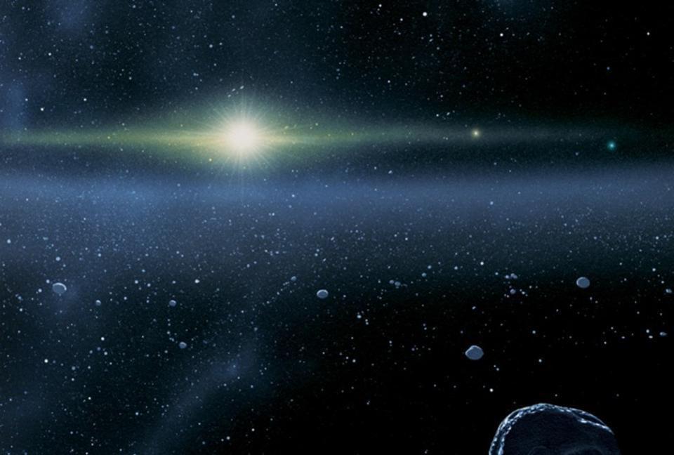
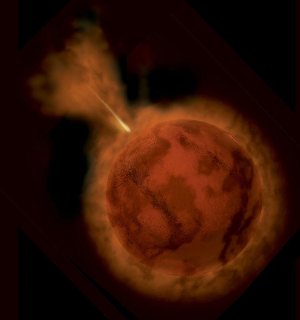
In the beginning, the Solar System took shape from a pre-solar nebula and a protoplanetary disk surrounding it. At the center of this nebula was a proto-star that would grow into our Sun, while the disk developed instabilities within it. Over time, nuclear fusion ignited in the proto-star’s core, transforming it into a full-fledged star: our Sun. The instabilities within the protoplanetary disk, likely over the span of just a few short million years, began to form what would become the cores of many protoplanets and, eventually, full-fledged planets. We are relatively certain that there were more than eight such worlds, initially, and that the extras were either ejected, hurled into the Sun, or collided with other bodies in events that created larger-mass planets and that gave rise to moons.

While the most well-known of these early planetary collisions was between the young Earth and a now-deceased world that we’ve named Theia – resulting in the kick-up of debris that would coalesce into our Moon – there were other collisions that occurred as well. Out in the distant reaches of the Kuiper belt, a world collided with Pluto, giving rise to Charon and the other four, smaller moons that orbit Pluto. It’s possible that collisions occurred on Venus and Uranus, perhaps giving them their unusual axial tilts. And on Mars, a giant collision also took place, leading to the formation of not merely its two surviving moons, Phobos and Deimos, but a third, larger, innermost moon as well: one that was transient, and destroyed not long after it formed.

That Moon, most likely, was first destroyed by the gravitational tidal forces exerted by the parent planet, Mars, where it was stretched out into a ring of debris. Unlike the modern Martian atmosphere, early Mars possessed a thicker planetary atmosphere more similar to that of a young Earth, likely augmented by the volatile gases emitted by the same continuous volcanic activity that persists even today on Mars. That ring-like debris from its larger moon then began interacting with the Martian atmosphere, where the drag forces eventually brought the entire ring – a full large moon’s worth – back down onto Mars, where it struck the surface and altered the landscape of the planet. The northern hemisphere of Mars, perhaps as a result of these processes, is at a significantly lower elevation than the southern hemisphere.
Just as early Earth had copious amounts of water on its surface, it was very likely that so did early Mars. While the combination of Earth’s size and mass, its active core, its volcanic activity, and the lubricating effects of surface water all contribute to Earth’s plate tectonics, tectonics on Mars operated very differently, even in these early stages. As a much smaller planet, Mars cooled far more quickly than the Earth did, while volcanic activity created the Tharsis bulge. This combination of impacts, external heating, internal volcanic activity, and planetary cooling likely created conditions that led to an important event: the formation of a strike-slip fault zone on Mars.
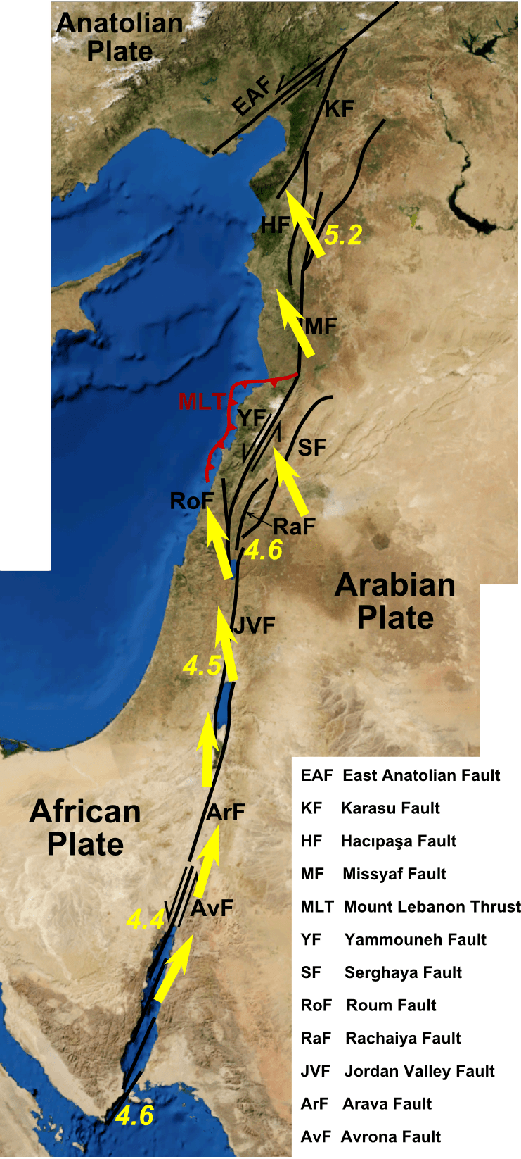
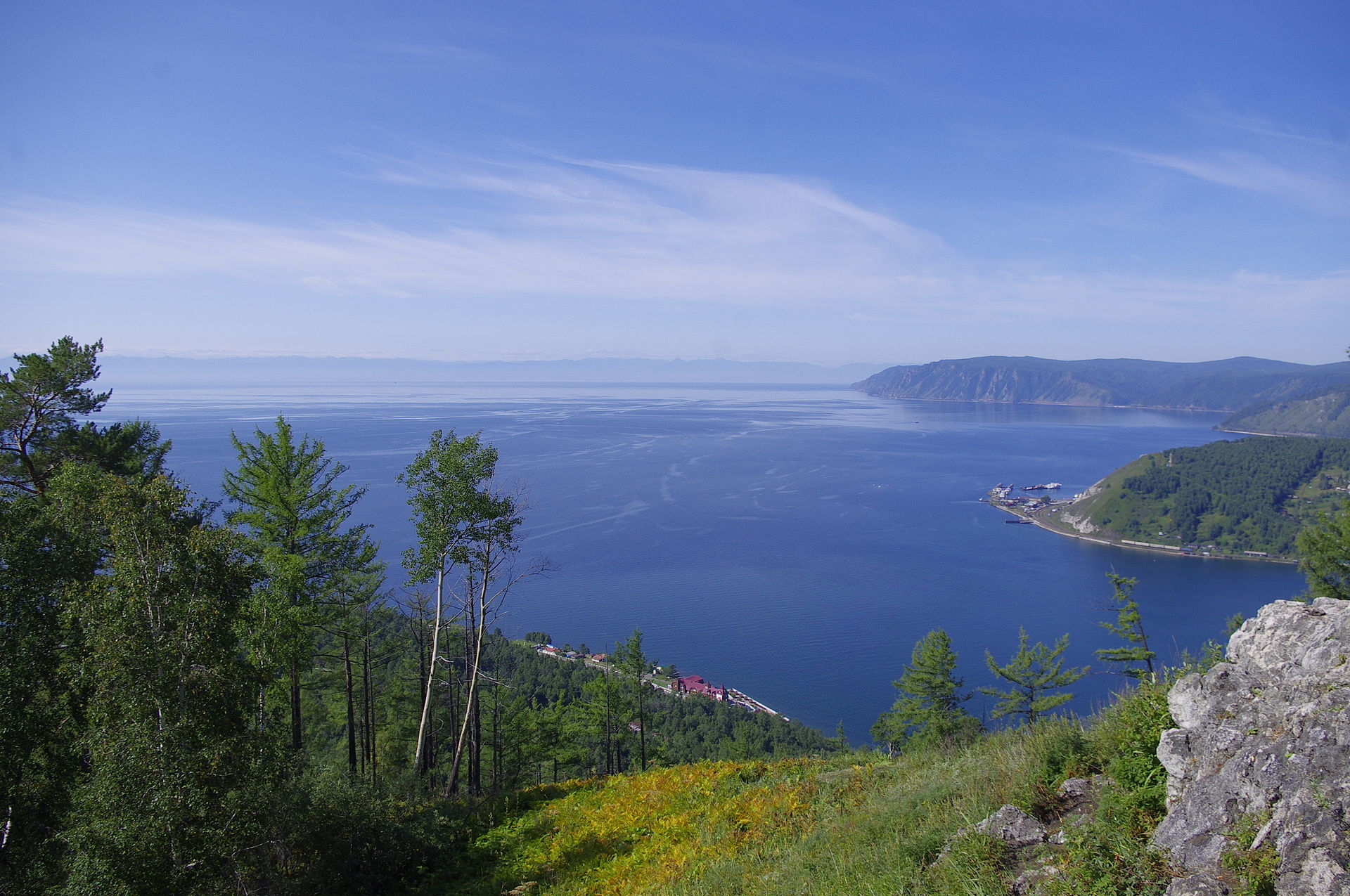
Here on Earth, we have familiarity with a very analogous tectonic feature: the Dead Sea Rift, which is actually a fault system that runs for around 1000 kilometers between two adjacent plates: the African Plate to the west and the Arabian plate to the east. Over time, the two plates have displaced relative to one another by more than 100 kilometers, and have experienced this relative motion only in geologically recent times: over no more than the past 50 million years or so. Rift zones occur all over an active planet with plate tectonics routinely, and represent a “pulling apart” of two portions of the lithosphere. Lake Baikal, the deepest, largest, oldest lake on Earth, formed because of this type of rifting phenomenon.
For a very long time – all of the 20th century and more than the first decade of the 21st – the explanations for the formation of Valles Marineris were inadequate, relying on ideas like:
- erosion from water,
- permafrost melting in glacier-rich regions,
- the sudden withdrawal of subsurface magma,
- or tensional fracturing which caused solid rock to split.
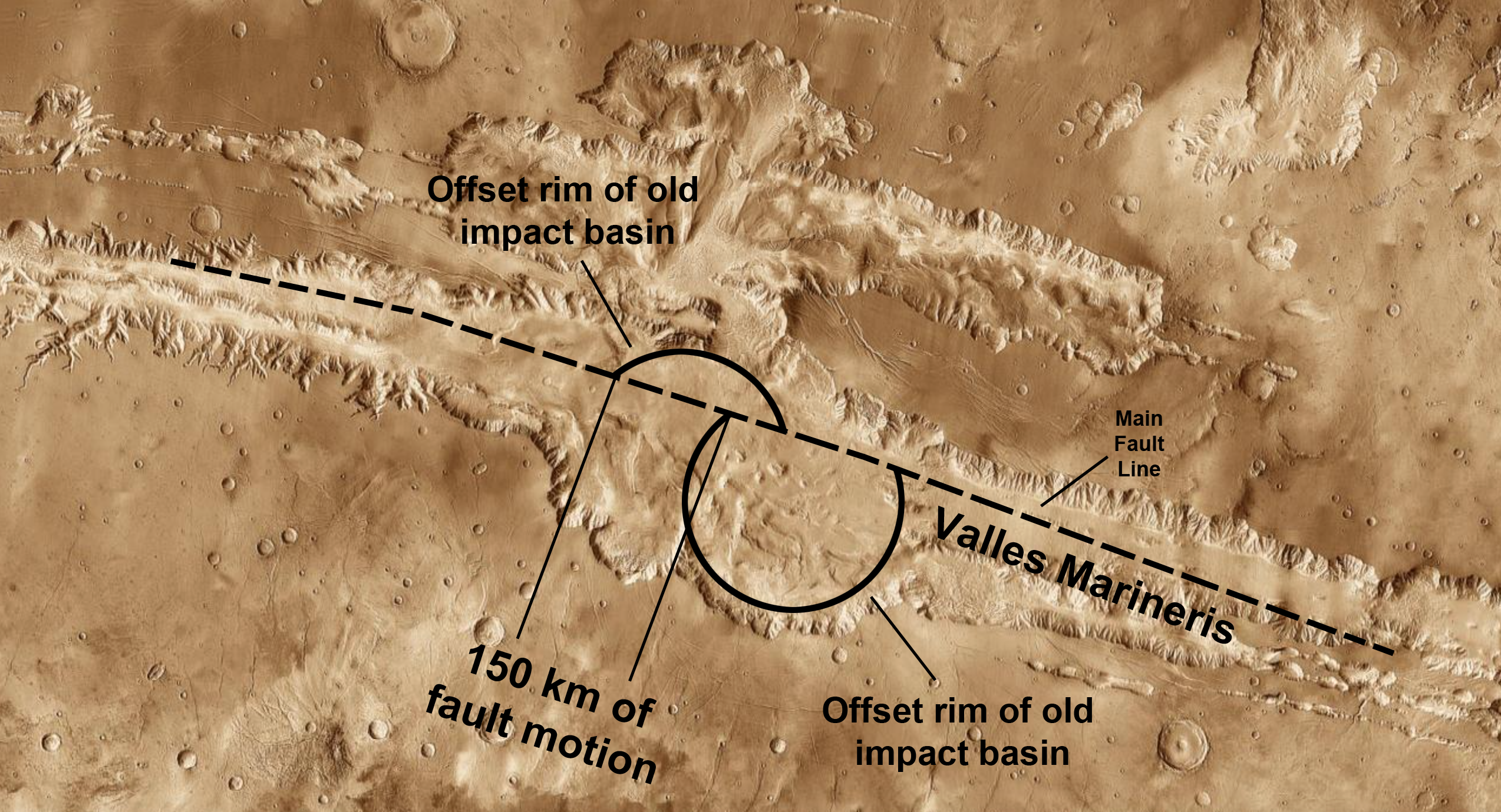
But in 2012, a scientific study came along that changed everything: using surveyed data of Mars from space, UCLA scientist An Yin (who died in 2023 at the relatively young age of 64) determined that features on one side of this valley, including features left by ancient crater impacts that still survive, were displaced from matching features on the valley’s opposite side of between 150-160 kilometers.
That rifting behavior along a fault line was the first step in the creation of Valles Marineris, but that’s only the beginning of the story. As Mars still possessed liquid water well into its history – for perhaps the first 1.5 billion years of our neighboring planet’s existence – erosion and the collapsing of rift walls are generally accepted to have then enlarged and expanded the long, narrow valley that initially rifted apart. (There is a possible analogy to the East African Rift here on Earth.)
Beyond the forces of erosion, there were also landslides that no doubt occurred, perhaps being connected to the watery past conditions on Mars but also subsequently, including long after the planet lost the last of its liquid surface water. This provides a possible explanation as to why, when we examine the walls on either side of Valles Marineris, we see that they appear to show evidence of enormous numbers of deposits on the floor of this canyon.
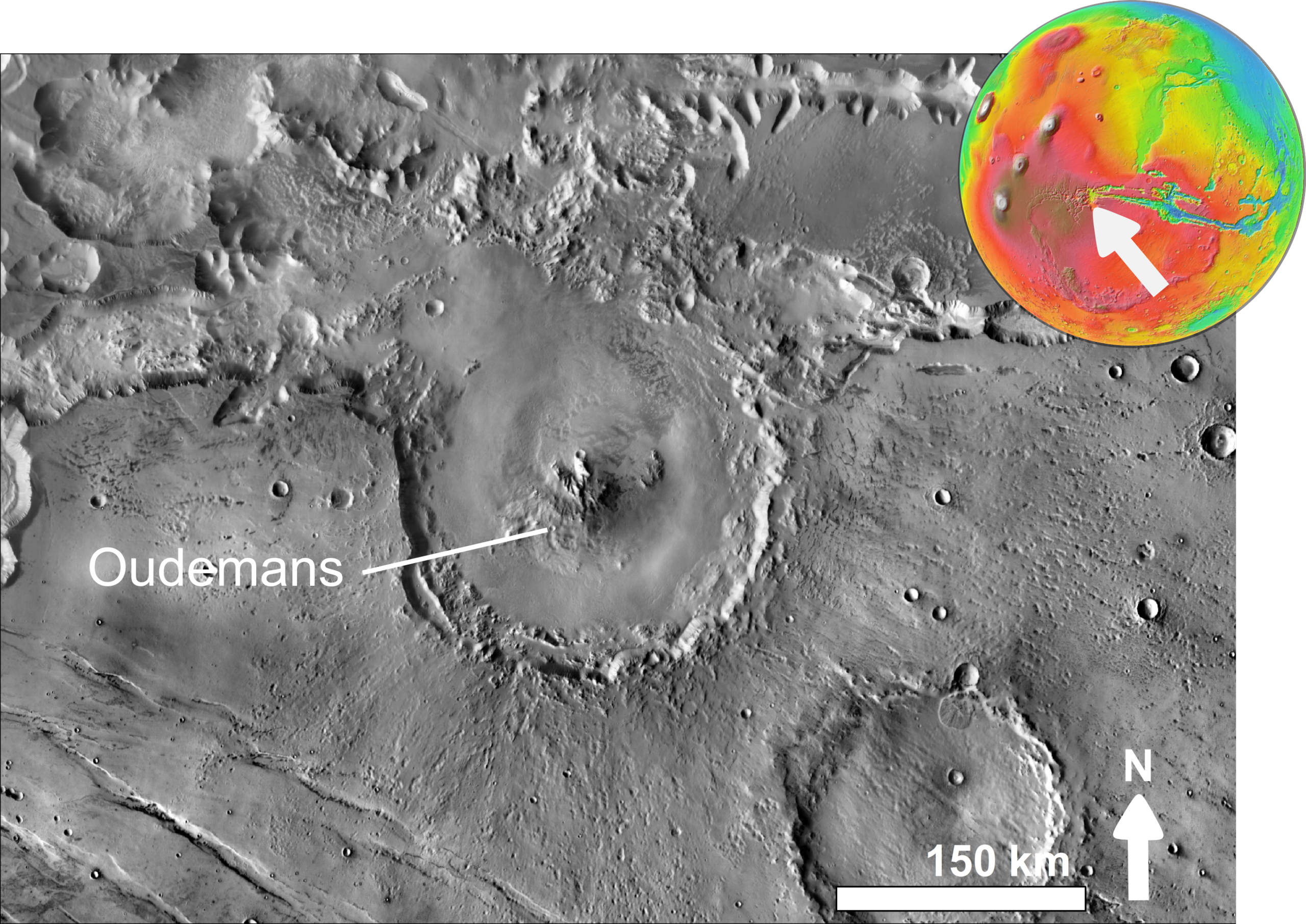
Landslides could also have contributed to further expanding the width of the canyon (at the expense of its depth, suggesting that it may once have been even deeper than it is today), which could have been further exacerbated by both marsquakes and by subsequent, late-time impact events. The formation of the relatively recent crater Oudemans, for example, may have triggered one of the landslides that occurred within Valles Marineris long after its initial formation.
However, there’s a tremendous difference between tectonics on Mars and tectonics on Earth, which is extremely important for understanding why Valles Marineris has persisted for so long and grown so large, whereas practically all of the rift valleys on Earth, as well as even our largest canyons, are under 100 million years old. Here on Earth, our planet’s lithosphere – the crust and the upper mantle – is fragmented into many large plates, which “float” atop the asthenosphere (the lower mantle). As those plates collide, spread apart, slide across one another, and otherwise generally move, features like mountains, volcanoes, and rifts form on our world.
On Mars, however, there’s evidence that even though it possesses tectonics, the notion of many separate, mobile, large plates is incongruent with the overall geological history of the planet. The three biggest geological features on Mars are as follows.
- Its northern lowlands, including indicators that the crust of Mars’s northern hemisphere is very thin and was resurfaced (by lava) relatively recently compared to the older southern hemisphere.
- Its southern highlands, whose surface is older than the northern lowlands and contains the oldest, most ancient impact craters found on Mars.
- And the Tharsis bulge: the equatorial highlands that contain Olympus Mons and several other large mountains: among the largest in the Solar System.
When we put all of these pieces of information together, we can tell a story – perhaps a likely, but unproven, past history of Mars – that explains the formation of Valles Marineris.
First, the giant impact that created Mars’s moons occurred, and then the largest, innermost moon fell back onto Mars. It’s plausible, but not necessarily certain, that this created the dichotomy between the northern and southern hemisphere. Then, a combination of volcanic activity and the “floating” of the thickened crust atop the mantle – known as isostatic uplift – occurred over what would become the Tharsis region of Mars.
However, because Mars’s lithosphere was not mobile, meaning that the volcanic “hot spots” weren’t moving relative to the surface features on the planet, depressions began to form and the crust began to spread out in that region, widening the Tharsis bulge and the plateau-like region it inhabited. This may have caused the Tharsis bulge to begin shifting relative to the volcanic hot spots beneath it, and may have gone as far as to shift the entire Martian crust and/or lithosphere relative to those volcanic hot spots.
Because the stability of the crust atop the mantle is dependent on being in what’s known as isostatic equilibrium, like a boat floating atop the ocean, shifting the position of the crust relative to the mantle beneath it results in instability. And, with so much mass to carry, the weak regions will begin to fracture.
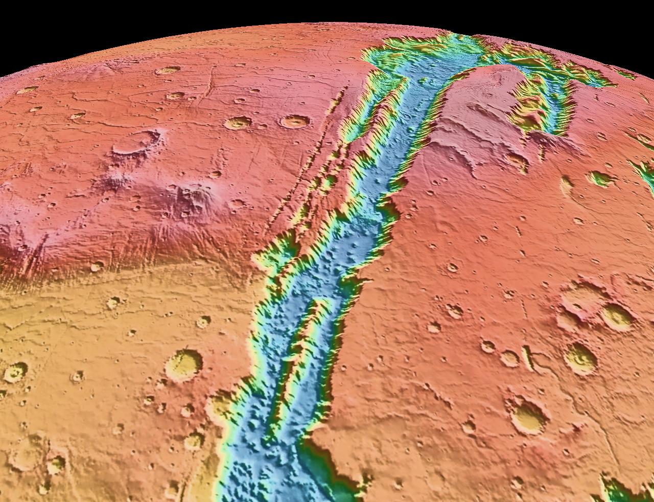
One of these fractures – perhaps the largest fracture of any location in the Solar System, even including the cooling-induced fractures that formed on Mercury – extended for some 4000 kilometers (2500 miles) across the surface of Mars, creating the initial rift that would lead to the modern-day Valles Marineris. The new locations of the volcanic hotspots would lead to the major Martian volcanoes that came to exist today, including Olympus Mons, Alba Mons, and the three Tharsis Montes, all of which are still actively growing even at present.
Additional volcanic and tectonic activity led to the further rifting of Valles Marineris, including the 150-160 kilometer “shift” identified between the northern and southern portions by An Yin. For as long as water flowed on Mars, Valles Marineris probably provided the main channel by which ices, snows, and other forms of water would flow eastward into a one-time ocean, creating a network of outflow channels that are still visible in modern-day altimetry data.
Finally, even after Mars became a dry, barren planet – after its core dynamo died, after its atmosphere was stripped away, and after liquid water became impossible on its surface – further landslides, possibly driven by quakes, tectonic activity, and/or subsequent impacts, created the landslides that further widened the grandest canyon of them all, at the expense of filling in its deepest depths, rendering them shallower than they were previously.
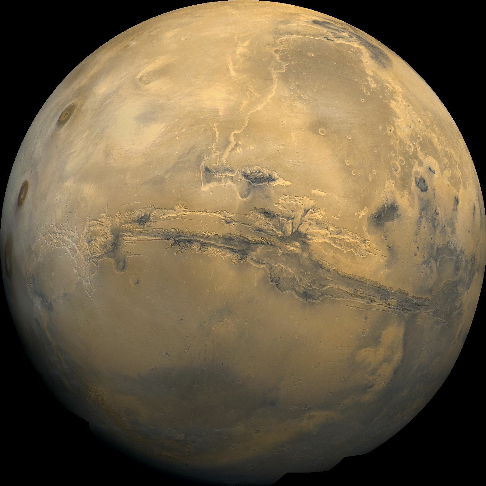
You have to realize just how impressively large Valles Marineris is to fully appreciate it. From end-to-end, it’s about 4000 kilometers (2500 miles) across, giving it a similar extent to the continental United States or the continent of Australia. At its widest, it’s approximately 200 kilometers (120 miles) from the uppermost high-walled rim to the lowermost rim on the opposite side of the valley: more than six times the maximum width of the Grand Canyon on Earth. And, despite the fact that landslides have filled in the deepest depths of this valley over billions of years, it’s still some 7 kilometers (23,000 feet) deep: deeper than all but the absolute deepest ocean trenches on Earth.
It’s even more impressive when you consider that Mars itself is a much smaller planet than Earth; with a Martian circumference of “only” 21,000 kilometers (about half that of Earth), Valles Marineris spans about 20% of the planet’s full physical extent. With a lower mass than Earth, Mars has a much smaller force of gravity at its surface than our planet does, allowing mountains to reach higher and valleys to form deeper than they can stably form on Earth. It isn’t a surprise that Mars would have larger mountains and deeper valleys than Earth, but the full extent of the grandest canyon of them all, Valles Marineris, never fails to impress!
Send in your Ask Ethan questions to startswithabang at gmail dot com!

The Power of Play