Far beneath the antarctic ice sprawls a massive system of lakes, rivers, and streams. These waterways have remained mostly hidden from us because they lie so deep.
This finally changed when a small team of four scientists traveled to western Antarctica. Their goal: to map this strange network of lakes and streams using a technology that had not been tried before. After weeks of grueling work and camping on the ice, they discovered just how large these under-ice systems are. They recently published their results in the journal Science.
A trek to Antarctica
Before this research, it was difficult to appreciate just how extensive these under-ice water systems are.
Airborne vehicles mapped some of the subglacial streams and lakes, and drilling expeditions were able to sample some of the water. However, the airborne surveys could only observe to a depth of about 100 meters beneath the ice, and only where the ice was relatively thin (less than 350 meters). Drilling could only extract water that flowed a few meters beneath the ice.
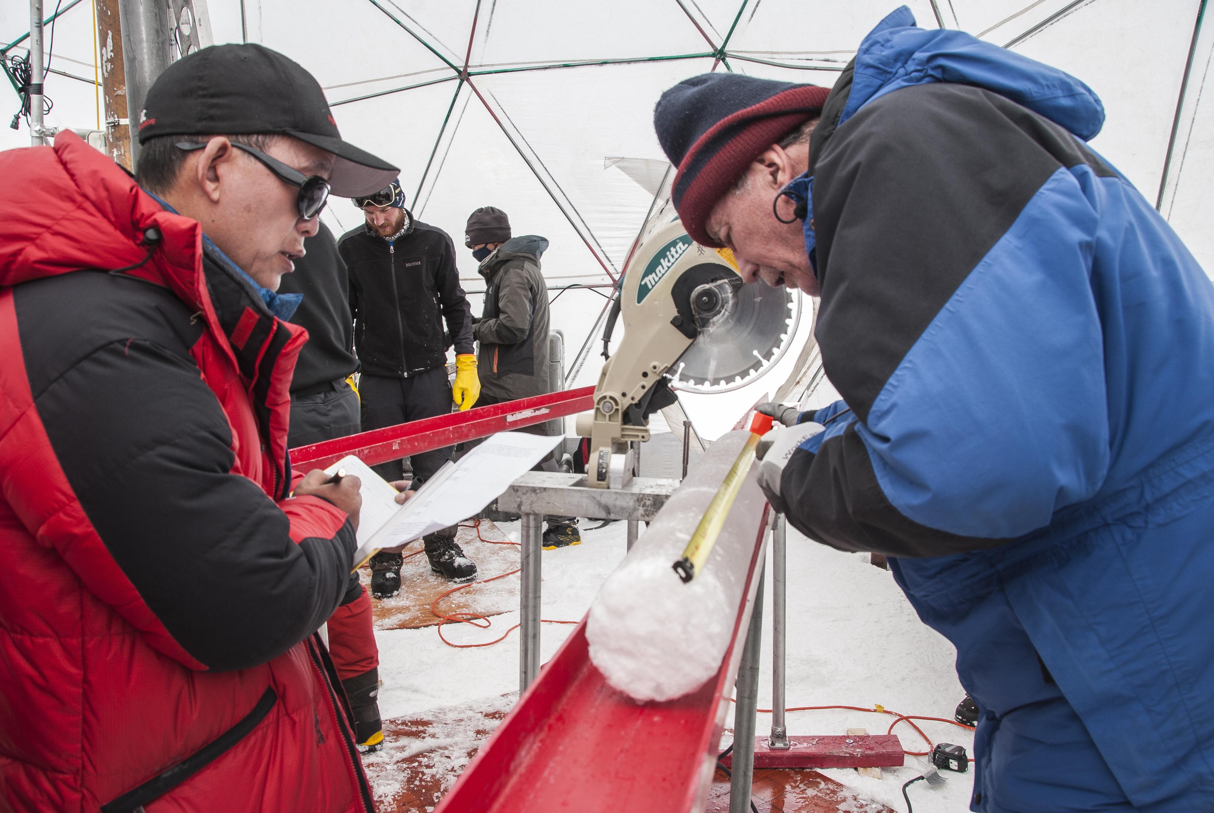
In 2018, a plane dropped off a team of four scientists who had a better idea of how to map these under-ice systems.
“The plane dropped us and all of our equipment off in what felt like the middle of nowhere on another planet, leaving the four of us to build camp and start doing science,” team leader Chloe Gustafson, of UC San Diego’s Scripps Institution of Oceanography, told Big Think. “That was surreal.”
The team spent its first three weeks studying the grounding zone — the area where the glacier goes from sitting on bedrock, to floating. The researchers then trekked across the expanse, stopping occasionally to dig down into the snow and ice and bury their instruments. (More on those below.) A day or so later, they would extract the buried instruments and move them, using sleds pulled by snowmobiles, to a new location.
“We were constantly using our hands,” Gustafson recalls, “to drive, to pack and unpack equipment from our sleds … to dig holes to put our equipment in, and to tighten our tents down to their anchors.”

By the time the job was done, the team had camped on ice for six whole weeks.
A new method for exploring beneath the ice
The researchers explored the Whillans Ice Stream in Western Antarctica. This is a river of ice that moves in bursts and surges. It is thought that the reason it moves is that a layer of liquid water underneath the ice sheet lubricates it. Indeed, as you dig deep enough into the ice, it starts to get warmer — just the same as digging into the earth. This geothermal heating, along with pressure and friction from the ice above, allows liquid water to be present.
“Where the ice meets the earth’s surface, it is just warm enough, and the pressure from the overlying ice reduces the freezing point just enough, that we have liquid water,” Gustafson says.
Underneath this is a basin of sediment carried by the movement of the glacier and reaching as far as a full kilometer under the ice. This sediment also holds enormous amounts of groundwater.
The team used a method known as magnetotelluric imaging to map these subglacial waters. The method allowed researchers to see much deeper under the ice.
Magnetotelluric imaging works by measuring how electromagnetic energy from the Earth’s atmosphere behaves as it moves into the ground. Freshwater, saltwater, bedrock, ice, and sediments all affect this energy in different ways.
By combining this technique with passive seismic surveys, Gustafson’s team discovered that the subglacial water system is much larger than previously known. Under about 800 meters of ice lies a huge basin filled with sediments and penetrated with groundwater. If this groundwater were isolated, it would form a water column 220 to 820 meters thick. This is somewhere between the depth of Lake Erie and Lake Ontario. This means the basin contains at least 10 times as much water as there is in the shallower subglacial lakes and streams.
Where did this water come from?
The study’s authors suggest it may have come from the ocean, which flooded the region about 5,000 to 7,000 years ago when the grounding line was farther inland. During this period, ocean water flooded the sedimentary basin and was trapped inside as the glaciers moved toward their current location. Since then, freshwater melting from the glacier mixed with the trapped water. The water’s salinity increases with depth.
Connection to climate change
Meltwater from the base of the glacier can sink into the sediments, while saltier water can rise up from below. These two movements form part of a system connecting the top and bottom levels of groundwater. This system helps us understand the dynamics of glaciers in a bit more detail.
For one, water and heat can travel up toward the base of the glacier, melting it from the bottom. On the flip side, the movement of water down through the sediment brings heat away from the glacier, leading to freezing. The balance between these two movements not only changes the size of the glacier, but also impacts its movement, as Gustafson explains.
“Water acts as a lubricant for ice flow,” she says. “If you have ice sitting on top of Earth’s surface, it can slide much quicker if there is water at the base of the ice, compared to if there is no water.”
Right now, we don’t know just how much this subglacial water will impact the glacier’s motion. If the ice sheet thins as the climate warms, the decrease in pressure would allow more liquid water to move upward, which would in turn allow the glacier to move faster. This could lead to a runaway effect.
But we have a lot to learn about how these processes work together.
“We need to first incorporate subglacial groundwater into our models of subglacial hydrology before we can really quantify its impact on ice flow,” says Gustafson.

The Power of Play