A Map of Synthetica, A New Continent of Plastics
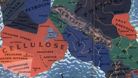
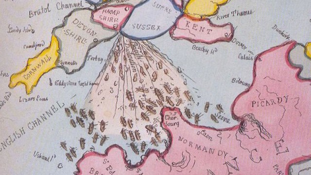
“On this broad but synthetic continent of plastics, the countries march right out of the natural world – that wild area of firs and rubber plantations, upper left – into the illimitable world of the molecule. It’s a world boxed only by the cardinal points of the chemical compass – carbon, hydrogen, oxygen, nitrogen.”
• “It floats upon a Sea of Glass, one of the oldest plastics known.”
• “New countries, like Melamine, constantly bulge from its coastline.”
• “The Alkyd country, a great swamp of height, impervious plastic paints, varnishes, and lacquers, creeps out like an implacable sargasso.”
• “Great chemical river systems, like the Acetylene, feed many countries. And boundaries are as unsteady as the maps of Europe.”
• “Lignin, the dark forest in the North, gives forth a new plastic made of the adhesive matter holding cellulose fibers together in wood.”
• “Petrolia is the land of the new synthetic rubbers.”
• “Cellulose is a great state, something like Texas, with many counties, all of which grew out of old Nitrocellulose (Celluloid).”
• “Rayon is a plastic island off the Cellulose coast, with a glittering night life.”
• “Vinyl-land, a fast-growing new country of safety-glass (…) and rubbery plastics, will probably subdivide soon.”
• “The Crystal Mountains of Acrylic (price elevation: 52,50 a pound) rund down into the Crystal Hills of Styrene – both brilliant new plastics with glandlike properties.”
• “The greatest plastic country of all – a heavy industrial region of coal-car chemicals led by Formaldehyde River – is Phenolic. Its hard-working plastics, in a sober Quaker dress of limited colors, go into most of industry. Capital: Bakelite, ruled Union Carbide & Carbon Corp.”
• “To the south is Urea, related to the (…), but a more frivolous and color-loving state. Its main industries are buttons, tableware, light globes.”
Strange Maps #175
This remarkable map appeared in the issue of Fortune Magazine for October 1940. Slightly resembling South America, a continent of fictional lands each symbolising different aspects of the then still new and exciting world of plastics is shown, floating on a sea of glass. The map was found here at fulltable.
