186 – Europe, If the Nazis Had Won

One of the mainstays of speculative history (together with “What if the South had won the US Civil War?”) is: What would the world have looked like if the Nazis had won the Second World War? And yet I’ve never seen a map showing what the Nazis’ post-war plans (for Europe of for the world) were, neither from their own files or reconstructed by war historians.
Which is very strange, considering that the Second World War is one of the most studied conflicts in world history. Maybe that’s because the Nazis didn’t have any concrete plans for after their victory – not because they didn’t believe in it themselves, but because of the chaotic nature of Nazi governance. The institutional overlap, competition and resulting chaos in the Third Reich is a well-established historical fact that contradicts the traditional notion of Germans as careful and thorough planners and which may well have prevented a German victory.
How the world would have looked like if such a victory had occurred, is a question that has been answered often in fiction, for example in the (passable) Robert Harris novel ‘Fatherland’ and the (brilliant) Philip K. Dick book ‘The Man in the High Castle’. Harris’ book includes a map, of a 1960s Europe dominated by Germany. This Nazi state, greatly expanded towards the East, doesn’t include Alsace-Lorraine. This rather puts a dent in the map’s credibility: it’s quite unthinkable that a victorious Nazi state would not annex these territories on the Rhine’s left bank, for so long disputed between France and Germany. Dick’s book, which focuses on the Japan-dominated West Coast of the (former) USA, sadly isn’t illustrated with a map. Not my copy at least.
This map does give what seems to be a well-considered vision of a Europe-wide Nazi state as it might have emerged after a German victory. German supremacy is ‘concealed’ by the construct of Neuropa (‘New Europe’), a sort of evil twin of the European Union in this universe.
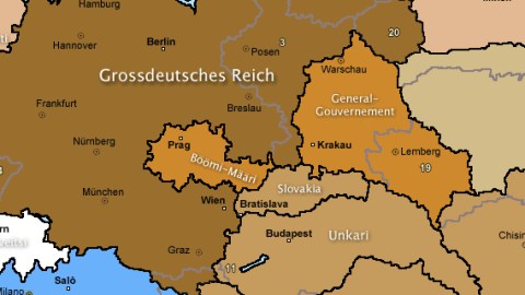
• Linchpin of Neuropa is the Greater German Empire (Grossdeutsches Reich), consisting of Germany in its 1937 borders, plus Alsace-Lorraine (from France), the entire Grand Duchy of Luxembourg, the Belgian German-speaking area of Eupen-Malmédy (from Belgium), all of Austria (Ostmark in Nazi parlance), a large part of present-day Slovenia, the Sudeten areas of former Czechoslovakia, and large parts of pre-war Poland. • Some areas are not part of the Reich, but nonetheless under direct ‘Protectorate’: Bohemia-Moravia and the Polish ‘General-Gouvernement’. • So far, nothing deviates from the situation as it was at the height of Nazi power in Europe. Different are two Reich exclaves in the East, implying Germany won the war with Soviet Russia: Gotenland (on the Krim peninsula) and St Petersburg. • Presumably outside the Reich in a technical sense, but still administered civilly by the NSDAP (Hitler’s National Socialist party) are large areas in the East: Estonia and Latvia, both enlarged by annexing parts of Russia, Lithuania, and Belarus. • There are also three autonomous NSDAP areas in the west: the Netherlands, Flanders and Wallonia (those two successor-states to Belgium also gaining territory, in this case to the detriment of France). • So far the areas under direct German control (either under the Reich or under the Party). Next in the map legend are other European states, major allies of the Nazis and “instigators of the New European Union”: Greater Finland (almost doubling in size by grabbing parts of Norway and Russia) and the Italian Social Republic, covering just the northern half of Italy but gaining the Savoy and Nice areas of France and the environs of Istria from Slovenia. • This is where the map’s colour scheme gets a bit confusing: the states signing up to the European Declaration in 1946 and later are indicated in one of several shades of brown and green used in the legend. To the best of my visual abilities, the 1946 ones are: Norway, Denmark, France, Slovakia, (Greater) Hungary, (Greater) Croatia, (Greater) Romania and (Greater) Bulgaria – those last four Balkan states enlarged at the expense their neighbours (sometimes including each other). • A second wave of member states signing the European Declaration in 1951 are (again, as far as I can see): Spain (also holding on to its possessions in Morocco), (Little) Serbia, Greece (losing part of Macedonia to Bulgaria and also some territory to Albania, but retaining an enclave at the Turkish border) and Ukraine, which, having lost some land to Romania and the General-Gouvernement, is extended eastward all the way to Saratov. • Later in the 1950s, Albania (enlarged also with a good part of Kosovo) joins the European Declaration. • A third wave of Neuropa members joins in the 1960s: Portugal, Montenegro, and several formerly Soviet areas in or near the Caucasus: Kuban, Kalmykia, Georgia (enlarged with North Ossetia), Armenia and Azerbaijan. • In the 1970s, three new states join: Dagestan in the Caucasus, and Udmurtia and Volga-Tatarstan further north. • Incorporated in Neuropa, but without voting rights are the areas of Moskova and an area in the Caucasus, somewhat conforming to where Chechnya is now (maybe corresponding with the former, larger Soviet autonomous area of Chechnya-Ingushetia).
This map was sent to me by Bruno De Cordier and is taken here from the Finnish site valtakunta.eu, dedicated to illustrating the parallel universe in which the Nazis have won the war.
Unfortunately mainly in Finnish, it’s impossible (for a non-Finnophone like me, anyway) to determine which is the POD (point of divergence) of this timeline: what was the turning point allowing the Nazis to win the war?


