Could aliens detect heat-based signs of life on Earth?

“Scanning for signs of life” is a staple of science fiction. Could it be science, too?
This post was written by Jillian Scudder. Jillian is a Postdoctoral Research Fellow in Astrophysics at the University of Sussex, in the UK. She received her Ph.D in 2014 from the University of Victoria, studying the interactions between galaxies in the nearby Universe. Follow her on Twitter at @Jillian_Scudder.
Could alien spacecraft ever detect “life signs” on a planet against a remotely noisy thermal background? If they were looking for intelligent life wouldn’t it always be easier to look for ordinary radio emissions?
Oh, “life signs.” The Star Trek franchise is probably responsible for this phrase: any planet they arrive near, they scan for signs of life. Sometimes, they scan for signs of intelligent life, or even signs of human life (or a specific alien species). Unfortunately, it’s never quite clear what exactly they’re doing, and the Star Trek: The Next Generation: Technical Manual book has a brief paragraph of incredible technobabble to explain it. (I am delighted that this book exists, by the way.)
“Charged cluster quark resonance scanners” is completely bogus — unless a “charged cluster quark” is just a fancy word for a “proton” — so we can get the Star Trek method out of the way pretty swiftly. And while listening for radio transmissions certainly can work (and is indeed the focus of our current searches for life out there), the success rate of that would also depend on how widespread radio transmissions are (are they still using radio, or do they prefer to beam information through fiber optic cables? Are they advanced enough for widespread radio?) and how much time you have to spend listening. Humans only got to using radio broadly around the 1920s, but there were plenty of intelligent, modern humans around before then. The SETI Institute has plenty of time to listen, though — they have a dedicated telescope just set to listen to what’s out there. Of course, they haven’t found anything, while the total amount of radio broadcasts (and even the total power of radio broadcasts) have steadily been on the decline. On the other hand, if you already have a galaxy-exploring spacecraft, you can go hunting for life that isn’t necessarily radio-using at the present time.
We won’t be able to detect that there are precisely 3,000 people living in a given small town — what we can see (both with thermal imaging or with other methods) are the marks that life leaves on the surface of its planet. We’re going to have to use humans and the Earth as our prototype here because we don’t have any other examples, but we have certainly left a series of impacts on our planet. We live in cities, which are distinct in that we’ve cut down trees to build them, and we light them up at night. We build roads between cities, and houses to live in, and we have cleared land to farm.
How much of the human changes to our planet’s surface you’d be able to see from space depends entirely on the resolution you can achieve with your camera — how small of an object can you spot? Resolution for an image only depends on three things: how close are you to the object in question, what wavelength of light are you looking at, and how many wavelengths of that light you can fit across your telescope. For a heat map, we’re looking in the infrared, from at least orbit around the planet — how much can you see in the infrared?
A heat map of our planet in its entirety looks something like the image below:
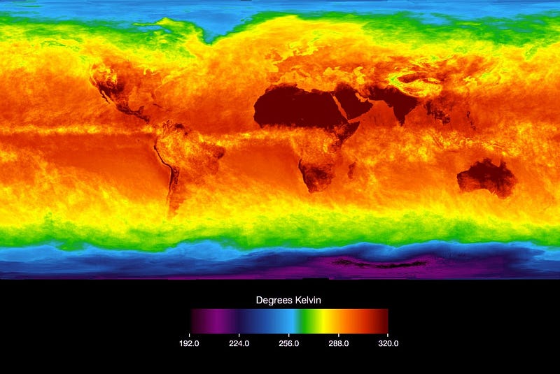
We can see that in general, the poles of our planet show up as cold, and the equator regions as much warmer, but at this resolution, you can’t see any real details. Cities don’t show up here, let alone individual humans. This is due to the combination of the wavelength (the infrared is a longer wavelength than optical light, so the resolution drops), the distance the satellite is orbiting the planet (about 440 miles up), and the size of the collecting area of the satellite.
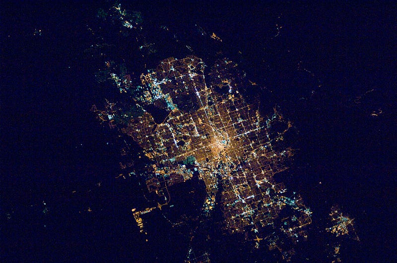
You can spot cities via heat measurements; if you’re not in the desert, dense cities tend to be warmer than the surrounding areas — part of this is that we’ve cut down all the trees to build the city; another part is that we’ve paved it with heat-absorbing asphalt. If the city has a lot of trees planted, this city ‘heat island’ is less obvious. The resolution on these images is about 100 feet, which is still well too large to detect individual people. The resolution here is partially because the size of the mirror on this satellite is still only 16 inches across (not very big, in the scheme of things).
If you just want high resolution, your best bet is to bring a really large mirror & camera (increased collecting area = better resolution), or to swap over to the optical, though clouds will become a problem if you do the second one. On Earth our cloud layer is not very thick, not very hot and tends to move over time, so if you wait long enough you should be able to see what’s underneath any given cloud over time, but if you’re observing a planet more Venus-like in its permanent cloud cover, the optical is not going to be your friend.
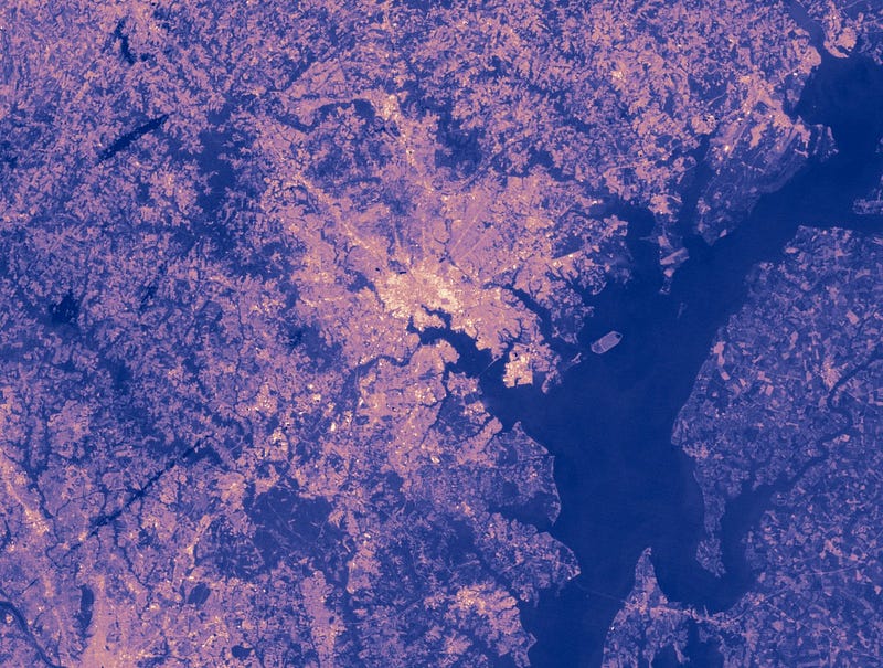
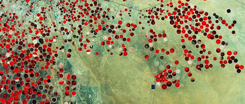
On Earth, however, it works fine; commercial satellites in orbit around the earth now can image the Earth down to a resolution of about a foot. (Or at least that’s as good as various militaries will allow them to disclose; super high resolution imagery of the Earth’s surface is also used for military reconnaissance.) With optical high resolution data, you can look for geometric patterns. Perfect circles, squares, rectangles, or triangles are unlikely to happen naturally, so if you spot widespread rectangles on the surface of the Earth, that usually means you’ve found a well-planned city or a farm, either of which indicates some kind of intelligence at work.
Of course, the further away from the planet you are, the harder this is to do — it’s not the sort of scanning you can do while cruising the galaxy at high speeds. To map the whole Earth at low resolution (between ~800 foot and ~3200 foot resolution), the MODIS instrument on one of our earth-orbiting satellites, orbiting at ~450 miles above the surface, takes 2 days. So it’s possible to detect signs of life on a planet via heat images if we’re looking for evidence of cities, but not if we’re looking for individuals, and not if you don’t want to spend a few days in orbit around the planet.

Still, if you built a very large aperture, wide-angle telescope, and had it orbiting the planet in space, you just might be able to spot people outside. The Enterprise-D from Star Trek: The Next Generation had a main dish that was approximately 500 meters in diameter, which would give it a resolution about 150 times greater than the Hubble Space Telescope. Even in the infrared, we’d be able to detect individual human beings if we gathered that much light — though to tell that anything was moving, you’d have to take a series of images and play spot the difference. (A series of extremely short exposures would also keep all your images from being blurred into unrecognizability, unless you’ve parked the Enterprise in geostationary orbit.) If you had an inkling of where to point your dish — and weren’t reliant on mapping the entire planet — the civilization we’ve dreamt that Earth becomes in the future may yet be able to spot intelligent life walking around.
Astroquizzical answers your questions about space! Submit a question at astroquizzical.com/ask.
This post first appeared at Forbes. Leave your comments on our forum, check out our first book: Beyond The Galaxy, and support our Patreon campaign!