Is this Map a Million Years Old?
Cartography is an ancient urge. Humans made maps long before they invented writing.
But whereas the origin of the written word can be pinpointed with some certainty to the Middle East at the end of the fourth millennium BC [1], no such archaeological consensus exists over the age and location of the world’s oldest map.
The problem, with each candidate piece of scratched or painted rock: Is it ritual abstraction, or realistic depiction? In other words, when does the shaman become a mapmaker?
The answers to that question vary wildly. The oldest examples of mapmaking are also the most debatable, probably because cartographer and augurer are still joined in Siamese twinship.
Take the Çatalhöyük wall painting, dated to the late seventh millennium BC. Does it really represent a map of the neolithic settlement it its Anatolian surroundings? Or are those rooftops really just an abstract pattern, and that erupting volcano nothing more than a leopard skin? [2]?
The oldest indisputable examples of cartography depict heavenly bodies, in large part because their position is still verifiable today. A drawing in France’s Lascaux cave, dated to 18,500 years ago, clearly shows the Pleiades [3], as well as the so-called Summer Triangle [4].
Even though other ancient examples of maps could still be unearthed, the scientific consensus is that cartography has an outer age limit – roughly the same one for burial rites, cave paintings and other expressions of symbolic thinking. The emergence of this ‘behavioural modernity’, either as a sudden shift in human genetics or as a gradual accumulation of skills, is thought to have culminated about 50,000 years ago with the advent of language.
Along comes an amateur archaeologist with a stunning find that could pulverise that age limit. What if the world’s oldest map is at least ten times older than that putative onset of abstract thought. How about a map that is anywhere from half a million to one million years old?
The amateur is David King, a passionate Yorkshireman who prefers to call himself an ‘intuitive archaeologist’: “[I don’t] possess academic qualifications, but I have been collecting, analysing and researching one site at the head of the Colne Valley [5] in England”. Over two decades, Mr. King has collected over 10,000 paleolithic artefacts in the area.
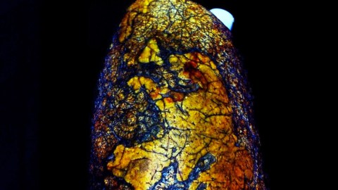
The map in question seems to be engraved on a 4.5-inch tall pebble. It takes only a small leap of the imagination to recognise the coastlines of Europe in the shapes incised into the stone. But matching the mapwork with the object’s supposed age – up to a million years, Mr. King contends – is several bridges too far for current science. And for most scientists.
Mr. King has had the map stone for over a decade, but in all those years was unable to have ‘official’ palaeontologists concede that it might be a man-made artefact. “They all say that it is a coincidence or a ‘natural’ occurrence, and that prehistoric man […] was incapable of such a feat […] The fact remains that it has been done […] Even a child with a limited grasp of geography can recognise the Western European coastline on this map”.
In fact, Mr. King contends, the stone surface presents “an accurate,detailed and concise map of the coastlines,lakes and river systems from north Europe all the way down to South Africa.”
If, as Mr. King’s non-intuitive colleagues maintain, the shapes displayed on the pebble are mere coincidences, they are pretty big ones. He lists some of the correspondences:
* “The mighty River Eridanos [6] flowed […] until about 700,000 years ago from the Baltic to the North Sea and marks the northernmost limit of the map, although Greenland could also be seen”.
* “In England, the Rivers Thames, Bytham [7] and Medway are shown, although Scotland is cut off and the Welsh coast is above water.The Bytham was known to have been obliterated by the Anglian Ice Age [8] as are several of the marked rivers in northern Germany,the Paris Basin appears to be flooded possibly between the Seine and the Somme”.
* “In Germany, the Rivers Rhine, Ems and Meuse and the lost rivers are marked. [S]trangely, the red ‘warrior figure’ is original and possibly a painted image… It does not scrub off!”
* “The west coast of France is remarkably accurate, with the Rivers Loire,Garonne,Rhône among others marked and the area south of Marseilles in shown above water (there are cave drawing off the coast there now 120 feet under water)”.
* “In Spain, the River Ebro is clearly marked, and [archaeological] finds there have been dated at before the geomagnetic field change 780,000 years ago [9].The Ebro appears to join up with the Rhône at a delta now under the sea”.
* “In Portugal the Rivers Tagus, Guadiana and others are shown”.
* “The Straits of Gibraltar are easily identifiable as is the north coast of Africa, although the Med looks rather different.Bearing in mind that this is a seismically active area and the African tectonic plates are sliding underneath the European plates,the changes over more than half a million years would have been considerable. It still looks recognisable today though”.
* “Lake Victoria and the River Nile appear to be shown too and [the map] appears to mark a land path north from East Africa to Europe crossing land that is now sea to join the Rivers Rhone,Ebro and Garonne”.
Mr. King speculates that the map stone is the receptacle of many generations’ worth of navigational knowledge, acquired as man left drought-stricken Africa for the more promising shores of Europe: “It must have been by boat or raft, probably bamboo, as [this] grows abundantly around rivers and coastlines. […] I expect that they moved slowly around the coast and navigable rivers,using natural safe harbours, settling in suitable areas where adequate water [and] food could be found,while some moved on to the next safe harbour […] Intimate knowledge of the coastlines and rivers [was] generated into a mental ‘map’ that probably first manifested in ‘written’ form on easier to use materials like clay, wax, wood or leather, but of course they would not have survived the passage of such a long period of time and no trace of them would remain today. After many,many generations,the accumulated knowledge was able to be transcribed onto stone with incredible accuracy”.
“[The artefact] must have been in much greater relief when made, the coastlines appear to have been incised and painted black (probably manganese dioxide) with the landmasses left in relief…it could even have been used to print copies onto beeswax, resin or clay”.
A fantastic story, but is it too good to be true? Mr King has a hard time convincing the scientific establishment of his theory that the earth-stone is an artefact, made by very, very, very early humans: “So far, not a single British archaeologist or anthropologist will even entertain the idea that it could have been made by Early Man, and [they] have never investigated further… [A]nd yet they freely admit they know so very little about pre-Neanderthal humans in Britain from 475,000 to 900,000 years [ago]!”
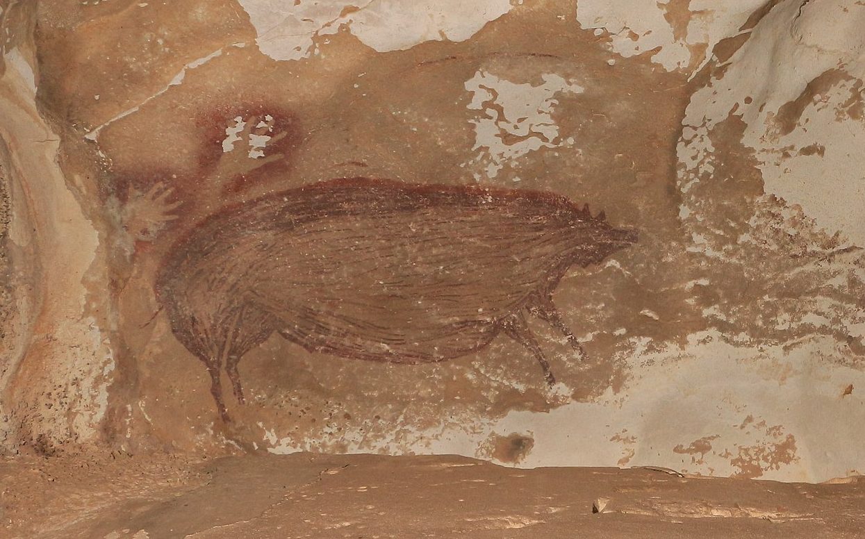
Perhaps because the oldest human artefact ever found, the so-called Venus of Hohle Fels [10], is between 35,000 and 40,000 years old, which is about the same age bracket for the world’s oldest cave painting yet discovered [11].
“[A]lthough very little is known of pre-Neanderthal humans [in the UK], I believe I have evidence that the European subspecies of Homo erectus (whether Homo antecessor or Homo heidelbergensis) that first came out of Africa around 1.2 million years ago was far more knowledgeable, intelligent, highly evolved and resourceful than is currently understood […] I doubt anyone today could make such an artefact as this by hand – but does this really mean it can’t have been made by man in deep time?”
“I believe this map holds many secrets and begs so very many questions that I have probably only touched the tip of an iceberg. So please tell me if you find more, I must have missed so much!”
The reason Mr. King refuses to believe this paleo-map is a coincidence, are other examples of stone maps he found at the Colne Valley site. “One map not only shows the rivers, but also two springs, crossing points, three distinct doglegs and landmarks, [in all] 33 points of reference to the existing topography”. He is working on a book to explain his findings in detail – even though established scientists will probably continue to ignore them: “I feel I have walked into an Aladdin’s cave of treasures, discovered a lost world and been given a ‘gift’ from above… And yet so far, nobody seems that interested when I try to pass the knowledge on.The vanity of these people, they think they know everything and because they have a few letters after their names, they refuse to accept that experienced amateurs such as myself have any part to play in future discoveries… Hasn’t science always been so!”
Many thanks to Mr. King for sending in these pictures of his find. More on them on his website, Colnianman Museum.
Strange Maps #620
Got a strange map? Let me know at[email protected].
_______
[1] The oldest extant examples of written language are over 5,000 years old, and from Mesopotamia (present-day Iraq). Writing then originated independently in China approximately 3,200 years ago, and in Central America around 2,600 years ago.
[2] Older examples of ‘map-like’ features carved in stone were found in the Czech Republic and Spain. Dated to 25,000 and 14,000 years ago respectively, the carvings could also represent a merely ‘spiritual’ landscape.
[3] A.k.a. the Seven Sisters, this star cluster in the constellation Taurus (Latin for bull) is one of the most striking objects in the night sky in the northern hemisphere.
[4] A triangular star pattern visible in the northern hemisphere, connecting the three brightest stars in the constellations Aquila (Latin for eagle), Cygnus (Latin for Swan) and Lyra (Latin for lyre), i.e. Altair (from the Arabic for [flying] eagle), Deneb (from the Arabic for [hen’s] tail) and Vega (from the Arabic for falling [eagle]), respectively.
[5] A valley in West Yorkshire, to the east of the main ridge of the Pennine Hills. The River Colne rises near Marsden, flowing east towards Huddersfield, where it is joined by the Holme, then towards Bradley, where the Colne itself joins the River Calder. The term ‘Colne Valley’ is mostly used to describe the area between Marsden and Huddersfield, but less frequently also includes the section towards Bradley.
[6] Named after a Greek mythical river flowing in distant Europe, Eridanos is also the name given an actual river, which flowed from 40 million years ago to the Middle Pleistocene.
[7] The Bytham was a Pleistocene-era river running from the Midlands east towards the North Sea. It may have provided Britain’s first inhabitants with a convenient ‘invasion route’, some time between 500,000 and 700,000 years ago. The river’s ancient course was identified only in the 1980s.
[8] The name used in Britain for a period of severe glaciation during the Pleistocene, lasting from 478,000 to 424,000 years ago. Its equivalent names are, among others, the Mindel Stage (in the Alps) and the Esterian Stage (in northern Europe). At the height of the Anglian Stage, glaciers reached all the way down to Hornchurch, in northeast London – further south than at any time during the Pleistocene.
[9] The Brunhes-Matuyama Reversal, about 780,000 years ago, is the latest of the geomagnetic field changes that frequently flip the polarity of Earth’s magnetic north and south. Such reversals occur on average every 450,000 years, and the geological period between them is called a chron. The reversal process can take up to 10 millennia, and involves a lot of wandering by both poles. A recent study suggests that a ‘mini-chron’ occurred around 41,000 years ago, when polarity was reversed for no longer than 250 years.
[10] A full-figured Venus figurine carved from the tusk of a woolly mammoth, found in 2008 near Ulm in southern Germany. The same cave in the Swabian Alb also yielded a 35,000-year-old bone flute – the world’s oldest instrument – indicating that figurative art and music were being practised as far back as 36 millennia ago.
[11] Artwork in the El Castillo cave in northern Spain, discovered in 1903, has recently been dated to 40,800 years ago.


