How to Make Kansas Even Flatter
The flattest state in the Union? Kansas, most Americans think. And not without reason. Science has confirmed the general suspicion that Kansas is, literally, flatter than a pancake. But an equally scientific ranking of America’s flattest states puts the Sunflower State at only seventh place out of 50.
Pardon the pun: That’s just plain wrong!
One cartographer has recently launched a modest proposal to match the state’s relief to its reputation. A Flatter Kansas Plan, as it were. Some shoveling is implied. And just what’s the point, you might very well ask? Our guess: It looks cool and weird on a map. At least, that would be enough for us. But it could also speed up the return of the Messiah.
Say what?
Bet you didn’t see that Second Coming coming. But let’s start at the beginning: Kansas’ reputation for flatness, and whether or not it is deserved. Tongue firmly in cheek, a paper published in 2003 in the Annals of Improbable Research compared the flatness of Kansas to that of a pancake. Of course, “(b)arring the acquisition of either a Kansas-sized pancake or a pancake-sized Kansas, mathematical techniques are needed to do a proper comparison.”
In order to quantify flatness, the scientists used a “flattening” ratio (f), whereby a perfectly flat surface will have a value of one, and an ellipsoid with equal axis lengths (in layman’s terms: a perfectly un-flat surface) will have a value of zero. Acquiring a sample pancake from IHOP, they collected “macro-pancake topography through digital image processing of a pancake image and ruler for scale calibration,” noting in their paper that “(t)he importance of this research dictated that we not be daunted by the ‘No Food or Drink’ sign posted in the microscopy room.”
Comparison to a similarly analysed topographic transect of Kansas showed that while the pancake had an f value of 0.957 (“pretty flat, but far from perfectly flat”), the slice of Kansas had an f value of 0.9997 (“damn flat”).

Comparative surface topography.
Whether or not because of that study, the idea of Kansas as the epitome of flatness has firmly lodged itself in the American imagination. In 2012, the American Geographical Society asked over 4,000 Americans which they thought was the flattest U.S. state. Fully 33 percent said Kansas, more than any other state. Florida came in second at 23 percent.
In fact, Florida is the flattest state. Much of the state is at or near sea level. Its highest point is Britton Hill; at 345 feet (105 m) the lowest state high point in the U.S.
The next-flattest states (and their highest points — not that they are absolutely relevant) are Illinois (Charles Mound: 1,235 ft, 376 m), North Dakota (White Butte: 3,508 ft, 1,069 m), Louisiana (Driskill Mountain: 535 ft, 163 m), Minnesota (Eagle Mountain: 2,302 ft, 702 m) and Delaware (near the Ebright Azimuth: 447 ft, 136 m). Oh, and the least flat state? Montana would have been neat, but the state doesn’t live up to its name. No, it’s West Virginia (1).
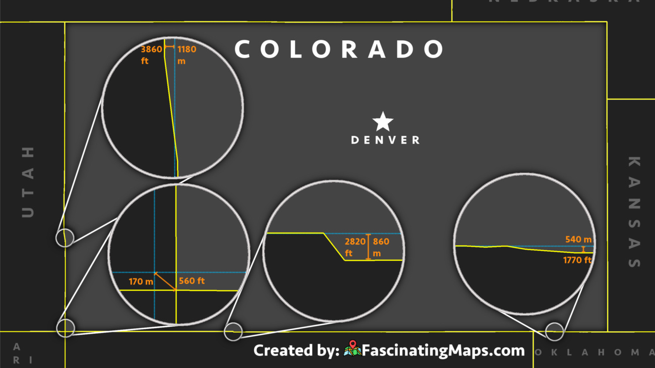
So why does Kansas only come in at no. 7? Because the seemingly flatter-than-flat state gradually tilts upward as you go west. From an elevation of 679 feet (207 m) on the Verdigris River in the southeast of Kansas, it rises to 4,040 feet (1,231 m) on the state’s western border with Colorado — at a place called “Mount” Sunflower, although the landscape here too is pancake-flat.
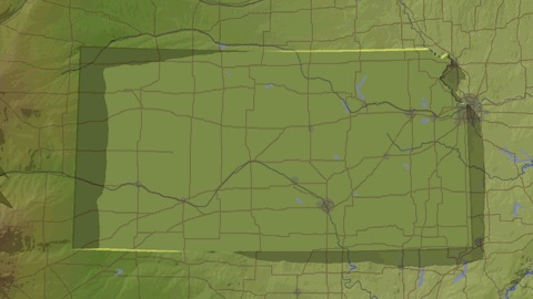
So the solution is obvious (though not easy): If we want to create a truly flat Kansas, we need to level the playing field, so to speak. Or, as the anonymous cartographer who made this map, and who evidently gave the matter some thought and calculation, says: “My plan is to create a perfectly flat and level Kansas by moving 5,501 cubic miles of earth from west to east. It’s the ideal Kansas. Still some details to work out about rivers, roads, etc. Watch out for the 900-foot cliff bisecting Kansas City.”

An ideal Kansas: not just flat, but also completely level.
Next time you’re travelling west to east through Kansas, pick up some dirt at the beginning of your trip and dump it at the end. You’ll be helping to fulfill the Prophecy mentioned in Isaiah 40:4: Every valley shall be exalted, and every mountain and hill shall be made low: and the crooked shall be made straight, and the rough places plain.
First image taken from the aforementioned article in the Annals of Improbable Research. Second image taken here at Cartographers Without Borders.
Strange Maps #750
Got a strange map? Let me know:[email protected].
(1) See “The Flatness of U.S. States,” an article by Jerome E. Dobson (geography professor, AGS president) and Joshua S. Campbell (geographer, GIS architect) first published in the Geographical Review on 7 April 2014. They developed an algorithm to determine the relative flatness of states, based on data from the Shuttle Radar Topography Mission. It is to be noted that relief is not the same as flatness. Which is why the heights of highest state points mentioned above do not correlate to the flatness ranking of each state.