Big ideas.
Once a week.
Subscribe to our weekly newsletter.
Even these Terrible Maps can teach us something
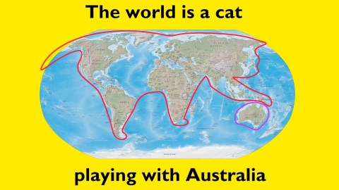
Despite itself, this collection of awful cartography may just make a few useful observations.

- Since 2016, Terrible Maps has been collecting, well… terrible maps.
- They're awful, pointless and stupid, but also funny (and sometimes even instructive).
- Here are 10 examples. Dive into the Twitter account for hundreds more.
What a strange map. How can I store it and collect more? That's how the Strange Maps blog got started back in 2006. Replace 'strange' with 'terrible', and you've got the idea behind Terrible Maps, a Twitter account that has been spewing awful, pointless, stupid maps since 2016.
Luckily, most are also quite funny – at least a chuckle, sometimes a snort – and not a few actually offer an insight worth contemplating. Here are our ten favorites. Click on the link below for the Twitter account.
All directions north
You can't go further south than the South Pole, which means that any other point is north again. Wait, does that mean you can't go east or west from the South Pole?
Iggy Coke?
Iggy Pop is a mercurial character. To some, he's The Passenger, a rock 'n roll legend; to others, he's a car insurance salesman. This map grafts his persona on the map of the US that shows the border between people who call a carbonated drink 'pop', and those for whom that's a 'soda'. (see also #308)
Moon on Flag and Flag on Moon
The Moon is frequently used in Islamic iconography: on top of mosques, and on the flags of several majority-Muslim nations, but also Croatia and Moldova (in red on this map). But while 13 countries have the moon on their flag, there is just one country with its flag on the moon. That's right: USA! USA!
Ding Dong, TX
Most people with have heard of Boring, Oregon. Here are some of America's other odd town names – one per state – that you might not have been aware of. Jackpot, NV and Okay, OK: yes, we see how those names came about. But Ding Dong, TX? Chugwater, WY? Booger Hole, WV?
Moose maps
Alaska is the biggest state in the U.S. But why is Maine second, Idaho third? The animal at the bottom is the key, and the legend of the map: each state is sized for their moose population. Even Nevada has a few.
Ages of the world
This map is a compound of the situation on the ground, and the prejudices of the mapmaker. Much of Africa, South America and the Arctic is living in the Stone Age. The interior of Australia, the north of Africa and elsewhere: colonial times. Russia, most of the US and China: the 1900s. The UK, the inhabited parts of Canada, Southern Europe, New Zealand: the present. Germany, Scandinavia, Japan, northeastern US, coastal China: the future. If you want to experience all at once: go to India.
Airus Forcus Romanus
Take any outline map and think of a legend that doesn't require you to alter it. Like this map of Roman Air Force bases in the second century AD. Also in this series: Electricity consumption in Europe in 1507. Countries arranged by geographical location. Knowledge of Cherokee in the EU. Popes per square mile. Alcoholism in Russia. Map of Earth if there was no land (i.e. blank). Saudi Arabia mapped only by its rivers (also blank). Map of Europe showing population per capita (a '1' in each country).
World Map of Bill Gates
Bill Gates is rich. Very rich. How rich? Richer than each of the countries on this map that have his grinning face superimposed on them.
Brexit vs. Mad Cow Disease
Left, in blue: UK areas that voted for Brexit in the 2016 referendum. Right, in dark grey: areas affected by bovine spongiform encephalopathy (BSE, a.k.a. 'Mad Cow Disease') during the 1992 outbreak. The correspondence between both maps is perfect. The message: the people who voted for Brexit were crazy, suffering from residual BSE. But the perfect correspondence is not that surprising: the second map is a black and white version of the first, with a different date slapped on. Point made. Fake data. Terrible map!
Gubernatorial eye colour map
A large, contiguous part of the US is ruled by blue-eyed governors: from Washington state all the way down to Florida. There are two blue-eyed islands in the northeast (Delaware-New Jersey and Massachusetts-New Hampshire). Virginia is the only state with a green-eyed governor. All the other states are ruled by brown-eyed top executives. Mind you, this map predates the mid-terms. Someone update this one, please!
Browsing through the Terrible Maps account, a few overlaps with Strange Maps jump out, including this map of potential EU leaving names, this world map of the metric system, and this map of the shortest route between all pubs in the UK. Are they terribly strange or just strangely terrible?
Find these and other terrible maps at Terrible Maps on Twitter or on Facebook. Thank you O. Jones for suggesting it. Strange Maps is also on Twitter, and on Facebook.
Strange Maps #952
Got a strange map? Let me know at strangemaps@gmail.com.
Iron Age discoveries uncovered outside London, including a ‘murder’ victim
A man's skeleton, found facedown with his hands bound, was unearthed near an ancient ceremonial circle during a high speed rail excavation project.
- A skeleton representing a man who was tossed face down into a ditch nearly 2,500 years ago with his hands bound in front of his hips was dug up during an excavation outside of London.
- The discovery was made during a high speed rail project that has been a bonanza for archaeology, as the area is home to more than 60 ancient sites along the planned route.
- An ornate grave of a high status individual from the Roman period and an ancient ceremonial circle were also discovered during the excavations.
Foul play?
<p>A skeleton representing a man who was tossed face down into a ditch nearly 2,500 years ago with his hands bound in front of his hips was dug up during a high speed rail excavation.</p><p>The positioning of the remains have led archaeologists to suspect that the man may have been a victim of an ancient murder or execution. Though any bindings have since decomposed, his hands were positioned together and pinned under his pelvis. There was also no sign of a grave or coffin. </p><p>"He seems to have had his hands tied, and he was face-down in the bottom of the ditch," <a href="https://www.livescience.com/iron-age-murder-victim-england.html" target="_blank">said archaeologist Rachel Wood</a>, who led the excavation. "There are not many ways that you end up that way."</p><p>Currently, archaeologists are examining the skeleton to uncover more information about the circumstances of the man's death. Fragments of pottery found in the ditch may offer some clues as to exactly when the man died. </p><p>"If he was struck across the head with a heavy object, you could find a mark of that on the back of the skull," Wood said to <a href="https://www.livescience.com/iron-age-murder-victim-england.html" target="_blank">Live Science</a>. "If he was stabbed, you could find blade marks on the ribs. So we're hoping to find something like that, to tell us how he died."</p>Other discoveries at Wellwick Farm
<p>The grim discovery was made at Wellwick Farm near Wendover. That is about 15 miles north-west of the outskirts of London, where <a href="https://www.hs2.org.uk/building-hs2/hs2-green-corridor/" target="_blank">a tunnel</a> is going to be built as part of a HS2 high-speed rail project due to open between London and several northern cities sometime after 2028. The infrastructure project has been something of a bonanza for archaeology as the area is home to more than 60 ancient sites along the planned route that are now being excavated before construction begins. </p><p>The farm sits less than a mile away from the ancient highway <a href="http://web.stanford.edu/group/texttechnologies/cgi-bin/stanfordnottingham/places/?icknield" target="_blank">Icknield Way</a> that runs along the tops of the Chiltern Hills. The route (now mostly trails) has been used since prehistoric times. Evidence at Wellwick Farm indicates that from the Neolithic to the Medieval eras, humans have occupied the region for more than 4,000 years, making it a rich area for archaeological finds. </p><p>Wood and her colleagues found some evidence of an ancient village occupied from the late Bronze Age (more than 3,000 years ago) until the Roman Empire's invasion of southern England about 2,000 years ago. At the site were the remains of animal pens, pits for disposing food, and a roundhouse — a standard British dwelling during the Bronze Age constructed with a circular plan made of stone or wood topped with a conical thatched roof.</p>Ceremonial burial site
<img type="lazy-image" data-runner-src="https://assets.rebelmouse.io/eyJhbGciOiJIUzI1NiIsInR5cCI6IkpXVCJ9.eyJpbWFnZSI6Imh0dHBzOi8vYXNzZXRzLnJibC5tcy8yMzUzMTk0Ni9vcmlnaW4uanBnIiwiZXhwaXJlc19hdCI6MTY0NDgwNTIyMX0.I49n1-j8WVhKjIZS_wVWZissnk3W1583yYXB7qaGtN8/img.jpg?width=1245&coordinates=0%2C82%2C0%2C83&height=700" id="44da7" class="rm-shortcode" data-rm-shortcode-id="46cfc8ca1c64fc404b32014542221275" data-rm-shortcode-name="rebelmouse-image" alt="top down view of coffin" data-width="1245" data-height="700" />A high status burial in a lead-lined coffin dating back to Roman times.
Photo Credit: HS2
<p>While these ancient people moved away from Wellwick Farm before the Romans invaded, a large portion of the area was still used for ritual burials for high-status members of society, Wood told Live Science. The ceremonial burial site included a circular ditch (about 60 feet across) at the center, and was a bit of a distance away from the ditch where the (suspected) murder victim was uncovered. Additionally, archaeologists found an ornately detailed grave near the sacred burial site that dates back to the Roman period, hundreds of years later when the original Bronze Age burial site would have been overgrown.</p><p>The newer grave from the Roman period encapsulated an adult skeleton contained in a lead-lined coffin. It's likely that the outer coffin had been made of wood that rotted away. Since it was clearly an ornate burial, the occupant of the grave was probably a person of high status who could afford such a lavish burial. However, according to Wood, no treasures or tokens had been discovered. </p>Sacred timber circle
<img type="lazy-image" data-runner-src="https://assets.rebelmouse.io/eyJhbGciOiJIUzI1NiIsInR5cCI6IkpXVCJ9.eyJpbWFnZSI6Imh0dHBzOi8vYXNzZXRzLnJibC5tcy8yMzUzMTk0Ny9vcmlnaW4uanBnIiwiZXhwaXJlc19hdCI6MTY2MDAwOTQ4Mn0.eVJAUcD0uBUkVMFuMOPSgH8EssGkfLf_MjwUv0zGCI8/img.jpg?width=1245&coordinates=0%2C149%2C0%2C149&height=700" id="9de6a" class="rm-shortcode" data-rm-shortcode-id="ee66520d470b26f5c055eaef0b95ec06" data-rm-shortcode-name="rebelmouse-image" alt="An aerial view of the sacred circular monument." data-width="1245" data-height="700" />An aerial view of the sacred circular monument.
Photo Credit: HS2
<p>One of the most compelling archaeological discoveries at Wellwick Farm are the indications of a huge ceremonial circle once circumscribed by timber posts lying south of the Bronze Age burial site. Though the wooden posts have rotted away, signs of the post holes remain. It's thought to date from the Neolithic period to 5,000 years ago, according to Wood.</p><p>This circle would have had a diameter stretching 210 feet across and consisted of two rings of hundreds of posts. There would have been an entry gap to the south-west. Five posts in the very center of the circle aligned with that same gap, which, according to Wood, appeared to have been in the direction of the rising sun on the day of the midwinter solstice. </p><p>Similar Neolithic timber circles have been discovered around Great Britain, such as one near <a href="https://bigthink.com/culture-religion/stonehenge-sarsens" target="_blank">Stonehenge</a> that is considered to date back to around the same time. </p>As we approach death, our dreams offer comfort and reconciliation
As patients approached death, many had dreams and visions of deceased loved ones.
One of the most devastating elements of the coronavirus pandemic has been the inability to personally care for loved ones who have fallen ill.
Surprising new feature of human evolution discovered
Research reveals a new evolutionary feature that separates humans from other primates.
Human evolution.
- Researchers find a new feature of human evolution.
- Humans have evolved to use less water per day than other primates.
- The nose is one of the factors that allows humans to be water efficient.
A model of water turnover for humans and chimpanzees who have similar fat free mass and body water pools.
Credit: Current Biology
Skepticism: Why critical thinking makes you smarter
Being skeptical isn't just about being contrarian. It's about asking the right questions of ourselves and others to gain understanding.