226 – Geo-Poetry, or: Finding Wordsworth

n
Five years have past; five summers, with the length
nOf five long winters! And again I hear
nThese waters, rolling from their mountain-springs
nWith a soft inland murmur (…)
n
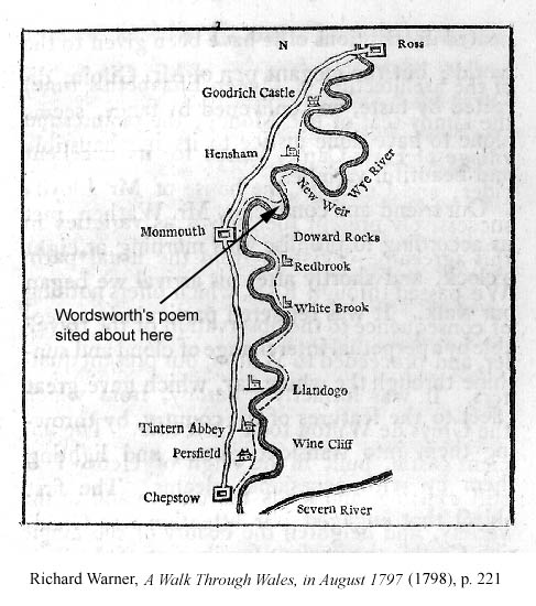
So begins one of the Lyrical Ballads, a collaboration between the English romantic poets Samuel Taylor Coleridge and William Wordsworth, published in 1798. Together with ‘I Wandered Lonely As A Cloud’, it’s one of Wordsworth’s most famous poems. It’s often referred to as ‘Tintern Abbey’, the ruin of a mediaeval monastery on the Welsh-English border that inspired it, but its actual, longer name is ‘Lines Composed A Few Miles Above Tintern Abbey, on Revisiting the Banks on the Wye during a Tour. July 13, 1798′.
n
Since air travel was out of the question in that period, Wordsworth obviously meant a few miles up- or downstream from the then ivy-covered magnet for proto-tourists, who flocked to the ruins for their ‘romantic’ (today we might equally say ‘gothic’) thrill.
n
This map, found here, shows exactly where Wordsworth might have penned the poem. If someone bothered to measure the exact distance, the poem could be renamed ‘Lines Composed 8.2 Miles Up the River from Tintern Abbey’… but that would no doubt detract from the work’s poetic quality. ‘I Wandered Lonely As a Stratocumulus’, anyone?
n


