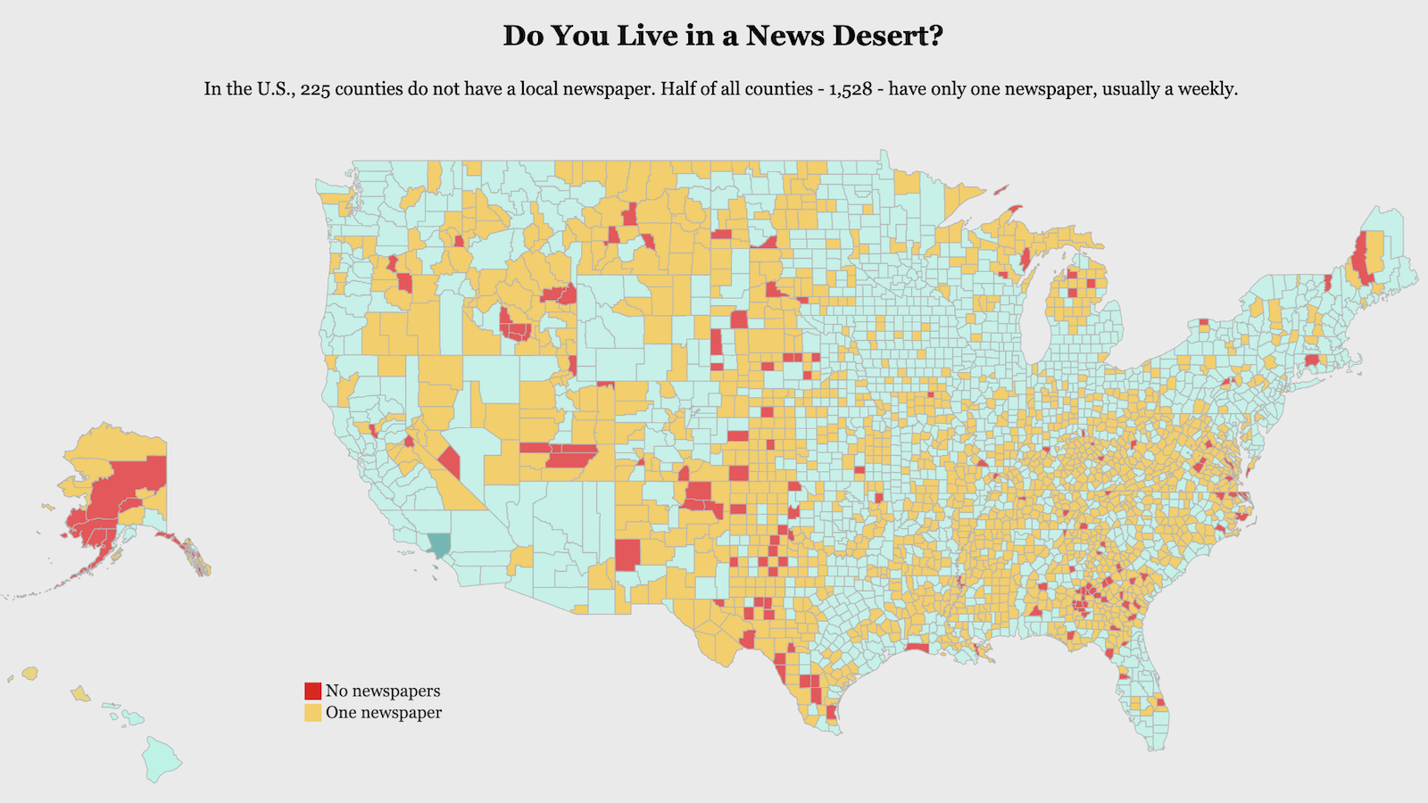
The Google Earth Guide to a Changing Planet
In conjunction with the U.S. Geological Survey, NASA and TIME, Google released millions of satellite images that cover a quarter century.
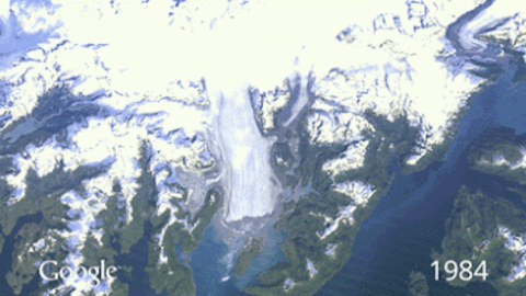
How is the Earth’s surface changing over time?
The image above depicts Alaska’s Columbia Glacier retreat from 1984 to 2011. This is just one of the many stunning phenomena that can be observed using the tools of the recently launched Timelapse project.
In conjunction with the U.S. Geological Survey, NASA and TIME, Google released millions of satellite images that cover a quarter century. You can check out this zoomable time-lapse map here.